Category:Yoronjima
island in Kagoshima Prefecture, Japan DJI_Mini2-0023.jpg)  | |||||
| Upload media | |||||
| Instance of | |||||
|---|---|---|---|---|---|
| Part of | |||||
| Location | Yoron, Oshima District, Kagoshima Prefecture, Japan | ||||
| Located in or next to body of water | |||||
| Population |
| ||||
| Area |
| ||||
| Elevation above sea level |
| ||||
 | |||||
English: Category for the Yoronjima (Yoron Island) in the Amami Islands, Kagoshima Prefecture, Japan
日本語: 鹿児島県与論町、奄美群島・与論島に関するカテゴリ
Subcategories
This category has the following 4 subcategories, out of 4 total.
R
Y
- Yoron Airport (11 F)
- Yoron Station (5 F)
Media in category "Yoronjima"
The following 26 files are in this category, out of 26 total.
-
 2021-04-09 Chabana-gyoko 茶花漁港 DJI Mini2-0033.jpg 4,000 × 2,250; 4.24 MB
-
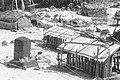
 2021-04-09 Yoronjima-seito 与論島製糖(株)DJI Mini2-0023.jpg 4,000 × 2,250; 4.38 MB
-
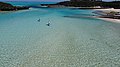
 2021-04-10 Beach Minata,Amami,Kagoshima (皆田海岸) DJI Mini2-0048.jpg 4,000 × 2,250; 3.87 MB
-
 2021-04-10 Beach Minata,Amami,Kagoshima (皆田海岸) DJI Mini2-0050.jpg 4,000 × 2,250; 4.09 MB
-
 2021-04-10 Beach Minata,Amami,Kagoshima (皆田海岸)-DJI Mini2-0043.jpg 4,000 × 2,250; 4.23 MB
-
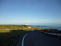
 2021-04-10 Chabana-Yoron,Oshima,Kagoshima 鹿児島県大島郡与論町茶花DJI Mini2-0063.jpg 4,000 × 2,250; 4.58 MB
-
 Okinawa-Guntō.jpg 1,135 × 707; 292 KB
-
 Okinawa.svg 1,052 × 744; 33 KB
-
-
 Yoron Island (8407010599).jpg 2,560 × 1,920; 283 KB
-
 Yoron Island 20080622.jpg 1,044 × 783; 149 KB
-
 Yoron Island Tomb in Pre-war Showa era.JPG 621 × 416; 85 KB
-
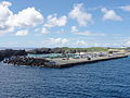 Yoron Port Kagoshima Kagoshima JAPAN.jpg 3,648 × 2,736; 3.64 MB
-
 Yoron Port.jpg 427 × 240; 47 KB
-
 Yoron port.jpg 3,840 × 2,160; 7.07 MB
-
 Yoron PRICIA 0122.jpg 3,560 × 2,510; 765 KB
-
 Yoronjima Island Aerial photograph.2008.jpg 8,776 × 5,625; 12.41 MB
-
 Yoronzenkei.jpg 1,280 × 960; 42 KB
-
 Yunnu Rakuen.jpg 1,600 × 1,200; 1.06 MB
-
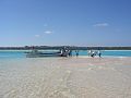 Yurigahama.jpg 960 × 720; 81 KB
-
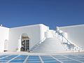 プリシアリゾート.jpg 1,600 × 1,200; 163 KB
-
 プリシアリゾート2.jpg 1,600 × 1,200; 173 KB
-
 プリシアリゾートのバーベキューテラス - panoramio.jpg 1,175 × 1,600; 616 KB
-
 プリシアリゾートプライベートビーチ.jpg 1,600 × 1,200; 364 KB
-
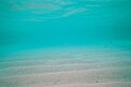
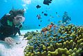 与論の海の中 - panoramio.jpg 1,538 × 1,053; 353 KB
-
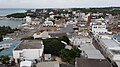
 与論町中心部.jpg 3,008 × 2,000; 2.64 MB

_DJI_Mini2-0048.jpg)
_DJI_Mini2-0050.jpg)
-DJI_Mini2-0043.jpg)


.jpg)


