Category:West Dunbartonshire
Council areas (municipalities) of Scotland: Aberdeen · Aberdeenshire · Angus · Argyll and Bute · Clackmannanshire · Dumfries and Galloway · Dundee · East Ayrshire · East Dunbartonshire · East Lothian · East Renfrewshire · Edinburgh · Falkirk · Fife · Glasgow · Highland · Inverclyde · Midlothian · Moray · North Ayrshire · North Lanarkshire · Outer Hebrides · Orkney Islands · Perth and Kinross · Renfrewshire · Scottish Borders · Shetland Islands · South Ayrshire · South Lanarkshire · Stirling · West Dunbartonshire · West Lothian

Scottish council area   | |||||
| Upload media | |||||
| Instance of | |||||
|---|---|---|---|---|---|
| Part of |
| ||||
| Location | Scotland | ||||
| Capital | |||||
| Legislative body |
| ||||
| Population |
| ||||
| Area |
| ||||
| official website | |||||
 | |||||
Subcategories
This category has the following 26 subcategories, out of 26 total.
+
A
C
E
G
H
I
N
O
P
S
T
Media in category "West Dunbartonshire"
The following 200 files are in this category, out of 554 total.
(previous page) (next page)-
 2015 October Holidays (21554683773).jpg 3,264 × 4,928; 3.07 MB
-
 A bend in the road - geograph.org.uk - 6181279.jpg 1,024 × 768; 267 KB
-
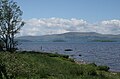
 A calm Loch Lomond - geograph.org.uk - 7656079.jpg 4,608 × 3,456; 4 MB
-

-
 A misty Loch Lomond - geograph.org.uk - 7655596.jpg 4,608 × 3,456; 4.45 MB
-
 A tributary of the Murroch Burn - geograph.org.uk - 6657184.jpg 1,024 × 768; 312 KB
-
 A811 at Badshalloch - geograph.org.uk - 7967244.jpg 4,000 × 3,000; 5.15 MB
-
 A811 towards Gartocharn - geograph.org.uk - 7967242.jpg 4,000 × 3,000; 5.31 MB
-

-
 A82 in Dumbarton - geograph.org.uk - 7538968.jpg 4,032 × 3,024; 2.46 MB
-
 A82 in Dumbarton - geograph.org.uk - 7538972.jpg 4,032 × 3,024; 2.53 MB
-
 Aber Isle - geograph.org.uk - 1664178.jpg 1,600 × 1,200; 214 KB
-
 Aber Isle - geograph.org.uk - 7653320.jpg 4,608 × 3,456; 6.58 MB
-
 Aber Isle - geograph.org.uk - 7655838.jpg 4,608 × 2,575; 1.88 MB
-
 Aber Isle - geograph.org.uk - 7655901.jpg 4,608 × 3,456; 7.03 MB
-
 Across Dumbarton Muir - geograph.org.uk - 6668756.jpg 640 × 480; 85 KB
-
 Alderwood Care Home construction site - geograph.org.uk - 6325937.jpg 1,024 × 640; 174 KB
-
 Alderwood Care Home construction site - geograph.org.uk - 6325945.jpg 1,024 × 768; 233 KB
-
 Alderwood Care Home construction site - geograph.org.uk - 6325949.jpg 1,600 × 800; 323 KB
-
 Alderwood Care Home construction site - geograph.org.uk - 6386449.jpg 1,024 × 640; 162 KB
-
 Alderwood Care Home construction site - geograph.org.uk - 6439083.jpg 1,600 × 889; 273 KB
-
 Alderwood Care Home construction site - geograph.org.uk - 6656131.jpg 1,600 × 666; 190 KB
-
 Alderwood Care Home construction site - geograph.org.uk - 6656135.jpg 1,600 × 900; 343 KB
-
 Algal bloom at the shoreline - geograph.org.uk - 6277949.jpg 1,024 × 768; 237 KB
-
 All that remains... - geograph.org.uk - 7591175.jpg 1,203 × 1,600; 519 KB
-
 An old boundary - geograph.org.uk - 6278081.jpg 1,024 × 768; 262 KB
-
 Anemometer mast - geograph.org.uk - 2495812.jpg 768 × 1,024; 114 KB
-
 Approaching Net Bay Viewpoint - geograph.org.uk - 6278093.jpg 1,024 × 768; 294 KB
-
 Artizan-Artisan Bridge, Dumbarton - geograph.org.uk - 6375657.jpg 800 × 601; 346 KB
-
 Auchenlarich - geograph.org.uk - 8172818.jpg 1,600 × 1,058; 451 KB
-
 Auchincarroch Road - geograph.org.uk - 8172680.jpg 1,600 × 1,067; 371 KB
-
 Auchincarroch Road - geograph.org.uk - 8172681.jpg 1,600 × 1,067; 370 KB
-
 Bank of Scotland - geograph.org.uk - 7590079.jpg 1,600 × 1,261; 399 KB
-
 Bankend Road, Dumbarton - geograph.org.uk - 7957978.jpg 4,000 × 3,000; 4.38 MB
-
 Banks of the Endrick - geograph.org.uk - 7592511.jpg 2,048 × 1,536; 1.03 MB
-
 Beside a path in the Overtoun Estate - geograph.org.uk - 6225983.jpg 1,024 × 768; 289 KB
-
 Beside Glasgow Road - geograph.org.uk - 6587818.jpg 1,024 × 768; 172 KB
-
 Beside the glen of the Murroch Burn - geograph.org.uk - 6657157.jpg 1,024 × 768; 292 KB
-
 Between parallel boundaries - geograph.org.uk - 6278124.jpg 1,024 × 768; 285 KB
-
 Between the old Sea Lock and the New Sea Lock - geograph.org.uk - 5591579.jpg 1,024 × 768; 272 KB
-
 Blocked footpath - geograph.org.uk - 6213166.jpg 1,024 × 768; 213 KB
-
 Blocked footpath - geograph.org.uk - 6213174.jpg 1,024 × 768; 238 KB
-
 Blocked footpath - geograph.org.uk - 6238042.jpg 1,600 × 800; 451 KB
-
 Blue plaque - geograph.org.uk - 6422575.jpg 1,600 × 1,442; 415 KB
-
 Blue plaque - geograph.org.uk - 7588075.jpg 1,599 × 1,600; 355 KB
-
 Blue plaque - geograph.org.uk - 7589704.jpg 1,011 × 1,011; 305 KB
-
 Blue plaque - geograph.org.uk - 7591056.jpg 1,600 × 1,199; 374 KB
-
 Boat Graveyard In Bowling Harbour - geograph.org.uk - 4013198.jpg 3,448 × 4,592; 3.27 MB
-
 Boat on the River Leven - geograph.org.uk - 6421978.jpg 1,600 × 1,167; 229 KB
-
 Boats on the River Leven - geograph.org.uk - 6416449.jpg 1,600 × 1,200; 411 KB
-
 Boats on the River Leven - geograph.org.uk - 6416572.jpg 1,275 × 1,600; 342 KB
-
 Bob’s Garage, River City set - geograph.org.uk - 8153549.jpg 1,024 × 768; 385 KB
-
 Boer War Memorial - geograph.org.uk - 7591251.jpg 843 × 1,600; 301 KB
-
 Boghead Road, Dumbarton - geograph.org.uk - 6952270.jpg 1,280 × 960; 854 KB
-
 Bonhill Road, Dumbarton - geograph.org.uk - 6952224.jpg 1,235 × 927; 594 KB
-
 Boundaries old and new beside Murroch Glen - geograph.org.uk - 6722043.jpg 1,024 × 768; 370 KB
-
 Bowling Basin Entrance - geograph.org.uk - 2667900.jpg 1,600 × 1,200; 554 KB
-
 Bowling Harbour - geograph.org.uk - 2667874.jpg 3,688 × 2,729; 7.27 MB
-
 Bowling Harbour - geograph.org.uk - 5591581.jpg 1,024 × 714; 86 KB
-
 Bowling Harbour - geograph.org.uk - 6401783.jpg 1,600 × 856; 211 KB
-
 Bridge over the Gallangad Burn - geograph.org.uk - 8172734.jpg 1,600 × 1,067; 626 KB
-
 Brock Bowling Club - geograph.org.uk - 6546150.jpg 1,600 × 889; 377 KB
-
 Bruce Street, Dumbarton - geograph.org.uk - 7373671.jpg 1,024 × 768; 120 KB
-
 Building detail, énergie fitness - geograph.org.uk - 6416533.jpg 1,594 × 1,600; 421 KB
-
 Buoy, Loch Lomond - geograph.org.uk - 7656012.jpg 4,608 × 3,456; 3.8 MB
-
 Buoy, north of Torrinch - geograph.org.uk - 7656260.jpg 3,018 × 3,018; 1.51 MB
-
 Businesses on Park Street - geograph.org.uk - 7589194.jpg 1,600 × 1,181; 400 KB
-
 Caldarvan Station Road - geograph.org.uk - 8172808.jpg 1,600 × 1,067; 537 KB
-
 Cameron House, Loch Lomond - geograph.org.uk - 5504808.jpg 1,280 × 960; 707 KB
-
 Cameron on the Clyde - geograph.org.uk - 5253166.jpg 640 × 480; 150 KB
-
 Cameron on the Clyde - geograph.org.uk - 5253168.jpg 640 × 480; 164 KB
-
 Cameron on the Clyde - geograph.org.uk - 5253171.jpg 640 × 480; 159 KB
-
 Cardinal Mark and Dumbarton Rock - geograph.org.uk - 2220627.jpg 1,024 × 768; 86 KB
-
 Carpark for RSPB Loch Lomond - geograph.org.uk - 7967240.jpg 4,000 × 3,000; 5.23 MB
-
 Castle Street, Dumbarton - geograph.org.uk - 6144929.jpg 1,024 × 683; 135 KB
-
 Caterpillar of Elephant Hawk-moth - geograph.org.uk - 6270909.jpg 1,600 × 1,200; 656 KB
-
 Cats Castle - geograph.org.uk - 5257271.jpg 640 × 480; 163 KB
-
 Changes at Bowling Harbour - geograph.org.uk - 5429440.jpg 1,024 × 768; 199 KB
-
 Church noticeboard, Riverside Parish Church, Dumbarton - geograph.org.uk - 6422534.jpg 1,209 × 1,600; 360 KB
-
 Church Street, Dumbarton - geograph.org.uk - 6422565.jpg 1,446 × 1,600; 364 KB
-
 Church Street, Dumbarton - geograph.org.uk - 7590897.jpg 1,131 × 1,600; 341 KB
-
 Cleared forestry land - geograph.org.uk - 6183075.jpg 1,024 × 768; 224 KB
-
 Cleared ground behind Castle Terrace - geograph.org.uk - 6463538.jpg 1,600 × 800; 338 KB
-
 Cleared site of Langcraigs Care Home - geograph.org.uk - 6198011.jpg 1,024 × 683; 203 KB
-
 Cleared site of Langcraigs Care Home - geograph.org.uk - 6198019.jpg 1,024 × 768; 223 KB
-
 Cleared site of Langcraigs Care Home - geograph.org.uk - 6274691.jpg 1,024 × 768; 205 KB
-
 Cleared site of Langcraigs Care Home - geograph.org.uk - 6274694.jpg 1,024 × 768; 201 KB
-
 Cleared woodland - geograph.org.uk - 6146053.jpg 1,600 × 960; 478 KB
-
 Closed footpath - geograph.org.uk - 6087353.jpg 1,024 × 768; 247 KB
-
 Clyde shoreline - geograph.org.uk - 5590048.jpg 1,024 × 768; 144 KB
-
 Co-op Funeralcare, Dumbarton - geograph.org.uk - 6952219.jpg 1,225 × 919; 494 KB
-
 Colourful speed hump - geograph.org.uk - 6952246.jpg 1,225 × 919; 613 KB
-
 Construction on former distillery site - geograph.org.uk - 6328860.jpg 1,024 × 768; 244 KB
-
 Cornstone outcrop - geograph.org.uk - 1692685.jpg 640 × 480; 116 KB
-
 Cornstone outcrop - geograph.org.uk - 1692703.jpg 640 × 480; 115 KB
-
 Counting House - geograph.org.uk - 7588050.jpg 1,432 × 1,600; 514 KB
-
 Counting House - geograph.org.uk - 7590255.jpg 1,238 × 1,600; 421 KB
-
 Creinch - geograph.org.uk - 1877168.jpg 640 × 480; 55 KB
-
 Creinch - geograph.org.uk - 3462622.jpg 640 × 458; 266 KB
-
 Creinch - geograph.org.uk - 7656087.jpg 4,608 × 3,456; 6.17 MB
-
 Creinch - Torrinch gap - geograph.org.uk - 7656090.jpg 4,608 × 3,456; 4.12 MB
-
 Creinch and Torrinch - geograph.org.uk - 4973293.jpg 3,371 × 2,128; 2.66 MB
-
 Creinch from Net Bay View Point - geograph.org.uk - 4973282.jpg 3,136 × 2,072; 2.2 MB
-
 Crosslet Road, Dumbarton - geograph.org.uk - 6952259.jpg 1,280 × 960; 799 KB
-
 Crossroads - geograph.org.uk - 8172755.jpg 1,600 × 1,064; 362 KB
-
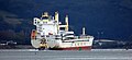 Da Cui Yun approaching Dumbarton - geograph.org.uk - 5146989.jpg 640 × 293; 70 KB
-
 David Muir - geograph.org.uk - 7590899.jpg 1,600 × 1,143; 377 KB
-
 Dead tree and Endrick Water - geograph.org.uk - 7593192.jpg 2,048 × 2,731; 2.61 MB
-
 Defibrillator - geograph.org.uk - 7589624.jpg 1,287 × 1,600; 267 KB
-
 Demolition of Langcraigs residential care home - geograph.org.uk - 6164646.jpg 1,600 × 800; 261 KB
-
 Demolition of Langcraigs residential care home - geograph.org.uk - 6164661.jpg 1,600 × 800; 301 KB
-
 Demolition of West Bridgend Community Centre - geograph.org.uk - 5559735.jpg 1,600 × 1,200; 566 KB
-
 Derelict boat, River Leven - geograph.org.uk - 6416545.jpg 1,306 × 1,600; 411 KB
-
 Detail, Dumbarton Library - geograph.org.uk - 7591101.jpg 1,234 × 1,600; 307 KB
-
 Done-cruising - geograph.org.uk - 7588197.jpg 1,600 × 1,200; 307 KB
-
 Doorway, Kilmaronock Old Kirk - geograph.org.uk - 6886608.jpg 1,218 × 1,600; 526 KB
-
 Doughnot Hill - geograph.org.uk - 6612634.jpg 3,655 × 2,741; 3.43 MB
-

-
 Drystane dyke beside Fyn Loch - geograph.org.uk - 7988845.jpg 4,608 × 3,456; 5.14 MB
-
 Dumbarton - Church St ^ view towards Riverside Parish Church - geograph.org.uk - 6333299.jpg 5,184 × 2,920; 4.36 MB
-
 Dumbarton - R Leven ^ view to Dumbarton Rock - geograph.org.uk - 6333305.jpg 5,184 × 2,920; 4.8 MB
-
 Dumbarton - Riverside Parish Church - geograph.org.uk - 6333302.jpg 2,920 × 5,184; 4.31 MB
-
 Dumbarton - W Dunbarton Council Offices - geograph.org.uk - 6333300.jpg 2,920 × 5,184; 1.44 MB
-
 Dumbarton and Ben Lomond - geograph.org.uk - 6103765.jpg 1,024 × 548; 207 KB
-
 Dumbarton Bridge - geograph.org.uk - 3357724.jpg 1,024 × 512; 133 KB
-
 Dumbarton Bridge - geograph.org.uk - 375427.jpg 640 × 363; 82 KB
-
 Dumbarton Bridge and tower blocks - geograph.org.uk - 5590036.jpg 1,024 × 768; 133 KB
-
 Dumbarton Castle - geograph.org.uk - 3318075.jpg 1,024 × 768; 95 KB
-
 Dumbarton Castle - geograph.org.uk - 7589342.jpg 1,199 × 1,600; 353 KB
-
 Dumbarton Central Station, 1965 - geograph.org.uk - 6158938.jpg 1,280 × 847; 302 KB
-
 Dumbarton Credit Union - geograph.org.uk - 7590113.jpg 1,600 × 1,326; 347 KB
-
 Dumbarton Distillery Tower - geograph.org.uk - 5262525.jpg 610 × 640; 145 KB
-
 Dumbarton from the rock - geograph.org.uk - 3567640.jpg 640 × 480; 189 KB
-
 Dumbarton Library - geograph.org.uk - 7591095.jpg 1,600 × 1,157; 323 KB
-
 Dumbarton Municipal Buildings - geograph.org.uk - 7591210.jpg 1,236 × 1,600; 421 KB
-
 Dumbarton People's Theatre Rehearsal Studio - geograph.org.uk - 7589097.jpg 1,600 × 1,038; 332 KB
-
 Dumbarton Prison, Burgh Arms - geograph.org.uk - 6036177.jpg 1,024 × 768; 183 KB
-
 Dumbarton Prison, cell windows - geograph.org.uk - 6036161.jpg 1,600 × 1,200; 391 KB
-
 Dumbarton Prison, door - geograph.org.uk - 6036167.jpg 1,200 × 1,600; 437 KB
-
 Dumbarton quayside, seen from the castle - geograph.org.uk - 8145363.jpg 1,024 × 683; 198 KB
-
 Dumbarton Railway Bridge - geograph.org.uk - 4312004.jpg 1,600 × 1,152; 414 KB
-
 Dumbarton Railway Bridge - geograph.org.uk - 5216165.jpg 1,600 × 727; 283 KB
-
 Dumbarton Railway Bridge - geograph.org.uk - 5216170.jpg 1,600 × 800; 250 KB
-
 Dumbarton Rock - geograph.org.uk - 2389761.jpg 640 × 480; 160 KB
-
 Dumbarton Rock - geograph.org.uk - 7346136.jpg 1,600 × 1,113; 375 KB
-
 Dumbarton Rock and Seagull - geograph.org.uk - 6536097.jpg 800 × 543; 151 KB
-
 Dumbarton Sheriff Court and Justice of the Peace Court - geograph.org.uk - 7591066.jpg 1,600 × 1,125; 356 KB
-
 Dumbarton shoreline and River Clyde - geograph.org.uk - 8145366.jpg 1,024 × 683; 146 KB
-
-
 Early 20th Century Water Tank - geograph.org.uk - 7343807.jpg 1,024 × 813; 337 KB
-
 East side of Aber Isle - geograph.org.uk - 7655847.jpg 4,608 × 3,456; 3.78 MB
-
 Eastern coast of Inchmurrin - geograph.org.uk - 3462331.jpg 640 × 423; 343 KB
-
 Eastern end of Boghead Road - geograph.org.uk - 6952266.jpg 1,210 × 908; 549 KB
-
 Eastern Shore of Loch Lomond - geograph.org.uk - 2922576.jpg 640 × 480; 60 KB
-
 Eastern tip of Creinch - geograph.org.uk - 7656085.jpg 4,608 × 3,456; 4.16 MB
-
 Elephant play equipment - geograph.org.uk - 7588111.jpg 1,600 × 1,098; 411 KB
-
 Enclosure around ruin of Spouts - geograph.org.uk - 1692750.jpg 640 × 480; 122 KB
-
 End wall, Grange Place - geograph.org.uk - 7588945.jpg 1,346 × 1,600; 367 KB
-
 Endrick Marshes - geograph.org.uk - 7593244.jpg 2,048 × 1,536; 1.21 MB
-
 Endrick Mouth - geograph.org.uk - 7593394.jpg 2,048 × 1,536; 1.05 MB
-
 Endrick Mouth - geograph.org.uk - 7593395.jpg 2,048 × 1,536; 1.11 MB
-
 Endrick Mouth - geograph.org.uk - 7593563.jpg 2,048 × 1,535; 721 KB
-
 Endrick Viewpoint - geograph.org.uk - 6278077.jpg 1,600 × 1,000; 553 KB
-
 Endrick Viewpoint to Net Bay Viewpoint - geograph.org.uk - 6278118.jpg 1,024 × 768; 286 KB
-
 Endrick Water - geograph.org.uk - 7592551.jpg 2,048 × 1,536; 1.14 MB
-
 Endrick Water - geograph.org.uk - 7592567.jpg 2,048 × 1,536; 824 KB
-
 Endrick Water - geograph.org.uk - 7592578.jpg 2,048 × 1,536; 1.16 MB
-
 Endrick Water - geograph.org.uk - 7593197.jpg 2,048 × 1,536; 1.79 MB
-
 Endrick Water - geograph.org.uk - 7593218.jpg 2,048 × 1,536; 920 KB
-
 Endrick Water - geograph.org.uk - 7593227.jpg 2,048 × 1,536; 1.46 MB
-
 Endrick Water, Kilmaronock - geograph.org.uk - 7593186.jpg 2,048 × 1,536; 1.04 MB
-
 Entrance to East End Park - geograph.org.uk - 7589071.jpg 1,600 × 1,200; 363 KB
-
 Exit into the Clyde - geograph.org.uk - 7427905.jpg 1,223 × 1,600; 262 KB
-
 Exit to the Clyde - geograph.org.uk - 8015159.jpg 1,600 × 1,067; 391 KB
-
 Farm track - geograph.org.uk - 6278049.jpg 1,024 × 576; 204 KB
-
 Fence, Loch Lomond - geograph.org.uk - 7655713.jpg 4,608 × 3,456; 3.66 MB
-
 Fence-lined minor road between Croftfoot and Blairquhomrie - geograph.org.uk - 6554728.jpg 4,000 × 3,000; 2.99 MB
-
 Field at Kilmaronock - geograph.org.uk - 6181264.jpg 1,600 × 1,200; 434 KB
-
 Field beside Finnery Road - geograph.org.uk - 8172831.jpg 1,600 × 1,066; 422 KB
-
 Field boundary - geograph.org.uk - 6274842.jpg 1,024 × 768; 227 KB
-
 Field gate - geograph.org.uk - 5667893.jpg 1,024 × 768; 305 KB
-
 Firebreak in forest near Knockupple - geograph.org.uk - 6668748.jpg 640 × 480; 157 KB
-
 Fish and chips and shoe repairs while you wait - geograph.org.uk - 7588090.jpg 1,600 × 1,273; 387 KB
-
 Flats on Bruce Street - geograph.org.uk - 7588908.jpg 1,600 × 1,100; 314 KB
-
 Floating Junkyards - geograph.org.uk - 7362390.jpg 1,024 × 851; 208 KB
-
 Flooding at Riverside Lane - geograph.org.uk - 3815352.jpg 1,600 × 1,026; 510 KB
-
 Flooding at Riverside Lane - geograph.org.uk - 3815374.jpg 1,600 × 900; 668 KB
-
 Flooding at Riverside Lane - geograph.org.uk - 3815384.jpg 1,024 × 768; 442 KB
-
 Flying the flag - geograph.org.uk - 7590919.jpg 1,145 × 1,600; 311 KB
-
 Fog bank, Loch Lomond - geograph.org.uk - 7655749.jpg 4,273 × 3,204; 1.87 MB
-
 Fog banks on Loch Lomond - geograph.org.uk - 7655739.jpg 4,608 × 3,456; 3.41 MB
-
 Footbridge over the Carling Burn - geograph.org.uk - 6145916.jpg 1,024 × 768; 232 KB
-
 Footpath across Knoxland Square, Dumbarton - geograph.org.uk - 7373672.jpg 1,024 × 768; 258 KB
-
 Forest edge and Gallangad Burn - geograph.org.uk - 6668773.jpg 640 × 480; 139 KB
-
 Forest edge towards Saughen Braes - geograph.org.uk - 6668754.jpg 640 × 480; 115 KB
-
 Forestry track - geograph.org.uk - 6183042.jpg 1,024 × 768; 186 KB
-
 Forestry track - geograph.org.uk - 6183072.jpg 1,024 × 768; 252 KB
-
 Former bonded warehouses - geograph.org.uk - 6590145.jpg 1,024 × 569; 148 KB
-
 Former bonded warehouses - geograph.org.uk - 6590154.jpg 1,024 × 585; 152 KB
-
 Former site of a mill dam in Silverton - geograph.org.uk - 6386575.jpg 1,024 × 683; 195 KB
.jpg)


_Bridge_-_geograph.org.uk_-_6375655.jpg)


