Category:Uttarakhand
Indian state   someja satełitar in zuño .svg)  | |||||
| Upload media | |||||
| Instance of | |||||
|---|---|---|---|---|---|
| Named after | |||||
| Location | India | ||||
| Capital | |||||
| Legislative body |
| ||||
| Executive body |
| ||||
| Head of state |
| ||||
| Head of government |
| ||||
| Inception |
| ||||
| Highest point | |||||
| Population |
| ||||
| Area |
| ||||
| Different from | |||||
| official website | |||||
 | |||||
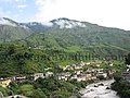
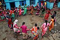
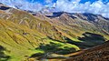
English: Uttarakhand (Hindi: उत्तराखण्ड, i.e. North + Section or Segment), is a state located in the northern part of India. It was carved out of Himalayan and adjoining districts of Uttar Pradesh on November 9, 2000, becoming the 27th state of the Republic of India. It borders People's Republic of China on the north, Nepal on the east, the Indian states of Uttar Pradesh to the south, Haryana on the west and Himachal Pradesh on the north west. Uttarakhand has an area of 20,682 sq mi (53,566 km²). In January 2007, the name of the state was officially changed from Uttaranchal, its interim name, to Uttarakhand. The provisional capital of Uttarakhand is Dehradun which is also a rail-head and the largest city in the region. The High Court of the state is in Nainital.
Subcategories
This category has the following 21 subcategories, out of 21 total.
Pages in category "Uttarakhand"
The following 3 pages are in this category, out of 3 total.
Media in category "Uttarakhand"
The following 172 files are in this category, out of 172 total.
-
 - panoramio (3519).jpg 1,536 × 2,048; 479 KB
-
 - panoramio (3521).jpg 640 × 480; 318 KB
-
 - panoramio (3914).jpg 2,560 × 1,920; 633 KB
-
 1894 Himalaya Album by Boeck.pdf 1,650 × 2,250, 33 pages; 30.93 MB
-
 A beautiful view from Ganga darshan hill station in Srinagar Garhwal, Uttarakhand.jpg 2,448 × 3,264; 3.72 MB
-
 A beautiful view of the Himalayan river valley and mountain settlement.jpg 3,072 × 4,080; 6.95 MB
-
 A day in the life of a tribal 01.jpg 2,560 × 1,714; 2.27 MB
-
 A day in the life of a tribal 02.jpg 2,560 × 1,714; 2.08 MB
-
 A day in the life of a tribal 03.jpg 2,560 × 1,714; 2.01 MB
-
 A day in the life of a tribal 04.jpg 2,560 × 1,714; 2.22 MB
-
 A day in the life of a tribal 05.jpg 1,714 × 2,560; 1.85 MB
-
 A day in the life of a tribal 06.jpg 1,557 × 2,325; 1.61 MB
-
 A day in the life of a tribal 07.jpg 1,714 × 2,560; 1.9 MB
-
 A day in the life of a tribal 08.jpg 3,872 × 2,592; 2.44 MB
-
 A day in the life of a tribal 09.jpg 3,872 × 2,592; 2.05 MB
-
 A day in the life of a tribal 10.jpg 1,714 × 2,560; 1.16 MB
-
 Aastha Ka Mandir Gate .jpg 4,032 × 2,268; 2.59 MB
-
 Amotha Pauri Garhwal Uttarakhand India 01.jpg 4,032 × 3,024; 3.06 MB
-
 Anuradha Nirala.jpg 729 × 730; 68 KB
-
 Badrinath on banks of Alaknanda during a snowy morning.jpg 3,456 × 5,184; 7.36 MB
-
 Badrinath temple with Bhot musicians.jpg 2,259 × 2,641; 2 MB
-
 BDC Cognizance .png 696 × 465; 503 KB
-
 Birdandsnow.jpg 4,000 × 1,844; 3.45 MB
-
 Biryani 4.jpg 3,000 × 4,000; 3.96 MB
-
 Biryani 5.jpg 3,000 × 4,000; 3.88 MB
-
 Brighter Horizons.jpg 1,800 × 3,794; 3.61 MB
-
 Budher resthouse -Moila top trek Uttarakhand.jpg 1,920 × 1,080; 384 KB
-
 Caterpillar fungus at Pathar Nachauni, Chamoli 01.jpg 2,560 × 1,714; 2.66 MB
-
 Caterpillar fungus at Pathar Nachauni, Chamoli 02.jpg 2,560 × 1,714; 1.29 MB
-
 Chachari Group Dance.jpg 5,184 × 3,456; 12.11 MB
-

-
 Chila project close shot.jpg 2,448 × 3,264; 1.45 MB
-
 Coat Of Arms,Doonga estate.jpg 1,121 × 887; 274 KB
-
 Collection of Kheeda Jadi or Caterpillar fungus.jpg 2,560 × 1,714; 2.56 MB
-
 Coridoor of haveli doonga.jpg 720 × 952; 344 KB
-
 Dehradun Heritage-Timeless Charm of Dehradun.jpg 3,060 × 4,080; 3.26 MB
-
 Dhol Damaun.jpg 1,600 × 1,200; 268 KB
-
 Dolphin PG Institute of Biomedical and Natural Sciences, Dehradun.jpg 1,920 × 1,080; 1.01 MB
-
 Dolphin pg Institute view from the top most side.jpg 1,280 × 853; 374 KB
-
 Doonga haveli , gautam rajputs.jpg 720 × 511; 184 KB
-
 Doonga haveli ,gautam rajputs.jpg 720 × 1,223; 292 KB
-
 Doonga Haveli - Gautam Rajputs.jpg 720 × 303; 104 KB
-
 Doonga Haveli Front.jpg 768 × 768; 125 KB
-
 Doonga Haveli of Gautam Rajputs.jpg 720 × 286; 100 KB
-
 Doonga haveli of gautam rajputs.jpg 720 × 327; 124 KB
-
 Doonga Haveli.jpg 3,120 × 4,160; 3 MB
-
 Doonga haveli.jpg 768 × 768; 124 KB
-

-
 DSC 0114 Original.jpg 856 × 1,280; 363 KB
-
 Embrace the Nature.jpg 1,095 × 864; 102 KB
-
 Entrance into Srinagar Garhwal.jpg 4,000 × 3,000; 6.62 MB
-
 Entrance of Chitai Golu Devta Temple.jpg 3,072 × 4,608; 5.41 MB
-
 Fire Demo by Uttrakhand Fire Service.jpg 6,048 × 4,024; 10.16 MB
-
 Flower Map of Valley of Flowers Uttarakhand.jpg 1,920 × 1,080; 403 KB
-
 Forest .jpg 2,048 × 1,152; 1.7 MB
-
Forest Fires in Ghat, Chamoli, Uttarakhand.webm 29 s, 848 × 478; 6.36 MB
-
 Gate Opening Ceremony of Latu Devta Temple.jpg 3,840 × 2,160; 7.07 MB
-
 Ghandiyal 1.jpg 540 × 960; 65 KB
-
 Gidara Bugyal Trek.jpg 4,032 × 2,268; 3.86 MB
-
 Glacier - panoramio (3).jpg 1,600 × 1,200; 725 KB
-
 Glimpse of Uttrakhand 01.jpg 3,000 × 4,000; 8.02 MB
-
 Glimpse of Uttrakhand 02.jpg 3,000 × 4,000; 7.22 MB
-
 Glimpse of Uttrakhand 03.jpg 3,000 × 4,000; 6.76 MB
-
 Glimpse of Uttrakhand 04.jpg 3,000 × 4,000; 6.36 MB
-
 Glimpse of Uttrakhand 05.jpg 3,000 × 4,000; 7.58 MB
-
 Glimpse of Uttrakhand 06.jpg 3,000 × 4,000; 7.14 MB
-
 Glimpse of Uttrakhand 07.jpg 3,000 × 4,000; 5.74 MB
-
 Glimpse of Uttrakhand 08.jpg 3,000 × 4,000; 2.53 MB
-
 Glimpse of Uttrakhand 09.jpg 4,000 × 3,000; 2.78 MB
-
 Glimpse of Uttrakhand 10.jpg 3,000 × 4,000; 4.43 MB
-
 Glimpse of Uttrakhand 11.jpg 3,000 × 4,000; 3.76 MB
-
 Glimpse of Uttrakhand 12.jpg 4,000 × 3,000; 4.09 MB
-
 Glimpse of Uttrakhand 13.jpg 3,000 × 4,000; 3.53 MB
-
 Glimpse of Uttrakhand 14.jpg 3,000 × 4,000; 6.62 MB
-
 Glimpse of Uttrakhand 15.jpg 3,000 × 4,000; 2.72 MB
-
 Green mountains in uttarakhand.jpg 960 × 1,280; 281 KB
-
 Gulabi Kantha Trek in winters.png 2,400 × 1,800; 5.61 MB
-
 Gypsy Moth Insect Pauri Garhwal Uttarakhand India.jpg 4,032 × 3,024; 3.59 MB
-
 Hanol Mahadev.jpg 3,024 × 4,032; 2.77 MB
-
 Haveli of Gautam Rajputs.jpg 720 × 1,249; 364 KB
-
 Hidden lakes in the himalayas.jpg 4,608 × 2,592; 12.03 MB
-
 Himalayan Garhwal University, Pauri Garhwal , Uttarakhand.png 320 × 320; 150 KB
-
 Himalayan Garhwal University, Pauri Garhwal, Uttarakhand.jpg 1,200 × 1,200; 926 KB
-
 ICB Roads in Uttarakhand.png 850 × 838; 324 KB
-
 IMG-20190521-WA0104.jpg 1,040 × 780; 134 KB
-
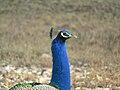 Indian peafowl (male) at Rajaji National Park & Tiger Reserve, Uttarakhand.jpg 5,152 × 3,864; 9.93 MB
-
 Jaraukhand.jpg 960 × 540; 118 KB
-
 Jhumadhuri- uttarakhand - ndia.jpg 2,560 × 1,920; 1.87 MB
-
 Khurpataal from Hill Point.jpg 6,016 × 4,000; 15.43 MB
-
 Kot Village Droneview Proposed for Sri Gadwall Airport.jpg 1,080 × 486; 229 KB
-
 Lakhudiyar Caves is a protected structure in Uttaranchal India.jpg 1,920 × 1,080; 411 KB
-
 Landhaura estate flag.jpg 1,125 × 1,487; 183 KB
-
 Lbsnaa photo.jpg 554 × 553; 98 KB
-
 Mahanagar Delhi - NCR Uttarakhand Pravashi Sangdhan.jpg 3,000 × 3,000; 241 KB
-
 Mayaleopard.jpg 3,821 × 2,293; 3.47 MB
-
 Missahita06.jpg 1,200 × 1,600; 1.02 MB
-
 Mori, Purola, uttarkashi, uttarakhand.jpeg 2,592 × 1,456; 1.89 MB
-
 Morning mountains.jpg 5,852 × 3,901; 10.37 MB
-
 Mountain of uttarakhand.jpg 2,176 × 4,608; 2.28 MB
-
 MT Educare at Uttarakhand.jpg 640 × 480; 75 KB
-
 Mysterious Skeleton Roopkund Lake Trek route-1.jpg 1,920 × 1,080; 370 KB
-
 Mysterious Skeleton Roopkund Lake Trek route-10.jpg 1,920 × 1,080; 212 KB
-
 Mysterious Skeleton Roopkund Lake Trek route-11.jpg 1,920 × 1,080; 385 KB
-
 Mysterious Skeleton Roopkund Lake Trek route-3.jpg 1,920 × 1,080; 78 KB
-
 Mysterious Skeleton Roopkund Lake Trek route-5.jpg 1,920 × 1,080; 137 KB
-
 Mysterious Skeleton Roopkund Lake Trek route-6.jpg 1,920 × 1,080; 374 KB
-
 Mysterious Skeleton Roopkund Lake Trek route-7.jpg 1,920 × 1,080; 220 KB
-
 Mysterious Skeleton Roopkund Lake Trek route-8.jpg 1,920 × 1,080; 384 KB
-
 Mysterious Skeleton Roopkund Lake Trek route-9.jpg 1,920 × 1,080; 258 KB
-
 Mysterious Skeleton Roopkund Lake Trek route4.jpg 1,920 × 1,080; 317 KB
-
 Nalai.jpg 1,536 × 2,048; 856 KB
-
 Nanaksagar.png 2,894 × 1,015; 3.33 MB
-
 Nanda Devi Dola.jpg 5,184 × 3,456; 11.58 MB
-
 Nanda devi from a hill above Milam.jpg 2,004 × 2,563; 1.67 MB
-
 Nargana - panoramio.jpg 1,600 × 1,200; 347 KB
-
 Nature love uttarakhand, india.jpg 1,920 × 960; 727 KB
-
 Nature of uttarakhand, india.jpg 1,920 × 960; 930 KB
-
 Nature uttarakhand, india.jpg 4,160 × 2,080; 2.41 MB
-
 Nomads of the Bugyals in Uttarakhand 01.jpg 2,560 × 1,412; 1.47 MB
-
 Nomads of the Bugyals in Uttarakhand 02.jpg 2,560 × 1,714; 5.65 MB
-
 Pahadi Bhotiya dog or Gaddi Kutta in Uttarakhand.jpg 1,024 × 461; 151 KB
-
 Parvati Kund mountains.jpg 1,280 × 590; 144 KB
-
 Passenger rest area Pauri Garhwal Uttarakhand India.jpg 4,032 × 2,714; 1.61 MB
-
 Picturesque Pir Panjal range along Sari Village-DeoriaTal Trek Uttarakhand, India.jpg 1,920 × 1,080; 346 KB
-
 Pindar river.jpg 5,042 × 3,724; 9.14 MB
-
 Polistes wattii 160452746.jpg 2,046 × 1,716; 2.12 MB
-
 Polistes wattii 160452822.jpg 2,002 × 1,940; 2.07 MB
-
 Polistes wattii 160828039.jpg 2,048 × 1,536; 1.92 MB
-
 Pulna to Ghangaria 10 km mule trail..jpg 3,120 × 4,160; 2.59 MB
-
 Pushpawati river inside the Valley of Flowers Uttarakhand I.jpg 1,920 × 1,080; 574 KB
-
Raj Rajeswari Devi Shaktipeeth Temple in Tehri District of Uttarakhand.webm 23 s, 1,080 × 1,080; 11.19 MB
-
 Ram Mahal.jpg 1,711 × 1,125; 827 KB
-
 Rang Mahal Landhaura.jpg 738 × 415; 54 KB
-
 Ranikhet Express.jpg 4,032 × 3,024; 8.31 MB
-
 River in Valley-of Flowers Uttarakhand India.jpg 1,920 × 1,080; 354 KB
-
 Rudrapur Legislative Assembly Constituency.png 500 × 500; 103 KB
-
 Rung-museum-dharchula-pithoragarh-5.jpg 638 × 573; 153 KB
-
 Sachidanand Bharti.jpg 360 × 450; 115 KB
-
 Sahastra Dhara Dheradhun.jpg 3,072 × 4,080; 7.57 MB
-
 SDRF Mock Drill in Uttarkashi.jpg 4,000 × 3,000; 4.28 MB
-
 Setting sun in Uttarakhand.jpg 4,000 × 3,000; 4.36 MB
-
 Shelter in Milam.jpg 2,153 × 3,062; 2.05 MB
-
 Shining uttarakhand news LOGO.jpg 2,288 × 1,102; 125 KB
-
 Shiv Parvati, 18th Century, Garhwal.jpg 3,819 × 2,885; 1.85 MB
-
 So cute leaves.jpg 2,448 × 3,264; 1.27 MB
-
 Sri Gadwall District Map.png 350 × 231; 46 KB
-
 Stargazing in Kedarkantha.jpg 1,600 × 1,200; 768 KB
-
 Swami Ramgovind das 111 kanyadan haldwani.jpg 1,280 × 854; 240 KB
-
 Teen Dhara , Uttarakhand.jpg 4,000 × 3,000; 8.12 MB
-
 Thali 2.jpg 3,000 × 4,000; 3.94 MB
-
 Thali 3.jpg 12,240 × 16,320; 14.47 MB
-
 The ancient budher cave Uttarakhand.jpg 1,920 × 1,080; 257 KB
-

-

-

-
 Til ke Pakore (Sesame Fritters).jpg 1,600 × 910; 92 KB
-
 Timli State Flag.jpg 950 × 920; 338 KB
-
 Uttarakhand has a deep-rooted passion for football.jpg 1,024 × 461; 147 KB
-
 Uttarakhand india 01.jpg 1,280 × 578; 37 KB
-
 Uttarakhand india 02.jpg 1,600 × 1,204; 209 KB
-
 Uttarakhand india 03.jpg 1,600 × 1,204; 305 KB
-
 UTTARAKHAND MARRIAGE.jpg 1,920 × 2,560; 1.36 MB
-
 Uttarakhand Montage.png 800 × 1,000; 1.65 MB
-
 Uttarakhand tradition.jpg 828 × 960; 860 KB
-
 Uttarakhand, india.jpg 1,040 × 1,040; 99 KB
-
 Valley of flowers Utrakhand.jpg 973 × 1,350; 1.07 MB
-
 View of Nachiketa Taal at Uttarkashi District of Uttarakhand.jpg 5,184 × 3,048; 4.61 MB
-
 Walls that Remember.jpg 4,608 × 3,072; 7.66 MB
-
Women Performing Dhuska Nritya.webm 39 s, 1,920 × 1,080; 78.48 MB
-
 Wow uttarakhand, india.jpg 2,155 × 2,560; 2.62 MB
-

-
 मुख्यमंत्री श्री पुष्कर सिंह धामी.jpg 1,114 × 817; 147 KB
.jpg)
.jpg)
.jpg)


.jpg)


_at_Rajaji_National_Park_%26_Tiger_Reserve,_Uttarakhand.jpg)


.jpg)


