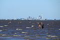
Category:Uruguay River
river in South America  .png) | |||||
| Upload media | |||||
| Instance of | |||||
|---|---|---|---|---|---|
| Location |
| ||||
| Length |
| ||||
| Elevation above sea level |
| ||||
| Origin of the watercourse | |||||
| Mouth of the watercourse | |||||
| Drainage basin | |||||
| Basin country | |||||
| Tributary |
| ||||
| Different from | |||||
 | |||||
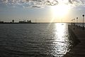
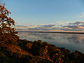
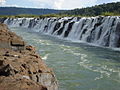
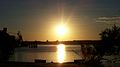
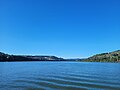
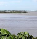
English: The Uruguay River — in southern South America.
- The river flows from north to south, draining the Uruguay Basin, and forms national borders between regions of Brazil, Argentina, and Uruguay.
- The Uruguay River joins the Paraná River to form the Río de la Plata, which flows to the Atlantic.
Español: Río Uruguay — pronunciation: [uɾuˈɣwai].
Português: Rio Uruguai — pronunciation: [uɾuˈɡwaj].
Subcategories
This category has the following 9 subcategories, out of 9 total.
Media in category "Uruguay River"
The following 197 files are in this category, out of 197 total.
-
 Alto Uruguay.JPG 4,320 × 3,240; 5.84 MB
-
 Amanecer en la Meseta de Artigas, Paysandú, Uruguay..jpg 800 × 600; 222 KB
-
 Aprender (Entre Ríos) - Colon - Hotel Costa Arenas.jpg 3,504 × 2,336; 1.12 MB
-
 Aprender (Entre Ríos) - Río Uruguay (1).jpg 2,336 × 3,504; 3.13 MB
-
 Aprender (Entre Ríos) - Río Uruguay (10).jpg 3,504 × 2,336; 1.32 MB
-
 Aprender (Entre Ríos) - Río Uruguay (11).jpg 3,504 × 2,336; 1.03 MB
-
 Aprender (Entre Ríos) - Río Uruguay (12).jpg 3,504 × 2,336; 1.91 MB
-
 Aprender (Entre Ríos) - Río Uruguay (14).jpg 3,504 × 2,336; 868 KB
-
 Aprender (Entre Ríos) - Río Uruguay (15).jpg 3,504 × 2,336; 2.48 MB
-
 Aprender (Entre Ríos) - Río Uruguay (16).jpg 3,504 × 2,336; 2.07 MB
-
 Aprender (Entre Ríos) - Río Uruguay (17).jpg 3,504 × 2,336; 1.99 MB
-
 Aprender (Entre Ríos) - Río Uruguay (18).jpg 3,504 × 2,336; 1.62 MB
-
 Aprender (Entre Ríos) - Río Uruguay (19).jpg 3,504 × 2,336; 3.15 MB
-
 Aprender (Entre Ríos) - Río Uruguay (2).jpg 2,336 × 3,504; 3.18 MB
-
 Aprender (Entre Ríos) - Río Uruguay (20).jpg 2,336 × 3,504; 2.34 MB
-
 Aprender (Entre Ríos) - Río Uruguay (3).jpg 2,336 × 3,504; 1.43 MB
-
 Aprender (Entre Ríos) - Río Uruguay (4).jpg 2,336 × 3,504; 2.39 MB
-
 Aprender (Entre Ríos) - Río Uruguay (5).jpg 2,336 × 3,504; 1.33 MB
-
 Aprender (Entre Ríos) - Río Uruguay (6).jpg 3,504 × 2,336; 1.4 MB
-
 Aprender (Entre Ríos) - Río Uruguay (7).jpg 2,336 × 3,504; 3.16 MB
-
 Aprender (Entre Ríos) - Río Uruguay (8).jpg 3,504 × 2,336; 2.76 MB
-
 Aprender (Entre Ríos) - Río Uruguay (9).jpg 3,504 × 2,336; 2.6 MB
-
 Arbol seco sobre la costa.jpg 640 × 480; 79 KB
-
 At Don Enerique Lodge, Yaboti, Misiones, Argentina, 10th, Jan 2011 - Flickr - PhillipC.jpg 4,288 × 2,848; 3.93 MB
-
 At Don Enerique Lodge, Yaboti, Misiones, Argentina, 10th. Jan. 2011 - Flickr - PhillipC.jpg 4,288 × 2,848; 4.93 MB
-
 Atardecer del Anglo II.JPG 4,320 × 3,240; 2.74 MB
-
 Atardecer del Anglo III.JPG 4,320 × 3,240; 2.32 MB
-
 Atardecer del Anglo IV.JPG 4,320 × 3,240; 2.96 MB
-
 Atardecer del Anglo V.JPG 4,320 × 3,240; 2.77 MB
-
 Atardecer del Anglo VI.JPG 4,320 × 3,240; 2.67 MB
-
 Atardecer del Anglo VII.JPG 4,320 × 2,342; 1.88 MB
-
 Atardecer del Anglo VIII.JPG 4,320 × 3,240; 2.92 MB
-
 Atardecer del Anglo.JPG 4,320 × 3,240; 2.7 MB
-
 Atardecer en el canal.JPG 4,320 × 3,240; 2.79 MB
-
 Atrás, el sol. Río Uruguay. Salto, Uruguay.JPG 4,320 × 3,240; 2.93 MB
-

-
 Avenida Costanera y río Uruguay en Colón 2.JPG 4,608 × 3,456; 5.45 MB
-
 Avenida Costanera y río Uruguay en Colón.jpg 4,608 × 3,456; 5.41 MB
-
 Bajante del Uruguay.jpg 2,592 × 1,944; 925 KB
-
 Balneario de Alba Posse.JPG 4,912 × 1,080; 2.65 MB
-
 Balneario La Concordia - Fotografía Aérea.jpg 3,264 × 2,448; 2.17 MB
-
 Balneario La Concordia.jpg 4,000 × 3,000; 4.18 MB
-
 Balsa a punto de cruzar el río Uruguay desde Alvear (Argentina) a Itaquí (Brasil).jpg 2,243 × 1,683; 683 KB
-
 Balsa no Rio Uruguai.jpg 4,032 × 3,024; 3.3 MB
-
 Balsas amarradas en Porto Mauá, Rio Grande do Sul.JPG 4,320 × 3,240; 5.33 MB
-
 Botnia-Ñandubaysal (detalle).jpg 1,217 × 1,013; 280 KB
-
 Botnia-Ñandubaysal.jpg 3,872 × 2,592; 1.02 MB
-
 Brasil - Rio Grande do Sul - Porto Vera Cruz.jpg 3,704 × 2,472; 2.56 MB
-
 Brazil - Represa Hidroeléctrica de Machadinho (1).jpg 3,000 × 4,000; 4.63 MB
-
 Brazil - Represa Hidroeléctrica de Machadinho (2).jpg 4,000 × 3,000; 4.03 MB
-
 Brazil - Represa Hidroeléctrica de Machadinho (3).jpg 4,000 × 3,000; 5.2 MB
-
 Brazil - Represa Hidroeléctrica de Machadinho (4).jpg 4,000 × 3,000; 4.73 MB
-
 Brazil - Represa Hidroeléctrica de Machadinho (5).jpg 4,000 × 3,000; 4.35 MB
-
 Brazil - Represa Hidroeléctrica de Machadinho (6).jpg 3,000 × 4,000; 4.25 MB
-
 Brazil - Represa Hidroeléctrica de Machadinho (7).jpg 4,000 × 3,000; 4.82 MB
-

-
 Con mamá ^ - panoramio.jpg 1,200 × 900; 325 KB
-
 Concordia.jpg 2,304 × 1,728; 616 KB
-
 Costanera de Colon, Entre Rios.JPG 2,592 × 1,944; 1.3 MB
-
 Costanera de Colón, Entre Ríos.jpg 4,000 × 3,000; 8.56 MB
-
 Creciente del río Uruguay en Colón.JPG 4,608 × 3,456; 4.25 MB
-
 Divisa RS SC Rio Uruguai.jpg 4,096 × 2,304; 2.27 MB
-
 DJI Mini 3 - Misiones - Mojón Grande - Ruta Provincial 2 (1).jpg 4,000 × 2,250; 4.69 MB
-
 DJI Mini 3 - Misiones - Mojón Grande - Ruta Provincial 2 (2).jpg 4,000 × 2,250; 5.06 MB
-
 DJI Mini 3 - Misiones - Mojón Grande - Ruta Provincial 2 (3).jpg 4,000 × 2,250; 3.85 MB
-
 DJI Mini 3 - Misiones - Mojón Grande - Ruta Provincial 2 (4).jpg 4,000 × 2,250; 4.39 MB
-
 DJI Mini 3 - Misiones - Mojón Grande - Ruta Provincial 2 (5).jpg 4,000 × 2,250; 4.82 MB
-
 DJI Mini 3 - Misiones - Mojón Grande - Ruta Provincial 2 (6).jpg 4,000 × 2,250; 4.99 MB
-
 DJI Mini 3 - Misiones - Mojón Grande - Ruta Provincial 2 (7).jpg 4,000 × 2,250; 5.05 MB
-
 DJI Mini 3 - Puerto Panambi - Misiones (1).jpg 4,000 × 2,250; 4.55 MB
-
 DJI Mini 3 - Puerto Panambi - Misiones (10).jpg 4,000 × 2,250; 4.46 MB
-
 DJI Mini 3 - Puerto Panambi - Misiones (11).jpg 4,000 × 2,250; 5.51 MB
-
 DJI Mini 3 - Puerto Panambi - Misiones (12).jpg 4,000 × 2,250; 4.42 MB
-
 DJI Mini 3 - Puerto Panambi - Misiones (13).jpg 4,000 × 2,250; 3.42 MB
-
 DJI Mini 3 - Puerto Panambi - Misiones (14).jpg 4,000 × 2,250; 4.58 MB
-
 DJI Mini 3 - Puerto Panambi - Misiones (15).jpg 4,000 × 2,250; 5.2 MB
-
 DJI Mini 3 - Puerto Panambi - Misiones (16).jpg 4,000 × 2,250; 5.05 MB
-
 DJI Mini 3 - Puerto Panambi - Misiones (17).jpg 4,000 × 2,250; 5.51 MB
-
 DJI Mini 3 - Puerto Panambi - Misiones (18).jpg 4,000 × 2,250; 4.5 MB
-
 DJI Mini 3 - Puerto Panambi - Misiones (2).jpg 4,000 × 2,250; 3.89 MB
-
 DJI Mini 3 - Puerto Panambi - Misiones (3).jpg 4,000 × 2,250; 4.16 MB
-
 DJI Mini 3 - Puerto Panambi - Misiones (8).jpg 4,000 × 2,250; 5.1 MB
-
 DJI Mini 3 - Puerto Panambi - Misiones (9).jpg 4,000 × 2,250; 4.33 MB
-
 Don Enerique Lodge, Yaboti, Misiones, Argentina, 10th. Jan. 2011 - Flickr - PhillipC.jpg 4,288 × 2,848; 4.18 MB
-
 El Uruguay a través de un siglo page 422 recorte 02.tif 3,042 × 1,953; 17.13 MB
-

-
 Espejo.JPG 4,320 × 3,240; 5.92 MB
-
 Esteros de Farrapos e Islas del Rao Uruguay S2B MSI L1C 17August2018 432 MM crop.tif 8,000 × 6,000; 274.69 MB
-
 Extremo norte del Parque Roosvelt sobre margen del Río Uruguay - Fray Bentos.JPG 3,920 × 3,012; 8.9 MB
-
 Ferry crossing Uruguay River, Alba Posse - Porto Mauá.jpg 2,816 × 2,112; 1.94 MB
-
 Fotografia aerea rio uruguay soriano.jpg 4,000 × 3,000; 3.71 MB
-
 Foz do Peperi.jpg 4,032 × 3,024; 1.75 MB
-
 Foz do Rio Guarita.jpg 4,032 × 3,024; 3.87 MB
-
 Frigorifico Anglo... - Fray Bentos - Rio Negro - Uruguay.JPG 4,000 × 3,000; 2.31 MB
-
 Hito Punta Gorda 01.jpg 3,024 × 3,024; 3.92 MB
-
 Hito Punta Gorda 02.jpg 3,024 × 3,024; 4.24 MB
-
 Hotel Costa Arenas en Colón.jpg 4,608 × 3,456; 3.95 MB
-
 Hotel Horacio Quiroga.jpg 1,278 × 839; 1.14 MB
-
 Ilha Brasileira (CBERS-4A) - 2022-02-14.png 610 × 625; 497 KB
-

-
 Inundaciones en Argentina Argentina.A2003128.1420.250m.jpg 4,000 × 5,200; 3.12 MB
-
 Inundaciones en Argentina Argentina.A2003128.1420.721.250m.jpg 4,000 × 5,200; 4.47 MB
-
 IslaSola.png 321 × 75; 33 KB
-
 Itapiranga vista do Rio Uruguai.jpg 4,032 × 3,024; 838 KB
-
 Leporinus striatus 1 (cropped).jpg 3,319 × 1,076; 903 KB
-
 Leporinus striatus 1.jpg 4,096 × 2,304; 2.25 MB
-
 Leporinus striatus 2.jpg 4,096 × 2,304; 2.24 MB
-
 Marco das Três Fronteiras - Itapiranga.jpg 780 × 1,040; 202 KB
-
 Maria im Wasser (4270162774).jpg 2,304 × 1,728; 1.18 MB
-
 Meseta de Artigas 3.jpg 1,200 × 797; 357 KB
-
 Mirando hacia el frigorifico.JPG 4,288 × 3,216; 1.94 MB
-
 Misiones - Inundación del río Uruguay en 2014 (2).jpg 1,024 × 683; 253 KB
-
 Misiones - Inundación del río Uruguay en 2014 (4).jpg 1,024 × 746; 268 KB
-
 Misiones - Inundación del río Uruguay en 2014.jpg 1,024 × 683; 204 KB
-
 Misiones - Ruta Provincial 103 - Argentina (1).jpg 4,000 × 3,000; 4.4 MB
-
 Misiones - Ruta Provincial 103 - Argentina (2).jpg 4,000 × 3,000; 3.57 MB
-
 Moconá.JPG 3,888 × 2,592; 3.54 MB
-
 Monitoreo del Rio Uruguay.jpg 2,894 × 1,868; 552 KB
-
 Monte Caseros seen from Uruguay.jpg 4,160 × 3,120; 3.91 MB
-
 Monumento al Río Uruguay.JPG 1,944 × 2,592; 956 KB
-
 Muelle - Barrio Anglo 1.jpg 4,160 × 3,120; 4.33 MB
-
 Muelle - Barrio Anglo 2.jpg 4,160 × 3,120; 3.77 MB
-
 Muelle del ex- Frigorífico Anglo.JPG 4,608 × 3,456; 2.46 MB
-
 Nueva Palmira 0001 08.jpg 4,000 × 3,000; 3.04 MB
-
 Nueva Palmira 0001 10.jpg 4,000 × 3,000; 2.79 MB
-
 NuevaPalmira.JPG 3,072 × 2,048; 2.22 MB
-
 Nuevo Paysandú, 60000 Paysandú, Paysandú Department, Uruguay - panoramio (2).jpg 2,048 × 1,536; 858 KB
-
 OdacirAr 114.JPG 2,816 × 1,872; 2.83 MB
-
 OdacirAr 128.JPG 2,816 × 1,872; 2.36 MB
-
 Panambi.JPG 1,200 × 900; 246 KB
-
 Parador punta gorda.JPG 4,320 × 3,240; 3.09 MB
-
 Parque del Lago, Departamento de Salto, Uruguay.jpg 4,160 × 3,120; 3.26 MB
-
 Parque Floresta Estadual do Turvo RS.jpg 1,280 × 960; 598 KB
-
 Paso Internacional Panambí - Porto Vera Cruz.JPG 4,648 × 2,992; 2.79 MB
-
 Paysandu.jpg 2,048 × 1,143; 416 KB
-
 Placa Capitania Fluvial Porto Alegre na Balsa Itapiranga.jpg 4,032 × 3,024; 2.39 MB
-
 Placa na Balsa Itapiranga.jpg 3,024 × 4,032; 1.96 MB
-
 Playa de la Agraciada.jpg 3,872 × 2,592; 924 KB
-
 Playa en Colón, Entre Ríos.jpg 1,280 × 960; 107 KB
-
 Por do sol entre Brasil e Argentina.JPG 1,155 × 768; 158 KB
-
 Porto da Barca Aliança - Barra do Guarita.jpg 4,032 × 3,024; 4.65 MB
-
 Porto mondai - panoramio.jpg 2,816 × 2,112; 1.2 MB
-
 Puerto Alvear.jpg 720 × 540; 96 KB
-
 Puerto Viejo (Uruguay).jpg 894 × 612; 119 KB
-
 Reintroduction.jpg 772 × 524; 82 KB
-
 Rio de la Plata Cuenca.png 600 × 780; 1.09 MB
-
 Rio Plata delta Air view 1.JPG 3,200 × 2,400; 1.78 MB
-
 Rio Plata delta Air view 2.JPG 3,200 × 2,400; 1.67 MB
-
 Rio Uruguai - Balsa Itapiranga.jpg 4,032 × 3,024; 3.11 MB
-
 Rio Uruguai - São Borja-RS.jpg 3,355 × 2,458; 5.09 MB
-
 Rio Uruguai em Itá.jpg 4,160 × 2,340; 1.27 MB
-
 Rio Uruguai entre Itapiranga e Barra do Guarita.jpg 4,032 × 3,024; 3.46 MB
-
 Rio Uruguai entre Itapiranga e Pinheirinho do Vale.jpg 4,032 × 3,024; 3.03 MB
-
 Rio Uruguai Itá SC.jpg 16,139 × 12,104; 14.11 MB
-
 Rio Uruguai Pinheirinho do Vale RS.jpg 4,000 × 3,000; 2.11 MB
-
 Rio Uruguai.JPG 3,488 × 2,616; 2.19 MB
-
 Rio Uruguay - panoramio.jpg 3,696 × 2,448; 2.3 MB
-
 RioUruguai eloi.jpg 800 × 600; 51 KB
-
 Riouruguay.JPG 1,200 × 900; 325 KB
-
 Río Paraná Bravo desembocando en el río Uruguay.JPG 1,890 × 2,010; 1.83 MB
-
 Río Uruguay - Bella Unión.jpg 4,160 × 2,448; 3.59 MB
-
 Río Uruguay - Salto, Uruguay.JPG 4,320 × 3,240; 3.18 MB
-
 Río Uruguay al norte de Salto.JPG 4,608 × 3,456; 3.86 MB
-
 Río Uruguay desde la costa oriental, en Rincón de Franquía, Bella Unión, Uruguay.jpg 4,160 × 2,340; 3.31 MB
-
 Río Uruguay en Bella Unión.jpg 750 × 562; 102 KB
-
 Río Uruguay en Colonia.jpg 500 × 375; 170 KB
-
 Río Uruguay visto desde Salto, Uruguay.JPG 4,320 × 3,240; 3.19 MB
-

-
 Río Uruguay, desde Rincón de Franquía.jpg 4,160 × 2,340; 3.94 MB
-
 Salto do Roncador.jpg 4,608 × 2,592; 2.36 MB
-
 San Javier.jpg 661 × 414; 30 KB
-
 Silencio y paz- Río Uruguay, Colón, Prov. Entre Ríos.jpg 960 × 623; 80 KB
-
 Tabela de preços Barca Aliança Itapiranga Ltda..jpg 4,032 × 3,024; 3.02 MB
-
 Tabela de preços Barca Aliança Itapiranga.jpg 4,032 × 3,024; 2.7 MB
-
 Tardes en el río.jpg 968 × 653; 359 KB
-
 The Uruguay River, a fertile ground for agriculture (Copernicus 2024-03-23).jpg 4,961 × 3,508; 14.81 MB
-
 Travessia do Rio Uruguai - panoramio.jpg 1,024 × 768; 196 KB
-
 Urugay hudrograaf.jpg 513 × 365; 48 KB
-
 Uruguay hudrograaf.jpg 473 × 354; 39 KB
-
 Uruguay River at Colon, Entre Rios, Argentina, 1 Jan. 2011 - Flickr - PhillipC (1).jpg 4,288 × 2,848; 1.62 MB
-
 Uruguay River at Colon, Entre Rios, Argentina, 1 Jan. 2011 - Flickr - PhillipC.jpg 4,019 × 2,401; 1.81 MB
-
 Uruguay River at El Palmar, Entre Rios, Argentina, 1 Jan. 2011 - Flickr - PhillipC.jpg 3,805 × 2,362; 1.6 MB
-
 Uruguay River Ferry.JPG 2,048 × 1,536; 836 KB
-
 Uruguay River from Colón - 1.jpg 2,304 × 1,728; 975 KB
-
 Uruguay River near El Soberbio, Misiones, Argentina (January 12, 2011).jpg 4,288 × 2,848; 2.15 MB
-
 Uruguay River wetlands ESA415084.jpg 8,000 × 6,000; 8.67 MB
-
 Uruguay River, Colón (1).jpg 1,280 × 1,089; 130 KB
-
 Uruguay River, Colón (2).jpg 796 × 1,024; 82 KB
-
 Vista Ruta Nacional Nº2 - llegando a Puerto Rosario.JPG 3,696 × 2,448; 3.28 MB
-
 VistaFederacion-jul2022-0008.jpg 6,000 × 4,000; 3.31 MB
-
 VistaFederacion-jul2022-0055.jpg 5,826 × 3,872; 3.18 MB
-
 VistaFederacion-jul2022-0061.jpg 6,000 × 4,000; 3.63 MB
-
 VistaFederacion-jul2022-0070.jpg 6,000 × 4,000; 2.74 MB
-
 Visão do Rio Uruguai próximo ao Pórtico.jpg 4,000 × 3,000; 824 KB
-
 YaguariDib.png 335 × 351; 6 KB
-
 Zona Natural.JPG 4,320 × 3,240; 3.56 MB
-
 Zonas naturales barrancas y espacios verdes.JPG 1,591 × 2,386; 1.63 MB


_-_Colon_-_Hotel_Costa_Arenas.jpg)
_-_R%C3%ADo_Uruguay_(1).jpg)
_-_R%C3%ADo_Uruguay_(10).jpg)
_-_R%C3%ADo_Uruguay_(11).jpg)
_-_R%C3%ADo_Uruguay_(12).jpg)
_-_R%C3%ADo_Uruguay_(14).jpg)
_-_R%C3%ADo_Uruguay_(15).jpg)
_-_R%C3%ADo_Uruguay_(16).jpg)
_-_R%C3%ADo_Uruguay_(17).jpg)
_-_R%C3%ADo_Uruguay_(18).jpg)
_-_R%C3%ADo_Uruguay_(19).jpg)
_-_R%C3%ADo_Uruguay_(2).jpg)
_-_R%C3%ADo_Uruguay_(20).jpg)
_-_R%C3%ADo_Uruguay_(3).jpg)
_-_R%C3%ADo_Uruguay_(4).jpg)
_-_R%C3%ADo_Uruguay_(5).jpg)
_-_R%C3%ADo_Uruguay_(6).jpg)
_-_R%C3%ADo_Uruguay_(7).jpg)
_-_R%C3%ADo_Uruguay_(8).jpg)
_-_R%C3%ADo_Uruguay_(9).jpg)


.jpg)


_a_Itaqu%C3%AD_(Brasil).jpg)


.jpg)


.jpg)
.jpg)
.jpg)
.jpg)
.jpg)
.jpg)
.jpg)
.jpg)


.jpg)
.jpg)
.jpg)
.jpg)
.jpg)
.jpg)
.jpg)
.jpg)
.jpg)
.jpg)
.jpg)
.jpg)
.jpg)
.jpg)
.jpg)
.jpg)
.jpg)
.jpg)
.jpg)
.jpg)
.jpg)


_-_2022-02-14.png)
.jpg)


.jpg)


.jpg)
.jpg)

.jpg)
.jpg)


.jpg)


.jpg)


_visto_desde_una_orqueta_de_un_a%C3%B1oso_%C3%A1rbol_ubicado_en_la_Avenida_Costanera_de_El_Soberbio,_Provincia_de_Misiones,_Argentina_(a%C3%B1o_2011).jpg)


.jpg)


.jpg)


.jpg)

.jpg)
.jpg)


.jpg)