Category:Teton County, Wyoming
county in Wyoming, United States    | |||||
| Upload media | |||||
| Instance of | |||||
|---|---|---|---|---|---|
| Named after | |||||
| Location | Wyoming | ||||
| Capital | |||||
| Inception |
| ||||
| Population |
| ||||
| Area |
| ||||
| Different from | |||||
| official website | |||||
 | |||||
Subcategories
This category has the following 19 subcategories, out of 19 total.
Media in category "Teton County, Wyoming"
The following 200 files are in this category, out of 273 total.
(previous page) (next page)-
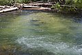
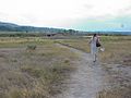
 Algae mat - panoramio.jpg 3,264 × 1,840; 2.35 MB
-
 Alpine Nation (264131389).jpeg 2,048 × 842; 484 KB
-
 Another Planet (219523749).jpeg 2,048 × 1,362; 1.11 MB
-
 Aquilegia coerulea var. ochroleuca - Whitney Brook Matson 01.jpg 1,536 × 2,048; 915 KB
-
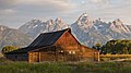
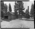
 Barn in the mountains (Unsplash).jpg 4,304 × 3,444; 3.6 MB
-
 Black road along the mountains (Unsplash).jpg 4,928 × 3,264; 11.19 MB
-
 Black Sand basin - panoramio.jpg 4,320 × 3,240; 2.92 MB
-
 Bridge on Hidden Falls Trail - Tetons DyeClan.com - panoramio.jpg 3,088 × 2,056; 4.9 MB
-
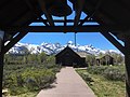
 Chapel of the Transfiguration WY.jpg 4,032 × 3,024; 6.71 MB
-
 Chapel of the Transfiguration Wyoming by Sammi Brooks 2017.jpg 4,032 × 3,024; 5.94 MB
-
 Childrenplaying.JPG 3,072 × 2,304; 3.91 MB
-
 Cliff Geyser in Black Sand Basin DyeClan.com - panoramio.jpg 2,448 × 3,264; 5.87 MB
-
 Colter Bay Marina, Jackson Lake, GrandTeton 2011 (29059406816).jpg 1,163 × 813; 468 KB
-
 Crested Pool. Yellowstone National Park, Wyoming (30529248792).jpg 3,493 × 2,328; 5.57 MB
-
 Departing Storm (44101848741).jpg 2,048 × 1,365; 2.51 MB
-
 Driftwood (246903945).jpeg 2,048 × 1,362; 965 KB
-
 Fireweed Wildflower at Jenny Lake, DyeClan.com - panoramio.jpg 3,000 × 4,000; 3.85 MB
-
 Fishing Cone (3679483926).jpg 1,067 × 1,600; 579 KB
-
 Flag of Teton County, Wyoming.svg 512 × 307; 9 KB
-
 Glacial Lakes, DyeClan.com - panoramio.jpg 3,000 × 4,000; 4.3 MB
-
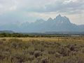
 Grand Teton (Unsplash).jpg 4,272 × 2,145; 2.01 MB
-
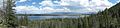
 Grand Teton lake panorama (Unsplash).jpg 5,392 × 1,901; 2.59 MB
-
 Grand Teton, United States (Unsplash).jpg 4,928 × 3,264; 6.33 MB
-
 Grassy Lake Dam WY1.jpg 350 × 230; 25 KB
-

-
-
-
-

-
-

-

-
-

-

-

-
 Hello (223187595).jpeg 2,048 × 1,362; 1.45 MB
-
 Hi Do You Wanna Be Friends (224018489).jpeg 2,048 × 1,362; 1.12 MB
-
 Hidden Falls - panoramio.jpg 1,024 × 1,280; 829 KB
-
 Hidden Falls - Teton National Park DyeClan.com - panoramio.jpg 2,448 × 3,264; 4.47 MB
-
 High on a Hill.jpg 2,448 × 3,264; 1.26 MB
-
 Horses In The Tetons (245997065).jpeg 1,888 × 1,318; 1.08 MB
-
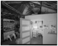
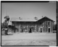
 INTERIOR, BOILERS - Lake Lodge, Boiler House, Lake, Teton County, WY HABS WYO,20-LAK,2B-3.tif 5,560 × 4,467; 23.69 MB
-

-

-

-

-
-
 Is This For Real (221059555).jpeg 2,048 × 1,362; 1.02 MB
-
 Isalake.jpg 298 × 219; 41 KB
-
-
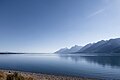 Jackson Lake, Grand Teton National Park (21442584983).jpg 2,048 × 1,365; 526 KB
-
 Jenny Lake (215840701).jpeg 2,048 × 1,365; 1.03 MB
-
 Jenny Lake, DyeClan.com - panoramio.jpg 3,296 × 2,472; 1.92 MB
-
 Jenny Lake, Grand Teton National Park - panoramio.jpg 4,246 × 1,000; 1.05 MB
-
 Jenny Lake, United States (Unsplash).jpg 5,256 × 7,880; 10.74 MB
-
 June 2022 Teton County, Wyoming, tornado damage.jpg 578 × 768; 258 KB
-
 KJAC Aerial Photograph.jpg 4,020 × 5,037; 19.06 MB
-
 Lake Jackson, Wyoming (49936182298).jpg 2,048 × 1,152; 1.17 MB
-
 Lake of Craggs - panoramio.jpg 1,280 × 1,024; 295 KB
-
 Leigh Lake and Mount Moran Grand Teton National Park.jpg 780 × 523; 106 KB
-
 Leigh Lake With Mt Moran (264131103).jpeg 2,048 × 1,129; 1.19 MB
-
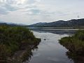
 Madison River - panoramio (1).jpg 5,184 × 3,456; 9.16 MB
-

-
 Mammooth Springs Bison (35924434).jpeg 2,048 × 1,199; 775 KB
-
 Marion Lake, 2014, Grand Teton National Park.jpg 4,000 × 1,612; 5.09 MB
-

-
 Midway Geyser Basin in Yellowstone DyeClan.com - panoramio (1).jpg 3,850 × 1,548; 674 KB
-
 Midway Geyser Basin in Yellowstone DyeClan.com - panoramio (2).jpg 3,088 × 2,056; 4.17 MB
-
 Midway Geyser Basin in Yellowstone DyeClan.com - panoramio (3).jpg 3,088 × 2,056; 3.5 MB
-
 Midway Geyser Basin in Yellowstone DyeClan.com - panoramio.jpg 3,264 × 2,448; 5.85 MB
-
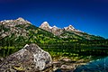
 Moose Pond and Grand Teton - panoramio.jpg 1,944 × 2,592; 2.59 MB
-
 Moose, United States (Unsplash).jpg 3,602 × 1,966; 5.01 MB
-
 Mormon Row (48197196).jpeg 2,048 × 1,365; 647 KB
-
 Mormon Row, Moose, United States (Unsplash).jpg 3,946 × 2,200; 2.24 MB
-
 MormonRowHistoricDistrict.jpg 3,538 × 1,199; 2.3 MB
-
 Morning Over The Desert (246105421).jpeg 2,048 × 1,378; 654 KB
-
 Morningglory2021.jpg 3,024 × 2,096; 2.34 MB
-
 Mountain lake in Grand Teton National Park (Unsplash).jpg 5,184 × 2,916; 3.38 MB
-
 Mvc-594x (5270815958).jpg 1,024 × 768; 183 KB
-
 Mvc-595x (5270207707).jpg 1,024 × 768; 108 KB
-
 Mvc-602x (5270208231).jpg 1,024 × 768; 140 KB
-
 Mvc-603x (5270208307).jpg 1,024 × 768; 145 KB
-
 Mvc-604x (5270816734).jpg 1,024 × 768; 140 KB
-
 Mvc-608x (5270208721).jpg 1,024 × 768; 264 KB
-
 Mvc-609x (5270208797).jpg 1,024 × 768; 183 KB
-
 Mvc-612x (5270209015).jpg 1,024 × 768; 133 KB
-
 Mvc-614x (5270209185).jpg 1,024 × 768; 106 KB
-
 Mvc-616x (5270817808).jpg 1,024 × 768; 92 KB
-
 Mvc-617x (5270817884).jpg 1,024 × 768; 237 KB
-
 Mvc-618x (5270209591).jpg 1,024 × 768; 168 KB
-
 Mvc-619x (5270818044).jpg 1,024 × 768; 100 KB
-
 Mvc-620x (5270209739).jpg 1,024 × 768; 125 KB
-
 Mvc-621x (5270818260).jpg 1,024 × 768; 221 KB
-
 Mvc-622x (5270209953).jpg 1,024 × 768; 261 KB
-
 Mvc-623x (5270818408).jpg 1,024 × 768; 90 KB
-
 Mvc-624x (5270818472).jpg 1,024 × 768; 93 KB
-
 Mvc-625x (5270210169).jpg 1,024 × 768; 289 KB
-
 Mvc-626x (5270818622).jpg 1,024 × 768; 189 KB
-
 Mvc-627x (5270818688).jpg 1,024 × 768; 203 KB
-
 Mvc-628x (5270210407).jpg 1,024 × 768; 202 KB
-
 Mvc-629x (5270818816).jpg 1,024 × 768; 227 KB
-
 Mvc-630x (5270210575).jpg 1,024 × 768; 226 KB
-
 Mvc-631x (5270210653).jpg 1,024 × 768; 145 KB
-
 Mvc-632x (5270210769).jpg 1,024 × 768; 152 KB
-
 Mvc-633x (5270210815).jpg 1,024 × 768; 204 KB
-
 Mvc-634x (5270819160).jpg 1,024 × 768; 247 KB
-
 Mvc-635x (5270210983).jpg 1,024 × 768; 89 KB
-
 Mvc-636x (5270211067).jpg 1,024 × 768; 116 KB
-
 Mvc-637x (5270211137).jpg 1,024 × 768; 131 KB
-
 Mvc-638x (5270819462).jpg 1,024 × 768; 113 KB
-
 Mvc-639x (5270819526).jpg 1,024 × 768; 95 KB
-
 Mvc-640x (5270211339).jpg 1,024 × 768; 82 KB
-
 Mvc-641x (5270819658).jpg 1,024 × 768; 82 KB
-
 Mvc-642x (5270819732).jpg 1,024 × 768; 99 KB
-
 Mvc-643x (5270211529).jpg 1,024 × 768; 86 KB
-
 Mvc-644x (5270211599).jpg 1,024 × 768; 80 KB
-
 Mvc-645x (5270211681).jpg 1,024 × 768; 110 KB
-
 Mvc-646x (5270820032).jpg 1,024 × 768; 92 KB
-
 Mvc-647x (5270211805).jpg 1,024 × 768; 150 KB
-
 Mvc-648x (5270820182).jpg 1,024 × 768; 95 KB
-
 Mvc-649x (5270211921).jpg 1,024 × 768; 102 KB
-
 Mvc-650x (5270820336).jpg 1,024 × 768; 204 KB
-
 Mvc-651x (5270820396).jpg 1,024 × 768; 133 KB
-
 Mvc-652x (5270212157).jpg 1,024 × 768; 100 KB
-
 Mvc-653x (5270820540).jpg 1,024 × 768; 86 KB
-
 Mvc-654x (5270212289).jpg 768 × 1,024; 166 KB
-
 Mvc-655x (5270212393).jpg 1,024 × 768; 112 KB
-
 Mvc-656x (5270212455).jpg 1,024 × 768; 114 KB
-
 Mvc-699x (5270824092).jpg 1,024 × 768; 265 KB
-
 Mvc-700x (5270824194).jpg 1,024 × 768; 259 KB
-
 Mvc-701x (5270215949).jpg 1,024 × 768; 251 KB
-

-

-

-
 NRCSWY02022 - Wyoming (6909)(NRCS Photo Gallery).jpg 1,500 × 2,100; 5.15 MB
-
 NRCSWY02022 - Wyoming (6909)(NRCS Photo Gallery).tif 1,500 × 2,100; 12.02 MB
-
 Old Faithful (221979627).jpeg 2,048 × 1,362; 869 KB
-
 On Jenny Lake - Teton National Park DyeClan.com - panoramio.jpg 3,088 × 2,056; 3.89 MB
-
-

-
 Oxbow Bend (264131257).jpeg 2,048 × 1,014; 1.02 MB
-
 Pfeiffer Homestead outhouse 374014pu.jpg 4,050 × 5,132; 9.59 MB
-

-

-
 Reflections (35924442).jpeg 2,048 × 1,368; 426 KB
-
 Remnants of '88 - panoramio.jpg 2,292 × 3,056; 1 MB
-
 Rivererside Geyser Erupting.jpg 4,000 × 3,000; 10.47 MB
-

-
 Rockchuck Peak (189236059).jpeg 2,048 × 1,365; 821 KB
-
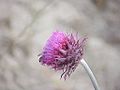
 Rocky Mountain Fringed Gentian - Flickr - brewbooks (1).jpg 4,050 × 3,148; 5.58 MB
-
 Rocky Mountain Fringed Gentian - Flickr - brewbooks (2).jpg 4,608 × 3,456; 8.03 MB
-
 Rocky Mountain Fringed Gentian - Flickr - brewbooks (3).jpg 3,783 × 2,345; 4.57 MB
-
 Rocky Mountain Fringed Gentian - Flickr - brewbooks.jpg 4,608 × 3,456; 6.67 MB
-
 Section of Burned Forest, DyeClan.com - panoramio.jpg 4,000 × 3,000; 5.22 MB
-
 Shell Geyser, Biscuit Basin, Yellowstone DyeClan.com - panoramio.jpg 2,448 × 3,264; 6.93 MB
-

-
 Silver Globe, Biscuit Basin, Yellowstone DyeClan.com - panoramio.jpg 3,264 × 2,448; 6.63 MB
-
 Smokey Tetons - panoramio.jpg 2,160 × 1,440; 223 KB
-
 Snake River Canyon WY1.jpg 2,335 × 3,657; 9.56 MB
-
 Snake River Overlook (264130877).jpeg 2,048 × 935; 732 KB
-
-

-

-
 South Park WY1.jpg 3,870 × 2,210; 7.83 MB
-
 Spouting Off (241847475).jpeg 2,048 × 1,365; 757 KB
-
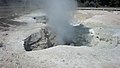 Steam vent - panoramio.jpg 3,264 × 1,840; 1.51 MB
-

-
-
 Storm Moving Into The Plains (189271553).jpeg 2,048 × 1,365; 502 KB
-
 String Lake - panoramio.jpg 1,620 × 1,080; 326 KB
-
 Taggert Lake Grand Teton National Park (222649179).jpeg 2,000 × 1,333; 1,007 KB
-
 Targhee Road Upgrade & Lift Expansion Plan.jpg 953 × 616; 241 KB
-
 Teton County, WY, USA - panoramio (1).jpg 800 × 410; 411 KB
-
 Teton County, WY, USA - panoramio (10).jpg 6,338 × 3,789; 1.18 MB
-
 Teton County, WY, USA - panoramio (11).jpg 3,629 × 2,592; 748 KB
-
 Teton County, WY, USA - panoramio (12).jpg 6,879 × 2,004; 890 KB
-
 Teton County, WY, USA - panoramio (13).jpg 3,264 × 2,448; 3.14 MB
-
 Teton County, WY, USA - panoramio (14).jpg 3,264 × 2,448; 2.73 MB
-
 Teton County, WY, USA - panoramio (15).jpg 3,264 × 2,448; 3.15 MB
-
 Teton County, WY, USA - panoramio (16).jpg 3,264 × 2,448; 3.1 MB
-
 Teton County, WY, USA - panoramio (17).jpg 3,264 × 2,448; 3.11 MB
-
 Teton County, WY, USA - panoramio (18).jpg 3,264 × 2,448; 3.11 MB
-
 Teton County, WY, USA - panoramio (19).jpg 2,988 × 5,312; 7.88 MB
-
 Teton County, WY, USA - panoramio (20).jpg 5,312 × 2,988; 4.8 MB
-
 Teton County, WY, USA - panoramio (21).jpg 2,988 × 5,312; 2.2 MB
-
 Teton County, WY, USA - panoramio (22).jpg 5,312 × 2,988; 7.3 MB
-
 Teton County, WY, USA - panoramio (7).jpg 3,072 × 2,048; 3.73 MB
-
 Teton County, WY, USA - panoramio (8).jpg 3,072 × 2,048; 2.85 MB
-
 Teton County, WY, USA - panoramio (9).jpg 3,629 × 2,592; 832 KB
-
 Teton Moran (264130989).jpeg 2,048 × 1,100; 779 KB
-
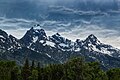
 Teton Range (21444211903).jpg 2,048 × 1,536; 1.39 MB
-
 Teton Siesta (189236099).jpeg 2,048 × 683; 496 KB
-
 The Backdrop (264131357).jpeg 2,048 × 963; 895 KB
-
 The Coachman Inn Motel - panoramio.jpg 3,264 × 2,448; 2.31 MB
-
 The First Light (264130915).jpeg 2,048 × 981; 828 KB
-
 The Flow (35924438).jpeg 1,437 × 2,048; 1.32 MB
-
 The Golden Mountain (35924432).jpeg 2,048 × 1,227; 556 KB
-
 The Hot Mammooth (35924436).jpeg 1,359 × 2,048; 629 KB
-
 The Majestic (264131479).jpeg 2,048 × 1,055; 869 KB

.jpeg)

.jpg)
.jpg)


.jpg)
.jpg)
.jpg)
.jpeg)

.jpg)

.jpg)
.jpg)

.jpeg)
.jpeg)


.jpeg)
.jpeg)

.jpg)
.jpg)
.jpeg)

.jpg)


.jpg)


.jpeg)
.jpg)
.jpeg)
.jpg)
.jpg)


.jpg)
.jpeg)
.jpg)
.jpeg)

.jpg)
.jpg)
.jpg)
.jpg)
.jpg)
.jpg)
.jpg)
.jpg)
.jpg)
.jpg)
.jpg)
.jpg)
.jpg)
.jpg)
.jpg)
.jpg)
.jpg)
.jpg)
.jpg)
.jpg)
.jpg)
.jpg)
.jpg)
.jpg)
.jpg)
.jpg)
.jpg)
.jpg)
.jpg)
.jpg)
.jpg)
.jpg)
.jpg)
.jpg)
.jpg)
.jpg)
.jpg)
.jpg)
.jpg)
.jpg)
.jpg)
.jpg)
.jpg)
.jpg)
.jpg)
.jpg)
.jpg)
.jpg)
.jpg)
.jpg)
.jpg)
.jpg)
.jpg)
.jpg)
(NRCS_Photo_Gallery).jpg)
.jpeg)

.jpeg)

.jpeg)


.jpeg)
.jpg)
.jpg)
.jpg)


.jpeg)

.jpeg)

.jpeg)

.jpeg)

.jpg)
.jpg)
.jpg)
.jpg)
.jpg)
.jpg)
.jpg)
.jpg)
.jpg)
.jpg)
.jpg)
.jpg)
.jpg)
.jpg)
.jpg)
.jpg)
.jpeg)
.jpg)
.jpeg)

.jpeg)
.jpeg)
.jpeg)
.jpeg)
.jpeg)
.jpeg)
.jpg)
.jpg)
.jpg)
.jpeg)