Category:Strait of Georgia
strait in North America  | |||||
| Upload media | |||||
| Instance of | |||||
|---|---|---|---|---|---|
| Part of | |||||
| Named after | |||||
| Located in protected area |
| ||||
| Location |
| ||||
| Connects with |
| ||||
| Length |
| ||||
| Inflows | |||||
| Different from | |||||
 | |||||
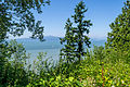
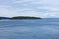
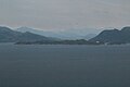
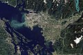
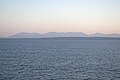
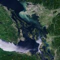
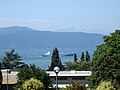
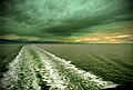
Strait of Georgia separates Vancouver Island from British Columbia mainland. Many of British Columbia's islands are within this strait.
Subcategories
This category has the following 13 subcategories, out of 13 total.
A
- Ahgykson (3 F)
B
- Ballenas Islands (2 F)
D
G
H
- Hernando Island (2 F)
S
T
- Thormanby Islands (2 F)
- Trail Bay (3 F)
W
- Whaling Station Bay (2 F)
Media in category "Strait of Georgia"
The following 133 files are in this category, out of 133 total.
-
 Across the Strait (16071283013).jpg 2,500 × 1,667; 1.01 MB
-
 Admiralty Chart No 576 Strait of Georgia Alden Bank to Nanaimo, Published 1952.jpg 20,871 × 11,257; 71.88 MB
-
 Another sunset 2.jpg 7,942 × 3,896; 8.97 MB
-
 Ballenas arrowsmith.jpg 7,792 × 1,320; 5.8 MB
-

-
 BC trip (9536145540).jpg 2,448 × 3,264; 2 MB
-
 Bell buoy P 54 Comox Bar (164366301) (cropped).jpg 241 × 322; 50 KB
-
 Bell buoy P 54 Comox Bar (164366301).jpg 569 × 900; 199 KB
-
 Bow of Queen of Oak Bay, sailing across the Straits of Georgia (5946420656).jpg 4,752 × 3,168; 3.41 MB
-
 Brew Bay BC from air.jpg 5,184 × 3,456; 7.79 MB
-
 British Columbia IMG 2245 (14625655813).jpg 2,421 × 3,631; 590 KB
-
 British Columbia IMG 2251 (14625657253).jpg 4,172 × 2,781; 849 KB
-
 British Columbia IMG 2254 (14602339251).jpg 4,203 × 2,802; 716 KB
-
 Calm Waters, Calm Skies (46328360875).jpg 4,370 × 3,278; 1.81 MB
-
 Campbell River Fisherman's Wharf 1.jpg 6,000 × 4,000; 12.04 MB
-
 Campbell River Fisherman's Wharf 2.jpg 6,000 × 4,000; 13.18 MB
-

-
 Chrome Island Light 2.jpg 1,926 × 1,188; 1.52 MB
-
 Chrome island light.jpg 1,600 × 1,200; 1.03 MB
-
 Clear December air over Georgia Strait at sunset. (4164104741).jpg 3,264 × 2,448; 2.73 MB
-
 Clouds 14.jpg 4,608 × 2,112; 2.32 MB
-
 Comox Glacier from Powell River (998366107).jpg 2,717 × 1,807; 2.88 MB
-
 Comox Glacier from Powell River (998366487).jpg 3,037 × 2,027; 3.5 MB
-
 Comox Glacier from Powell River (998366609).jpg 3,024 × 2,015; 3.83 MB
-
 Comox Glacier from Powell River, June 2007 (927339073).jpg 3,072 × 2,304; 3.86 MB
-
 Comox Glacier from Powell River, June 2007 (927339229).jpg 3,072 × 2,304; 4.6 MB
-
 Comox Valley from Mt Washington.jpg 1,317 × 988; 225 KB
-
 Cooper Green Regional Park.jpg 4,176 × 3,131; 2.42 MB
-
 Courtenay Banner.jpg 6,904 × 984; 4.52 MB
-
 Coutenay mtns.jpg 6,904 × 1,576; 7.26 MB
-
 Cruising over the Georgia Straight @ 3000' (375235592).jpg 2,272 × 1,704; 1.19 MB
-
 Dark Reflections.jpg 4,032 × 3,024; 1.54 MB
-
 Davis bay 4.jpg 4,608 × 2,112; 2.73 MB
-
 Davis bay 5.jpg 4,618 × 3,464; 3.17 MB
-
 December cycling, Lantzville, BC, adjacent to Nanaimo. (4164024223).jpg 2,439 × 2,120; 2.07 MB
-
 Duke Point ferry terminal.jpg 2,061 × 1,620; 1.8 MB
-
 English Bay from Point Grey 01.jpg 4,608 × 3,072; 14.91 MB
-
 English Bay from Point Grey 02.jpg 4,608 × 3,072; 14.84 MB
-
 English Bay from Point Grey 03.jpg 4,608 × 3,072; 14.24 MB
-
 English Bay from Point Grey 04.jpg 4,608 × 3,072; 13.77 MB
-
 Ferry Coastal Inspiration in Strait of Georgia.jpg 2,832 × 2,128; 9.15 MB
-
 Ferry ride between Vancouver and Victoria (2556529575).jpg 600 × 400; 52 KB
-
 Fire during the crossing (19993131131).jpg 2,500 × 813; 695 KB
-
 Flat top islands.jpg 3,072 × 2,304; 3.35 MB
-
 Flight from Vancouver to Kauai. Strait of Georgia, Vancouver (502681) (16502173567).jpg 4,000 × 2,248; 1.62 MB
-
 Flight from Vancouver to Kauai. Strait of Georgia, Vancouver (502683) (16521863808).jpg 3,376 × 1,900; 993 KB
-
 Flight from Vancouver to Kauai. Strait of Georgia, Vancouver (502684) (16521859528).jpg 3,850 × 2,164; 950 KB
-
 Flight from Vancouver to Kauai. Strait of Georgia, Vancouver (502685) (16097973734).jpg 3,793 × 2,132; 925 KB
-
 Flight from Vancouver to Kauai. Strait of Georgia, Vancouver (502686) (16534158409).jpg 3,658 × 2,056; 800 KB
-

-
 Garry Point Lighthouse - panoramio.jpg 2,048 × 1,536; 1.34 MB
-
 Georgia Straight Sunset (15505641496).jpg 4,928 × 2,772; 4.97 MB
-
 Georgia Strait Herring Fishery, 2010 (4395268283).jpg 3,264 × 2,448; 2.54 MB
-
 Georgia strait pano 10.jpg 20,288 × 1,640; 16.51 MB
-
 Gossip Island British Columbia.jpg 6,000 × 4,000; 13 MB
-
 Gulfislfromair.jpg 900 × 675; 80 KB
-
 Hardy Island from air.jpg 5,184 × 3,456; 7.94 MB
-
 Herring fishing, day one.jpg 5,168 × 3,439; 3.95 MB
-
 Herring fishing, day two.jpg 4,165 × 2,314; 1.78 MB
-
 Horswell rock east cardinal buoy.jpg 3,264 × 2,448; 3.19 MB
-
 ISS-62 Strait of Juan de Fuca and Salish Sea.jpg 5,568 × 3,712; 2.51 MB
-
 Kanada (32623279552).jpg 4,608 × 2,592; 2.13 MB
-
 Kitty Coleman Beach Provincial Park (6942517582).jpg 1,024 × 768; 126 KB
-
 Lang Bay BC from air.jpg 5,184 × 3,456; 7.68 MB
-
 Looking back toward Vancouver Island over the Georgia Straight (105071151).jpg 1,704 × 2,272; 1.55 MB
-
 Looking East over Georgia Straight (105073243).jpg 2,272 × 1,704; 2.06 MB
-
 Lund BC from air.jpg 5,184 × 3,456; 7.86 MB
-
 McGod? (4808834849).jpg 599 × 346; 26 KB
-
 Mount Baker from Bellhouse Provincial Park, BC.jpg 4,320 × 3,240; 2.62 MB
-
 My rainbow.jpg 4,608 × 2,112; 2.39 MB
-
 Nanaimo aerial 1.jpg 1,597 × 1,065; 1.5 MB
-
 Nanaimo aerial 2.jpg 1,600 × 1,200; 1.17 MB
-
 Nanaimo from Georgia Strait (3923152907).jpg 3,264 × 2,448; 1.77 MB
-
 Nelson Island from air.jpg 5,184 × 3,456; 7.18 MB
-
 Newcastlepanoramakjfmartin.jpg 7,499 × 2,787; 14.33 MB
-
 North-Shore-Mountains.jpg 5,848 × 3,796; 13.62 MB
-
 On the Booth 6 into Vancouver (406059175).jpg 2,272 × 1,704; 808 KB
-
 On the long sail toward Vancouver.jpg 2,592 × 3,872; 3.26 MB
-
 Passage Island from the ferry.jpg 6,000 × 4,000; 13.17 MB
-
 Pointrobertswide oli 2020210 lrg.jpg 2,695 × 1,797; 5.68 MB
-
 Pointrobertswide oli 2020210.jpg 720 × 480; 508 KB
-
 Red lateral buoy (418164438).jpg 3,008 × 2,000; 3.27 MB
-
 Sailboat in the Strait of Georgia, August 2017.jpg 5,184 × 3,456; 4.76 MB
-
 Sailboats near Sidney BC.jpg 3,733 × 2,499; 2.54 MB
-
 Sangster.jpg 2,818 × 1,074; 2.66 MB
-
 Sea line (220308617).jpg 2,136 × 3,452; 3.87 MB
-
 Simson Provincial Park from air.jpg 5,184 × 3,456; 6.68 MB
-
 Small yacht near Prevost Island.jpg 3,872 × 2,592; 4.25 MB
-
 South Texada Island from air.jpg 5,184 × 3,456; 6.91 MB
-
 Spirit of Vancouver Island 2008.jpg 3,587 × 2,401; 2.61 MB
-
 Spirit of Vancouver Island en route to Swartz Bay.jpg 3,872 × 2,592; 2.81 MB
-
 Straight of Georgia (5976735634).jpg 2,796 × 1,869; 965 KB
-
 Straight of Georgia from SFU.JPG 2,048 × 1,098; 271 KB
-
 Strait of Georgia (4191769395).jpg 4,000 × 1,840; 5.63 MB
-
 Strait of Georgia 1.jpg 4,608 × 3,072; 7.65 MB
-
 Strait of Georgia and entrance to Howe Sound (2289593134).jpg 3,310 × 1,412; 1.66 MB
-
 Strait of Georgia from Orcas Island.jpg 5,957 × 2,280; 1.84 MB
-
 Strait of Georgia near south of Vancouver Island, August 2017.jpg 5,184 × 3,456; 4.6 MB
-
 Strait of Georgia Vancouver.jpg 4,288 × 1,777; 483 KB
-
 Strait of Georgia.jpg 500 × 187; 49 KB
-
 Sunset over Georgia Straight (464787240).jpg 640 × 480; 24 KB
-
 Sunset over Strait of Georgia (1).jpg 6,000 × 4,000; 11.91 MB
-
 Sunset over Strait of Georgia (2).jpg 6,000 × 4,000; 12.94 MB
-
 Sunset over Strait of Georgia (3).jpg 6,000 × 4,000; 12.87 MB
-
 Sunset Over Strait of Georgia - British Columbia (6301134356).jpg 3,888 × 2,592; 1.75 MB
-
 Sunset over the Georgia Straight (149403324).jpg 2,272 × 1,704; 1.97 MB
-
 Texada Island from air.jpg 5,184 × 3,456; 6.26 MB
-
 The Big Muddy, Western Edition (6987590721).jpg 5,559 × 3,706; 5.91 MB
-
 The Coast Guard in Georgia Strait.jpg 2,774 × 2,036; 2.44 MB
-
 Tug towing logs in BC.jpg 1,000 × 729; 304 KB
-
 Upwood point light texada.jpg 3,264 × 2,448; 5.08 MB
-

-

-
 Vancouver Island from the ferry (1).jpg 6,000 × 4,000; 13.11 MB
-
 Vancouver Island from the ferry (2).jpg 5,776 × 3,808; 12.34 MB
-
 Vancouver Island from the ferry (3).jpg 6,000 × 4,000; 12.58 MB
-
 Vancouver Island from the ferry (4).jpg 6,000 × 4,000; 12.75 MB
-
 Vancouver Island from the ferry (5).jpg 6,000 × 4,000; 14.04 MB
-
 Vancouver Island from the ferry (6).jpg 5,760 × 3,760; 12.24 MB
-
 Vancouver Island from the ferry (7).jpg 5,848 × 3,824; 12.74 MB
-
 Vancouver Island, BC.jpg 3,264 × 2,448; 1.77 MB
-
 Vancouver, Canada ESA23172710.jpeg 8,094 × 8,094; 24.8 MB
-
 Vancouver, Canada ESA23172710.tiff 16,187 × 16,187; 550.28 MB
-
 View from Collinson Point.JPG 160 × 120; 13 KB
-
 View from lower Eagle Bluffs.jpg 10,943 × 3,535; 15.1 MB
-
 View from roberts creek.JPG 2,592 × 1,944; 874 KB
-
 View of Georgia Strait (UBC campus-2009).jpg 3,264 × 2,448; 1.98 MB
-
 Wake in the Sunset (6013313460).jpg 2,790 × 1,873; 789 KB
-
 Wea02169 - Flickr - NOAA Photo Library.jpg 1,808 × 1,212; 1.21 MB
-

-
 Where we've been.jpg 3,872 × 2,592; 3.69 MB
-
 Wreck of the steamer DEL NORTE, 1868 (TRANSPORT 647).jpg 768 × 395; 75 KB
-
 ジョージア海峡.JPG 640 × 480; 32 KB
.jpg)


.jpg)
.jpg)
_(cropped).jpg)
.jpg)
.jpg)

.jpg)
.jpg)
.jpg)
.jpg)


_-_Yale_Center_for_British_Art.jpg)


.jpg)
.jpg)
.jpg)
.jpg)
.jpg)


.jpg)


.jpg)


.jpg)

_(16502173567).jpg)
_(16521863808).jpg)
_(16521859528).jpg)
_(16097973734).jpg)
_(16534158409).jpg)
.jpg)

.jpg)
.jpg)


.jpg)
.jpg)

.jpg)
.jpg)

.jpg)


.jpg)


.jpg)


.jpg)


.jpg)


.jpg)

.jpg)

.jpg)


.jpg)
.jpg)
.jpg)
.jpg)
.jpg)
.jpg)

.jpg)


_await_the_arrival_of_a_small_craft.jpg)
_10.jpg)
.jpg)
.jpg)
.jpg)
.jpg)
.jpg)
.jpg)
.jpg)


.jpg)
.jpg)

.jpg)


.jpg)
.jpg)
.jpg)