Category:Snares Islands
Regions of New Zealand: Auckland · Bay of Plenty · Canterbury · Gisborne · Hawke's Bay · Manawatu-Whanganui · Marlborough · Nelson · Otago · Northland · Southland · Taranaki · Tasman · Waikato · Wellington · West Coast
Outlying islands, territories and dependencies: Antipodes Islands · Auckland Islands · Bounty Islands · Chatham Islands · Kermadec Islands · Snares Islands · Three Kings Islands · Tokelau – Territory with specific status: Ross Dependency
Associated countries: Cook Islands · Niue
Outlying islands, territories and dependencies: Antipodes Islands · Auckland Islands · Bounty Islands · Chatham Islands · Kermadec Islands · Snares Islands · Three Kings Islands · Tokelau – Territory with specific status: Ross Dependency
Associated countries: Cook Islands · Niue
small group of islands SSW of Stewart Island, New Zealand   | |||||
| Upload media | |||||
| Instance of |
| ||||
|---|---|---|---|---|---|
| Part of | |||||
| Location |
| ||||
| Located in or next to body of water | |||||
| Heritage designation |
| ||||
| Time of discovery or invention |
| ||||
| Population |
| ||||
| Area |
| ||||
| Elevation above sea level |
| ||||
 | |||||
Subcategories
This category has only the following subcategory.
Media in category "Snares Islands"
The following 12 files are in this category, out of 12 total.
-
 Broughton Island 1.JPG 3,072 × 2,304; 787 KB
-
 FMIB 50747 South Coast of Snares, Looking East.jpeg 1,192 × 833; 291 KB
-
 FMIB 50748 Western Coast of Snares, Looking South.jpeg 1,192 × 833; 356 KB
-

-
 Insulanoplectron spinosum Observations Snares Island.png 1,050 × 948; 83 KB
-
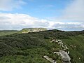
 Snares HoHo Bay.jpg 800 × 600; 71 KB
-
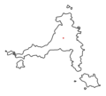
 Snares Islands New Zealand geographic map en.svg 2,751 × 1,800; 195 KB
-
 Snares Islands relief location map.svg 2,751 × 1,800; 190 KB
-
 Snares Loom.jpg 800 × 600; 65 KB
-
 Snares North East Island.jpg 3,072 × 2,304; 891 KB
-
 Snares Western Chain Alert Stack.jpg 3,648 × 2,736; 4.02 MB
-
 SnaresInseln.jpg 562 × 295; 29 KB


