Category:Simushir
island in Kuril Islands, Russia | |||||
| Upload media | |||||
| Instance of | |||||
|---|---|---|---|---|---|
| Part of |
| ||||
| Location | Kurilsky District, Sakhalin Oblast, Russia | ||||
| Located in or next to body of water |
| ||||
| Width |
| ||||
| Length |
| ||||
| Population |
| ||||
| Area |
| ||||
| Elevation above sea level |
| ||||
 | |||||


Simushir (Симушир) / Shimushiru (新知島)
Subcategories
This category has the following 2 subcategories, out of 2 total.
M
- Milna (volcano) (1 F)
P
- Prevo (vulcan) (1 F)
Media in category "Simushir"
The following 19 files are in this category, out of 19 total.
-
 Brouton Bay (ISS015-E-26171, cropped).jpg 367 × 183; 16 KB
-
 Brouton Bay.jpg 4,608 × 3,456; 2.8 MB
-
 IleSimushir.png 4,320 × 4,320; 15.15 MB
-
 Kuriles Simushir.PNG 365 × 235; 4 KB
-
 Nested Calderas of Zavaritskogo (153906).jpg 5,191 × 3,461; 1.94 MB
-
 Simushir ISS006-E-24468.jpg 3,032 × 2,008; 848 KB
-
 Simushir ISS015-E-26171.jpg 1,000 × 661; 129 KB
-
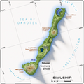
 Simushir.png 334 × 245; 36 KB
-
 SimushirDetail.png 4,320 × 4,320; 13.28 MB
-
 SimushirGeneral.png 7,560 × 7,560; 27.84 MB
-
 Urataman.jpg 2,000 × 2,500; 918 KB
-
 USSR map NL 56-2 Ketoi-shima.jpg 5,000 × 3,924; 2.74 MB
-
 USSR map NL 56-5 Take-yama.jpg 5,000 × 3,927; 2.62 MB
-
 Zavaritskii Volcano, Russian Kuril Islands (ASTER).jpg 3,083 × 3,305; 834 KB
-
 Zavaritskogo ISS cut.jpg 2,240 × 1,888; 1.43 MB
-
 Вулкан Мильна (Курилы, о.Симушир).jpg 503 × 480; 43 KB
-
 Карта Симушира.png 4,320 × 4,320; 14.8 MB
-
 新知島の地図.png 4,320 × 4,320; 15.08 MB
-
 新知島武魯頓湾に面した旧ソ連軍基地の廃墟.JPG 4,608 × 3,456; 3.27 MB
.jpg)

.jpg)


.jpg)

.jpg)


