Category:Sentinel Range
mountain range in Antarctica, northward of Minnesota Glacier, forms the northern half of the Ellsworth Mountains   | |||||
| Upload media | |||||
| Instance of | |||||
|---|---|---|---|---|---|
| Location | Antarctic Treaty area | ||||
| Has part(s) |
| ||||
| Width |
| ||||
| Length |
| ||||
| Mountain range | |||||
| Highest point | |||||
| Area |
| ||||
| Elevation above sea level |
| ||||
 | |||||
Subcategories
This category has the following 2 subcategories, out of 2 total.
G
- Mount Gardner (1 F)
V
- Vinson Massif (1 P, 16 F)
Media in category "Sentinel Range"
The following 10 files are in this category, out of 10 total.
-
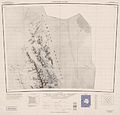
 C78082s1 Ant.Map Vinson Massif.jpg 3,849 × 3,247; 1.43 MB
-
 Craddock-Massif-and-Vinson-Plateau.jpg 1,200 × 795; 319 KB
-
 Ellsworth-Mountains-location-map.png 1,600 × 1,260; 3.04 MB
-
 Mount Press, Ellsworth Mountains, Antarctica.jpg 1,000 × 708; 48 KB
-
 Mount Shinn from North East by Christian Stangl (flickr).jpg 1,400 × 930; 1,003 KB
-
 Mount Sisu location.jpg 491 × 681; 170 KB
-
 Mount Tyree (Antarctica) from East by Christian Stangl (flickr).jpg 1,400 × 901; 814 KB
-
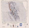
 Northern-Sentinel-Map.jpg 3,222 × 3,078; 5.3 MB
-
 Sentinel Range, Ellsworth Mountains, Antarctica.jpg 2,000 × 1,325; 1.08 MB
-
 Vinson-Map.jpg 3,207 × 3,070; 5.48 MB


.jpg)

_from_East_by_Christian_Stangl_(flickr).jpg)

