Category:Rutherglen
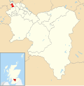
English: Rutherglen is a town in South Lanarkshire, Scotland.
town in South Lanarkshire, Scotland, UK  | |||||
| Upload media | |||||
| Instance of | |||||
|---|---|---|---|---|---|
| Location |
| ||||
| Population |
| ||||
| Different from | |||||
 | |||||
Subcategories
This category has the following 29 subcategories, out of 29 total.
A
- Auchenshuggle Bridge (7 F)
B
C
- Croftfoot railway station (19 F)
- Cuningar Loop Park (23 F)
D
- Dalmarnock Bridge (15 F)
- Dalmarnock railway bridge (15 F)
E
F
G
H
M
- M74 Rutherglen viaduct (20 F)
O
P
Q
R
- Rutherglen Bridge (17 F)
- Rutherglen Glencairn F.C. (33 F)
- Rutherglen Ladies F.C. (1 F)
S
- Shawfield Smartbridge (19 F)
- Shawfield Stadium (14 F)
- Stonelaw Parish Church (6 F)
T
- Topgolf Glasgow (5 F)
Media in category "Rutherglen"
The following 158 files are in this category, out of 158 total.
-
 2018 European Mountain Bike Championships DSCF6205 (43193681244).jpg 1,980 × 1,485; 343 KB
-
 2018 European Mountain Bike Championships DSCF6269 (43193836054).jpg 1,485 × 1,980; 581 KB
-
 A small park off Cityford Drive - geograph.org.uk - 2485090.jpg 640 × 480; 287 KB
-
 Apartments at Blackfaulds - geograph.org.uk - 108263.jpg 640 × 480; 124 KB
-

-
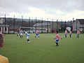
 Astroturf pitch (geograph 2482650).jpg 640 × 480; 237 KB
-
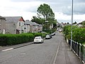
 Bankhead Road - geograph.org.uk - 1232618.jpg 640 × 480; 113 KB
-
 Bend in King's Park Avenue - geograph.org.uk - 1232620.jpg 640 × 480; 106 KB
-
 Bins on King Street - geograph.org.uk - 3407554.jpg 503 × 640; 124 KB
-

-
 Braidfauld and the River Clyde from the air (geograph 2987418).jpg 480 × 640; 155 KB
-
 Buildings on Dalmarnock Road - geograph.org.uk - 1167871.jpg 640 × 480; 101 KB
-
 Burgh Primary School (geograph 3411619).jpg 640 × 480; 115 KB
-
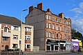
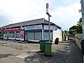
 Business premises in Rutherglen - geograph.org.uk - 3729754.jpg 640 × 480; 58 KB
-
 Cabinet in Rutherglen (14096567488).jpg 4,520 × 3,315; 5.39 MB
-
 Cabinet in Rutherglen (14096607229).jpg 4,627 × 3,014; 5.66 MB
-
 Cairnhall 2016-03-07.jpg 1,920 × 2,560; 2.08 MB
-
 Calderwood Road (geograph 7873372).jpg 1,024 × 768; 382 KB
-
 Calderwood Road - geograph.org.uk - 2482662.jpg 640 × 480; 293 KB
-

-
 Cambuslang from the air (geograph 4517259) (burnside).jpg 347 × 260; 88 KB
-
 Cambuslang from the air (geograph 4517259) (rglen sth).jpg 483 × 362; 149 KB
-
 Cambuslang from the air (geograph 4517259).jpg 640 × 480; 221 KB
-
 Cambuslang from the air (geograph 5374281) (eastfield).jpg 326 × 245; 62 KB
-
 Cambuslang from the air (geograph 5374281).jpg 640 × 480; 189 KB
-
 Cambuslang Road (A724), Rutherglen (geograph 6970536).jpg 1,024 × 705; 136 KB
-
 Cambuslang Road - geograph.org.uk - 1230009.jpg 640 × 480; 113 KB
-

-
 Carmyle and the east end from the air (geograph 2987415).jpg 640 × 480; 177 KB
-
 Castlemilk and Cathkin Braes from the air (geograph 4517246).jpg 640 × 480; 209 KB
-
 Castlemilk Drive (geograph 5409936).jpg 640 × 403; 113 KB
-
 Cathcart Road - geograph.org.uk - 1138135.jpg 640 × 480; 114 KB
-
 Cathkin Landfill Site - geograph.org.uk - 96160.jpg 640 × 480; 101 KB
-
 Chapel Street, Burnhill - geograph.org.uk - 1138139.jpg 640 × 480; 109 KB
-
 Corner of King Street & Queen Street, Rutherglen (geograph 4120917).jpg 5,184 × 3,456; 6.69 MB
-
 Croftfoot Drive and Croftfoot Road (geograph 5780788).jpg 1,600 × 1,200; 369 KB
-
 Croftfoot Road at Castlemilk Road (geograph 5409974).jpg 640 × 480; 222 KB
-
 Crossroads in Croftfoot (geograph 3241587).jpg 640 × 480; 69 KB
-
 Dalmarnock Road (A740) (geograph 6966584).jpg 800 × 600; 81 KB
-
 Dalmarnock road, Rutherglen - geograph.org.uk - 3542580.jpg 640 × 481; 80 KB
-
 Definition of irony^ - geograph.org.uk - 1230002.jpg 640 × 480; 97 KB
-
 Drumilaw Road - geograph.org.uk - 1230089.jpg 640 × 480; 107 KB
-
 Dual Carriageway ahead - geograph.org.uk - 1230094.jpg 640 × 480; 116 KB
-
 Duchess Road - geograph.org.uk - 1230007.jpg 640 × 480; 126 KB
-
 Dunkeld Avenue (geograph 2483149).jpg 640 × 480; 334 KB
-
 East Glasgow from the air (geograph 5374271).jpg 640 × 480; 188 KB
-
 East Kilbride Road - geograph.org.uk - 1230079.jpg 640 × 480; 120 KB
-
 Farmeloan Road - geograph.org.uk - 1167857.jpg 480 × 640; 119 KB
-
 Farmeloan Road at King Street - geograph.org.uk - 3411397.jpg 640 × 480; 138 KB
-
 Flats on Dalmarnock Road (geograph 3629220).jpg 1,024 × 768; 161 KB
-
 Footpath to East Kilbride Road - geograph.org.uk - 1497237.jpg 640 × 480; 187 KB
-
 Forest Path on Cathkin Braes - geograph.org.uk - 125833.jpg 640 × 480; 186 KB
-
 Former Employment Exchange (geograph 3411637).jpg 640 × 367; 80 KB
-
 Former Gateway to Castlemilk Estate - geograph.org.uk - 737295.jpg 640 × 480; 77 KB
-
 Former industrial land - geograph.org.uk - 3395502.jpg 640 × 480; 135 KB
-
 Former Spittal Sports Ground (geograph 5410035).jpg 640 × 480; 152 KB
-
 Former Spittal Sports Ground (geograph 5410060).jpg 640 × 480; 191 KB
-
 Former Spittal Sports Ground - geograph.org.uk - 5410033.jpg 640 × 480; 139 KB
-
 Funeral directors at Rutherglen cemetery - geograph.org.uk - 1232614.jpg 640 × 480; 123 KB
-
 Gable End on Victoria Street - geograph.org.uk - 3411626.jpg 480 × 640; 103 KB
-
 Gable End on Victoria Street - geograph.org.uk - 3411632.jpg 480 × 640; 165 KB
-
 Gallowflat Street (geograph 2981368).jpg 640 × 480; 274 KB
-
 Garden in bloom at Melrose Court - geograph.org.uk - 2959106.jpg 1,024 × 768; 307 KB
-
 Glasgow Road (geograph 3407572).jpg 640 × 442; 98 KB
-
 Glasgow Rutherglen ScottishParliamentConstituency.svg 162 × 143; 18 KB
-
 High Street - geograph.org.uk - 3407519.jpg 640 × 427; 93 KB
-
 Hindu Temple 2016-02-28 16.49.23.jpg 2,560 × 1,920; 1.46 MB
-
 Houses at Bankhead - geograph.org.uk - 3730134.jpg 640 × 480; 62 KB
-
 Houses on Kirkconnel Drive (geograph 5410041).jpg 640 × 406; 123 KB
-
 King Street - geograph.org.uk - 3411409.jpg 640 × 480; 122 KB
-
 King's Park Avenue - geograph.org.uk - 5410051.jpg 640 × 437; 126 KB
-
 Kings Park Avenue (geograph 5410053).jpg 640 × 480; 127 KB
-
 Kings Park Avenue (geograph 6045268).jpg 2,000 × 1,333; 1.9 MB
-
 Kings Park Hotel (geograph 2483191).jpg 640 × 480; 276 KB
-
 Landemer Drive (geograph 2483198).jpg 640 × 480; 247 KB
-
 Limeside Avenue (geograph 2482670).jpg 640 × 480; 252 KB
-
 Looking across Glasgow Road - geograph.org.uk - 1138092.jpg 640 × 480; 110 KB
-
 Looking north on the A749 (geograph 3440551).jpg 640 × 481; 51 KB
-
 M74 extension - geograph.org.uk - 1230011.jpg 640 × 480; 130 KB
-
 M74 extension - geograph.org.uk - 811793.jpg 640 × 426; 64 KB
-
 M74 extension, Rutherglen - geograph.org.uk - 1167862.jpg 640 × 480; 92 KB
-
 M74 Junction 2A.jpg 4,160 × 2,336; 2.35 MB
-

-
 Masonic Lodge, Rutherglen (geograph 3003017).jpg 3,008 × 2,000; 2.91 MB
-

-
 Mill Street, Rutherglen (geograph 4121498).jpg 1,600 × 1,067; 470 KB
-
 Montford Avenue (geograph 2483214).jpg 640 × 480; 275 KB
-
 New motorway bridge over Farmeloan Road - geograph.org.uk - 1230004.jpg 640 × 480; 113 KB
-
 Northbound M74, Junction 2A (geograph 2915365).jpg 640 × 480; 363 KB
-
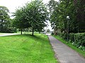 Path by Stonelaw High School - geograph.org.uk - 2485075.jpg 640 × 480; 332 KB
-
 Path off Landemer Drive (geograph 2483208).jpg 640 × 480; 249 KB
-
 Path off Landemer Drive - geograph.org.uk - 2485088.jpg 480 × 640; 377 KB
-
 Pillar box on Limeside Avenue - geograph.org.uk - 2485082.jpg 640 × 480; 342 KB
-
 Plaque on Castle Street (geograph 3411648).jpg 640 × 507; 204 KB
-
 Plaque on King Street (geograph 3407940).jpg 640 × 514; 161 KB
-
 Plinth on Main Street - geograph.org.uk - 3407962.jpg 480 × 640; 140 KB
-
 Public Discussion in Rutherglen (14096749057).jpg 4,865 × 3,012; 6.18 MB
-
 Public Discussion in Rutherglen (14281278642).jpg 5,184 × 3,456; 7.39 MB
-
 Public Discussion in Rutherglen (14282841864).jpg 4,682 × 3,152; 8.11 MB
-
 Public Discussion in Rutherglen (14283321725).jpg 5,048 × 2,963; 7.89 MB
-
 Pubs off Glasgow Road - geograph.org.uk - 3407569.jpg 640 × 397; 101 KB
-
 Queen Street - geograph.org.uk - 3395496.jpg 640 × 480; 122 KB
-
 Queen Street - geograph.org.uk - 3400296.jpg 640 × 480; 116 KB
-
 Railway Bridge in Burnside (geograph 3241604).jpg 640 × 480; 76 KB
-
 Reuther Hall (geograph 3411670).jpg 640 × 480; 118 KB
-
 Road passing Shawfield Stadium (geograph 2644548).jpg 640 × 480; 107 KB
-
 Roadworks on Cambuslang Road - geograph.org.uk - 1230010.jpg 640 × 480; 136 KB
-
 Rubble from M74 construction - geograph.org.uk - 1230006.jpg 640 × 480; 199 KB
-
 Rutherglen - Farmeloan Road - geograph.org.uk - 4671167.jpg 3,264 × 2,448; 1.98 MB
-
 Rutherglen Bowling Club (geograph 2483171).jpg 640 × 480; 233 KB
-
 Rutherglen Cemetery (geograph 4121471).jpg 5,184 × 3,456; 7.73 MB
-
 Rutherglen Central and North.svg 1,319 × 1,345; 2.63 MB
-
 Rutherglen Harbour - geograph.org.uk - 1167886.jpg 640 × 480; 108 KB
-
 Rutherglen Police Station (geograph 3408449).jpg 640 × 359; 81 KB
-
 Rutherglen Primary Care Centre - geograph.org.uk - 7883212.jpg 1,024 × 427; 62 KB
-
 Rutherglen Primary Care Centre 2016-03-07.jpg 2,560 × 686; 582 KB
-
 Rutherglen railway station (geograph 3407923).jpg 640 × 480; 168 KB
-
 Rutherglen railway station (geograph 3411676).jpg 640 × 480; 137 KB
-
 Rutherglen South.svg 1,319 × 1,345; 2.63 MB
-
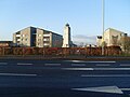
 Rutherglen War Memorial (geograph 4120906).jpg 800 × 1,200; 311 KB
-
 Rutherglen War Memorial (geograph 4121518).jpg 800 × 1,200; 268 KB
-
 Shawfield gateway signs (geograph 7164872).jpg 1,600 × 786; 496 KB
-
 Shops on Kings Park Avenue (geograph 5409073).jpg 640 × 480; 128 KB
-
 Shops on Kings Park Avenue (geograph 5409076).jpg 640 × 480; 123 KB
-
 Small path towards Burnside Road - geograph.org.uk - 1498315.jpg 640 × 480; 146 KB
-
 South Lanarkshire - Cairn Hall, 86 Hamilton Road, Rutherglen, Glasgow - 20200322182453.jpg 1,488 × 1,618; 1.03 MB
-
 South Lanarkshire - Public House, 41 Dalmarnock Road, Glasgow - 20240729093858.jpg 1,983 × 1,335; 1.09 MB
-
 Spittal Estate - geograph.org.uk - 91596.jpg 640 × 480; 141 KB
-
 Spittal Primary F.C. - geograph.org.uk - 741208.jpg 640 × 480; 37 KB
-
 Spittal Primary School - geograph.org.uk - 723809.jpg 640 × 480; 39 KB
-
 St Columbkilles Primary 2016-03-07 panorama.jpg 4,573 × 1,344; 1.35 MB
-
 Stonelaw High School entrance.jpg 3,968 × 2,976; 3.36 MB
-
 Stonelaw playing fields.jpg 3,968 × 2,976; 4.95 MB
-
 Telephone box - geograph.org.uk - 1232622.jpg 640 × 480; 112 KB
-
 Tenement building on Johnstone Drive (geograph 7873371).jpg 1,024 × 768; 329 KB
-
 Tesco Extra Rutherglen (geograph 1695929).jpg 640 × 364; 94 KB
-
 The Croft - geograph.org.uk - 761334.jpg 640 × 480; 62 KB
-
 The Dubliner, Glasgow Road, Rutherglen - geograph.org.uk - 4120913.jpg 5,184 × 3,456; 6.04 MB
-
 The Kings Park Hotel - geograph.org.uk - 5381040.jpg 1,333 × 2,000; 1.44 MB
-
 The Lighthouse Church Centre, Rutherglen (geograph 4121444).jpg 1,600 × 1,067; 564 KB
-
 The Mill Funeral Home, Mill Street, Rutherglen - geograph.org.uk - 4121459.jpg 5,184 × 3,456; 7.53 MB
-
 The Victoria Bar (geograph 3411529).jpg 640 × 480; 126 KB
-
 Tower Block UK photo cl2-67.jpg 2,501 × 1,744; 649 KB
-
 Underpass, Kings Park (geograph 2483224).jpg 640 × 480; 327 KB
-
 Veterinary surgery on East Kilbride Road - geograph.org.uk - 1498321.jpg 640 × 480; 159 KB
-
 Victoria Street - geograph.org.uk - 3411610.jpg 640 × 480; 115 KB
-
 Victoria Street - geograph.org.uk - 3411642.jpg 640 × 480; 109 KB
-
 Victoria Street - geograph.org.uk - 3411652.jpg 640 × 480; 118 KB
-
 View across Glasgow's East End - geograph.org.uk - 1230001.jpg 640 × 480; 122 KB
-
 View from the Kings Park Hotel - geograph.org.uk - 5768907.jpg 2,000 × 1,333; 2.03 MB
-
-
 Wall between two tenements - geograph.org.uk - 5518726.jpg 1,067 × 1,600; 391 KB
-
 War Memorial at Rutherglen Cemetery (geograph 4121479).jpg 800 × 1,200; 299 KB
-

-
 Wee Mill, Farme Cross, Rutherglen (ex-Tennents Bar) 2016-02-28.jpg 1,248 × 1,129; 553 KB
-
 Westmuir Place - geograph.org.uk - 1138140.jpg 640 × 480; 113 KB
-
 Westmuir Place - geograph.org.uk - 1138142.jpg 640 × 480; 111 KB
-
 Electricity Substation, Rutherglen - geograph.org.uk - 134843.jpg 640 × 480; 166 KB
.jpg)
.jpg)


.jpg)


_(cropped).jpg)
.jpg)

.jpg)

.jpg)
.jpg)

.jpg)


_(burnside).jpg)
_(rglen_sth).jpg)
.jpg)
_(eastfield).jpg)
.jpg)
,_Rutherglen_(geograph_6970536).jpg)

,_Rutherglen_-_geograph.org.uk_-_6966588.jpg)
.jpg)
.jpg)
.jpg)


.jpg)
.jpg)
.jpg)
.jpg)
_(geograph_6966584).jpg)


.jpg)
.jpg)


.jpg)


.jpg)


.jpg)
.jpg)


.jpg)

.jpg)


.jpg)


.jpg)
.jpg)
.jpg)
.jpg)
.jpg)

.jpg)


,_Rutherglen_(geograph_6966591).jpg)
.jpg)

.jpg)
.jpg)

.jpg)

.jpg)


.jpg)
.jpg)

.jpg)
.jpg)
.jpg)
.jpg)


.jpg)
.jpg)
.jpg)


.jpg)
.jpg)


.jpg)

.jpg)
.jpg)

.jpg)
.jpg)
.jpg)
.jpg)
.jpg)


.jpg)
.jpg)


.jpg)

.jpg)

.jpg)


.jpg)

_2016-02-28.jpg)


