Category:Republic of Yucatán
English: This page should include media and or subcategories that relate to the short-lived Republic of Yucatan which declared independence from the government of Santa Anna in the 1840's.
former country  .svg) | |||||
| Upload media | |||||
| Instance of |
| ||||
|---|---|---|---|---|---|
| Capital | |||||
| Official language | |||||
| Inception |
| ||||
| Dissolved, abolished or demolished date |
| ||||
| Area |
| ||||
| Replaces |
| ||||
| Replaced by |
| ||||
 | |||||
Subcategories
This category has the following 2 subcategories, out of 2 total.
B
- Miguel Barbachano (6 F)
M
- Santiago Méndez (2 F)
Media in category "Republic of Yucatán"
The following 16 files are in this category, out of 16 total.
-
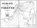 1848 map Yucatan.jpg 2,500 × 1,907; 1.27 MB
-
 Flag Map Of Republic Of Yucatán.png 4,000 × 3,158; 536 KB
-
 Flag of the Republic of Yucatan.svg 600 × 300; 883 bytes
-
 Guatemala Republic of Yucatán Locator.png 362 × 264; 5 KB
-
 Intendencia de yucatán.PNG 237 × 375; 28 KB
-
 Locatie Yucatan.png 250 × 115; 5 KB
-
 Map of Mexico inc Yucatan & Upper California Mitchell 1848.jpg 3,886 × 2,880; 2.02 MB
-
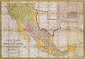
 Map of Mexico including Yucatan and Upper California 1847.jpg 8,695 × 6,367; 6.67 MB
-
 Mapa Mexico 1847.PNG 1,455 × 1,250; 93 KB
-
 Peninsula Divisiones.PNG 2,289 × 1,985; 302 KB
-
 Republic of Yucatan (orthographic projection).svg 550 × 550; 371 KB
-
 Republic of Yucatán Republic of Texas Locator.png 324 × 342; 8 KB
-
 Seal of the Republic of Yucatán.svg 420 × 509; 8 KB
-

-
 Mitchell & Stealey Map of Mexico 1847 UTA (Map of Mexico).jpg 2,782 × 2,057; 6.62 MB
-


.jpg)
