Category:Remich
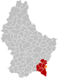
city and commune in Luxembourg  d'Märei zu Réimech   D'Gemeng Réimech (orange) am Kanton Réimech (rout) | |||||
| Upload media | |||||
| Pronunciation audio | ⓘ | ||||
|---|---|---|---|---|---|
| Instance of | |||||
| Location | Canton of Remich, Luxembourg | ||||
| Located in or next to body of water | |||||
| Population |
| ||||
| Area |
| ||||
| Elevation above sea level |
| ||||
| official website | |||||
 | |||||
Subcategories
This category has the following 13 subcategories, out of 13 total.
Media in category "Remich"
The following 39 files are in this category, out of 39 total.
-
 Armoiries Remich.png 360 × 400; 79 KB
-
 Coat of arms remich luxbrg.png 545 × 600; 235 KB
-
 Map Remich.PNG 203 × 270; 7 KB
-
 259 - Remich - levels.jpg 21,490 × 13,581; 57.11 MB
-
 259 - Remich.jpg 21,490 × 13,581; 48.88 MB
-
 Art at Remich photo 1.jpg 4,032 × 3,024; 7.89 MB
-
 Art at Remich photo 2.jpg 4,032 × 3,024; 5.96 MB
-
 Art at Remich photo 3.jpg 2,817 × 3,756; 4.57 MB
-
 Art at Remich photo 4.jpg 3,024 × 4,032; 6.98 MB
-
 Art at Remich photo 5.jpg 3,024 × 4,032; 8.39 MB
-
 Art at Remich photo 6.jpg 3,024 × 4,032; 8.84 MB
-
 Art at Remich photo 7.jpg 3,983 × 2,987; 5.37 MB
-
 Briedemesserkreiz Réimescher Bësch .jpg 3,024 × 4,032; 6.21 MB
-
 E,22b route barrée - déviation.jpg 1,920 × 2,560; 1.31 MB
-
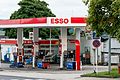 Esso, Route de l'Europe, Remich-101.jpg 5,434 × 3,627; 14.25 MB
-
 Gemeinde remich lux.png 203 × 270; 4 KB
-
 Grenzschëld Réimech.jpg 1,200 × 1,200; 236 KB
-

-
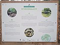 Info board d'Heedbaach .jpg 4,032 × 3,024; 4.17 MB
-
 Info board Totes Holz Réimescher Bësch .jpg 4,032 × 3,024; 5.13 MB
-
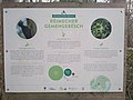 Info bord Réimescher Gemenegësch.jpg 4,032 × 3,024; 4.61 MB
-
 Coat of arms of Remich (canton).svg 546 × 701; 185 KB
-
 Remich (100).jpg 4,943 × 3,707; 6.11 MB
-
 Remich (101).jpg 5,120 × 3,840; 6.12 MB
-
 Remich coat of arms.png 700 × 850; 23 KB
-
 Remich map.svg 556 × 775; 3.32 MB
-
 Remich Via Democratia Europa.jpg 1,080 × 1,920; 362 KB
-
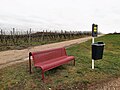 Remich, banc rouge.jpg 3,648 × 2,736; 3.87 MB
-
 Remich, interdiction de nourrir.jpg 2,675 × 3,565; 1.34 MB
-
 Remich, panneau de localisation.jpg 3,648 × 2,736; 3.81 MB
-
 Remich, panneau frontière allemande 2km.jpg 2,684 × 2,684; 1.66 MB
-
 Remich, Pärel vun der Musel.jpg 2,494 × 3,325; 2.99 MB
-
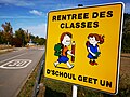 Remich, rentrée des classes.jpg 3,648 × 2,736; 2.45 MB
-
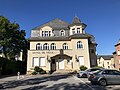 Remich-rathaus.jpeg 4,032 × 3,024; 2.46 MB
-
 Remicherboesch.jpg 864 × 1,080; 1.24 MB
-
 Tomb at the Saint Stephen church in Remich (1).jpg 3,747 × 5,451; 18.72 MB
-
 Tussen Remich en Bous, panorama foto7 2017-05-26 14.44.jpg 4,325 × 2,748; 9.52 MB
-
 Weiher Éitzepoul Réimescher Bësch Info board.jpg 4,032 × 3,024; 5.39 MB
-
 Weiher Éitzepoul Réimescher Bësch.jpg 4,032 × 3,024; 7.41 MB


.svg)
.jpg)
.jpg)


.jpg)


