Butun axtardiqlarinizi tapmaq ucun buraya: DAXIL OLUN
  Mp4 Mp3 Axtar Yukle
  Video Axtar Yukle
  Shekil Axtar Yukle
  Informasiya Melumat Axtar
  Hazir Inshalar Toplusu
  AZERI CHAT + Tanishliq
  Saglamliq Tibbi Melumat
  Whatsapp Plus Yukle(Yeni)

  • Home
  • Random
  • Nearby
  • Log in
  • Settings
Donate Now If this site has been useful to you, please give today.
  • About Wikimedia Commons
  • Disclaimers

Category:Queen Charlotte Strait

<nowiki>Estrecho de la Reina Carlota; 莎樂皇后海峽; détroit de la Reine-Charlotte; Queen Charlotte Strait; Königin-Charlotte-Straße; Estreito da Rainha Carlota; 夏洛特皇后海峽; クイーン・シャーロット海峡; Queen Charlotte Strait; Cieśnina Królowej Charlotty; Şahzadə Şarlotta boğazı; Queen Charlotte Strait; Queen Charlotte; Markolo de Reĝino Charlotte; Stretto della Regina Carlotta; Queen Charlotte Strait; مضيق الملكة شارلوت; Queen Charlotte Strait; Пролив Королевы Шарлотты; formación geografica; কানাডার নদী; détroit du Canada; Meerenge in Kanada; Strait between northern Vancouver Island and the Mainland Coast of British Columbia, Canada; cieśnina w Kolumbii Brytyjskiej w Kanadzie; נהר; نهر في كندا; Пролив Королевы Шарлотты (Канада); Queen Charlotte Strait; Estrecho de la reina carlota</nowiki>
Queen Charlotte Strait 
Strait between northern Vancouver Island and the Mainland Coast of British Columbia, Canada
Diskoveri gəmisi
Upload media
 Wikipedia
Instance of
  • strait
Named after
  • Charlotte of Mecklenburg-Strelitz
LocationBritish Columbia, Canada
Connects with
  • Fife Sound
  • Trainer Passage
  • Arrow Passage
  • Sunday Passage
  • Philips Passage
  • Wells Passage
  • Blackfish Sound
  • Schooner Channel
  • Slingsby Channel
  • Goletas Channel
  • Richards Channel
  • Gordon Channel
  • Broughton Strait
  • Johnstone Strait
Map50° 53′ 50″ N, 127° 21′ 11″ W
Authority file
Wikidata Q1796011
VIAF cluster ID:
  • Reasonator
  • Scholia
  • Wikidocumentaries
  • PetScan
  • statistics
  • WikiMap
  • Locator tool
  • KML file
  • WikiShootMe
  • OpenStreetMap
  • Search depicted
Edit infobox data on Wikidata

Subcategories

This category has the following 3 subcategories, out of 3 total.

B

  • Broughton Archipelago (13 C, 4 F)

P

  • Pine Island (British Columbia) (1 F)
  • Port Hardy, British Columbia (2 C, 1 P, 35 F)

Media in category "Queen Charlotte Strait"

The following 7 files are in this category, out of 7 total.

  • Canadian pilot, near Port Hardy BC.jpg 4,752 × 3,168; 3.66 MB
  • Coast Mountains and forested islets along Queen Charlotte Strait.jpg 4,692 × 3,128; 3.6 MB
  • Early morning on Queen Charlotte Strait.jpg 4,752 × 3,168; 5.54 MB
  • Northeast of Nigei Island, Queen Charlotte Strait.jpg 2,552 × 1,912; 2.5 MB
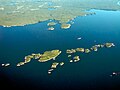
  • Numas Islands - panoramio.jpg 2,566 × 1,551; 1.44 MB
  • Port Hardy - panoramio.jpg 1,280 × 1,024; 366 KB
  • The Discovery on the rocks.jpg 4,840 × 3,096; 4.19 MB
Retrieved from "/w/index.php?title=Category:Queen_Charlotte_Strait&oldid=492757790"
Informasiya Melumat Axtar