Category:Qatar National Library
National Library of Qatar  | |||||
| Upload media | |||||
| Instance of | |||||
|---|---|---|---|---|---|
| Location | Al Rayyan Municipality, Qatar | ||||
| Architect | |||||
| Inception |
| ||||
| official website | |||||
 | |||||
Subcategories
This category has only the following subcategory.
Pages in category "Qatar National Library"
This category contains only the following page.
Media in category "Qatar National Library"
The following 193 files are in this category, out of 193 total.
-
 'The Khalifa, halted at Ctesiphon' and 'The Arch of Ctesiphon'.jpg 1,910 × 3,000; 949 KB
-
 1867 Abyssinia Map Depicting Gadabursi Somali.jpg 1,200 × 1,200; 496 KB
-
 1920 Treaty of Seeb.png 934 × 943; 1.47 MB
-

-
 Aden Jew - mid 1870s.jpg 729 × 1,200; 185 KB
-
 AdenHenryYule.jpg 863 × 1,200; 224 KB
-

-

-

-
 Al Bidda trigonometrical plan 1823.jpg 2,742 × 2,223; 4.31 MB
-
 Al Khor trigonometrical plan 1823.jpg 2,554 × 2,370; 2.1 MB
-
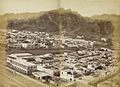
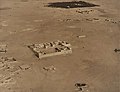 Al Rayyan aerial 1934 (cropped).jpg 406 × 311; 49 KB
-
 Al Rayyan aerial 1934.jpg 1,045 × 981; 589 KB
-
 AlSijziGeometric.jpg 619 × 1,170; 248 KB
-
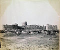
 Alwakrahfort1908.jpg 673 × 347; 54 KB
-
 Amir Chah showing W end of valley. Closed by sand drifts. Also Amir Chah thana.jpg 3,000 × 1,919; 669 KB
-
 Arab pearl divers in the Persian Gulf.jpg 800 × 542; 290 KB
-
 Arabia according to its modern divisions.jpg 3,000 × 2,304; 1.41 MB
-
 Arabia by Jodocus Hondius 1598, reprinted 1616.tif 1,396 × 1,024; 4.09 MB
-

-

-

-

-

-
-

-

-

-

-

-
 Asir1916.jpg 2,048 × 1,294; 282 KB
-
 Asir1919.jpg 1,791 × 1,431; 676 KB
-
 Autolycus ar manuscript.png 445 × 735; 515 KB
-
 Awn al-Rafiq 1885.png 3,060 × 4,049; 11.56 MB
-
 Baghdad – Samarra.jpg 1,108 × 801; 115 KB
-
 Bahrainharbor.jpg 1,106 × 290; 60 KB
-
 Bani Shaybah gatekeeper c.1880.png 700 × 916; 433 KB
-
 BaniBuAliAerial.jpg 1,200 × 1,200; 245 KB
-
 Bassidore Station.jpg 2,400 × 2,028; 875 KB
-
 Blueprint sketch map of Qatar in 1939.jpg 1,489 × 1,930; 686 KB
-
 British Foreign office memorandum January 1940 regarding the border between Jordan and Saudi Arabia.djvu 3,306 × 4,678, 7 pages; 692 KB
-

-
 BritishBahrainAgreement1868.jpg 613 × 582; 140 KB
-
 Burial Mounds in Bahrain 1918.jpg 2,330 × 1,701; 1.7 MB
-
 Bushehrseafront1870.png 1,112 × 522; 637 KB
-
 Bushire Resident's Country House.jpg 3,000 × 2,000; 839 KB
-
 Bushire sea-side view.jpg 3,000 × 2,031; 766 KB
-
 Coast from Jezeerat Gunnum to Ras Sheik Munsoud by Michael Houghton 1825.jpg 4,053 × 3,000; 1.28 MB
-
 Coast from Ras Moosendem to Perforated Rock by Michael Houghton 1825.jpg 4,053 × 3,000; 1.08 MB
-
 CoastalTownsThomasElwon (Loheia, Luhayya).jpg 2,800 × 341; 467 KB
-
 CoastalTownsThomasElwon.jpg 3,000 × 1,785; 829 KB
-
 Complete Book on the Judgment of the Stars - 1523.png 551 × 773; 655 KB
-
 CraterAden1870.jpg 1,192 × 860; 351 KB
-
 Doha (Al Bidda) Harbor (cropped).jpg 2,181 × 1,189; 1.34 MB
-
 Doha (Al Bidda) Harbor.jpg 1,928 × 3,000; 773 KB
-
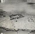
 Doha looking northwest 1934 (cropped).jpg 1,040 × 1,050; 615 KB
-
 Doha looking northwest 1934.jpg 2,033 × 3,000; 749 KB
-
 Doha looking west 1934 (cropped).jpg 1,045 × 1,044; 560 KB
-
 Doha looking west 1934.jpg 2,033 × 3,000; 709 KB
-
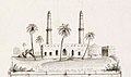
 Doha Palace looking south.jpg 1,063 × 1,032; 192 KB
-
 Doha1908.jpg 654 × 384; 78 KB
-
 Drawing of mosque in Bahrain in 1825.jpg 604 × 357; 148 KB
-
 Eastarabiamap1794.jpg 623 × 395; 61 KB
-
 Entrance to Bushire Residency.jpg 3,000 × 2,306; 1.17 MB
-
 Entrance to Khawr al Udayd looking WNW.jpg 1,033 × 1,043; 104 KB
-

-
 Geneaological tree of the Al Thani tribe.jpg 2,729 × 1,875; 478 KB
-
 General view of Medina around 1880.jpg 3,000 × 2,070; 836 KB
-
 Governor's House Bushire.jpg 3,000 × 2,300; 1.19 MB
-
 Hawar Fort 1938.png 795 × 513; 627 KB
-
 Hawar Island aerial view.jpg 424 × 426; 43 KB
-
 Hawar Pier 1938.png 757 × 474; 507 KB
-
 HejOut.svg 574 × 602; 115 KB
-
 His Highness Sheikh Chassib in his youth.jpg 795 × 800; 122 KB
-
 Hormus village 1908 photo.jpg 1,360 × 1,049; 331 KB
-
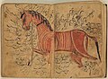 Horse Or1523 22v.jpg 1,111 × 816; 977 KB
-
 Jaafaria School Bahrain 1931.png 1,366 × 962; 1.46 MB
-
 James rich seal.jpg 620 × 442; 68 KB
-
-
 James Silk Buckingham's General Map of Persia.jpg 3,000 × 2,135; 1.16 MB
-

-
 Jezeerat Gunnum (cropped).jpg 3,451 × 563; 205 KB
-
 Jezirat Tanb 1928 sketch map.jpg 1,834 × 2,487; 865 KB
-

-
 Khamis Mosque 1956.jpg 3,467 × 4,979; 3.01 MB
-
 Khawr Al Udayd trigonometrical survey.jpg 1,992 × 2,718; 3 MB
-
 Kitab isqilawus.png 399 × 677; 514 KB
-
 Kumzar ca 1908.png 2,366 × 1,487; 7.66 MB
-
 Kuwait map 1925 IOR R 15 1 733 0035.jpg 5,287 × 4,800; 3.08 MB
-
 Letter by Sheikh Zayed 1870.jpg 689 × 1,121; 211 KB
-
 Little Quoin 1909 photo.jpg 3,200 × 1,988; 917 KB
-
 LordCurzonSharjah.jpg 806 × 547; 102 KB
-
 Manama View 1945.jpg 2,975 × 831; 1.17 MB
-
 Map of Ancient Arabia - 1720.tif 1,235 × 1,024; 3.62 MB
-
 Map of Ancient Arabia WDL2923.png 1,235 × 1,024; 2.25 MB
-
 Map of Arabian Peninsula and Bahrain in 1825.jpg 2,026 × 3,000; 650 KB
-
 Map of Arabistan.jpg 1,207 × 1,083; 367 KB
-
 Map of Catura (Qatar) 1794 (cropped).jpg 259 × 203; 20 KB
-
 Map of Catura (Qatar) 1794.jpg 259 × 222; 20 KB
-
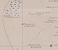
 Map of Qatar Peninsula in 1824 (cropped) - Fuwayrit.jpg 461 × 404; 34 KB
-
 Map of Qatar Peninsula in 1824 - Abu Dhalouf.jpg 324 × 290; 25 KB
-
 Map of Qatar Peninsula in 1824 - Al Huwaila.jpg 287 × 269; 15 KB
-
 Map of Qatar Peninsula in 1824 - Dooat el Wosseil.jpg 458 × 350; 32 KB
-
 Map of Qatar Peninsula in 1824 - northern peninsula.jpg 541 × 431; 48 KB
-
 Map of Qatar Peninsula in 1824 - Ras Laffan.jpg 209 × 177; 10 KB
-
 Map of Qatar Peninsula in 1824 - Zubarah.jpg 390 × 352; 26 KB
-
 Map of Qatar Peninsula in 1824.jpg 2,367 × 3,000; 797 KB
-
-
 Map of the Arabian Peninsula and Persian Gulf in 1829.jpg 2,382 × 3,000; 1,009 KB
-
 Map to show the Limits of Kuwait and Adjacent Country (1913).jpg 3,457 × 3,373; 1.13 MB
-
 Mapofqatar1849.jpg 856 × 856; 213 KB
-
 Mecca1880s.jpg 897 × 580; 201 KB
-
 Meccan merchant and his Circassian slave.jpg 1,309 × 1,685; 667 KB
-
 Minaret in Ormuz.jpg 1,918 × 3,000; 912 KB
-
 MubarakAlSabah1903.jpg 620 × 411; 47 KB
-
 Muscat Consulate & Agency, c. 1870.jpg 1,426 × 1,200; 328 KB
-
 Muscat in 1918.png 1,001 × 741; 732 KB
-
 Muscat Squadron.png 1,073 × 794; 1.12 MB
-
 Mustatraf manuscript qnl.png 1,129 × 959; 2.6 MB
-
 Nicomachus adad2.PNG 826 × 1,185; 1.78 MB
-
 Northern Entrance to Discovery Strait by Michael Houghton 1825.jpg 3,300 × 2,443; 773 KB
-
 Northern Village - Hawar Islands 1938.png 668 × 431; 393 KB
-
 Oman und Mahra 1846-2.jpg 6,184 × 6,963; 16.3 MB
-
 Oman und Mahra 1846.jpg 6,184 × 6,963; 4.86 MB
-
 Opening page of Gazetteer of the Persian Gulf - Lorimer.jpg 704 × 1,099; 132 KB
-
 Or 8416 0273.jpg 990 × 1,200; 257 KB
-

-
 Panénjoan Mekah ku Haji Gofur (Christiaan Snouck Hurgronje).jpg 1,200 × 660; 150 KB
-
 Panénjoan Mekah ku Haji Gofur (cropped).jpg 1,200 × 420; 275 KB
-
 Perim Island part plan 1928.png 1,987 × 1,489; 2.19 MB
-
 Persian Gulf western sheet - Al Bidda Harbor.jpg 669 × 371; 257 KB
-
 Persian Gulf western sheet - Khawr al Udayd.jpg 294 × 242; 17 KB
-
 Persian Gulf western sheet.jpg 1,978 × 3,000; 1.1 MB
-
 Persian Gulf, Oman and Central Arabia map by F.F. Hunder 1905 (retouched).jpg 7,920 × 5,856; 31.82 MB
-
 Persian Gulf, Oman and Central Arabia map by F.F. Hunder 1905-2.jpg 7,954 × 5,964; 26.92 MB
-
 Persian Gulf, Oman and Central Arabia map by F.F. Hunder 1905.jpg 7,954 × 5,964; 7.17 MB
-
 Photograph of Sultan Massoud Mirza Qajar Zelle Soltan (Mass'oud Mirza Zell-e Soltan).jpg 2,190 × 3,000; 696 KB
-

-
 Piratecoastpersiangulf.jpg 501 × 409; 45 KB
-

-
 Portuguese Fort Bahrain 1870.jpg 2,000 × 1,665; 374 KB
-
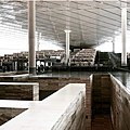
 Qatar National Library.jpg 4,032 × 3,024; 3.49 MB
-
 Qatarmap1920.jpg 494 × 306; 53 KB
-
 QNL.jpg 1,125 × 1,126; 1.02 MB
-
 QNLL qf.png 778 × 778; 1.03 MB
-
 RAF sketch map of the Qatar Peninsula (cropped) - Shagra.jpg 254 × 237; 13 KB
-
 RAF sketch map of the Qatar Peninsula Al Kharsaah.jpg 379 × 326; 19 KB
-
 RAF sketch map of the Qatar Peninsula.jpg 1,976 × 3,000; 778 KB
-
 Reigning family of Lahej.png 623 × 493; 621 KB
-
 Rizat irrigation in Dhofar (cropped).jpg 1,163 × 711; 247 KB
-
 Rizat irrigation in Dhofar.jpg 1,960 × 3,000; 851 KB
-
 Robat Koh shewing view of Robat Killa camping ground (Koh-i-Malik Seah).jpg 3,000 × 1,917; 873 KB
-
 Rocky ground. View to N. of Manzil.jpg 3,000 × 1,885; 691 KB
-
 Rough map of Qatar Peninsula in 1937 (cropped).jpg 440 × 412; 52 KB
-
 Rough map of Qatar Peninsula in 1937 Khawr al Udayd.jpg 1,092 × 997; 171 KB
-
 Rough map of Qatar Peninsula in 1937.jpg 1,836 × 3,000; 995 KB
-

-
 Rough sketch map showing Dawhat Salwa.jpg 1,788 × 3,000; 740 KB
-
 Rough sketch map showing Jebel Nakhsh.jpg 1,685 × 1,034; 185 KB
-
 Sarhang Hájji Ibrahim Khán, Commandant of the Bakhtiari Horse.jpg 1,937 × 3,000; 709 KB
-
 Shewing track leading westwards towards Leh, or to Ladis, looking northwards.jpg 3,000 × 1,919; 735 KB
-
 Signature of Ibrahim Ali Khan of Tonk.png 616 × 78; 84 KB
-
 Sixth Map of Asia - 1478.tif 1,378 × 1,024; 4.04 MB
-
 Sixth Map of Asia Which Includes Arabia Felix, Carmania, and the Persian Gulf.tif 1,333 × 1,024; 3.91 MB
-
 Sketch map illustrating Qatari Saudi border dispute.jpg 2,019 × 2,741; 576 KB
-
 Sketch map of Qatar and Bahrain in 1933 (cropped) - Fuwayrit.jpg 299 × 265; 14 KB
-
 Sketch map of Qatar and Bahrain in 1933 - Al Nasraniya.jpg 586 × 481; 43 KB
-
 Sketch map of Qatar and Bahrain in 1933 - Khawr al Udayd.jpg 594 × 590; 48 KB
-
 Sketch map of Qatar and Bahrain in 1933 - Umm Taqa.jpg 473 × 330; 23 KB
-
 Sketch map of Qatar and Bahrain in 1933.jpg 1,920 × 3,000; 834 KB
-
 Sohar Fort in 1940.jpg 2,115 × 3,000; 752 KB
-
 Telegraph Station, Jask.jpg 3,000 × 2,071; 956 KB
-
 The Quoins by Michael Houghton 1825 (cropped).jpg 1,826 × 434; 80 KB
-

-
 Travels in Assyria Ras Al Khaimah (cropped).jpg 1,214 × 844; 355 KB
-
 Travels in Assyria Ras Al Khaimah.jpg 2,453 × 3,000; 1.11 MB
-
 Trigonometrical Plan of the Island and Harbour of Bahrain.jpg 2,098 × 2,376; 1.8 MB
-
 Trigonometricalalbidda.jpg 1,342 × 333; 95 KB
-
 Um Al Qura 306.jpg 815 × 1,200; 278 KB
-
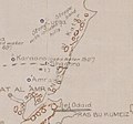
 View of houses in Al Karaana 1934 (cropped).jpg 413 × 324; 49 KB
-
 View of houses in Al Karaana 1934.jpg 982 × 957; 308 KB
-
 View of Pir Sultan Ziarat near Manzil.jpg 3,000 × 1,960; 782 KB
-
 View of the Red Sea coastline by Thomas Elwon (1793 94–1835).jpg 1,200 × 393; 70 KB
-
 Village School Bahrain.png 1,600 × 884; 1.71 MB
-
 Zircooa Island from the Eastward by Michael Houghton 1825.jpg 4,500 × 1,856; 699 KB
-
 Zubarah1937.jpg 3,000 × 3,000; 1.06 MB
-
 امارت کلاه فرنگی بندرعباس در سال 1917.jpg 6,060 × 5,275; 7.23 MB
-
 تحفة الطلاب في شرح نزهة الحُسَّاب.jpg 931 × 1,200; 293 KB
-
 رسالة فی البراهین علی مسائل الجبر و المقابله - عمر ابن ابراهیم الخیامی.png 1,200 × 2,080; 4.85 MB
-
 شريف مكة المكرمة عون الرفيق.png 265 × 353; 113 KB
-
 كتاب المعطيات ص1.jpg 1,000 × 1,688; 467 KB
-
 مذكرات بريطانية عن نفوذ الحرث.png 1,903 × 811; 585 KB
-
 مذكرات-جورج-سادلير.jpg 477 × 650; 48 KB


.jpg)


.jpg)


,_Londres_to_Viscount_Grey_(Sir_Edward_Grey),_1_September_1916.jpg)


,_Londres_to_Sir_Edward_Grey,_9_May_1916.png)
.jpg)

_to_Count_Alexander_Konstantinovich_Benckendorff_(Russian_Ambassador_to_the_United_Kingdom),_23_May_1916.jpg)
_to_Paul_Cambon,_15_May_1916.jpg)
_to_Paul_Cambon,_16_May_1916_01.png)
_to_Paul_Cambon,_30_August_1916.jpg)
_to_Count_Alexander_Konstantinovich_Benckendorff,_23_October_1916.jpg)


_Harbor_(cropped).jpg)
_Harbor.jpg)
.jpg)

.jpg)


_and_Sheep_Island_(Jazirat_Umm_al_Ghanam)_1904.jpg)


.jpg)

.jpg)


_1794_(cropped).jpg)
_1794.jpg)
_-_Fuwayrit.jpg)


.jpg)


.jpg)


.jpg)


.jpg)


_-_Shagra.jpg)


.jpg)

.jpg)

.jpg)


_-_Fuwayrit.jpg)


.jpg)
.jpg)


.jpg)


.jpg)
.jpg)
.jpg)
.jpg)
.jpg)