Category:Qaen
city in South Khorasan Province, Iran  | |||||
| Upload media | |||||
| Instance of | |||||
|---|---|---|---|---|---|
| Location | Central District, Qaen County, South Khorasan Province, Iran | ||||
| Located in or next to body of water |
| ||||
| Mountain range | |||||
| Population |
| ||||
| Elevation above sea level |
| ||||
| official website | |||||
 | |||||
Subcategories
This category has the following 9 subcategories, out of 9 total.
B
C
E
G
H
N
P
S
Ω
Media in category "Qaen"
The following 16 files are in this category, out of 16 total.
-
 A view of Bozormehr tomb, which is located on a mountain slope in Qain city.jpg 4,128 × 3,096; 7.17 MB
-
 Abul mafa.jpg 8,816 × 6,612; 44.16 MB
-
-
 Another view of the construction of the historical monument of the grave of Ghaznavid.jpg 4,128 × 3,096; 4.16 MB
-
 Bozormehr Qaini's tomb with a seven-hundred-year-old baneh tree.jpg 4,128 × 3,096; 11.71 MB
-

-
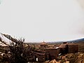
 Qain mountain castle.jpg 4,000 × 2,250; 7.93 MB
-
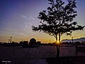
 Qayen.JPG 614 × 248; 54 KB
-
 Sky A picture of the dawn of a snowy day in the castle.jpg 4,128 × 3,096; 4.59 MB
-
 بزرگمهر قاینی (1) 01.jpg 5,212 × 3,909; 16.17 MB
-
 بزرگمهر قاینی (1) 02.jpg 9,189 × 6,892; 18.94 MB
-
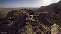 مسیر ورودی قلعه کوه قاین 02.jpg 15,102 × 8,428; 18.52 MB
-
 مسیر ورودی قلعه کوه قاین 03.jpg 9,080 × 6,810; 14.61 MB
-
 مسیر ورودی قلعه کوه قاین 04.jpg 9,997 × 9,511; 15.53 MB
-
 نمایی از داخل قلعه آرتاگوانا به جاده اصلی و مسیر قاین به مشهد.jpg 6,912 × 9,216; 39.53 MB
-
 نمایی از مسیر تاریخی شهر قاین از کاخ زرتشتیان تا مسجد جامه و آرامگاه ابوالمفاخر.jpg 6,912 × 9,216; 13.84 MB


_01.jpg)
_02.jpg)


