Butun axtardiqlarinizi tapmaq ucun buraya: DAXIL OLUN
  Mp4 Mp3 Axtar Yukle
  Video Axtar Yukle
  Shekil Axtar Yukle
  Informasiya Melumat Axtar
  Hazir Inshalar Toplusu
  AZERI CHAT + Tanishliq
  Saglamliq Tibbi Melumat
  Whatsapp Plus Yukle(Yeni)

  • Home
  • Random
  • Nearby
  • Log in
  • Settings
Donate Now If this site has been useful to you, please give today.
  • About Wikimedia Commons
  • Disclaimers

Category:Peary Land

<nowiki>Tierra de Peary; Пири жери; Pearyren Lurraldea; Terra de Peary; Peary Land; Зямля Піры; سرزمین پیری; Земя Пири; Peary Land; ピアリーランド; Peary Land; Земля Пірі; 皮里地; Peary Land; Pearylando; Pearyho země; Terra di Peary; Terre de Peary; Terra de Peary; Pīrija Zeme; Pirio Žemė; Peary Land; Ziemia Peary’ego; Peary Land; Piri Torpağı; Pearyland; Земля Пири; Pearyho zem; ארץ פירי; Peary Land; بيري لاند; 皮里地; 皮里地; territorio groenlandese; peninusula in Greenland; semenanjung; półwysep Grenlandii; poloostrov v severním Grónsku; schiereiland van Denemarken; شبه جزيرة في حديقة شمال شرق جرينلاند الوطنية; polotok na severu Grenlandije; Halbinsel in Grönland; península no norte da Gronelândia; паўвостраў; duoninsulo en Gronlando; 格陵兰的半岛; halvö i norra Grönland; Pearyjeva dežela</nowiki>
Peary Land 
peninusula in Greenland
Upload media
 Wikipedia
Instance of
  • peninsula
Named after
  • Robert Peary
Located in protected area
  • Northeast Greenland National Park
LocationNortheast Greenland National Park
Located in or next to body of water
  • Victoria Fjord
Map82° 38′ 00″ N, 32° 30′ 00″ W
Authority file
Wikidata Q1484427
VIAF cluster ID:
IdRef ID:
  • Reasonator
  • Scholia
  • Wikidocumentaries
  • PetScan
  • statistics
  • WikiMap
  • Locator tool
  • KML file
  • WikiShootMe
  • OpenStreetMap
  • Search depicted
Edit infobox data on Wikidata

Media in category "Peary Land"

The following 11 files are in this category, out of 11 total.

  • Cape Morris Jesup 1900.jpg 669 × 486; 59 KB
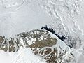
  • Greenland.A2004208.1810.250m.jpg 3,200 × 2,400; 1.11 MB
  • Nordkrone-23 59 Sentinel-1.jpg 416 × 266; 64 KB
  • North Greenland section-txu-pclmaps-oclc-8322829 a 1.jpg 3,056 × 3,641; 3.39 MB
  • Northern Greenland (ASTER).jpg 3,190 × 2,810; 1.49 MB
  • Northward over the great ice - a narrative of life and work along the shores and upon the interior ice-cap of northern Greenland in the years 1886 and 1891-1897, with a description of the little tribe (14595704229).jpg 2,528 × 1,588; 1.21 MB
  • Northward over the great ice - a narrative of life and work along the shores and upon the interior ice-cap of northern Greenland in the years 1886 and 1891-1897, with a description of the little tribe (14779210861).jpg 2,416 × 1,612; 1.02 MB
  • Peary Land map 1903.jpg 1,230 × 932; 446 KB
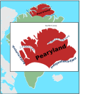
  • Pearyland.svg 744 × 875; 576 KB
  • Roosevelt Range 1903.png 710 × 374; 497 KB
  • Wandel Sea map.png 2,000 × 2,000; 215 KB
Retrieved from "/w/index.php?title=Category:Peary_Land&oldid=1094393192"
Informasiya Melumat Axtar