Category:Panaitan Island
island in Pandeglang Regency, Banten Province, Indonesia  | |||||
| Upload media | |||||
| Instance of | |||||
|---|---|---|---|---|---|
| Part of | |||||
| Location | Pandeglang, Banten, Indonesia | ||||
| Located in or next to body of water | |||||
| Heritage designation |
| ||||
| Width |
| ||||
| Length |
| ||||
| Population |
| ||||
| Area |
| ||||
| Elevation above sea level |
| ||||
 | |||||
Media in category "Panaitan Island"
The following 9 files are in this category, out of 9 total.
-
 AMH-5137-NA Map of Java's west coast and Princen Island.jpg 2,400 × 1,699; 579 KB
-
 Estuary Citaleunan River (Muara) - panoramio.jpg 800 × 600; 135 KB
-
 Gundang's house diagram.jpg 245 × 112; 23 KB
-
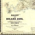 Kaart van het eiland Java.jpg 3,499 × 3,438; 2.08 MB
-
 Lovely Sunset Panaitan Island - panoramio.jpg 845 × 634; 129 KB
-
 One Palm Point, Panaitan Island.JPG 2,544 × 1,696; 474 KB
-
 Panaitan Prinseneiland old map by Johannes Vingboons.jpg 4,174 × 3,543; 2.63 MB
-

-
 South Banten map.png 583 × 417; 21 KB

_-_panoramio.jpg)


