Category:Northern Region, Uganda
English: The Northern Region — of Uganda.
- Former colonial province and administrative subdivision, present-day geographic region of Uganda.
region of Uganda   | |||||
| Upload media | |||||
| Instance of | |||||
|---|---|---|---|---|---|
| Location | Uganda | ||||
| Capital | |||||
| Population |
| ||||
| Area |
| ||||
| Elevation above sea level |
| ||||
 | |||||
Subcategories
This category has the following 30 subcategories, out of 30 total.
A
- Adjumani (19 F)
- Agago District (6 F)
- Apac District (7 F)
D
- Dokolo District (4 F)
E
G
K
L
M
- Mount Kadam (16 F)
N
O
- Oyam District (36 F)
P
Z
- Zombo District (11 F)
Media in category "Northern Region, Uganda"
The following 60 files are in this category, out of 60 total.
-
 Uganda - Northern.svg 1,441 × 1,466; 377 KB
-
 UgandaNorthernNumbered.PNG 515 × 518; 25 KB
-
-
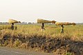
 A sunnier outlook sunflowers oiling the local economy (6721493541).jpg 3,888 × 2,592; 4.09 MB
-
 A track and pedestrians cross the Albert Nile bridge in Northern Uganda.jpg 4,465 × 2,977; 1.3 MB
-
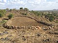 Agoro hills, kitugum.jpg 4,608 × 3,456; 8.43 MB
-
 Albert Nile Bridge in Pakwach district in Northern Uganda.jpg 2,445 × 3,667; 3.66 MB
-
 Albert Nile Bridge in Pakwach district, north eastern Uganda.jpg 2,887 × 3,849; 7.68 MB
-
 Beautiful Moorish child holding grasshopper.jpg 2,592 × 4,608; 1.98 MB
-
 Bell Tower at St Joseph's Cathedral Gulu 01.jpg 3,120 × 4,160; 3.71 MB
-
 Building a brighter future after decades of conflict (6721454823).jpg 3,888 × 2,592; 3.96 MB
-

-
 Defense.gov photo essay 080123-F-2114K-310.jpg 2,000 × 3,011; 4.37 MB
-
 Defense.gov photo essay 080123-F-2114K-560.jpg 2,500 × 1,572; 4.07 MB
-
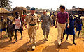
 Flickr - DVIDSHUB - Dedication Ceremony in Uganda.jpg 4,256 × 2,832; 4.45 MB
-
 From child soldier to bricklayer UK aid at work in northern Uganda (6721454863).jpg 3,888 × 2,592; 4.98 MB
-
 Defense.gov News Photo 080125-F-2114K-232.jpg 3,989 × 2,776; 1.01 MB
-
 Gulu Mental Health Unit Tortoise Monument.jpg 3,264 × 2,448; 3.44 MB
-
 Harvesting hope after war in the fields of northern Uganda (6721493499).jpg 2,800 × 1,867; 1.17 MB
-
 Fire in Parabongo IDP camp, Uganda crop.jpg 1,350 × 1,053; 152 KB
-
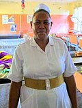 Nurse from Uganda helps protect womens health (6188985167).jpg 260 × 343; 14 KB
-
 Kitgum IDP camp from the air, Uganda.jpg 450 × 338; 48 KB
-
 Labujecamp1.jpg 380 × 355; 42 KB
-
 Labuje IDP camp, Uganda water.jpg 450 × 316; 30 KB
-
 Market Lebuje camp, Uganda.jpg 400 × 267; 43 KB
-
 Tailor Lebuje camp, Uganda.jpg 400 × 323; 49 KB
-

-
 A handful of hope in Gulu, northern Uganda (6721454911).jpg 3,888 × 2,592; 1.33 MB
-
 Northern Uganda Africa3 031.jpg 2,592 × 1,944; 1.18 MB
-
 Northern Uganda Africa3 034.jpg 2,592 × 1,944; 838 KB
-
 On the road to the future in northern Uganda (6721454803).jpg 3,888 × 2,592; 4.47 MB
-
 Ongiertho Emmanuel Jor.jpg 2,448 × 2,456; 2.34 MB
-
 Pakwach banner.jpg 3,565 × 510; 219 KB
-
 Palenga IDP camp, northern Uganda.jpg 450 × 283; 26 KB
-
 Patients at Apac hospital.png 2,720 × 2,040; 7.73 MB
-
 PEACE MONUMENT IN GULU NORTHERN UGANDA.jpg 3,264 × 2,448; 2.97 MB
-
 Re-wiring a lost generation (6721493549).jpg 3,888 × 2,592; 3.49 MB
-
 Road Sketch from Gondokoro to Mongulla. (WOMAT-AFR-BEA-114).jpg 8,520 × 6,410; 24.15 MB
-
 Swapping aid for trade in northern Uganda (6721493455).jpg 3,888 × 2,592; 5.63 MB
-
 The Sacred Hearts Monument in Gulu Roman Catholic Archdiocese 01.jpg 3,120 × 4,160; 5.5 MB
-
 The Sacred Hearts Monument in Gulu Roman Catholic Archdiocese 02.jpg 3,120 × 4,160; 4.94 MB
-
 Uganda night commuter - single child.jpg 338 × 450; 23 KB
-
 Uganda night commuters - full room.jpg 450 × 381; 36 KB
-
 UgandadistrictsKarenga.png 640 × 651; 261 KB
-
 UgandadistrictsKwania.png 640 × 651; 261 KB
-
 UgandadistrictsMadiOkollo.png 640 × 651; 261 KB
-
 UgandadistrictsNabilatuk.png 640 × 651; 261 KB
-
 UgandadistrictsNakapiripirit2020.png 640 × 651; 261 KB
-
 UgandadistrictsNebbi2015.png 640 × 651; 261 KB
-
 UgandadistrictsObongi.png 640 × 651; 261 KB
-
 UgandadistrictsOromo.png 640 × 651; 261 KB
-
 UgandadistrictsPakwach.png 640 × 651; 261 KB
-
 Ugandan children.jpg 380 × 258; 50 KB
-
 Water Lebuje camp, Uganda.jpg 400 × 378; 54 KB
-
 Defense.gov News Photo 080122-F-2114K-148.jpg 2,704 × 3,752; 1.48 MB
-
 Defense.gov News Photo 090505-F-7426P-593.jpg 2,832 × 4,256; 1.65 MB
-
 IDP's in Northern Uganda.png 495 × 541; 61 KB
-
 Kitgum District Uganda.png 661 × 751; 32 KB
-
 Uganda Kitgum.png 515 × 518; 14 KB
-
 Ugandan districts affected by Lords Resistance Army.png 596 × 735; 92 KB


.jpg)


.jpg)
.jpg)


.jpg)


.jpg)

.jpg)


.jpg)


.jpg)


.jpg)
.jpg)
.jpg)


