Category:Norðurland eystra
Regions of Iceland: Austurland · Höfuðborgarsvæðið · Norðurland eystra · Norðurland vestra · Suðurland · Suðurnes · Vestfirðir · Vesturland

region in Iceland   | |||||
| Upload media | |||||
| Instance of | |||||
|---|---|---|---|---|---|
| Location | Iceland | ||||
| Capital | |||||
| Population |
| ||||
| Area |
| ||||
 | |||||
English: Norðurland eystra, litt. Northern Land east in Icelandic, is a region of Iceland.
Subcategories
This category has the following 21 subcategories, out of 21 total.
Media in category "Norðurland eystra"
The following 81 files are in this category, out of 81 total.
-
Norðurland eystra pronunciation.ogg 4.1 s; 216 KB
-
 Gunnlaugsson 1844 Iceland NE.djvu 8,040 × 6,548; 406 KB
-
 2005-05-28 11 50 43 Iceland-Þverá.JPG 2,048 × 1,536; 2.29 MB
-
 2005-05-28 12 19 08 Iceland-Skútustaðir.jpg 2,048 × 1,536; 2.28 MB
-
 2008-05-20 12-12-37 Iceland Norðurland Eystra Skinnastaður.JPG 1,536 × 2,048; 2.98 MB
-
 2008-05-20 12-18-05 Iceland Norðurland Eystra Skinnastaður.JPG 2,048 × 1,536; 2.11 MB
-
 2014-05-02 12-19-44 Iceland Norðurland Eystra - Kópasker 4h 140°.JPG 10,990 × 2,370; 13.8 MB
-
 Akureyri , Islande - panoramio (1).jpg 3,648 × 2,736; 8.74 MB
-
 Akureyri , Islande - panoramio (13).jpg 3,648 × 2,736; 9.23 MB
-
 Akureyri , Islande - panoramio (14).jpg 3,648 × 2,736; 7.85 MB
-
 Akureyri , Islande - panoramio (15).jpg 3,648 × 2,736; 6.54 MB
-
 Akureyri , Islande - panoramio (16).jpg 3,648 × 2,736; 7.01 MB
-
 Akureyri , Islande - panoramio (17).jpg 3,648 × 2,736; 7.63 MB
-
 Akureyri , Islande - panoramio (2).jpg 3,648 × 2,736; 8.94 MB
-
 Akureyri , Islande - panoramio (20).jpg 3,648 × 2,736; 7.65 MB
-
 Akureyri , Islande - panoramio (21).jpg 3,648 × 2,736; 8.44 MB
-
 Akureyri , Islande - panoramio (22).jpg 3,648 × 2,736; 8.45 MB
-
 Akureyri , Islande - panoramio (23).jpg 3,648 × 2,736; 7.36 MB
-
 Akureyri , Islande - panoramio (25).jpg 3,648 × 2,736; 7.96 MB
-
 Akureyri , Islande - panoramio (3).jpg 3,648 × 2,736; 9.68 MB
-
 Akureyri , Islande - panoramio (5).jpg 3,648 × 2,736; 7.77 MB
-
 Akureyri , Islande - panoramio (6).jpg 3,648 × 2,736; 9.18 MB
-
 Akureyri , Islande - panoramio (7).jpg 3,648 × 2,736; 8.3 MB
-
 Between Krafla and Detifoss - panoramio.jpg 1,354 × 838; 351 KB
-
 Brautarholl.jpg 1,500 × 1,125; 380 KB
-
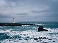 Digranes lighthouse.jpg 7,967 × 5,975; 5.7 MB
-
 Eastern Region, Iceland - panoramio (3).jpg 4,272 × 2,848; 5.59 MB
-
 Fjallasýn (2895345471).jpg 2,592 × 1,964; 2.07 MB
-
 Geothermal power plant at Jarðbaðshólar.jpg 1,247 × 1,000; 417 KB
-
 Hafen Husavik.jpg 3,504 × 2,336; 486 KB
-
 Hellir.jpg 3,024 × 4,032; 2.79 MB
-
 Hof í Svarfaðardal.jpg 1,764 × 1,312; 554 KB
-
 HverfellInnerCrater.jpg 2,980 × 1,955; 1.06 MB
-
 I Natturunni.jpg 3,024 × 4,032; 2.59 MB
-
 Iceland - panoramio (40).jpg 2,432 × 3,648; 12.09 MB
-
 Island 2017 228-0 (38321720672).jpg 6,693 × 4,459; 13.69 MB
-
 Island Hafragilsfoss 1.JPG 3,444 × 2,586; 1.85 MB
-
 Island Hafragilsfoss 2.JPG 3,444 × 2,586; 1.44 MB
-
 Island Ringstraße im Nordosten 13.JPG 3,444 × 2,586; 1.06 MB
-
 Karl og Kerling - panoramio.jpg 3,240 × 4,320; 9.03 MB
-
 Kinnarfjöll.jpg 1,572 × 628; 790 KB
-
 Kjúklingasúpa.jpg 3,703 × 3,022; 2.15 MB
-
 Krakkaæfingin..jpg 5,312 × 2,988; 6.7 MB
-
 Kvennamót.jpg 5,312 × 2,988; 4.94 MB
-
 Lake Myvatn - panoramio (1).jpg 6,489 × 1,382; 13.27 MB
-
 Laugahlíð Svarfaðardal.jpg 1,764 × 1,174; 1.56 MB
-
 Laugahlíð2 Svarfaðardal.jpg 1,764 × 1,133; 1.58 MB
-
 Naustárfoss.JPG 3,264 × 2,448; 1.97 MB
-
 Nordisland 5590.JPG 3,888 × 2,592; 3.54 MB
-
 Nordisland 5592.JPG 3,888 × 2,592; 3.7 MB
-
 Nordisland 5596.JPG 2,463 × 3,090; 2.75 MB
-
 Nordisland 5615.JPG 3,888 × 2,592; 3.07 MB
-
 Nordisland 5616.JPG 3,888 × 2,210; 2.94 MB
-
 Northeast, Iceland - panoramio.jpg 1,280 × 851; 217 KB
-
 Northeastern Region, Iceland - panoramio (11).jpg 2,848 × 4,272; 6.14 MB
-
 Northeastern Region, Iceland - panoramio (5).jpg 2,848 × 4,272; 5.49 MB
-
 Norðurland in 2024 01.jpg 3,060 × 4,080; 6.44 MB
-
 Norðurland in 2024 02.jpg 3,060 × 4,080; 3.39 MB
-
 Norðurland in 2024 09.jpg 3,060 × 4,080; 5.93 MB
-
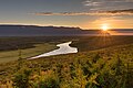
 River Jökulsá á Fjöllum - 2013.08 - panoramio.jpg 3,970 × 2,978; 3.4 MB
-
 Road to Lake Mývatn - 2013.08 - panoramio.jpg 4,514 × 3,385; 2.88 MB
-
 Roads on Mars 1 - panoramio.jpg 4,928 × 3,264; 11.04 MB
-
 Roads on Mars 2 - panoramio.jpg 4,928 × 3,264; 10.11 MB
-
 Roads on Mars 3 - panoramio.jpg 4,928 × 3,264; 11.18 MB
-
 Rock Formations in Höfði Nature Park - 2013.08 - panoramio (1).jpg 4,608 × 3,456; 2.63 MB
-
 Rock Formations in Höfði Nature Park - 2013.08 - panoramio.jpg 4,608 × 3,456; 2.39 MB
-
 Siglufjordur.jpg 4,032 × 3,024; 2.82 MB
-
 Siglufjördur.jpg 4,032 × 3,024; 2.65 MB
-
 Spræna.jpg 3,024 × 3,024; 3.6 MB
-
 Strong Contrast between Grasslands and Lava Flows - 2013.08 - panoramio.jpg 3,767 × 2,119; 2.68 MB
-
 Sulphur Pool at Leirhnjúkur - 2013.08 - panoramio.jpg 4,020 × 2,228; 2.28 MB
-
 The pseudo craters by lake Mývatn (Mosquito lake) - panoramio.jpg 4,928 × 3,264; 9.36 MB
-
 The road no. 1 heading Myvatn - panoramio.jpg 1,328 × 837; 372 KB
-
 Urðabjörg.jpg 1,764 × 1,201; 574 KB
-
 Vaðlaheiði pass.jpg 930 × 600; 41 KB
-
 Viti crater - panoramio.jpg 835 × 1,354; 342 KB
-
 Víti (Hell) by Krafla - panoramio.jpg 4,928 × 3,264; 9.77 MB
-
 Ystihver.JPG 3,264 × 2,448; 2.34 MB
-
 Öxarfjoerdur.jpg 10,314 × 8,063; 11.67 MB
-
 Útkinn view to the south.jpg 1,000 × 750; 290 KB
-
 黑色的岩石.jpg 3,264 × 2,448; 2.27 MB


.jpg)
.jpg)
.jpg)
.jpg)
.jpg)
.jpg)
.jpg)
.jpg)
.jpg)
.jpg)
.jpg)
.jpg)
.jpg)
.jpg)
.jpg)
.jpg)


.jpg)
.jpg)


.jpg)
.jpg)


.jpg)
.jpg)


.jpg)


_-_panoramio.jpg)


_by_Krafla_-_panoramio.jpg)


.jpg)