Category:Mount Whitney
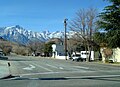
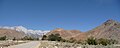
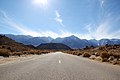
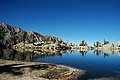
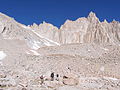
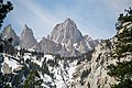
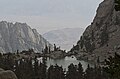
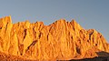
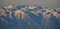
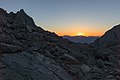
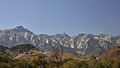
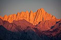
English: Mount Whitney (14,505 feet or 4,421 metres) the highest point in the Contiguous United States.
Español: Monte Whitney — Sierra Nevada, California.
highest mountain in California and the contiguous United States  Vista de la cara este del monte Whitney | |||||
| Upload media | |||||
| Instance of | |||||
|---|---|---|---|---|---|
| Part of |
| ||||
| Named after |
| ||||
| Made from material | |||||
| Located in protected area |
| ||||
| Location |
| ||||
| Significant event |
| ||||
| Mountain range | |||||
| Topographic prominence |
| ||||
| Topographic isolation |
| ||||
| Has climbing route | |||||
| Elevation above sea level |
| ||||
| Parent peak | |||||
 | |||||
Subcategories
This category has the following 3 subcategories, out of 3 total.
Media in category "Mount Whitney"
The following 164 files are in this category, out of 164 total.
-
 01-2007-Lone-Pine-Whitney.jpg 2,118 × 1,530; 357 KB
-
 37242632352 Jpg (229688519).jpeg 2,048 × 465; 274 KB
-
 A346, from summit of Mount Whitney, California, USA, 2011.JPG 1,024 × 683; 417 KB
-
 Alabama Hills under Mt. Whitney.jpg 3,840 × 2,160; 2.73 MB
-
 Alabama Hills with Mount Whitney in background.JPG 3,712 × 1,493; 2.31 MB
-

-
 Barren scape between Forester Pass and Mt. Whitney (4896501137).jpg 2,592 × 1,936; 3.25 MB
-
 Breeder and sportsman (1893) (20222714329).jpg 2,036 × 1,250; 1.18 MB
-
 California - Mt. Whitney - NARA - 23934643.jpg 3,656 × 2,880; 1.49 MB
-
 California - Mt. Whitney - NARA - 23934645.jpg 3,656 × 2,880; 1.77 MB
-
 California - Mt. Whitney - NARA - 23934647.jpg 3,656 × 2,880; 1.67 MB
-
 California - Mt. Whitney - NARA - 23934649.jpg 3,656 × 2,880; 2.14 MB
-
 California - Mt. Whitney - NARA - 23934651.jpg 3,656 × 2,880; 1.98 MB
-
 California - Mt. Whitney - NARA - 23934653.jpg 3,656 × 2,880; 2 MB
-
 California - Mt. Whitney - NARA - 23934655.jpg 3,656 × 2,880; 2.28 MB
-
 California - Mt. Whitney - NARA - 23934657.jpg 3,656 × 2,880; 2.19 MB
-
 California - Mt. Whitney - NARA - 23934659.jpg 3,288 × 2,840; 1.98 MB
-
 California a guide to the Golden state - Mt Whitney, from Whitney portal.jpg 2,586 × 3,486; 3.88 MB
-

-

-
 California National Guard - 48650425808.jpg 4,032 × 3,024; 2.78 MB
-
 California National Guard - 48650785161.jpg 4,032 × 3,024; 3.29 MB
-

-
 Camping at Upper Boyscout Lake.jpg 900 × 675; 282 KB
-

-
 Consultation Lake, 5.jpg 4,000 × 3,000; 3.37 MB
-
 Crooks Peak and Mt Whitney, CA 6-20-16 (27250690954).jpg 2,800 × 2,800; 2.69 MB
-
 Cya later, Mt. Whitney - Flickr - daveynin.jpg 3,456 × 2,304; 2.82 MB
-

-

-

-
 Diaz Lake, Sunrise, Sierra Nevada 2016 (29991104024).jpg 2,800 × 1,805; 1.73 MB
-
 Dodecatheon redolens (Primula fragrans), Mount Whitney.jpg 2,048 × 1,615; 902 KB
-
 DSC 3810b - Flickr - Clinton Steeds.jpg 3,008 × 2,000; 2.58 MB
-
 East Face Mount Whitney.jpg 1,281 × 1,461; 476 KB
-
 East Face of Sierra Nevada with Mt Whitney, CA 2015 (32272108125).jpg 2,800 × 1,977; 2.36 MB
-
 Eastern Sierra with Mount Whitney.jpg 2,688 × 1,425; 955 KB
-
 FMIB 39575 Whitney Creek as it enters Crabtree Meadow.jpeg 571 × 789; 128 KB
-

-
 Good Morning from Mount Whitney (Unsplash).jpg 5,184 × 3,456; 10.72 MB
-
 Heron Flight, Diaz Lake, Sierra Nevada 6-16 (27722249090).jpg 2,800 × 1,739; 1.48 MB
-
 Hiding in Plain Sight, Mt. Whitney, CA 9-16 (30945615716).jpg 3,204 × 2,274; 3.15 MB
-
 Hiding Mt Whitney, Lone Pine, CA 5-19-15 (18807490710).jpg 2,800 × 1,915; 1.66 MB
-
 High And Low (228703663).jpeg 1,920 × 1,200; 885 KB
-
 High Camp.jpg 2,048 × 1,536; 686 KB
-
 Highs and lows in California.jpg 2,149 × 2,149; 797 KB
-
 Hiking - Riding - California - DPLA - 17c71a6de3759e5a7da4608946ef306c.jpg 1,737 × 1,273; 243 KB
-
 Image 8-29-21 at 1.15 PM Mountains.jpg 3,230 × 3,962; 3.43 MB
-
 Lake Diaz Sunrise, Eastern Sierra Nevada, CA 5-2016 (30725135033).jpg 3,148 × 2,572; 2.89 MB
-
 Lone Pine Alabama Hills Mt Whitney 2018-04-07 California 01.jpg 3,326 × 4,435; 2.1 MB
-
 Lone Pine Alabama Hills Mt Whitney 2018-04-07 California 02.jpg 4,436 × 3,327; 2.71 MB
-
 Lone Pine Peak and Mount Whitney.jpg 1,005 × 850; 978 KB
-
 Marmots Eating Trash.jpg 2,489 × 1,961; 1.96 MB
-
 Me and Dominoe below Mt Whitney (3186132885).png 733 × 537; 804 KB
-
 Mount Whitney (28614888246).jpg 2,000 × 1,625; 1.81 MB
-
 Mount Whitney (3027967483).jpg 3,872 × 2,592; 4.61 MB
-
 Mount Whitney (4 421 m) from Highway to Onion Valley.jpg 2,592 × 1,944; 2.4 MB
-
 Mount Whitney (4 421 m) from U.S. Route 395.jpg 2,592 × 1,944; 2.4 MB
-
 Mount Whitney - panoramio.jpg 2,048 × 1,536; 1.03 MB
-
 Mount Whitney 2003-03-25.jpg 1,536 × 1,024; 1.54 MB
-
 Mount Whitney 3D map version1.jpg 1,136 × 786; 626 KB
-
 Mount Whitney 3D version 1.gif 450 × 321; 19.79 MB
-
 Mount Whitney behind Owens Valley.jpg 3,872 × 2,592; 3.46 MB
-
 Mount Whitney Change of Command (8849825).jpg 5,939 × 3,890; 1.38 MB
-
 Mount Whitney Departs Cabo Verde, Obangame Express 2025 (9020516).jpg 5,568 × 3,712; 10.09 MB
-
 Mount Whitney Departs Cabo Verde, Obangame Express 2025 (9020517).jpg 5,568 × 3,712; 10.73 MB
-
 Mount Whitney Departs Cabo Verde, Obangame Express 2025 (9020518).jpg 5,568 × 3,712; 8.77 MB
-
 Mount Whitney Departs Cabo Verde, Obangame Express 2025 (9020519).jpg 5,568 × 3,712; 11.19 MB
-
 Mount Whitney from Flight Over Death Valley National Park, California (15516641509).jpg 4,000 × 3,000; 3.03 MB
-
 Mount Whitney from Flight Over Death Valley National Park, California (15678789386).jpg 4,000 × 3,000; 2.54 MB
-

-
 Mount Whitney from Highway to Onion Valley.jpg 2,592 × 1,944; 2.41 MB
-
 Mount Whitney from Route to Onion Valley.jpg 2,592 × 1,944; 2.32 MB
-
 Mount Whitney from south.jpg 2,048 × 1,373; 550 KB
-
 Mount Whitney from U.S. Route 395.jpg 2,592 × 1,944; 2.41 MB
-
 Mount Whitney landscape.jpg 4,928 × 3,264; 1.51 MB
-
 Mount Whitney plaque.JPG 3,072 × 2,304; 1.3 MB
-
 Mount Whitney September 2009.JPG 3,072 × 2,304; 4.88 MB
-
 Mount Whitney Trailhead - Flickr - daveynin.jpg 3,456 × 2,304; 3.7 MB
-
 Mount Whitney Wikivoyage banner.jpg 3,027 × 432; 1.14 MB
-
 Mount Whitney, as seen from Lone Pine.jpg 2,048 × 1,536; 493 KB
-
 Mount Whitney, east face, from Trail Camp, Sept. 17, 2014 - panoramio.jpg 4,128 × 2,322; 2.56 MB
-
-
 Mount Whitney, Sierra Nevada.jpg 978 × 1,280; 373 KB
-
 Mount Whitney, Touching the Clouds - Flickr - kla4067.jpg 4,837 × 3,338; 5.16 MB
-
 Mt Muir, base at 12000 feet - 360 Pano.jpg 25,000 × 5,622; 43.73 MB
-
 Mt Whitney from Alabama Hills-wideshot.jpg 1,140 × 580; 119 KB
-
 Mt Whitney from Alabama Hills2.jpg 611 × 369; 33 KB
-
 Mt Whitney Hiding, Sierra Nevada Range, CA 5-15 (31261902991).jpg 3,349 × 1,628; 1.48 MB
-
 Mt Whitney in Clouds, CA 5-19-50 (18750645566).jpg 2,800 × 2,101; 1.37 MB
-
 Mt Whitney Panorama, Lone Pine, CA 2016 (32615691172).jpg 3,459 × 1,779; 2.4 MB
-
 Mt Whitney Panorama, Sierra Nevada, CA 6-16 (27683394770).jpg 2,800 × 817; 976 KB
-
 Mt Whitney Range, Sierra Nevada, CA 6-16 (27783228620).jpg 2,800 × 1,742; 1.64 MB
-
 Mt Whitney Reflection and Heron, CA 6-21-16 (27821936475).jpg 2,800 × 2,100; 1.93 MB
-
 Mt Whitney, CA 6-20-16 (27765952931) (cropped).jpg 2,800 × 1,388; 1.97 MB
-
 Mt Whitney, CA 6-20-16 (27765952931).jpg 2,800 × 2,102; 2.29 MB
-
 Mt Whitney, CA 6-20-16a (27841986865).jpg 2,800 × 2,100; 2.46 MB
-
 Mt Whitney, Highest in the Lower 48, CA 9-16 (30306110865).jpg 2,450 × 1,371; 1.67 MB
-
 Mt Whitney, Tallest in Lower Forty-eight, CA 2016.jpg 2,706 × 1,546; 1.86 MB
-
 Mt. Whitney (GeoDIL number - 2200).jpg 1,564 × 1,069; 309 KB
-
 Mt. Whitney and south-eastern Sierra Nevada aerial.jpg 2,320 × 1,352; 820 KB
-
 Mt. Whitney, CA 2016 (28893679930).jpg 3,312 × 2,456; 3.57 MB
-
 Mt. Whitney, California 1999 (6309693707).jpg 1,464 × 986; 409 KB
-
 Mt. Whitney, Lone Pine, USA (Unsplash).jpg 4,240 × 2,832; 10.79 MB
-
 MtWhitney.png 3,840 × 2,160; 5.63 MB
-
 Olivas Ranch Road with views of Mt. Whitney - panoramio.jpg 2,048 × 1,536; 622 KB
-
 Panorama of Mt. Whitney.jpg 22,080 × 1,680; 8.31 MB
-
 PSM V52 D630 Mount whitney from lone pine canyon.jpg 1,703 × 1,113; 352 KB
-
 Sequoia National Park 03 Topography.png 7,680 × 4,320; 40.81 MB
-
 Sierra Nevada Banner.jpg 3,456 × 494; 535 KB
-
 Sierra Nevada Mt Whitney 02.png 3,840 × 2,160; 5.39 MB
-
 Sierra nevada schematic.png 800 × 512; 22 KB
-
 Sixth Fleet Birthday Aboard USS Mount Whitney (8867457).jpg 4,868 × 3,315; 1.51 MB
-
 Sixth Fleet Birthday Aboard USS Mount Whitney (8867458).jpg 7,947 × 5,298; 1.54 MB
-
 Sixth Fleet Birthday Aboard USS Mount Whitney (8867459).jpg 7,541 × 5,348; 2.13 MB
-
 Sixth Fleet Birthday Aboard USS Mount Whitney (8867460).jpg 4,646 × 3,877; 1.72 MB
-
 Sixth Fleet Birthday Aboard USS Mount Whitney (8867461).jpg 6,135 × 3,642; 1.82 MB
-
 Sixth Fleet Birthday Aboard USS Mount Whitney (8867462).jpg 5,985 × 4,531; 2.41 MB
-
 Southern Sierra.jpg 710 × 473; 222 KB
-
 Sun Flares from Mt. Whitney towards Guitar Lake (4896504807).jpg 2,592 × 1,936; 2.13 MB
-
 Sunrise at Diaz Lake, Sierra Nevada, CA 2016 (28862575496).jpg 2,800 × 1,933; 2.77 MB
-
 Sunrise at Mt. Whitney - Flickr - d.catch.jpg 5,212 × 3,468; 11.26 MB
-
 Sunrise on Lake Diaz, Serra Nevada, CA 6-16 (28171971920).jpg 3,555 × 1,924; 2.34 MB
-
 Sunset At Mt Whitney (128332695).jpeg 2,048 × 1,367; 1.08 MB
-
 Task Force 61-2 visits the USS Mount Whitney (9242140).jpg 5,795 × 4,478; 3.79 MB
-
 Task Force 61-2 visits USS Mount Whitney (9242141).jpg 3,898 × 5,457; 2.9 MB
-
 Task Force 61-2 visits USS Mount Whitney (9242142).jpg 6,965 × 4,975; 3.21 MB
-
 Task Force 61-2 visits USS Mount Whitney (9242143).jpg 6,963 × 4,974; 4.97 MB
-
 Task Force 61-2 visits USS Mount Whitney (9242144).jpg 7,257 × 5,184; 4.51 MB
-
 Team Souda Welcomes USS Mount Whitney (8907682).jpg 5,493 × 3,662; 1.67 MB
-
 Team Souda Welcomes USS Mount Whitney (8907683).jpg 4,892 × 3,261; 1.61 MB
-
 Team Souda Welcomes USS Mount Whitney (8907684).jpg 5,088 × 3,392; 1.8 MB
-
 Team Souda Welcomes USS Mount Whitney (8907685).jpg 4,711 × 3,141; 1.78 MB
-
 Thor Peak, Mount Whitney.jpg 2,659 × 1,592; 1,014 KB
-
 U S 6th Fleet embarks flagship USS Mount Whitney (8865314).jpg 6,953 × 4,966; 3.29 MB
-
 U S 6th Fleet embarks USS Mount Whitney (9243304).jpg 5,549 × 3,964; 3.31 MB
-
 U S 6th Fleet embarks USS Mount Whitney (9243306).jpg 3,192 × 2,280; 3.07 MB
-
 U S 6th Fleet embarks USS Mount Whitney (9243307).jpg 7,059 × 5,042; 5.11 MB
-
 U S 6th Fleet embarks USS Mount Whitney (9243308).jpg 7,706 × 5,504; 3.96 MB
-
 U S 6th Fleet embarks USS Mount Whitney (9243310).jpg 3,647 × 2,605; 3.94 MB
-
 U S 6th Fleet embarks USS Mount Whitney (9243312).jpg 5,126 × 3,661; 2.84 MB
-
 U S 6th Fleet embarks USS Mount Whitney (9243313).jpg 7,706 × 5,504; 5.17 MB
-
 Ukraine flag on Mount Whitney.JPG 4,128 × 2,322; 3.88 MB
-
 USS Mount Whitney (8849848).jpg 6,154 × 4,447; 1.72 MB
-
 Lone Pine Peak (links) 3945m en Mount Whitney 4421m (centraal) - 8-10-2012 14-09-42.jpg 4,285 × 2,413; 7.58 MB
-
 View of Mt. Whitney from Lone Pine, CA.jpg 6,016 × 4,000; 2.25 MB
-
 Views from Mt. Whitney (4897099432).jpg 2,592 × 1,936; 2.5 MB
-
 Whitney (6183481656).jpg 2,560 × 1,707; 3.7 MB
-
 Whitney Climbers 1931.jpg 662 × 510; 52 KB
-
 Whitney East Face.jpg 400 × 266; 67 KB
-
 Whitney Needles.jpg 800 × 600; 257 KB
-
 Whitney Portal Road and Mt. Whitney - Flickr - daveynin.jpg 2,304 × 3,456; 2.62 MB
-
 Whitney Portal Road line can be seen front from us - Flickr - daveynin.jpg 3,456 × 2,304; 3.06 MB
-
 Whitney Portal Road, Lone Pine, United States (Unsplash).jpg 4,000 × 6,000; 5.26 MB
-
 Whitney Portal Road.jpg 2,304 × 3,072; 2.52 MB
-
 Whitney Portal, Mt Whitney, CA 99 (33313944141).jpg 1,800 × 1,212; 789 KB
-
 Whitney's October season - Flickr - daveynin.jpg 3,456 × 2,304; 3.47 MB
-
 Whitney-Zone1000px.jpg 1,000 × 897; 734 KB
-
 WhitneyAlbertBierstadt.jpeg 489 × 283; 49 KB
-
 WhitneyPlaque.JPG 930 × 697; 104 KB
-
 Ivesia lycopodioides.jpg 4,608 × 3,456; 4.61 MB
-
 A347, Skypilot near summit of Mount Whitney, California, USA, 2011.JPG 800 × 534; 184 KB
-
 FMIB 39559 Cliffs south of Langley's Camp, base of Mount Whitney.jpeg 959 × 511; 159 KB
-
 Sky Pilot (Polemonium eximium).jpg 1,600 × 1,200; 262 KB


_(14592299889).jpg)
.jpg)
_(20222714329).jpg)


_(19962091973).jpg)

.jpg)

.jpg)
.jpg)
.jpg)
.jpg)
,_Mount_Whitney.jpg)


.jpg)


.jpg)
.jpg)
.jpg)
.jpg)
.jpeg)


.jpg)


.png)
.jpg)
.jpg)
_from_Highway_to_Onion_Valley.jpg)
_from_U.S._Route_395.jpg)


.jpg)
.jpg)
.jpg)
.jpg)
.jpg)
.jpg)
.jpg)


.jpg)


.jpg)
.jpg)
.jpg)
.jpg)
.jpg)
_(cropped).jpg)
.jpg)
.jpg)
.jpg)

.jpg)

.jpg)
.jpg)
.jpg)


.jpg)
.jpg)
.jpg)
.jpg)
.jpg)
.jpg)

.jpg)
.jpg)

.jpg)
.jpeg)
.jpg)
.jpg)
.jpg)
.jpg)
.jpg)
.jpg)
.jpg)
.jpg)
.jpg)

.jpg)
.jpg)
.jpg)
.jpg)
.jpg)
.jpg)
.jpg)
.jpg)

.jpg)
_3945m_en_Mount_Whitney_4421m_(centraal)_-_8-10-2012_14-09-42.jpg)

.jpg)
.jpg)


.jpg)

.jpg)


.jpg)
.jpeg)
.jpg)