Category:Mount Terror
volcano on Ross Island, Antarctica  El mont Terror (a la dreta) i el mont Erebus (a l'esquerra) vists des de la península Punt Hut a l'illa Ross | |||||
| Upload media | |||||
| Instance of | |||||
|---|---|---|---|---|---|
| Named after | |||||
| Location | Antarctic Treaty area | ||||
| Mountain range | |||||
| Topographic prominence |
| ||||
| Elevation above sea level |
| ||||
 | |||||
Media in category "Mount Terror"
The following 32 files are in this category, out of 32 total.
-
 1-33terranova.jpg 2,400 × 966; 501 KB
-
 2020Oct21-Mount-Terror-Repeater-Install-HR.jpg 2,448 × 2,448; 4.37 MB
-
 2020October21-Cape-Bird-HR.jpg 3,264 × 2,448; 4.67 MB
-
 B-15A Helo.jpg 2,000 × 1,312; 891 KB
-
 C77190s1 Ant.Map Ross Island.jpg 5,118 × 3,249; 1.95 MB
-
 Cape Crozier Mount Terror-Voyage Southern and Antarctic Regions-1847-0313.jpg 1,999 × 1,229; 343 KB
-

-
 Die Gartenlaube (1864) b 149.jpg 989 × 1,407; 907 KB
-
 ErebusTerror.jpg 900 × 600; 77 KB
-
 FMIB 50016 Mount Erebus and Terror.jpeg 745 × 614; 171 KB
-

-
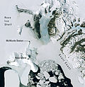
 McMurdo Sound und Ross-Insel.png 3,436 × 3,519; 19.98 MB
-
 Mcmurdo.jpg 2,325 × 2,377; 3.71 MB
-
 Mont mount Erebus Kaiser.jpg 1,414 × 940; 810 KB
-
 Mount Erebus craters, Ross Island, Antarctica (aerial view, 18 December 2000).jpg 2,000 × 1,312; 1.32 MB
-
 Mount Terror and its Glaciers.jpg 3,127 × 584; 1.15 MB
-

-
 Mount Terror, Ross Island, Antarctica.jpg 3,840 × 2,160; 2.34 MB
-
 Mount Terror.jpg 432 × 221; 38 KB
-
 National Antarctic Expedition, 1901-1903 RMG S1048-004.jpg 1,280 × 1,119; 1.34 MB
-
 National Antarctic Expedition, 1901-1903 RMG S1048-010.jpg 1,280 × 991; 1.1 MB
-
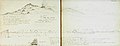
 P301 Voyage of Discovery Ross Vol 1.jpg 2,199 × 1,626; 934 KB
-
 PM 110563 Liebig Chromos.jpg 600 × 381; 392 KB
-
 Road to the Ross Ice Shelf.jpg 3,648 × 2,736; 1.84 MB
-
 Ross Island From McMurdo Sound.jpg 5,486 × 1,942; 2.02 MB
-
 Ross Island Map USGS 250k.png 2,106 × 1,686; 4.33 MB
-
 The Barrier and Mount Terror.jpg 634 × 425; 117 KB
-

-

-
-
 Voyage Southern and Antarctic Regions-1847-0313.jpg 1,999 × 1,340; 358 KB
-
 Worst Journey in the World-1-353.jpg 3,241 × 1,105; 607 KB


_-_Yale_Center_for_British_Art.jpg)
_b_149.jpg)

.jpg)


.jpg)
.jpg)


_RMG_PV9978.jpg)

_RMG_PV9979.jpg)
_RMG_PV9980.jpg)