Category:Mount Roraima
High plateau in South America .JPG) | |||||
| Upload media | |||||
| Instance of | |||||
|---|---|---|---|---|---|
| Made from material | |||||
| Located in protected area |
| ||||
| Location | |||||
| Significant event |
| ||||
| Mountain range |
| ||||
| Topographic prominence |
| ||||
| Area |
| ||||
| Elevation above sea level |
| ||||
| Partially coincident with |
| ||||
 | |||||
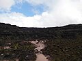
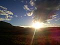
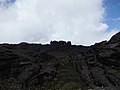
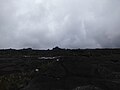
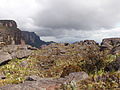
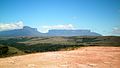
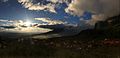
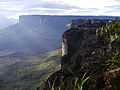
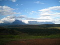
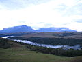
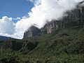
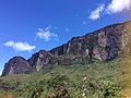
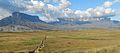
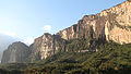
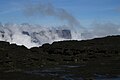
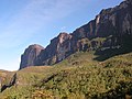
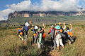
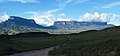
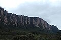
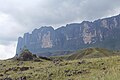
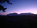
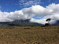
English: Mount Roraima – a mountain plateau (tepui) located in:
Venezuela (85% of its territory, part of the Canaima National Park, in Gran Sabana Municipality, Bolívar State),
Guyana (10% of its territory, in Cuyuni-Mazaruni Region), and
Brazil (5% of its territory, part of the Mount Roraima National Park, in Uiramutã, Roraima State).
Español: Monte Roraima – una meseta de montaña (tepuy) ubicada en:
Venezuela (85% de su territorio, parte del Parque Nacional Canaima, en el Municipio Gran Sabana, estado de Bolívar),
Guyana (10% de su territorio, en la Región de Cuyuni-Mazaruni) y
Brasil (5% de su territorio, parte del Parque Nacional del Monte Roraima, en Uiramutã, estado de Roraima).
Français : Mont Roraima – un plateau montagneux (tepuy) situé :
au Venezuela (85% de son territoire, partie du Parc national Canaima, dans la municipalité de Gran Sabana et l’État de Bolívar),
au Guyana (10% de son territoire, dans la Région Cuyuni-Mazaruni) et
au Brésil (5% de son territoire, partie du Parc national du mont Roraima, à Uiramutã dans l’État de Roraima).
Português: Monte Roraima – um planalto da montanha (tepui) localizado:
na Venezuela (85% do seu território, parte do Parque Nacional Canaima, no município de Gran Sabana, estado de Bolívar),
na Guyana (10% do seu território, na região de Cuyuni-Mazaruni) e
no Brasil (5% do seu território, parte do Parque Nacional do Monte Roraima, em Uiramutã, estado de Roraima).

Subcategories
This category has the following 26 subcategories, out of 26 total.
A
C
- Campamento Río Tek (2 F)
- Caves of mount Roraima (13 F)
- Cima del Roraima (53 F)
- Cliffs of Mount Roraima (15 F)
F
- Fog in Mount Roraima (6 F)
H
- History of Mount Roraima (3 F)
J
- Jacuzzis of Mount Roraima (10 F)
L
- La Rampa (Mount Roraima) (9 F)
M
- Maps of Mount Roraima (6 F)
N
- Night in Mount Roraima (2 F)
P
- Panoramics in Mount Roraima (18 F)
- Pared del Roraima (22 F)
- Punto Triple (4 F)
R
S
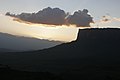
- Sunsets of Mount Roraima (4 F)
T
- Trails in Mount Roraima (17 F)
V
- Views from Mount Roraima (27 F)
Media in category "Mount Roraima"
The following 130 files are in this category, out of 130 total.
-
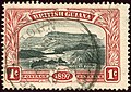 1898 1c Br Guiana Mount Roraima Yv88 SG216.jpg 937 × 660; 675 KB
-

-
 Amanecer en campamento rio tek y Tepuy Roraima en Canaima Venezuela.jpg 1,296 × 864; 319 KB
-
 APRECIANDO LA VISTA.JPG 4,320 × 3,240; 5.08 MB
-
 ASCENSO AL RORAIMA.JPG 4,320 × 3,240; 4.91 MB
-
 Atardecer en Roraima.JPG 4,912 × 1,080; 2.23 MB
-
 Autoretrato en el roraima.jpg 5,184 × 3,456; 5.87 MB
-
 BASE DEL RORAIMA.JPG 4,320 × 3,240; 5.38 MB
-
 CAMINANDO PARA EL RORAIMA.JPG 4,320 × 3,240; 5.19 MB
-
 CAMINANDO POR RORAIMA.JPG 4,320 × 3,240; 5.19 MB
-
 CAMINITO A RORAIMA (cropped).JPG 4,320 × 2,892; 4.98 MB
-
 CAMINITO A RORAIMA.JPG 4,320 × 3,240; 5.25 MB
-
 CAMINITO AL RORAIMA.JPG 4,320 × 3,240; 4.96 MB
-
 CAMINO HACIA RORAIMA.JPG 4,320 × 3,240; 5.19 MB
-
 Caída de agua en el valle de las lagrimas del tepuy Roraima.jpg 1,296 × 864; 731 KB
-
 CERCA DEL RORAIMA.JPG 4,320 × 3,240; 5.19 MB
-
 Cielo En Roraima.jpg 1,080 × 4,912; 230 KB
-
 Contemplando el Roraima.jpg 960 × 640; 79 KB
-
 CONTEMPLANDO EL RORAIMA.JPG 4,320 × 3,240; 5.18 MB
-
 DESDE EL RORAIMA.JPG 4,320 × 3,240; 5.19 MB
-
 El Mirador - Monte Roraima.JPG 2,448 × 2,448; 1.86 MB
-
 El Roraima te regala otra oportunidad.jpg 960 × 720; 36 KB
-
 EL RORAIMA.JPG 4,320 × 3,240; 5.18 MB
-
 El tendedero a sus pies.jpg 960 × 720; 98 KB
-
 En las faldas del Roraima.jpg 604 × 453; 34 KB
-
 Entre el día y la noche.jpg 3,264 × 2,448; 979 KB
-
 ESCALANDO EL RORAIMA.JPG 4,320 × 3,240; 5.19 MB
-
 EXCURSION RORAIMA.JPG 4,320 × 3,240; 4.18 MB
-
 EXCURSIONANDO POR EL RORAIMA.JPG 4,320 × 3,240; 5.09 MB
-
 Excursionistas ascendiendo Roraima.jpg 1,999 × 1,499; 2.73 MB
-
 EXCURSIÓN RORAIMA.JPG 4,320 × 3,240; 5.22 MB
-
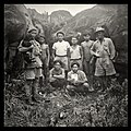 Expedition members on Roraima in 1948.jpg 2,969 × 2,957; 7.33 MB
-
 Gran Sabana - Roraima.JPG 1,920 × 1,080; 874 KB
-
 Gran Sabana 2.JPG 1,280 × 960; 243 KB
-
 KITLV A873 - Roroima-gebergte in Brits Guyana, KITLV 107366.tiff 2,603 × 1,917; 14.29 MB
-
 Kukenan y Roraima.JPG 4,608 × 3,456; 5.37 MB
-
 LLEGANDO AL RORAIMA.JPG 4,320 × 3,240; 4.94 MB
-
 Los sueños al alba descubren Roraima.JPG 3,264 × 2,164; 852 KB
-
 MARAVILLAS DEL RORAIMA.JPG 4,320 × 3,240; 5.19 MB
-
 Monte Roraima - nascer do sol.JPG 3,264 × 2,448; 1.06 MB
-
 Monte Roraima - panoramio (2).jpg 3,504 × 2,336; 2.05 MB
-
 Monte Roraima - panoramio.jpg 3,504 × 2,336; 2.87 MB
-
 Monte Roraima - pôr do sol.JPG 4,978 × 2,400; 2.23 MB
-
 Monte Roraima com nuvens e céu azul.jpg 5,472 × 3,648; 15.4 MB
-
 Monte Roraima derivado 2013 000.jpg 944 × 1,584; 332 KB
-
 Monte Roraima e Kukenan Tepui noturno.jpg 5,472 × 3,648; 10.96 MB
-
 Monte Roraima, ponto mais alto.jpg 5,496 × 3,670; 16.74 MB
-
 Monte Roraima-trilha.JPG 3,264 × 2,448; 1.24 MB
-
 Monte Roraima.jpg 720 × 480; 50 KB
-
 Montes Roraima y Kukenam.jpg 3,264 × 2,448; 2.78 MB
-
 Mount Roraima banner.jpg 4,592 × 661; 590 KB
-
 Mount Roraima, Venezuela (12371174655).jpg 4,592 × 3,448; 2.19 MB
-
 Mount Roraima, Venezuela (12371267943).jpg 4,592 × 3,448; 1.88 MB
-
 Mount Roraima, Venezuela (12371474504).jpg 4,592 × 3,448; 2.26 MB
-
 Mount Roraima, Venezuela (12372404495).jpg 4,592 × 3,448; 2.79 MB
-
 Mt Roraima in Venezuela 001.JPG 800 × 600; 95 KB
-
 OBSERVANDO.JPG 4,320 × 3,240; 5.27 MB
-
 Panorámica del Tepuy Roraima.jpg 2,439 × 1,230; 3.1 MB
-
 Paolo Costa Roraima.jpg 4,120 × 2,680; 5.2 MB
-
 Parque Nacional do Monte Roraima 01.JPG 4,000 × 3,000; 3.37 MB
-
 Parque Nacional do Monte Roraima 02.JPG 4,000 × 3,000; 3.5 MB
-
 Parque Nacional do Monte Roraima 03.JPG 4,000 × 3,000; 4.05 MB
-
 Parque Nacional do Monte Roraima 04.JPG 4,000 × 3,000; 3.96 MB
-
 Parque Nacional do Monte Roraima 05.JPG 4,000 × 3,000; 4.1 MB
-
 Parque Nacional do Monte Roraima 07.JPG 4,000 × 3,000; 4.56 MB
-
 Parque Nacional do Monte Roraima 08.JPG 4,000 × 3,000; 4.48 MB
-
 Parque Nacional do Monte Roraima 09.JPG 4,000 × 3,000; 4.64 MB
-
 Parque Nacional do Monte Roraima 10.JPG 4,000 × 3,000; 4.68 MB
-
 Parque Nacional do Monte Roraima 11.JPG 4,000 × 3,000; 4.47 MB
-
 Piedra Loca.JPG 3,648 × 2,736; 6.14 MB
-
 Rampa de subida - Monte Roraima.JPG 3,264 × 2,448; 2.88 MB
-
 RIO RORAIMA.JPG 4,320 × 3,240; 5.03 MB
-
 ROCAS DEL RORAIMA.JPG 4,320 × 3,240; 5.19 MB
-
 Roraima 1973 Boundary.jpg 3,000 × 2,021; 5.07 MB
-
 Roraima 1973 Rare Sighting.jpg 2,000 × 1,347; 2.22 MB
-
 Roraima 1992 000.jpg 1,133 × 773; 271 KB
-
 Roraima 1992 001.jpg 1,129 × 757; 172 KB
-
 Roraima 1992 002.jpg 1,169 × 785; 213 KB
-
 Roraima 1992 003.jpg 1,185 × 781; 210 KB
-
 Roraima 1992 004.jpg 1,187 × 802; 281 KB
-
 Roraima 2 1.JPG 1,544 × 1,024; 790 KB
-
 Roraima 2 2.JPG 1,544 × 1,024; 844 KB
-
 RORAIMA 2012 EXCURSION.JPG 4,320 × 3,240; 5.15 MB
-
 RORAIMA 2012.JPG 4,320 × 3,240; 4.26 MB
-
 Roraima a lo lejos.jpg 556 × 417; 20 KB
-
 Roraima caminata.JPG 4,608 × 3,456; 6.8 MB
-
 RORAIMA CIMA.JPG 4,320 × 3,240; 5.18 MB
-
 Roraima e kukenan.jpg 6,611 × 2,931; 1.9 MB
-
 Roraima en la tarde.jpg 800 × 800; 80 KB
-
 Roraima Kukenan venezuelian village.jpg 1,024 × 683; 194 KB
-
 Roraima Paratepui Route1.jpg 3,840 × 2,160; 7.75 MB
-
 Roraima Paratepui Route2.jpg 3,840 × 2,160; 7.53 MB
-
 Roraima Rocks12.JPG 1,024 × 683; 67 KB
-
 Roraima soleado.JPG 4,608 × 3,456; 6.21 MB
-
 Roraima Tepuy visto desde la Serra do Sol en la frontera con Brasil.jpg 1,200 × 800; 651 KB
-
 RORAIMA TEPUY.jpg 3,344 × 1,962; 3.14 MB
-
 Roraima vistaBase.JPG 3,680 × 2,760; 2.94 MB
-
 Roraima waterfall1.jpg 1,944 × 2,592; 2.05 MB
-
 Roraima y Kukenan.JPG 4,608 × 3,456; 8.09 MB
-
 RORAIMA Y KUKENAN.JPG 4,320 × 3,240; 5.19 MB
-
 Roraima, despedida.JPG 3,088 × 2,056; 3.66 MB
-
 Roraima.jpg 1,024 × 475; 239 KB
-
 RORAIMA.JPG 4,320 × 3,240; 5.19 MB
-
 Roraima1 cfa.JPG 1,728 × 1,152; 581 KB
-
 RUMBO AL RORAIMA.JPG 4,320 × 3,240; 5.33 MB
-
 Stamp British Guiana 1899 2c on 5c.jpg 1,200 × 862; 309 KB
-
 SUBIENDO PARA EL RORAIMA.JPG 4,320 × 3,240; 4.9 MB
-
-
 Tepuy Roraima ruta trekking Parque Nacional Canaima Venezuela.jpg 1,296 × 864; 548 KB
-
 Tepuy Roraima y Kukenán al amanecer..JPG 1,024 × 768; 299 KB
-
 Tepuy Roraima.jpg 556 × 417; 20 KB
-
 TEPUY RORAIMA.JPG 1,920 × 1,080; 391 KB
-
 Tepuy, Roraima..jpg 3,045 × 1,805; 282 KB
-
 Tepuyes Kukenan y Roraima.jpg 1,920 × 1,080; 817 KB
-
 Trilha Monte Roraima - panoramio (3).jpg 3,504 × 2,336; 3.23 MB
-
 Trilha Monte Roraima.JPG 3,264 × 2,448; 2.1 MB
-
 VIAJE AL RORAIMA.JPG 4,320 × 3,240; 5.08 MB
-
 VIENDO EL RORAIMA.JPG 4,320 × 3,240; 5.32 MB
-
 VISTA DE LA GRAN SABANA.JPG 4,320 × 3,240; 5.19 MB
-
 VISTA DE LOS TEPUYS.JPG 4,320 × 3,240; 5.19 MB
-
 VISTA DEL RORAIMA Y KUKENAN.JPG 4,320 × 3,240; 5.04 MB
-
 VISTA DEL RORAIMA.JPG 4,320 × 3,240; 5.18 MB
-

-
 Vista del Tepuy Roraima..JPG 1,024 × 768; 288 KB
-
 VISTA DESDE EL RORAIMA.JPG 4,320 × 3,240; 5.19 MB
-
 Vista do Passo das Lagrimas - Flickr - Guilherme Jófili.jpg 2,000 × 1,330; 1.53 MB
-
 Vista Tepuy Roraima.jpg 3,264 × 2,448; 2.1 MB
-
 Vista-desde-Maverick-Campamento-Cima-Tepuy-Roraima-Bolivar-Venezuela.JPG 2,816 × 2,112; 1.53 MB
-
 Vista-desde-Maverick-Punto-Mas-Alto-Tepuy-Roraima-Bolivar-Venezuela.JPG 2,816 × 2,112; 1.33 MB
-
 VIVIENDO EL RORAIMA.JPG 4,320 × 3,240; 5.2 MB


.JPG)


.jpg)


.jpg)
.jpg)
.jpg)
.jpg)


.jpg)


