Category:Mount Asama
volcano on the border of Gunma and Nagano prefectures in Japan .jpg)    ,_SRTM-1.jpg) | |||||
| Upload media | |||||
| Instance of | |||||
|---|---|---|---|---|---|
| Part of |
| ||||
| Made from material | |||||
| Located in protected area | |||||
| Location | |||||
| Significant event |
| ||||
| Elevation above sea level |
| ||||
 | |||||
Subcategories
This category has the following 11 subcategories, out of 11 total.
*
- Views from Mount Asama (2 F)
F
- Figures of Mount Asama (5 F)
H
M
- Mount Asama in art (18 F)
O
- Onioshidashien (16 F)
T
Media in category "Mount Asama"
The following 45 files are in this category, out of 45 total.
-
 20080524SunsetAsamaYama.jpg 1,280 × 960; 358 KB
-
 2009年2月の噴火後の浅間山.JPG 4,000 × 3,000; 4.3 MB
-
 220929 Mt Asama Karuizawa Nagano pref Japan01s3.jpg 6,000 × 4,000; 17.47 MB
-
 ASAMA Volcano Museum 2017-04.jpg 4,608 × 3,456; 5 MB
-
 AsamaYamaYatsugatake.jpg 1,280 × 960; 396 KB
-
 AsamaYamaYatsugatakeTagged.jpg 1,280 × 960; 272 KB
-
 Hikarigoke Schistostega.JPG 2,592 × 1,728; 2.55 MB
-
 Iwagami no Tobiishi postcard.1910.jpg 1,564 × 1,043; 898 KB
-
 Karuizawa and Mt. Asama (51744767255).jpg 5,860 × 3,907; 5.16 MB
-
 Mt asama landsat.jpg 800 × 600; 125 KB
-
 Mt.Asama, Karuizawa.jpg 1,192 × 671; 320 KB
-
 Mt.asama.jpg 640 × 432; 58 KB
-
 My old friend. (8651147789).jpg 1,600 × 1,200; 2.39 MB
-
 NDL1189315 浅間山.pdf 6,820 × 5,056, 61 pages; 59.11 MB
-
 NDL1208258 浅間山 - 戯曲集 part1.pdf 8,652 × 5,339, 100 pages; 102.4 MB
-
 NDL1208258 浅間山 - 戯曲集 part2.pdf 8,652 × 5,339, 100 pages; 104.51 MB
-
 NDL1208258 浅間山 - 戯曲集 part3.pdf 8,652 × 5,339, 12 pages; 12.41 MB
-
 NDL764824 浅間山 part1.pdf 5,722 × 4,308, 100 pages; 135.06 MB
-
 NDL764824 浅間山 part2.pdf 5,722 × 4,308, 100 pages; 124.54 MB
-
 NDL764824 浅間山 part3.pdf 5,722 × 4,308, 55 pages; 62.83 MB
-
 Oni-oshidashi.jpg 640 × 480; 70 KB
-
 Reaching Mt. Asama summit (51914513687).jpg 6,000 × 4,000; 10.22 MB
-
 Sierra Club bulletin (1893) (14772607942).jpg 2,598 × 1,760; 1.35 MB
-
 The romance of modern geology BHL21491338.jpg 2,144 × 3,444; 693 KB
-
 ごみ焼却場クリーンヒルこもろから上がる水蒸気と白くなった浅間山20251119.jpg 4,096 × 3,072; 3.08 MB
-
 北陸新幹線からの浅間山20211224-P1280868.jpg 1,600 × 1,201; 355 KB
-
 北陸新幹線からの浅間山20220410-IMG 1246.jpg 1,600 × 1,067; 262 KB
-
 北陸新幹線からの浅間山20220508-IMG 2534.jpg 1,600 × 1,067; 300 KB
-
 北陸新幹線からの浅間山20230423-IMG 7411.jpg 1,600 × 1,067; 360 KB
-
 夕映えの浅間山.jpg 4,096 × 3,072; 1.72 MB
-
 夕映えの雪の浅間山.jpg 5,312 × 2,988; 2.45 MB
-
 月と夕映えの浅間山.jpg 2,988 × 5,312; 3.39 MB
-
 浅間山 20251216 (小諸市菱平).jpg 4,096 × 3,072; 1.72 MB
-
 浅間山と広域農道浅間サンライン (20830).jpg 3,840 × 2,160; 3.11 MB
-
 浅間山と広域農道浅間サンライン (23146).jpg 3,840 × 2,160; 3.34 MB
-
 浅間山と広域農道浅間サンライン (39840).jpg 3,840 × 2,160; 3.46 MB
-
 浅間山と広域農道浅間サンライン.jpg 3,840 × 2,160; 3.14 MB
-
 浅間山(北陸新幹線軽井沢付近)20260222-IMG 5858.jpg 1,600 × 1,067; 320 KB
-
 浅間火山観測所.jpg 1,800 × 1,278; 549 KB
-
 浅間登山古道の馬頭観音.jpg 2,988 × 5,312; 6.79 MB
-
 浅間登山道の一里の丁石.jpg 2,988 × 5,312; 9.56 MB
-
 白い浅間山20251119.jpg 4,096 × 3,072; 3.74 MB
-
 白い浅間山とブルーベリーの木の霧氷 20260106.jpg 4,096 × 3,072; 4.85 MB
-
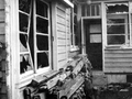 空振による被害の例(浅間山・1950年).png 649 × 487; 409 KB
-
 立岩から見た浅間山(中央奥)と荒船山(右手前).jpg 5,259 × 3,506; 2.7 MB


.jpg)


.jpg)

.jpg)
_(14772607942).jpg)


.jpg)
.jpg)
.jpg)
.jpg)

20260222-IMG_5858.jpg)


.png)
と荒船山(右手前).jpg)