Category:Mitú
Capital of the Colombian department of Vaupés .svg)   | |||||
| Upload media | |||||
| Instance of | |||||
|---|---|---|---|---|---|
| Location | Vaupés Department, Colombia | ||||
| Located in or next to body of water | |||||
| Inception |
| ||||
| Population |
| ||||
| Area |
| ||||
| Elevation above sea level |
| ||||
| Different from | |||||
| official website | |||||
 | |||||
Media in category "Mitú"
The following 44 files are in this category, out of 44 total.
-
 Alcaldía de Mitú - Vaupés.jpg 5,312 × 2,988; 5.29 MB
-
 Atardecer en Mitú, río Vaupés - panoramio.jpg 5,312 × 2,988; 5.53 MB
-
 Baile Tradicional Piratapuyo (Wa'íkâná) En Mitú, Vaupés.jpg 1,280 × 960; 288 KB
-
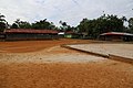
 Cancha de fútbol de Mitú.jpg 5,312 × 2,988; 6.82 MB
-
 Carrera 8A de Mitú, Vaupés.jpg 4,960 × 1,808; 2.76 MB
-
 Casa en Mitú, Vaupés - 1.jpg 5,312 × 2,988; 4.48 MB
-
 Casa en Mitú, Vaupés - 2.jpg 5,312 × 2,988; 5.72 MB
-
 Caño Ceima Cachivera, Mitú, Vaupés.jpg 5,472 × 3,648; 9.63 MB
-
 Caño Cuduyari cayendo al río Vaupes - panoramio.jpg 5,472 × 3,648; 5.18 MB
-
 Caño Sangre. Mitu - panoramio.jpg 5,472 × 3,648; 12.37 MB
-
 Cerro Guacamaya, Mitu, Vaupes - panoramio.jpg 5,312 × 2,988; 6.67 MB
-
 Colombia - Vaupés - Mitú.svg 1,884 × 2,032; 268 KB
-
 Comando de Policía de Vaupés.jpg 5,312 × 2,988; 5.35 MB
-
 Comunidad indígena Cubay - panoramio.jpg 5,472 × 3,648; 10.13 MB
-
 Comunidad indígena Golondrina - panoramio.jpg 5,472 × 3,648; 8.9 MB
-
 Comunidad indígena Mitu Cachivera - panoramio.jpg 5,472 × 3,648; 11.48 MB
-
 Comunidad indígena Santa Marta - panoramio.jpg 5,472 × 3,648; 7.34 MB
-
 Escudo de Mitú.svg 762 × 854; 143 KB
-
 Flag of Mitú (Vaupés).svg 750 × 500; 3 KB
-
 Iglesia de Mitú, Vaupés.jpg 4,224 × 1,808; 2.47 MB
-
 Imponente rio Vaupes - panoramio.jpg 5,312 × 2,988; 6.1 MB
-
 Malecón del río Vaupés, Mitú.jpg 5,312 × 2,988; 4.36 MB
-
 Malecón del Río Vaupés.jpg 5,312 × 2,988; 5.27 MB
-
 Maloca indígena Cubay - panoramio.jpg 5,472 × 3,648; 6.34 MB
-
 Maloca Ipanore, Mitú.jpg 5,312 × 2,988; 2.81 MB
-
 Mapa Vicariato Apostólico de Mitú.svg 754 × 779; 248 KB
-
 Escudo del Vicariato Apostólico de Mitú.svg 477 × 999; 34 KB
-
 Mitú, cerca al río Vaupés.jpg 5,312 × 2,988; 4.46 MB
-
 Mitú.jpg 3,264 × 1,836; 1.6 MB
-
 MunsVaupes Mitu.png 2,269 × 1,823; 1.75 MB
-
 Niños indígenas navegando por el rio Vaupes - panoramio.jpg 5,472 × 3,648; 5.15 MB
-
 Parque principal de Mitú, Vaupés.jpg 5,312 × 2,988; 5.85 MB
-
 Planta eléctrica de Mitú, Vaupés.jpg 5,312 × 2,988; 6.3 MB
-
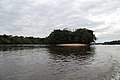 Playa sobre isla del amor, rio Vaupes - panoramio.jpg 5,472 × 3,648; 4.75 MB
-
 Playas de la isla de Urania en rio Vaupes - panoramio.jpg 5,472 × 3,648; 8.39 MB
-
 Puente sobre comunidades Santa Marta y Golondrina - panoramio.jpg 5,472 × 3,648; 10.98 MB
-
 Puerto de carga de Mitú, Vaupés.jpg 5,472 × 3,648; 6.56 MB
-
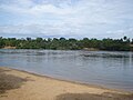 Rio Vaupés a la altura de Mitú.jpg 3,072 × 2,304; 3.01 MB
-
 Rio Vaupés desde Mitú.jpg 7,168 × 1,664; 2.9 MB
-
 San Victorino, Mitu - panoramio.jpg 5,472 × 3,648; 8.02 MB
-
 Tawny-tufted Toucanet.jpg 926 × 1,391; 346 KB
-
 Virgen en medio del río Vaupés, Mitú.jpg 5,472 × 3,648; 6.99 MB
-
 Vista desde el cerro Guacamaya - panoramio.jpg 5,472 × 3,648; 4.6 MB
-
 Vista espectacular del rio Vaupes - panoramio.jpg 5,472 × 3,648; 7.75 MB


_En_Mit%C3%BA,_Vaup%C3%A9s.jpg)


