Category:Milngavie
town in East Dunbartonshire, Scotland, UK  | |||||
| Upload media | |||||
| Instance of |
| ||||
|---|---|---|---|---|---|
| Location |
| ||||
| Population |
| ||||
 | |||||
Subcategories
This category has the following 15 subcategories, out of 15 total.
B
- Bardowie Castle (4 F)
C
- Craigmaddie Reservoir (57 F)
D
- Dumbrock Loch (2 F)
L
- Lillie Art Gallery (8 F)
M
- Milngavie railway station (86 F)
P
R
- Rangers Training Centre (7 F)
T
- Tannoch Loch (6 F)
Media in category "Milngavie"
The following 123 files are in this category, out of 123 total.
-
 1860 Mugdock Reservoir Map.png 375 × 550; 317 KB
-
 A coot - geograph.org.uk - 6837739.jpg 1,600 × 1,194; 604 KB
-
-
 Aldi, Milngavie - geograph.org.uk - 6602055.jpg 1,600 × 1,166; 317 KB
-
 All covered up - geograph.org.uk - 6447802.jpg 1,184 × 1,600; 488 KB
-
 Allander Leisure Centre (geograph 5645681).jpg 1,600 × 962; 241 KB
-

-
 Baldernock Road - geograph.org.uk - 1404426.jpg 640 × 480; 152 KB
-
 Baldernock Road, Milngavie - geograph.org.uk - 1466720.jpg 640 × 480; 104 KB
-
 Baldernock Road, Milngavie - geograph.org.uk - 738057.jpg 640 × 428; 106 KB
-
 Bankell House.jpg 1,985 × 1,306; 801 KB
-
 Barnado's, Milngavie - geograph.org.uk - 5997416.jpg 1,600 × 1,065; 337 KB
-
 Bollards across Kerland Drive - geograph.org.uk - 7922777.jpg 1,600 × 1,067; 322 KB
-
 BP station, Glasgow Road - geograph.org.uk - 1127543.jpg 640 × 480; 117 KB
-
 Bunkers at Clober Golf Course - geograph.org.uk - 1518450.jpg 640 × 480; 180 KB
-
 Burn beneath Craigton path - geograph.org.uk - 1518454.jpg 640 × 480; 142 KB
-
 Clydebank and Milngavie (Scottish Parliament constituency).svg 281 × 326; 63 KB
-
 Craigallian Lodge (geograph 6436003).jpg 1,600 × 1,122; 321 KB
-
 Craigdhu Road - geograph.org.uk - 514491.jpg 640 × 480; 94 KB
-
 Craigton Road, Milngavie - geograph.org.uk - 1518446.jpg 640 × 480; 169 KB
-
 Crawford Road, Cloberfield, Milngavie - geograph.org.uk - 79403.jpg 640 × 479; 137 KB
-
 Crossing Allander Water - geograph.org.uk - 620392.jpg 640 × 480; 119 KB
-
 Details of the old all metal waterwheel at Gavin's Mill, Milngavie, Glasgow.jpg 3,940 × 3,864; 3.79 MB
-
 Details of the waterwheel at Gavin's Mill, Milngavie, Glasgow.jpg 5,152 × 3,864; 4 MB
-
 Dougalston Loch - geograph.org.uk - 61279.jpg 640 × 480; 147 KB
-
 Esso garage, Stockiemuir Road - geograph.org.uk - 514089.jpg 640 × 480; 60 KB
-
 Exterieur van Clober House te Milngavie, RP-F-2001-7-426-23.jpg 8,270 × 5,598; 5.26 MB
-
 Exterieur van Craigmaddie House nabij Milngavie, RP-F-2001-7-426-28.jpg 8,270 × 5,598; 5.07 MB
-
 Exterieur van Mains House nabij Glasgow, RP-F-2001-7-426-70.jpg 5,120 × 8,270; 3.78 MB
-
 Fairways - geograph.org.uk - 1127568.jpg 640 × 480; 150 KB
-
 Field between Bearsden and Milngavie - geograph.org.uk - 514487.jpg 640 × 480; 60 KB
-
 Forest path - geograph.org.uk - 625844.jpg 640 × 480; 362 KB
-
 Former Heatherbank Museum of Social Work (geograph 6435958 by Richard Sutcliffe).jpg 1,600 × 1,129; 330 KB
-
 Friendship House, Milngavie - geograph.org.uk - 620887.jpg 640 × 452; 74 KB
-
 Garden-near-river-near-Glengoyne-Distillery-1.JPG 2,560 × 1,920; 2.83 MB
-
 Garden-near-river-near-Glengoyne-Distillery-2.JPG 2,560 × 1,920; 2.74 MB
-
 Garden-near-river-near-Glengoyne-Distillery-3.JPG 1,920 × 2,560; 2.92 MB
-
 Gavin's Mill Fish Pass, Milngavie - geograph.org.uk - 80181.jpg 640 × 479; 198 KB
-
 Glengoyne-Distillery-3.JPG 1,920 × 2,560; 2.9 MB
-
 Glengoyne-Distillery-4.JPG 2,560 × 1,920; 2.77 MB
-
 Glengoyne-Distillery-Waterfall-1.JPG 1,920 × 2,560; 2.8 MB
-
 Glengoyne-Distillery-Waterfall-2.JPG 1,920 × 2,560; 2.75 MB
-
 Glengoyne-Distillery-Waterfall-3.JPG 1,920 × 2,560; 2.79 MB
-
 Heatherbank House.jpg 4,080 × 3,072; 4.46 MB
-
 Honesty-Shop.JPG 2,560 × 1,920; 2.61 MB
-
 House on Tannoch Drive - geograph.org.uk - 7922924.jpg 1,600 × 1,067; 428 KB
-
 Houses on Clober Road - geograph.org.uk - 5352583.jpg 1,600 × 1,101; 326 KB
-
 Hunter Road, Milngavie - geograph.org.uk - 514103.jpg 640 × 480; 85 KB
-
 Igloo in The Garden.jpg 3,450 × 4,108; 6.3 MB
-
 Keystore, Milngavie - geograph.org.uk - 1518441.jpg 640 × 480; 126 KB
-
 Lord Provost's lamppost, Burnbrae Avenue - geograph.org.uk - 6512973.jpg 1,600 × 1,080; 332 KB
-
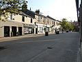
 Main Street Milngavie (geograph 3680582).jpg 640 × 596; 123 KB
-
 Main Street Milngavie - geograph.org.uk - 3680556.jpg 640 × 414; 123 KB
-
 Mains Estate, Milngavie - geograph.org.uk - 514094.jpg 640 × 480; 93 KB
-
 Mains housing estate - geograph.org.uk - 49194.jpg 640 × 480; 121 KB
-
 Marriage Stone at Gavin's Mill, Milngavie, Glasgow.jpg 2,569 × 1,051; 771 KB
-

-
-
 Memorial Fountain to James M Gale.jpg 3,072 × 4,080; 4.43 MB
-
 Memorial stone at Milngavie Waterworks - geograph.org.uk - 701110.jpg 480 × 640; 185 KB
-
 Milepost, Milngavie Road (geograph 7068647).jpg 1,259 × 1,600; 548 KB
-
 Milngavie - geograph.org.uk - 620416.jpg 480 × 640; 167 KB
-
 Milngavie Fire Station - geograph.org.uk - 49195.jpg 640 × 458; 70 KB
-
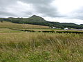
 Milngavie from the air (geograph 2988019).jpg 640 × 480; 158 KB
-
 Milngavie from the air (geograph 5609681).jpg 640 × 480; 249 KB
-
 Milngavie Heritage Centre - geograph.org.uk - 5591508.jpg 1,600 × 1,070; 322 KB
-
 Milngavie-Center.JPG 2,560 × 1,920; 2.82 MB
-
 Milngavie-Spider-Webs-in-Forest-1.JPG 2,560 × 1,920; 2.88 MB
-
 Milngavie-Spider-Webs-in-Forest-2.JPG 2,560 × 1,920; 3 MB
-
Milngavie.ogg 1.0 s; 22 KB
-
 MilngavieReservoir2020.jpg 1,024 × 676; 288 KB
-
 Mosspark Avenue, Milngavie - geograph.org.uk - 737649.jpg 640 × 428; 100 KB
-
 Mugdock Road housing - geograph.org.uk - 694267.jpg 640 × 480; 62 KB
-
 New Greggs shop and cafe - geograph.org.uk - 8250081.jpg 1,600 × 1,204; 549 KB
-
 New Greggs shop and cafe - geograph.org.uk - 8250085.jpg 1,600 × 1,205; 636 KB
-
 Notice Board - geograph.org.uk - 7061599.jpg 1,600 × 1,356; 402 KB
-
 On the move - geograph.org.uk - 8250021.jpg 1,600 × 1,205; 574 KB
-
 Ordnance Survey One-Inch Tourist Map of Loch Lomond and the Trossachs, published 1961.jpg 13,089 × 16,626; 25.68 MB
-
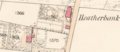 OSHeatherbank.png 1,173 × 505; 946 KB
-
 Path to Barloch Moor - geograph.org.uk - 737972.jpg 640 × 428; 112 KB
-
 Profile of James M Gale.jpg 3,072 × 4,080; 4.14 MB
-
 Provost's lamppost (detail) - geograph.org.uk - 6512997.jpg 1,134 × 1,600; 170 KB
-
 Really^^ - geograph.org.uk - 1407833.jpg 640 × 480; 147 KB
-
 Relics of the Antonine Wall, Milngavie - geograph.org.uk - 49092.jpg 640 × 480; 182 KB
-
 Residential now. - geograph.org.uk - 621021.jpg 480 × 640; 81 KB
-
 River-in-Milngavie-1.JPG 2,560 × 1,920; 3.04 MB
-
 River-in-Milngavie-2.JPG 2,560 × 1,920; 2.96 MB
-

-
 Road to Baldernock - geograph.org.uk - 738073.jpg 640 × 428; 111 KB
-
 Road-after-Glengoyne-Distillery-1.JPG 2,560 × 1,920; 2.87 MB
-
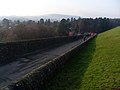
 Roadworks at the bridge (geograph 6791868).jpg 1,600 × 1,076; 355 KB
-
 Scottish-Landscape-1.JPG 2,560 × 1,920; 2.64 MB
-
 Sign for the 2024 Milngavie Car Show - geograph.org.uk - 7789442.jpg 1,600 × 1,067; 399 KB
-
 Small water channel by Mugdock Road - geograph.org.uk - 694255.jpg 640 × 480; 133 KB
-
 Stockiemuir Road - geograph.org.uk - 514091.jpg 640 × 480; 131 KB
-

-
 Tannoch Drive, Milngavie - geograph.org.uk - 737941.jpg 640 × 427; 115 KB
-
 Telephone Exchange, Milngavie - geograph.org.uk - 6624668.jpg 1,600 × 1,199; 424 KB
-
 The Allander and Gavin's Mill, Milngavie, Glasgow.jpg 5,152 × 3,864; 5.1 MB
-
 The front area at Gavin's Mill, Milngavie, Glasgow.jpg 5,152 × 3,864; 7.67 MB
-
 The old all metal waterwheel at Gavin's Mill, Milngavie, Glasgow. Side view.jpg 4,548 × 3,216; 3.12 MB
-
 The old all metal waterwheel at Gavin's Mill, Milngavie, Glasgow.jpg 3,975 × 3,864; 3.86 MB
-
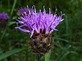 Thistle-1.JPG 4,896 × 3,672; 6.36 MB
-
 Thistle-2.JPG 4,896 × 3,672; 6.98 MB
-
 Top up from the tap - geograph.org.uk - 6203286.jpg 1,200 × 1,600; 392 KB
-
 Tree-on-Field-near-Milngavie-1.JPG 2,560 × 1,920; 2.63 MB
-
 Tree-on-Field-near-Milngavie-2.JPG 2,560 × 1,920; 2.86 MB
-
 Tree-with-moss.JPG 2,560 × 1,920; 2.74 MB
-
 Tributary stream of Allander Water - geograph.org.uk - 1127585.jpg 640 × 480; 180 KB
-
 Milngavie United Free Church - geograph.org.uk - 6014618.jpg 1,600 × 1,046; 268 KB
-
 Milngavie United Free Church - geograph.org.uk - 6511724.jpg 1,600 × 1,128; 356 KB
-
 Milngavie United Free Church - geograph.org.uk - 6576460.jpg 1,600 × 1,088; 335 KB
-
 V milngavie.jpg 4,320 × 3,240; 6.46 MB
-
 View across milngavie.jpg 4,320 × 3,240; 3.18 MB
-
 View back towards Milngavie - geograph.org.uk - 1407824.jpg 640 × 480; 180 KB
-
 Vintage buses (geograph 7789390).jpg 1,600 × 1,068; 475 KB
-
 Visible part of Bankell Reservoir - geograph.org.uk - 696808.jpg 640 × 480; 79 KB
-
 West Highland Way, Milngavie - geograph.org.uk - 737635.jpg 428 × 640; 107 KB
-
 West of Scotland Football Club (geograph 3790481).jpg 640 × 480; 45 KB
-
 West of Scotland Rugby Football Club - geograph.org.uk - 49098.jpg 640 × 462; 83 KB
-
 West Rugby (geograph 5868284).jpg 1,600 × 933; 341 KB
-
 Woodland path to Finlay Rise - geograph.org.uk - 1127564.jpg 640 × 480; 181 KB
-
 Wych Elm - geograph.org.uk - 6829371.jpg 1,600 × 1,092; 285 KB


.jpg)


.svg)
.jpg)


.jpg)


.jpg)


.png)


.jpg)


.jpg)
.jpg)


_-_geograph.org.uk_-_6512997.jpg)


.jpg)


.jpg)


.jpg)

.jpg)

