Category:Mangochi District
district in the Southern Region of Malawi  | |||||
| Upload media | |||||
| Instance of | |||||
|---|---|---|---|---|---|
| Location | Southern Region, Malawi | ||||
| Capital | |||||
| Area |
| ||||
 | |||||
Subcategories
This category has the following 4 subcategories, out of 4 total.
M
- Majuni, Mangochi (4 F)
- Monkey Bay (21 F)
N
- Namizimu Forest Retreat (1 F)
Pages in category "Mangochi District"
This category contains only the following page.
Media in category "Mangochi District"
The following 22 files are in this category, out of 22 total.
-
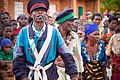 Beni Majuni Malawi 2006-1.jpg 1,439 × 957; 317 KB
-
 Beni Majuni Malawi 2006-4.jpg 1,439 × 957; 277 KB
-
 Beni Majuni Malawi 2006.jpg 1,440 × 960; 1.32 MB
-
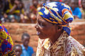
 Chiponde, Malawi.jpg 4,608 × 3,456; 1.5 MB
-
 Chiponde.jpg 1,200 × 798; 343 KB
-
 ISS023-E-35130 - View of Earth.jpg 4,256 × 2,913; 1.04 MB
-

-

-

-
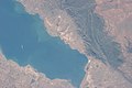 ISS036-E-4839 - View of Malawi.jpg 4,256 × 2,832; 961 KB
-
 Lake malawi mangochi.jpg 583 × 388; 80 KB
-
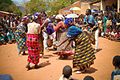
 Likwata Majuni Malawi 2006-1.jpg 1,439 × 957; 317 KB
-
 Likwata Majuni Malawi 2006-2.jpg 1,439 × 957; 329 KB
-
 Likwata Majuni Malawi 2006-3.jpg 1,439 × 957; 332 KB
-
 Likwata Majuni Malawi 2006-4.jpg 1,439 × 957; 371 KB
-
 Likwata Majuni Malawi 2006-5.jpg 1,439 × 957; 386 KB
-
 Likwata Majuni Malawi 2006-6.jpg 1,439 × 957; 378 KB
-
 Likwata Majuni Malawi 2006-7.jpg 1,439 × 957; 399 KB
-
 Mountain close to Nsalema, Mangochi, Malawi.jpg 4,608 × 3,456; 2.39 MB
-
 Nselema, Mangochi, Malawi.jpg 4,608 × 3,456; 2.2 MB
-
 Psammophis orientalis 21270044.jpg 1,799 × 1,173; 65 KB
-
 Psammophis orientalis 21270106.jpg 1,798 × 1,202; 66 KB


.jpg)
.jpg)
.jpg)


