Category:London Borough of Brent
Boroughs of London: City of London · City of Westminster · Barking and Dagenham · Barnet · Bexley · Brent · Bromley · Camden · Croydon · Ealing · Enfield · Greenwich · Hackney · Hammersmith and Fulham · Haringey · Harrow · Havering · Hillingdon · Hounslow · Islington · Kensington and Chelsea · Kingston · Lambeth · Lewisham · Merton · Newham · Redbridge · Richmond · Southwark · Sutton · Tower Hamlets · Waltham Forest · Wandsworth
borough in the London Region in England ,_Wembley_-_geograph.org.uk_-_865102.jpg)   | |||||
| Upload media | |||||
| Pronunciation audio | ⓘ | ||||
|---|---|---|---|---|---|
| Instance of | |||||
| Named after | |||||
| Location | Greater London, London, England | ||||
| Capital | |||||
| Legislative body |
| ||||
| Executive body |
| ||||
| Head of government |
| ||||
| Inception |
| ||||
| Population |
| ||||
| Area |
| ||||
| Replaces |
| ||||
| official website | |||||
 | |||||
Subcategories
This category has the following 26 subcategories, out of 26 total.
A
B
E
F
G
H
N
P
S
Media in category "London Borough of Brent"
The following 200 files are in this category, out of 2,678 total.
(previous page) (next page)-

-

-
 (Part of) Station Road, NW10 - geograph.org.uk - 2751078.jpg 480 × 640; 94 KB
-
 A Somewhat Empty Wembley - geograph.org.uk - 8222730.jpg 4,032 × 2,268; 6.07 MB
-
 A4003 - geograph.org.uk - 8204655.jpg 1,024 × 684; 183 KB
-
 A4005, A4089 junction - geograph.org.uk - 6551985.jpg 1,024 × 684; 162 KB
-
 A404 - geograph.org.uk - 4534780.jpg 640 × 426; 56 KB
-
 A407 - geograph.org.uk - 6510481.jpg 1,024 × 684; 244 KB
-
 A4088 - A4089 junction - geograph.org.uk - 8229976.jpg 1,024 × 684; 165 KB
-
 A4088 - geograph.org.uk - 8032959.jpg 1,024 × 684; 200 KB
-
 A4088 - geograph.org.uk - 8217258.jpg 1,024 × 684; 132 KB
-
 A4089 - geograph.org.uk - 8229867.jpg 1,024 × 684; 156 KB
-
 A4089 - geograph.org.uk - 8229967.jpg 1,024 × 684; 165 KB
-
 A4089 - geograph.org.uk - 8229975.jpg 1,024 × 684; 161 KB
-
 A5, Kilburn - geograph.org.uk - 5337962.jpg 640 × 350; 58 KB
-
 Access from Beresford Avenue to Grand Union Walk - geograph.org.uk - 2726737.jpg 2,298 × 2,496; 2.15 MB
-
 Access from Water Road to canal towpath - geograph.org.uk - 2726734.jpg 2,919 × 2,186; 2.63 MB
-
 Access self storage on Ealing Road, Alperton - geograph.org.uk - 4201485.jpg 2,304 × 1,728; 665 KB
-
 Adult Training Centre, Hillside, Benchmark - geograph.org.uk - 7812244.jpg 768 × 1,024; 262 KB
-
 Advertising by Queensbury Station - geograph.org.uk - 6818700.jpg 1,920 × 1,280; 1.23 MB
-
 Allied House, Burnt Oak - geograph.org.uk - 2198150.jpg 4,320 × 3,240; 3.76 MB
-
 Alperton House - geograph.org.uk - 2864441.jpg 640 × 469; 72 KB
-
 Alperton House - geograph.org.uk - 6551979.jpg 1,024 × 685; 116 KB
-
 Alto Stratus^ - geograph.org.uk - 4895336.jpg 3,900 × 2,800; 1.74 MB
-
 Angular building - geograph.org.uk - 2143095.jpg 640 × 480; 83 KB
-
 Apartment block, Kingsbury Circle - geograph.org.uk - 2880651.jpg 640 × 480; 201 KB
-
 Apartment block, Pitfield Way - geograph.org.uk - 5615530.jpg 1,600 × 1,200; 753 KB
-
 Apartment block, Stafford Road - geograph.org.uk - 4752550.jpg 1,600 × 1,200; 1.86 MB
-
 Apartments on The Mall - geograph.org.uk - 6293744.jpg 4,890 × 3,468; 3.33 MB
-
 Approach to the North Circular Road - geograph.org.uk - 4098734.jpg 4,000 × 3,000; 3.96 MB
-
 Approaching Neasden Junction - geograph.org.uk - 3072566.jpg 640 × 495; 79 KB
-
 Approaching Queens Park - geograph.org.uk - 6189686.jpg 1,024 × 768; 198 KB
-
 Architectural salvage business, Willesden - geograph.org.uk - 4764125.jpg 1,200 × 1,600; 1.3 MB
-
 Argenta House, London NW10 - geograph.org.uk - 3097731.jpg 640 × 563; 85 KB
-
 Ark Academy Primary School - geograph.org.uk - 8229864.jpg 1,024 × 684; 160 KB
-
 Ark Academy Primary School - geograph.org.uk - 8229969.jpg 1,024 × 684; 232 KB
-
 Ark Franklin Primary Academy - geograph.org.uk - 8051888.jpg 1,024 × 684; 205 KB
-
 Art Deco factory off East Lane, Wembley - geograph.org.uk - 2246471.jpg 1,600 × 1,200; 538 KB
-
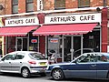 Arthur's Cafe, Station Terrace, NW10 - geograph.org.uk - 2639622.jpg 640 × 480; 87 KB
-
 Ashton Lodge care home, The Hyde - geograph.org.uk - 6302660.jpg 1,696 × 1,280; 1,016 KB
-
 Attewood Avenue - geograph.org.uk - 7522637.jpg 2,048 × 2,048; 1,005 KB
-
 Avenue Mansions - geograph.org.uk - 4702663.jpg 640 × 360; 60 KB
-
 Avery House on Carlisle Road - geograph.org.uk - 5322387.jpg 2,304 × 1,728; 859 KB
-
 Aylsbury St - geograph.org.uk - 8218219.jpg 1,024 × 684; 147 KB
-
 B454 - geograph.org.uk - 5465707.jpg 640 × 426; 65 KB
-
 B454 - geograph.org.uk - 5465720.jpg 640 × 426; 92 KB
-
 Back in the pound - geograph.org.uk - 7260112.jpg 3,200 × 2,400; 1.22 MB
-
 Back view of buildings close to North Wembley Station - geograph.org.uk - 3500528.jpg 1,600 × 1,200; 371 KB
-
 Baird Close, Kingsbury - geograph.org.uk - 6930179.jpg 3,200 × 2,400; 2.11 MB
-
 Balmoral Rd - geograph.org.uk - 8217183.jpg 1,024 × 684; 176 KB
-
 Barn Hill - geograph.org.uk - 8229993.jpg 1,024 × 684; 204 KB
-
 Barn Hill - geograph.org.uk - 8230004.jpg 1,024 × 684; 202 KB
-
 Barn Hill - geograph.org.uk - 8230005.jpg 1,024 × 684; 214 KB
-
 Barn Hill - geograph.org.uk - 8230022.jpg 1,024 × 684; 388 KB
-
 Barn Hill - geograph.org.uk - 8230023.jpg 1,024 × 684; 340 KB
-
 Barn Hill - geograph.org.uk - 8230025.jpg 1,024 × 684; 333 KB
-
 Barn Hill Open Space ahead - geograph.org.uk - 8230006.jpg 1,024 × 684; 281 KB
-
 Barn Hill, Wembley - geograph.org.uk - 4549289.jpg 4,000 × 3,000; 4.23 MB
-
 Barn Hill, Wembley Park - geograph.org.uk - 2246479.jpg 1,600 × 1,200; 629 KB
-
 Barn Rise, Wembley Park - geograph.org.uk - 5212681.jpg 2,048 × 1,152; 796 KB
-
 Barn Way - geograph.org.uk - 8229999.jpg 1,024 × 684; 229 KB
-
 Barnhill Rd - geograph.org.uk - 8229773.jpg 1,024 × 684; 298 KB
-
 Barnhill Rd - geograph.org.uk - 8229775.jpg 1,024 × 684; 204 KB
-
 Barnhill Rd - geograph.org.uk - 8229779.jpg 1,024 × 684; 222 KB
-
 Barningham Way, Kingsbury - geograph.org.uk - 6930527.jpg 3,200 × 2,400; 1.37 MB
-
 Barningham Way, Kingsbury - geograph.org.uk - 6932441.jpg 3,200 × 2,400; 1.73 MB
-
 Barons Court, Kingsbury - geograph.org.uk - 6932447.jpg 3,200 × 2,400; 1.91 MB
-
 Beacon Bingo, Cricklewood - geograph.org.uk - 5317211.jpg 640 × 480; 63 KB
-
 Beaconsfield Road, Willesden - geograph.org.uk - 4430337.jpg 2,304 × 1,728; 874 KB
-
 Berens Road and The Georgian House - geograph.org.uk - 2421806.jpg 800 × 600; 491 KB
-
 Beverley Drive, Queensbury - geograph.org.uk - 7610715.jpg 3,200 × 2,400; 995 KB
-
 Bilton Road crossing the Grand Union Canal - geograph.org.uk - 6461763.jpg 1,888 × 1,230; 1.71 MB
-
 Blackbird Cross, Kingsbury - geograph.org.uk - 5291132.jpg 3,264 × 2,448; 2.42 MB
-
 Blackbird Hill, Kingsbury - geograph.org.uk - 4249398.jpg 2,514 × 1,856; 1.3 MB
-
 Blair Avenue from the junction of Winston Avenue - geograph.org.uk - 7009319.jpg 4,000 × 3,000; 2.95 MB
-
 Block of flats by Gladstone Park - geograph.org.uk - 4188163.jpg 2,304 × 1,728; 816 KB
-
 Block of flats on Gloucester Close, Stonebridge Park - geograph.org.uk - 3766949.jpg 2,304 × 1,728; 837 KB
-
 Block on the corner of Harrow Road, Sudbury - geograph.org.uk - 5655797.jpg 1,600 × 1,200; 224 KB
-

-
 Bolton Gardens - geograph.org.uk - 3778277.jpg 4,608 × 3,456; 7.05 MB
-
 Bolton Gardens, London NW10 - geograph.org.uk - 2578395.jpg 4,320 × 3,240; 3.75 MB
-
 Bowater Rd - geograph.org.uk - 8229815.jpg 1,024 × 684; 240 KB
-
 Box junction, A4088 - geograph.org.uk - 8032913.jpg 1,024 × 684; 158 KB
-

-
 Boycroft Avenue, Kingsbury - geograph.org.uk - 7314609.jpg 3,200 × 2,400; 1.42 MB
-
 Brahma Kumaris World Spiritual University - geograph.org.uk - 3524802.jpg 1,600 × 1,200; 355 KB
-
 Brendon Avenue - geograph.org.uk - 8218207.jpg 1,024 × 684; 154 KB
-
 Brent Aqueduct - geograph.org.uk - 6552102.jpg 1,024 × 684; 90 KB
-
 Brent Aqueduct - geograph.org.uk - 6552105.jpg 1,024 × 684; 209 KB
-
 Brent Aqueduct - geograph.org.uk - 6552146.jpg 1,024 × 684; 203 KB
-
 Brent Civic Centre - geograph.org.uk - 4470380.jpg 1,024 × 768; 156 KB
-
 Brent Civic Centre and Wembley Library - geograph.org.uk - 3927996.jpg 1,019 × 633; 486 KB
-
 Brent Education Centre - geograph.org.uk - 3767021.jpg 2,304 × 1,728; 1.47 MB
-
 Brent Indian Association, Alperton - geograph.org.uk - 5863344.jpg 2,048 × 1,536; 1.6 MB
-

-
 Brenthurst Rd - geograph.org.uk - 8217264.jpg 1,024 × 684; 206 KB
-

-
 Bridge Food, Harlesden - geograph.org.uk - 2355089.jpg 640 × 480; 177 KB
-

-
 Bridge over Dudding Hill line - geograph.org.uk - 4743997.jpg 640 × 480; 114 KB
-
 Bridge over the former Wembley Loop Line - geograph.org.uk - 4088473.jpg 4,000 × 3,000; 2.78 MB
-

-
 Bridge Road, Wembley Park - geograph.org.uk - 4774511.jpg 2,304 × 1,728; 1.44 MB
-
 Bridge Road, Wembley Park - geograph.org.uk - 4774512.jpg 2,304 × 1,728; 1.19 MB
-
 Bridge Road, Wembley Park - geograph.org.uk - 6872568.jpg 3,200 × 2,400; 1.43 MB
-
 Bridge, Metropolitan Line - geograph.org.uk - 5456607.jpg 640 × 426; 69 KB
-
 Bridgehill Close - geograph.org.uk - 6551947.jpg 1,024 × 684; 147 KB
-
 Brondesbury Christian Church, London Nw6 - geograph.org.uk - 2969877.jpg 640 × 616; 121 KB
-
 Brondesbury Medical Centre, Kilburn - geograph.org.uk - 2969282.jpg 640 × 528; 76 KB
-
 Brondesbury Park - Aylestone Avenue, NW6 - geograph.org.uk - 2538229.jpg 640 × 480; 108 KB
-

-
 Brondesbury Rd - geograph.org.uk - 8205013.jpg 1,024 × 684; 156 KB
-
 Brondesbury Station - geograph.org.uk - 8204601.jpg 684 × 1,024; 158 KB
-
 Brondesbury, Iverson Road - geograph.org.uk - 4751023.jpg 4,608 × 3,456; 6.19 MB
-
 Brook Avenue - geograph.org.uk - 6500233.jpg 1,024 × 684; 203 KB
-
 Brook Avenue - geograph.org.uk - 6500236.jpg 1,024 × 684; 199 KB
-
 Brook Avenue - geograph.org.uk - 6500238.jpg 1,024 × 684; 166 KB
-
 Brook Avenue - geograph.org.uk - 6500239.jpg 1,024 × 684; 206 KB
-
 Brook Avenue - geograph.org.uk - 6500244.jpg 1,024 × 696; 190 KB
-
 Brook Avenue at the junction of Bridge Road - geograph.org.uk - 8205669.jpg 4,080 × 3,060; 3.63 MB
-
 Brook Avenue, Wembley Park - geograph.org.uk - 7837491.jpg 3,200 × 2,400; 1,011 KB
-
 Brook Avenue, Wembley Park - geograph.org.uk - 8177299.jpg 3,200 × 2,400; 1,000 KB
-
 Brook Avenue, Wembley Park - geograph.org.uk - 8177301.jpg 3,200 × 2,400; 946 KB
-

-

-
 Bruce Road - Hazeldean Road, NW10 - geograph.org.uk - 2911236.jpg 640 × 480; 82 KB
-
 Bruce Road, NW10 (2) - geograph.org.uk - 2913579.jpg 640 × 480; 82 KB
-
 Bruce Road, NW10 (3) - geograph.org.uk - 2913592.jpg 640 × 480; 92 KB
-
 Bruce Road, NW10 - geograph.org.uk - 2911189.jpg 640 × 480; 99 KB
-
 Bryan Avenue, NW10 - geograph.org.uk - 2640711.jpg 640 × 480; 82 KB
-
 BT Building Cricklewood Broadway - geograph.org.uk - 4217984.jpg 2,816 × 2,112; 1.42 MB
-
 Buchanan Gardens, Kensal Rise - geograph.org.uk - 3691446.jpg 1,600 × 1,200; 604 KB
-
 Buckingham Road, NW10 - geograph.org.uk - 2751743.jpg 640 × 480; 84 KB
-
 Buckley Road, NW6 - geograph.org.uk - 2553731.jpg 640 × 480; 105 KB
-
 Buckley Road, NW6 - geograph.org.uk - 3182117.jpg 640 × 458; 79 KB
-

-
 Building by WCML - geograph.org.uk - 6519866.jpg 1,024 × 685; 96 KB
-
 Building construction, Wembley - geograph.org.uk - 3169532.jpg 480 × 640; 103 KB
-
 Building new flats, Albert Road - geograph.org.uk - 2355059.jpg 480 × 640; 171 KB
-
 Building Site by the Station - geograph.org.uk - 4886737.jpg 4,000 × 3,000; 2.51 MB
-
 Building site on Fourth Way, Wembley - geograph.org.uk - 4109170.jpg 2,304 × 1,728; 862 KB
-
 Building work by Reeves Avenue, Kingsbury - geograph.org.uk - 7220946.jpg 3,200 × 2,400; 1.48 MB
-
 Building work on Brook Avenue, Wembley Park - geograph.org.uk - 7736284.jpg 3,200 × 2,400; 1.21 MB
-
 Building works on Merley Court, Kingsbury - geograph.org.uk - 5708432.jpg 1,600 × 1,200; 353 KB
-
 Buildings by Wembley Stadium on South Way - geograph.org.uk - 4109174.jpg 2,304 × 1,728; 1.19 MB
-
 Buildings from Barham Park, Sudbury - geograph.org.uk - 5649133.jpg 1,600 × 1,200; 169 KB
-
 Bulmer Gardens from the junction with Woodcock Hill - geograph.org.uk - 3873745.jpg 2,304 × 1,728; 809 KB
-
 Bungalow on Blair Avenue, Kingsbury - geograph.org.uk - 6951860.jpg 3,200 × 2,400; 915 KB
-
 Bungalow on Townsend Lane, Kingsbury - geograph.org.uk - 7056501.jpg 4,000 × 3,000; 3.24 MB
-
 Burmead Court on Tanfield Avenue - geograph.org.uk - 4493883.jpg 2,304 × 1,728; 817 KB
-
 Burnley Road - geograph.org.uk - 2863335.jpg 1,024 × 683; 258 KB
-
 Burrows Road, Kensal Green - geograph.org.uk - 4752426.jpg 1,600 × 1,200; 1.32 MB
-
 Burrows Road, NW10 - geograph.org.uk - 2639517.jpg 640 × 480; 80 KB
-
 Burton Road, Kilburn - geograph.org.uk - 6685470.jpg 1,886 × 1,226; 1.49 MB
-
 Burton Road, Kilburn - geograph.org.uk - 7505631.jpg 1,920 × 1,280; 1.33 MB
-
 Burton Road, NW6 - geograph.org.uk - 2552236.jpg 640 × 480; 98 KB
-
 Bus stop in Wembley Park Drive - geograph.org.uk - 5599413.jpg 640 × 480; 64 KB
-
 Bus stop on The Paddocks, Wembley - geograph.org.uk - 6228954.jpg 640 × 480; 74 KB
-
 Bush Farm, Kingsbury - geograph.org.uk - 2675216.jpg 1,600 × 1,200; 242 KB
-
 Bush Hill Road at the junction of Preston Hill - geograph.org.uk - 4304442.jpg 2,226 × 1,618; 1.23 MB
-
 Business Park, 1000 North Circular Road - geograph.org.uk - 4728148.jpg 2,304 × 1,728; 862 KB
-
 Business Park, 1000 North Circular Road - geograph.org.uk - 4728180.jpg 2,304 × 1,728; 816 KB
-
 Business Park, 1000 North Circular Road - geograph.org.uk - 4728185.jpg 2,220 × 1,610; 1.04 MB
-
 Business units by the canal - geograph.org.uk - 3804272.jpg 640 × 430; 69 KB
-
 Businesses in Marsh Lane - geograph.org.uk - 6239778.jpg 3,648 × 2,736; 2.93 MB
-
 Businesses on The Hyde, Colindale - geograph.org.uk - 3689726.jpg 2,560 × 1,920; 2.01 MB
-
 Butler's Green, Sudbury - geograph.org.uk - 7578223.jpg 3,200 × 2,400; 2.09 MB
-
 Buxton Rd - geograph.org.uk - 8217184.jpg 1,024 × 684; 179 KB
-
 By Old Church Lane - geograph.org.uk - 5468180.jpg 640 × 426; 64 KB
-
 Byron Rd - geograph.org.uk - 8032897.jpg 1,024 × 684; 246 KB
-
 Byron Rd - geograph.org.uk - 8032899.jpg 1,024 × 684; 197 KB
-
 Byron Rd - geograph.org.uk - 8032900.jpg 1,024 × 684; 167 KB
-
 Cable bridge - geograph.org.uk - 3931873.jpg 2,000 × 1,333; 799 KB
-
 Cafe Shop, 69 Park Parade, NW10 - geograph.org.uk - 2758399.jpg 640 × 480; 98 KB
-
 Cambridge Close - geograph.org.uk - 8218228.jpg 1,024 × 684; 259 KB
-

-
 Canal Boat Tiles - geograph.org.uk - 3520606.jpg 1,557 × 1,192; 533 KB
-

-
 Canal feeder, Neasden - geograph.org.uk - 4743119.jpg 640 × 480; 184 KB
-
 Canal feeder, Stonebridge Park - geograph.org.uk - 3766831.jpg 2,304 × 1,728; 768 KB
-
 Canal feeder, Stonebridge Park - geograph.org.uk - 3766851.jpg 2,304 × 1,728; 819 KB
-
 Canal reflections at Alperton - geograph.org.uk - 4330055.jpg 4,608 × 3,456; 3.59 MB
-
 Canalside Buildings at Alperton - geograph.org.uk - 6379305.jpg 4,557 × 3,513; 2.53 MB
-
 Cannon Industrial Estate on First Way - geograph.org.uk - 4109176.jpg 2,304 × 1,728; 845 KB
-
 Canterbury House - geograph.org.uk - 8051987.jpg 1,024 × 703; 116 KB
-
 Canterbury Terrace - geograph.org.uk - 8051977.jpg 1,024 × 684; 151 KB
-
 Capital Ring - geograph.org.uk - 8230027.jpg 1,024 × 684; 346 KB
-
 Capital Ring - geograph.org.uk - 8230030.jpg 1,024 × 684; 362 KB
-
 Capital Ring - geograph.org.uk - 8230034.jpg 1,024 × 684; 348 KB
-
 Capital Ring - geograph.org.uk - 8230036.jpg 1,024 × 684; 337 KB
-
 Capital Ring - geograph.org.uk - 8230039.jpg 1,024 × 684; 150 KB
-
 Capital Ring - geograph.org.uk - 8230047.jpg 1,024 × 684; 329 KB
-
 Capitol Way - geograph.org.uk - 4719117.jpg 4,608 × 3,456; 3.49 MB
-
 Capitol Way, Colindale - geograph.org.uk - 7111575.jpg 3,200 × 2,400; 1.05 MB
-
 Caple Rd - geograph.org.uk - 8046353.jpg 1,024 × 685; 225 KB
-
 Car dealer Harlesden - geograph.org.uk - 2578499.jpg 4,320 × 3,240; 3.55 MB
-
 Car dealer, Alperton - geograph.org.uk - 2581082.jpg 4,320 × 3,240; 4.22 MB
-
 Car dealership, Holmstall Parade, Edgware Road, Burnt Oak - geograph.org.uk - 2198157.jpg 4,320 × 3,240; 4.28 MB
-
 Car park and railway lines by Heather Park Road - geograph.org.uk - 3844570.jpg 2,304 × 1,728; 831 KB
-
 Car transporter outside Asda, Colindale - geograph.org.uk - 5322384.jpg 2,304 × 1,728; 1.19 MB
_plaque_on_the_building_at_the_western_end_of_Park_Parade,_NW10_-_geograph.org.uk_-_2751757.jpg)
_sign_for_The_Royal_Oak,_High_Street_-_Park_Parade,_NW10_-_geograph.org.uk_-_2751753.jpg)
_Station_Road,_NW10_-_geograph.org.uk_-_2751078.jpg)


,_Grand_Union_Canal_-_Paddington_Branch_-_geograph.org.uk_-_3807305.jpg)


_-_geograph.org.uk_-_2911247.jpg)
_-_geograph.org.uk_-_2911262.jpg)

_-_geograph.org.uk_-_2913579.jpg)
_-_geograph.org.uk_-_2913592.jpg)


