Category:London Borough of Barking and Dagenham
Boroughs of London: City of London · City of Westminster · Barking and Dagenham · Barnet · Bexley · Brent · Bromley · Camden · Croydon · Ealing · Enfield · Greenwich · Hackney · Hammersmith and Fulham · Haringey · Harrow · Havering · Hillingdon · Hounslow · Islington · Kensington and Chelsea · Kingston · Lambeth · Lewisham · Merton · Newham · Redbridge · Richmond · Southwark · Sutton · Tower Hamlets · Waltham Forest · Wandsworth
borough in the London Region in England   | |||||
| Upload media | |||||
| Pronunciation audio | ⓘ | ||||
|---|---|---|---|---|---|
| Instance of | |||||
| Location | Greater London, London, England | ||||
| Located in or next to body of water | |||||
| Legislative body |
| ||||
| Executive body |
| ||||
| Head of government |
| ||||
| Inception |
| ||||
| Population |
| ||||
| Area |
| ||||
| Replaces |
| ||||
| official website | |||||
 | |||||
Subcategories
This category has the following 20 subcategories, out of 20 total.
A
E
F
H
P
S
Media in category "London Borough of Barking and Dagenham"
The following 200 files are in this category, out of 1,194 total.
(previous page) (next page)-
 "Soft" Improvements - geograph.org.uk - 2094645.jpg 640 × 429; 61 KB
-
 "The Seal" bench by the Thames Estuary - geograph.org.uk - 7764956.jpg 5,472 × 3,648; 5.18 MB
-
 'Arklow Rover' on jetty, Dagenham - geograph.org.uk - 7290383.jpg 1,024 × 768; 271 KB
-
 'Cymbeline' on Ford's jetty - geograph.org.uk - 2491629.jpg 640 × 480; 73 KB
-
 85, Warley Avenue - geograph.org.uk - 5746271.jpg 2,448 × 3,264; 2.34 MB
-
 A bleak scene at Barking Riverside - geograph.org.uk - 7343661.jpg 3,200 × 2,400; 2.94 MB
-
 A dismal scene - geograph.org.uk - 5232419.jpg 4,000 × 3,000; 4.48 MB
-
 A dull day at Dagenham - geograph.org.uk - 5724219.jpg 640 × 320; 31 KB
-
 A fire in Barking, seen from Thamesmead - geograph.org.uk - 6477891.jpg 4,000 × 3,000; 4.24 MB
-
 A monotonous path - geograph.org.uk - 2454700.jpg 640 × 480; 95 KB
-
 A patch of green, Dagenham - geograph.org.uk - 3171318.jpg 640 × 480; 141 KB
-
 A place to Be, Become and Belong - geograph.org.uk - 7762931.jpg 5,472 × 3,648; 2.59 MB
-
 A way out of Mayesbrook Park - geograph.org.uk - 5265979.jpg 640 × 480; 163 KB
-
 A1112 - geograph.org.uk - 7355500.jpg 1,024 × 684; 156 KB
-
 A1112 - geograph.org.uk - 7355505.jpg 1,024 × 684; 200 KB
-
 A1153 - geograph.org.uk - 7368880.jpg 1,024 × 684; 153 KB
-
 A1153, Lodge Avenue - geograph.org.uk - 5738602.jpg 640 × 426; 57 KB
-
 A124 - geograph.org.uk - 7400339.jpg 1,024 × 684; 158 KB
-
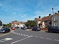
 A124 - welcome to Barking ^ Dagenham - geograph.org.uk - 6412575.jpg 1,024 × 685; 307 KB
-
 A1240 Heathway, Dagenham - geograph.org.uk - 7285178.jpg 1,024 × 768; 310 KB
-
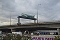
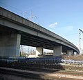
 A13 viaduct, Dagenham - geograph.org.uk - 5305612.jpg 640 × 426; 58 KB
-
 A13 viaduct, Dagenham - geograph.org.uk - 5305614.jpg 640 × 426; 45 KB
-
 A406 flyover - geograph.org.uk - 2892932.jpg 640 × 621; 65 KB
-
 Abbey Leisure Centre, Barking - geograph.org.uk - 6149793.jpg 800 × 513; 85 KB
-
 Abbey Road George V Postbox - geograph.org.uk - 2825288.jpg 3,072 × 2,304; 1.44 MB
-
 Abbey Road, Barking - geograph.org.uk - 5576564.jpg 2,304 × 1,728; 1.33 MB
-
 Abbey Wharf, Barking - geograph.org.uk - 8034860.jpg 5,015 × 3,284; 3.85 MB
-
 Access gate, Stone Walk, Creekmouth - geograph.org.uk - 4996800.jpg 640 × 480; 174 KB
-
 Access Self storage - geograph.org.uk - 5728297.jpg 640 × 425; 72 KB
-

-
 Aggregate Works - geograph.org.uk - 2093406.jpg 800 × 531; 51 KB
-
 Aggregate-waste site, Dagenham, 2011 - geograph.org.uk - 4998511.jpg 640 × 480; 93 KB
-
 Aggregates wharf, Dagenham - geograph.org.uk - 4998756.jpg 640 × 480; 94 KB
-
 Aggregates works - geograph.org.uk - 7716451.jpg 1,024 × 684; 102 KB
-
 Alderman Avenue, Thames View - geograph.org.uk - 3393738.jpg 4,288 × 3,168; 4.91 MB
-
 Alfred's Way (A13), Barking - geograph.org.uk - 6149791.jpg 800 × 600; 97 KB
-
 Alfred's Way (Barking By-Pass) near Barking - geograph.org.uk - 5948581.jpg 1,024 × 768; 185 KB
-
 Alfred's Way (Barking By-Pass) near Barking - geograph.org.uk - 5948588.jpg 1,024 × 768; 178 KB
-
 Alfred's Way (Barking By-Pass) near Barking - geograph.org.uk - 5948594.jpg 1,024 × 768; 179 KB
-
 Algor Wharf - geograph.org.uk - 2349543.jpg 640 × 480; 93 KB
-

-
 Almost buried pillbox, Beam Valley - geograph.org.uk - 3175691.jpg 640 × 480; 125 KB
-
 An entrance to Valence Park - geograph.org.uk - 5213376.jpg 4,000 × 3,000; 4.93 MB
-
 Anglia Court on Spring Close, Dagenham - geograph.org.uk - 8178147.jpg 1,920 × 1,280; 889 KB
-
 Apartments by the railway - geograph.org.uk - 2893745.jpg 640 × 302; 56 KB
-
 Approaching Town Quay, Barking - geograph.org.uk - 4861026.jpg 4,608 × 3,456; 3.41 MB
-
 Arnold Road (U) bus stop on Heathway, Dagenham - geograph.org.uk - 7285180.jpg 1,024 × 768; 391 KB
-
 Artificial bee habitat - geograph.org.uk - 4996946.jpg 640 × 480; 140 KB
-
 Asda Petrol Filling Station, Dagenham - geograph.org.uk - 3394462.jpg 4,288 × 3,216; 5.19 MB
-
 ASDA, Vicarage Field Centre - geograph.org.uk - 3913565.jpg 640 × 430; 39 KB
-
 ASDA, Vicarage Field Shopping Centre - geograph.org.uk - 3807433.jpg 640 × 398; 44 KB
-
 At the Junction - geograph.org.uk - 7992970.jpg 5,184 × 3,456; 3.39 MB
-
 Autumn colours in the suburbs - geograph.org.uk - 4790497.jpg 640 × 275; 50 KB
-
 Avenue of trees in Barking Park - geograph.org.uk - 4996243.jpg 4,608 × 3,456; 3.43 MB
-
 Avenue of trees in Barking Park - geograph.org.uk - 4996267.jpg 4,608 × 3,456; 3.41 MB
-
 Avenue of trees in Central Park - geograph.org.uk - 5227191.jpg 4,000 × 3,000; 4.83 MB
-
 Avenue of trees in Central Park - geograph.org.uk - 5227192.jpg 4,000 × 3,000; 4.96 MB
-
 Bank of the Thames near Dagenham - geograph.org.uk - 5951277.jpg 1,024 × 768; 185 KB
-
 Bank, The Chase Local Nature Reserve - geograph.org.uk - 7307249.jpg 1,024 × 768; 411 KB
-
 Bardag Lake - geograph.org.uk - 7307237.jpg 1,024 × 768; 419 KB
-
 Barking A and B power stations, Creekmouth 1950 - geograph.org.uk - 4588508.jpg 2,393 × 1,094; 1.32 MB
-
 Barking and Dagenham College - geograph.org.uk - 5304577.jpg 2,048 × 1,536; 1.48 MB
-
 Barking and Dagenham logo.svg 452 × 177; 5 KB
-
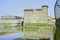
 Barking Barrage , weir - geograph.org.uk - 6565476.jpg 1,024 × 809; 670 KB
-
 Barking Bus Garage - geograph.org.uk - 2993117.jpg 3,072 × 2,304; 1.39 MB
-
 Barking bus garage, main frontage - geograph.org.uk - 6105531.jpg 1,600 × 921; 358 KB
-
 Barking bus garage, south elevation - geograph.org.uk - 6105526.jpg 1,600 × 1,294; 488 KB
-
 Barking Central - geograph.org.uk - 2566355.jpg 1,024 × 768; 204 KB
-
 Barking College of Adult Education - geograph.org.uk - 2783745.jpg 640 × 480; 48 KB
-
 Barking Community Hospital - geograph.org.uk - 7369003.jpg 1,024 × 684; 201 KB
-
 Barking Creek, 1990 - geograph.org.uk - 4787418.jpg 640 × 427; 112 KB
-
 Barking Creek, 1990 - geograph.org.uk - 4787442.jpg 640 × 427; 120 KB
-
 Barking drainage channel - 46232327635.jpg 3,072 × 2,304; 1.39 MB
-
 Barking drainage channel.jpg 3,072 × 2,304; 1.62 MB
-
 Barking EL3 bus route.jpg 3,072 × 2,304; 1.23 MB
-
 Barking from Choats Manor Way - 49148025218.jpg 3,072 × 2,304; 1.32 MB
-
 Barking from Choats Manor Way - 49148724647.jpg 3,072 × 2,304; 1.35 MB
-
 Barking from Choats Manor Way.jpg 3,072 × 2,304; 1.31 MB
-
 Barking Learning Centre - geograph.org.uk - 8034650.jpg 5,472 × 3,648; 2.59 MB
-
 Barking Market.jpg 4,814 × 3,703; 11.65 MB
-
 Barking Mill Pond, 1990 - geograph.org.uk - 4787284.jpg 640 × 427; 114 KB
-
 Barking Park Lake - geograph.org.uk - 4996256.jpg 4,608 × 3,456; 3.4 MB
-
 Barking Park new dawn - geograph.org.uk - 7058058.jpg 1,024 × 768; 272 KB
-
 Barking Park, Cafe, Boat Pier - geograph.org.uk - 7058051.jpg 1,024 × 768; 294 KB
-
 Barking Railfreight Terminal from the air - geograph.org.uk - 6256038.jpg 1,024 × 768; 434 KB
-
 Barking Railfreight Terminal from the air - geograph.org.uk - 6256041.jpg 1,024 × 768; 497 KB
-
 Barking Reach Power Station, Dagenham Docks - geograph.org.uk - 3394091.jpg 4,288 × 3,216; 6.4 MB
-
 Barking Riverside - geograph.org.uk - 5189346.jpg 3,396 × 2,722; 1.47 MB
-
 Barking Riverside - geograph.org.uk - 5189351.jpg 4,608 × 3,456; 3.43 MB
-
 Barking Riverside - geograph.org.uk - 5189352.jpg 4,608 × 3,456; 3.66 MB
-
 Barking Riverside Ferry Terminus - geograph.org.uk - 7763305.jpg 1,024 × 683; 144 KB
-
 Barking Riverside on the Horizon - geograph.org.uk - 7764938.jpg 5,472 × 3,648; 3.96 MB
-
 Barking Riverside Pier - geograph.org.uk - 7462916.jpg 1,600 × 1,200; 387 KB
-
 Barking Riverside Pier - geograph.org.uk - 7763447.jpg 5,472 × 3,648; 2.71 MB
-
 Barking Riverside Pier, disused end - geograph.org.uk - 7763297.jpg 5,472 × 3,648; 3.52 MB
-
 Barking Riverside regeneration area - geograph.org.uk - 7462911.jpg 1,600 × 1,200; 402 KB
-
 Barking Riverside site office - geograph.org.uk - 2349591.jpg 640 × 428; 59 KB
-
 Barking Riverside station - geograph.org.uk - 7798375.jpg 4,096 × 2,304; 2.12 MB
-
 Barking Riverside Station - geograph.org.uk - 8153000.jpg 4,080 × 3,060; 1.82 MB
-
 Barking Riverside station - the view west - geograph.org.uk - 7798373.jpg 4,096 × 2,304; 2.42 MB
-
 Barking Riverside Visitor Centre - geograph.org.uk - 7764926.jpg 5,138 × 3,144; 3.77 MB
-
 Barking Sidings South - geograph.org.uk - 4431163.jpg 640 × 430; 57 KB
-
 Barking Sidings South - geograph.org.uk - 4431166.jpg 640 × 504; 60 KB
-
 Barking Sidings South - geograph.org.uk - 4431167.jpg 640 × 430; 45 KB
-
 Barking sidings west - geograph.org.uk - 2892951.jpg 640 × 346; 63 KB
-
 Barking sidings west - geograph.org.uk - 2892955.jpg 640 × 430; 55 KB
-
 Barking solicitors.jpg 3,072 × 2,304; 1.35 MB
-
 Barking station, looking southeast - geograph.org.uk - 7798372.jpg 4,096 × 2,304; 2.54 MB
-
 Barking Sunday market site - geograph.org.uk - 4998118.jpg 640 × 480; 112 KB
-
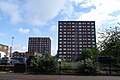
 Barking tower blocks.jpg 3,072 × 2,304; 1.3 MB
-
-
 Bastable Avenue, Barking - geograph.org.uk - 7438860.jpg 1,858 × 1,180; 997 KB
-
 Beam Auto Sluice 55BE0102-C501 - geograph.org.uk - 2337994.jpg 640 × 480; 108 KB
-
 Beam Bridge, A1306 New Road - geograph.org.uk - 7309447.jpg 1,024 × 768; 429 KB
-
 Beam River - geograph.org.uk - 2094663.jpg 429 × 640; 118 KB
-
 Beam River - geograph.org.uk - 7309302.jpg 1,024 × 768; 492 KB
-
 Beam River at Bretons Weir - geograph.org.uk - 1988689.jpg 640 × 480; 89 KB
-
 Beam River looking downstream - geograph.org.uk - 7308952.jpg 1,024 × 768; 486 KB
-
 Beam River seen from New Road - geograph.org.uk - 5197346.jpg 4,608 × 3,456; 3.85 MB
-
 Beam River, Eastbrookend Park - geograph.org.uk - 3514256.jpg 2,328 × 1,431; 1,014 KB
-
 Beam Valley Country Park - geograph.org.uk - 2094678.jpg 640 × 429; 55 KB
-
 Beam Valley Country Park - way out - geograph.org.uk - 7308839.jpg 1,024 × 768; 411 KB
-
 Beam Valley Country Park - way out - geograph.org.uk - 7308849.jpg 1,024 × 768; 486 KB
-
 Beam Valley Country Park, by railway - geograph.org.uk - 7308837.jpg 1,024 × 768; 336 KB
-
 Becontree Health and Leisure Centre - geograph.org.uk - 2494853.jpg 2,048 × 1,536; 475 KB
-
 Becontree Heath bus terminus - geograph.org.uk - 5524029.jpg 640 × 480; 64 KB
-
 Becontree Heath Leisure Centre - geograph.org.uk - 5302162.jpg 2,048 × 1,536; 927 KB
-
 Becontree Heath Leisure Centre - geograph.org.uk - 7284092.jpg 1,024 × 768; 282 KB
-
 Between bridges, River Roding - geograph.org.uk - 5265286.jpg 640 × 480; 193 KB
-
 Biffa, A13 - geograph.org.uk - 5724294.jpg 640 × 425; 50 KB
-
 Big Yellow Self Storage - geograph.org.uk - 7400521.jpg 1,024 × 684; 180 KB
-
 Billet Road - geograph.org.uk - 5238429.jpg 4,000 × 3,000; 4.94 MB
-
 Bioenergy holders on Choats Road, Dagenham - geograph.org.uk - 7438872.jpg 1,890 × 1,232; 710 KB
-
 Birds by the Lake, Mayesbrook Park - geograph.org.uk - 7992236.jpg 4,771 × 3,009; 3.08 MB
-
 Blackborne Road, Dagenham - geograph.org.uk - 8168436.jpg 1,920 × 1,280; 1.19 MB
-
 Blackborne Road, Dagenham - geograph.org.uk - 8169254.jpg 1,920 × 1,280; 1.26 MB
-
 Blake Avenue, near Barking - geograph.org.uk - 5520300.jpg 640 × 480; 54 KB
-
 Blake Avenue, near Barking - geograph.org.uk - 5520310.jpg 640 × 480; 67 KB
-
 Block of flats, Althorne Way, 2011 - geograph.org.uk - 7284893.jpg 1,024 × 684; 310 KB
-
 Block of flats, Becontree Heath - geograph.org.uk - 6412592.jpg 1,024 × 685; 328 KB
-
 Block of flats, Dovehouse Mead, Barking - geograph.org.uk - 6149792.jpg 800 × 536; 102 KB
-
 Block of shops, Whalebone Lane, Becontree Heath - geograph.org.uk - 7284230.jpg 1,024 × 768; 352 KB
-
 Blocked flood arches under The Chase - geograph.org.uk - 7306476.jpg 1,024 × 768; 592 KB
-
 Blumsom timber - geograph.org.uk - 3241274.jpg 640 × 480; 81 KB
-
 Boardwalk, Beam Valley - geograph.org.uk - 3175734.jpg 640 × 480; 112 KB
-
 Boardwalk, Beam Valley - geograph.org.uk - 7307280.jpg 768 × 1,024; 456 KB
-
 Boardwalk, Eastbrookend Country Park - geograph.org.uk - 7355470.jpg 1,024 × 684; 205 KB
-
 Borough boundary on Collier Row Road - geograph.org.uk - 5272643.jpg 640 × 480; 123 KB
-
 Boulders on Reef Street - geograph.org.uk - 7764166.jpg 5,472 × 3,648; 3.11 MB
-
 Boundary markers - geograph.org.uk - 5272520.jpg 640 × 480; 140 KB
-
 Boxes upon boxes, Creekmouth - geograph.org.uk - 3160095.jpg 640 × 480; 97 KB
-
 Breedon cement factory in Dagenham Dock - geograph.org.uk - 7435578.jpg 1,920 × 1,280; 1.26 MB
-
 Bridge over Chequers Lane, Dagenham - geograph.org.uk - 5952701.jpg 1,024 × 768; 182 KB
-
 Bridge over Linton Road - geograph.org.uk - 3265661.jpg 4,288 × 3,216; 4.53 MB
-

-
 Bridges over Beam River - geograph.org.uk - 7308909.jpg 1,024 × 768; 584 KB
-
 Brook 6th Form ^ Academy - geograph.org.uk - 7992179.jpg 5,472 × 3,648; 1.91 MB
-
 Broomfield Road, Chadwell Heath - geograph.org.uk - 1992377.jpg 3,072 × 2,304; 2.31 MB
-
 Brownfield land - geograph.org.uk - 3241342.jpg 640 × 480; 90 KB
-
 Brownfield site - Ford's former site, Chequers Lane, Dagenham.jpg 3,072 × 2,304; 1.4 MB
-
 Bubble Machine - geograph.org.uk - 2093455.jpg 800 × 531; 60 KB
-
 Building on Ford jetty, 2011 - geograph.org.uk - 5001055.jpg 640 × 480; 107 KB
-
 Building Site near the Town Hall - geograph.org.uk - 3612912.jpg 1,600 × 1,183; 449 KB
-
 Building Work at the Library - geograph.org.uk - 7992339.jpg 4,894 × 3,152; 1.99 MB
-
 Bungalows on Dagenham Road, Rush Green - geograph.org.uk - 5304578.jpg 2,048 × 1,536; 1.42 MB
-
 Bus depot on River Road, near Barking - geograph.org.uk - 5948629.jpg 1,024 × 768; 125 KB
-
-
 Bus stop and shelter on Choats Road, Dagenham - geograph.org.uk - 5952651.jpg 1,024 × 768; 173 KB
-

-
-
 Bus Stop, Ballards Road - geograph.org.uk - 7993121.jpg 5,184 × 3,456; 1.77 MB
-
 Bus stops on Billet Road - geograph.org.uk - 5238379.jpg 4,000 × 3,000; 4.83 MB
-
 Bus Terminal, Dagenham Docks - geograph.org.uk - 3394373.jpg 4,288 × 3,216; 4.44 MB
-
 Bus ^ Bicycles, Becontree - geograph.org.uk - 7992800.jpg 4,173 × 2,945; 1.47 MB
-
 Buses on Wood Lane - geograph.org.uk - 6413170.jpg 1,024 × 685; 280 KB
-
 Businesses on High Road (A118) - geograph.org.uk - 7274353.jpg 1,024 × 678; 114 KB
-
 Businesses on River Road, Creekmouth - geograph.org.uk - 6659974.jpg 1,920 × 1,280; 1,000 KB
-
 Buzzard Creek Industrial Estate, Creekmouth - geograph.org.uk - 5950052.jpg 1,024 × 768; 166 KB
-
 By the railway - geograph.org.uk - 5111882.jpg 640 × 426; 58 KB
-
 Cambeys Rd meets Reede Rd - geograph.org.uk - 7355957.jpg 1,024 × 684; 168 KB
-
 Canonsleigh Road, Becontree - geograph.org.uk - 7715523.jpg 1,920 × 1,280; 1.57 MB
-
 Capital Car Wash on Green Lane, Dagenham - geograph.org.uk - 6833522.jpg 1,920 × 1,280; 1.13 MB
-
 Capital Karts - geograph.org.uk - 5728285.jpg 640 × 391; 56 KB
-
 Car Park, Lidl and Iceland - geograph.org.uk - 5270134.jpg 640 × 480; 86 KB
-
 Car wash on Ripple Road, Barking - geograph.org.uk - 5576583.jpg 2,304 × 1,728; 1,012 KB
-
 Carpet Right and River Roding - geograph.org.uk - 3265464.jpg 4,288 × 3,216; 5.67 MB
-
 Cartwright Rd - geograph.org.uk - 7367555.jpg 1,024 × 600; 170 KB
-
 Castle Green - geograph.org.uk - 5188774.jpg 4,608 × 3,456; 3.4 MB
-
 Castle Green - geograph.org.uk - 5188775.jpg 4,608 × 3,456; 3.42 MB
-
 Castle Green Recreation Ground - geograph.org.uk - 5738605.jpg 640 × 347; 36 KB
-
 Castle Green Recreation Ground - geograph.org.uk - 5738606.jpg 640 × 425; 41 KB
-
 Cement Bags, Dagenham Dock - geograph.org.uk - 3394267.jpg 4,288 × 3,216; 4.55 MB
-
 Cemex jetty, Dagenham - geograph.org.uk - 4998732.jpg 640 × 480; 93 KB
-
 Central Park - geograph.org.uk - 5227188.jpg 4,000 × 3,000; 4.8 MB
-
 Central Park from Rainham Road North - geograph.org.uk - 5227186.jpg 4,000 × 3,000; 4.86 MB
-
 Chad End Court, Chadwell Heath - geograph.org.uk - 5238336.jpg 4,000 × 3,000; 4.71 MB
-
 Chadwell Heath Community Centre - geograph.org.uk - 5591723.jpg 2,042 × 1,528; 932 KB
-
 Chadwell Store Minimarket - geograph.org.uk - 7937680.jpg 5,472 × 3,648; 2.93 MB
-
 Chelmer Crescent, Barking.jpg 3,072 × 2,304; 1.4 MB
-
 Chequers Corner, Dagenham - geograph.org.uk - 3394489.jpg 4,288 × 3,216; 5.16 MB


,_Barking_-_geograph.org.uk_-_6149791.jpg)
_near_Barking_-_geograph.org.uk_-_5948581.jpg)
_near_Barking_-_geograph.org.uk_-_5948588.jpg)
_near_Barking_-_geograph.org.uk_-_5948594.jpg)


_bus_stop_on_Heathway,_Dagenham_-_geograph.org.uk_-_7285180.jpg)


._Barking_-_geograph.org.uk_-_6149810.jpg)


_-_geograph.org.uk_-_7274353.jpg)


