Category:Livingston, West Lothian
town in West Lothian, Scotland, UK  .png) | |||||
| Upload media | |||||
| Instance of | |||||
|---|---|---|---|---|---|
| Location |
| ||||
| Population |
| ||||
| Elevation above sea level |
| ||||
| official website | |||||
 | |||||
Čeština: *Livingston
Dansk: Livingston er en nyere by med 76,889 indbyggere (2009) i West Lothian, Skotland. Den blev grundlagt omkring 1960 for at aflaste Glasgow, men er mere tilknyttet Edinburgh. Den er admidnastrationscenter for regionen West Lothian. Den ligger 25 km vest for Edinburgh og 50 km øst for Glasgow.
Deutsch: Livingston ist eine New Town im mittleren Schottland in West Lothian, dessen einwohnerstärkste Gemeinde es ist. Die Stadt liegt rund 25 km westlich von Edinburgh und 50 km östlich von Glasgow und hat 50.826 Einwohner (2001).
English: Livingston is a large, commercial town in West Lothian. It is the fourth post-war new town to be built in Scotland, designated in 1962. It is also the only Large burgh in West Lothian. It is located approximately 15 miles (25 km) west of Edinburgh and 30 miles (50 km) east of Glasgow, and is bordered by the towns of Broxburn to the northeast and Bathgate to the northwest.
Español: Livingston, situada en el condado de West Lothian es la cuarta ciudad planeada construida en Escocia tras la Segunda Guerra Mundial, en 1962. Está situada 25 km al oeste de Edimburgo y 50 km al este de Glasgow, y rodeada por las localidades de Broxburn al noreste y Bathgate al noroeste. Otras ciudades vecinas son Polbeth, West Calder, East Calder, Mid Calder, Uphall Station y Pumpherston.
Euskara: Livingston ( Eskoziako gaeleraz: Baile Lèibhinn), Eskozia erdialdeko udalerria da, Mendebaldeko Lothian eskualdean dagoena.
Français : Livingston (Baile Dhùn Lèibhe en gaëlique écossais, Livingston en scots) est une ville située dans le comté du West Lothian en Écosse. C'est la quatrième ville nouvelle à avoir vu le jour en Écosse après la Seconde Guerre Mondiale, la décision de sa création remontant à 1962. Elle est située à environ 25 kilomètres à l'ouest d'Édimbourg et à environ 50 kilomètres à l'est de Glasgow. Elle est bordée par les villes de Broxburn au nord-est et Bathgate au nord-ouest.
Gàidhlig: Tha Baile Leibhinn ('S iomadh foirmean a tha air an ainm seo sa Ghàidhlig) na bhaile ùr ann an Lodainn-an-Iar. 'S e seo na co-chomharran aige: 55° 54′ 17.21″ Tuath agus 3° 30′ 52.85″ Iar.
Nederlands: Livingston is de vierde naoorlogse new town gebouwd in Schotland. De plaats ligt ongeveer 25 km ten westen van Edinburgh en 50 km ten oosten van Glasgow, en grenst aan Broxburn in het noordoosten en Bathgate in het noordwesten. Livingston telt ongeveer 55.000 inwoners en behoort tot West Lothian.
Norsk bokmål: Livingston er en ny by i West Lothian, Skottland. Den ble grunnlagt i 1960-årene for å avlaste Glasgow, men ligger nærmere Edinburgh og har hatt mest effekt der. Den er administrasjonsenter for regionen West Lothian. Kritiske røster har beskrevet den som et stort kjøpesenter som er sluppet ned oppå en landsby.
Polski: Livingston ( gael. Baile Dhùn Lèibhe) to miasto w Szkocji, około 54.000 mieszkańców. Miasto leży przy autostradzie M8 między Glasgow (30 mil) a Edynburgiem (10 mil). Przez miasto przebiega również droga A71 oraz A899. Livingston graniczy z innymi miastami: Bathgate, Broxburn, Mid Calder, Polbeth i Pumpherston, tworząc razem aglomerację z ponad 100 tysiącami mieszkańców. Stolica hrabstwa West Lothian z liczbą mieszkańców przekraczająca 163 tysiące obywateli. Hrabstwo graniczy z Edynburgiem. Miasto zostało założone w latach 60. poprzedniego wieku należy do tzw. "new town". Livingston jest drugim największyn miastem regionu Lothian zaraz po Edynburgu. Dzielnice miasta to: Almondvale, Craighshill, Carmondean, Deans, Howden, Lady Well, Eliburn i Murieston.
Scots: Leevinston is a new toun in Wast Lowden ower by aulder touns like Bathgate, Broxburn an Lithgae. In Leevinston thare's ither smawer touns, the auldest anes is Leevinston Station (nou cawed Deans) an Leevinston Veelage.
Simple English: Livingston is a town in the Scottish county of West Lothian. It is home to the Scottish First Division football club Livingston F.C.
Svenska: Livingston är en relativt ny stad i West Lothian i Skottland. Staden grundlades under 1960-talet för att avlasta Glasgows ökande invånarantal, men ligger närmare Edinburgh och har haft mest effekt där. Livingston är administrativ huvudort för regionen West Lothian och hade 53 670 invånare i centralorten år 2004, med totalt 62 230 invånare i hela tätortsområdet, inklusive de närbelägna orterna East Calder och Mid Calder.
Subcategories
This category has the following 18 subcategories, out of 18 total.
Media in category "Livingston, West Lothian"
The following 128 files are in this category, out of 128 total.
-
 A7066 road towards M8 & bathgate - panoramio.jpg 2,048 × 1,536; 848 KB
-
 As it was in 1992 - geograph.org.uk - 249154.jpg 640 × 350; 65 KB
-
 Awaiting development - geograph.org.uk - 1306328.jpg 640 × 480; 129 KB
-
 Boeing B747-400 JA8097 Nippon Airlines - panoramio.jpg 3,888 × 2,592; 3.6 MB
-

-

-
 Chestnut Grove - panoramio (1).jpg 3,888 × 2,592; 4.41 MB
-
 Chestnut Grove - panoramio.jpg 2,816 × 1,880; 2.56 MB
-
 Chestnut Grove rainbow - panoramio.jpg 1,936 × 1,288; 326 KB
-
 Chestnut Grove rainbow. - panoramio.jpg 1,936 × 1,288; 353 KB
-
 Clearing the car park - panoramio.jpg 3,264 × 2,448; 1.92 MB
-
 Corston Park Craigshill - panoramio.jpg 3,888 × 2,592; 4.23 MB
-
 Craigshill - panoramio.jpg 3,888 × 2,592; 3.5 MB
-
 Craigshill sunrise 22 Dec 09 - panoramio - tormentor4555.jpg 2,816 × 1,880; 2.3 MB
-
 Craigshill sunrise 22 Dec 09 - panoramio.jpg 2,816 × 1,880; 2.18 MB
-
 Craigshill sunset - panoramio.jpg 2,816 × 1,880; 2.37 MB
-
 Craigshill, heavy snow fall on main road - panoramio.jpg 2,816 × 1,880; 839 KB
-
 Cycle path - geograph.org.uk - 1306351.jpg 640 × 480; 84 KB
-
 Dechmont Law Park, Livingston, Scotland. Very few visitors - panoramio.jpg 1,600 × 1,200; 289 KB
-
 Deer crossing taken 03-03-2004 - panoramio.jpg 1,600 × 1,200; 598 KB
-
 Deer Park Roundabout - panoramio.jpg 3,888 × 2,592; 3.79 MB
-
 Deer Park roundabout. - panoramio.jpg 3,888 × 2,592; 692 KB
-
 Deer wanting to cross the road - panoramio.jpg 1,600 × 1,200; 614 KB
-
 Derelict house near Simpson parkway. - panoramio.jpg 1,570 × 1,045; 278 KB
-
 Development continues - geograph.org.uk - 1306337.jpg 640 × 370; 61 KB
-
 Disused Road - geograph.org.uk - 102095.jpg 640 × 480; 144 KB
-
 DIY corner - geograph.org.uk - 1306243.jpg 640 × 364; 59 KB
-
 Dowsing down the remains of the bonfire. - panoramio.jpg 3,888 × 2,592; 5.64 MB
-
 East Livingston and East Calder.svg 1,214 × 1,384; 977 KB
-
 Edinburgh - Bathgate railway. - geograph.org.uk - 80132.jpg 640 × 480; 84 KB
-
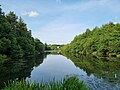 Eliburn Loch.jpg 4,032 × 3,024; 4.15 MB
-
 Eliburn Reservoir, Livingston.jpg 2,880 × 2,160; 1.45 MB
-
 Former bend in the road - geograph.org.uk - 167085.jpg 640 × 480; 132 KB
-
 Friendly bee - panoramio.jpg 1,900 × 1,430; 318 KB
-
 Frost returns. - geograph.org.uk - 80156.jpg 640 × 480; 69 KB
-
 Frozen tree. - panoramio.jpg 3,888 × 2,592; 4.49 MB
-
 Frozen web - panoramio.jpg 2,816 × 1,880; 2.3 MB
-
 Garbett Road - geograph.org.uk - 1242098.jpg 640 × 480; 120 KB
-
 Gavieside - geograph.org.uk - 167083.jpg 640 × 480; 124 KB
-
 Grange - geograph.org.uk - 167081.jpg 640 × 480; 74 KB
-
 Howden park - panoramio - tormentor4555 (1).jpg 2,816 × 1,880; 2.33 MB
-
 Howden park - panoramio - tormentor4555.jpg 2,816 × 1,880; 2.55 MB
-
 Howden park - panoramio.jpg 2,816 × 1,880; 2.77 MB
-
 Huston Road west Licingston - panoramio.jpg 2,048 × 1,536; 825 KB
-
 IMG 5149 - panoramio.jpg 3,888 × 2,592; 4.54 MB
-

-
 Knightsridge East Road. - geograph.org.uk - 80130.jpg 640 × 480; 82 KB
-
 Ladywell 'park and ride' - geograph.org.uk - 1980066.jpg 640 × 480; 67 KB
-
 Ladywell - geograph.org.uk - 80083.jpg 640 × 480; 58 KB
-
 Lammermuir House - geograph.org.uk - 893342.jpg 640 × 359; 48 KB
-
 Linn Jaw Waterfall (26909315159).jpg 5,184 × 3,456; 17.07 MB
-
 Linn Jaw Waterfall (26909322109).jpg 5,040 × 3,360; 15.96 MB
-
 Linn Jaw Waterfall (26909324619).jpg 3,855 × 1,718; 6.73 MB
-
 Linn Jaw Waterfall (26909329479).jpg 5,184 × 3,456; 15.94 MB
-
 Linn Run in Long Exposure (46621144784).jpg 2,048 × 1,366; 2.11 MB
-
 Linn Run on a Chilly Afternoon (31555171687).jpg 2,048 × 1,366; 2.79 MB
-
 Linn Run on a Chilly Afternoon (32622260948).jpg 2,048 × 1,366; 3.08 MB
-
 Livingston (location).png 144 × 251; 22 KB
-
 Livingston - geograph.org.uk - 10572.jpg 640 × 480; 91 KB
-
 Livingston banner Centre from Oakbank.jpg 3,500 × 500; 822 KB
-
 Livingston Boulavard Cominity statue. - panoramio.jpg 1,936 × 1,288; 1.12 MB
-
 Livingston boulavard. - panoramio.jpg 1,936 × 1,288; 890 KB
-
 Livingston Boulevard looking east. - panoramio.jpg 1,570 × 1,045; 229 KB
-
 Livingston Boulevard looking west. - panoramio.jpg 1,570 × 1,045; 241 KB
-
 Livingston Boulevard statue. - panoramio - tormentor4555.jpg 1,570 × 1,045; 211 KB
-
 Livingston bus stops area. - panoramio.jpg 1,570 × 1,045; 222 KB
-
 Livingston centre - panoramio.jpg 2,816 × 1,880; 2.81 MB
-
 Livingston centre from Oakbank.jpg 3,888 × 2,592; 3.85 MB
-
 Livingston deer - panoramio.jpg 1,600 × 1,200; 599 KB
-
 Livingston East Roundabout. - geograph.org.uk - 56083.jpg 640 × 480; 53 KB
-
 Livingston Fire Station.jpg 2,880 × 2,160; 1.78 MB
-
 Livingston foot bridge. - panoramio.jpg 1,570 × 1,045; 284 KB
-
 Livingston from East Cairn Hill - geograph.org.uk - 946781.jpg 559 × 640; 72 KB
-
 Livingston fun day - panoramio.jpg 3,888 × 2,592; 3.55 MB
-
 Livingston fun day. - panoramio.jpg 3,888 × 2,592; 4.64 MB
-
 Livingston North.svg 1,214 × 1,384; 977 KB
-

-
 Livingston Road. - geograph.org.uk - 80088.jpg 640 × 480; 53 KB
-
 Livingston Road. - geograph.org.uk - 80093.jpg 640 × 480; 62 KB
-
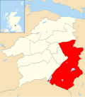
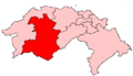 Livingston ScottishParliamentConstituency.PNG 478 × 276; 6 KB
-
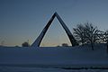
 Livingston Sculpture.JPG 336 × 424; 47 KB
-
 Livingston South.svg 1,214 × 1,384; 977 KB
-
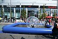
 Livingston swimming pool. - panoramio.jpg 1,570 × 1,045; 199 KB
-
 Livingston Town centre.jpg 2,880 × 2,160; 2.09 MB
-
 Livingston Underpass (48760464678).jpg 5,472 × 3,648; 13.52 MB
-
 Livingston War Memorial.JPG 2,056 × 3,088; 1.68 MB
-
 Livingston, UK - panoramio (1).jpg 3,888 × 2,592; 4.49 MB
-
 Livingston, UK - panoramio.jpg 3,888 × 2,592; 5.09 MB
-
 Livingston, United Kingdom (Unsplash).jpg 4,763 × 3,264; 5.15 MB
-
 Livingston, West Lothian.JPG 4,000 × 3,000; 3.29 MB
-
 LivingstonGraph.png 589 × 337; 30 KB
-
 LivingstonGraph.svg 944 × 520; 85 KB
-
 M8 westbound, by junction 3 - geograph.org.uk - 3340988.jpg 640 × 414; 38 KB
-
 McDonnell Douglas C-17 - panoramio.jpg 3,888 × 2,592; 1.7 MB
-
 Mill Farm Cattle. - panoramio.jpg 1,600 × 1,200; 430 KB
-
 Mill farm Highland cattle - panoramio.jpg 1,600 × 1,200; 439 KB
-
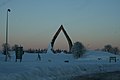
 Moonlit Sculpture - panoramio.jpg 1,944 × 2,592; 1.14 MB
-
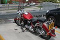 Motor bike on carpark that used to be Livingston Bus station. - panoramio.jpg 1,936 × 1,288; 736 KB
-
 My Garden in winter - panoramio.jpg 1,275 × 956; 461 KB
-
 Navigation House, Livingston.jpg 4,032 × 3,024; 3.26 MB
-
 New factories, West Livingston - geograph.org.uk - 80148.jpg 640 × 404; 31 KB
-
 Newyearfield - geograph.org.uk - 80134.jpg 640 × 480; 56 KB
-
 Old bridge, Livingston Village.JPG 2,056 × 3,088; 2.36 MB
-
 Old milestone (geograph 7140004).jpg 1,200 × 1,600; 676 KB
-
 Old milestone (geograph 7140015).jpg 1,200 × 1,600; 469 KB
-
 Ordnance Survey One-Inch Sheet 73 Falkirk & Motherwell, Published 1947.jpg 12,178 × 11,648; 17.57 MB
-
 Ordnance Survey Sheet NT 06 The Calders, Published 1956.jpg 7,198 × 7,819; 7.68 MB
-
 Ornate 18th c grave Livingston Churchyard.JPG 3,088 × 2,056; 1.63 MB
-
 Our dog Lassie in the snow. - panoramio.jpg 1,275 × 956; 266 KB
-
 Parh on banks or River Almond - panoramio.jpg 2,816 × 1,880; 3.18 MB
-
 Pentland House - geograph.org.uk - 893336.jpg 359 × 640; 60 KB
-
 Pine Grove Craigshill. - panoramio.jpg 3,888 × 2,592; 3.11 MB
-
 Piper PA-34 G-PEGI - panoramio.jpg 3,888 × 2,592; 2.99 MB
-
 Plane sailing - geograph.org.uk - 485842.jpg 640 × 293; 30 KB
-
 Pre-Livvi remnants. - geograph.org.uk - 80098.jpg 640 × 480; 103 KB
-
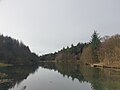
 River Almond at Livingston - geograph.org.uk - 1627839.jpg 640 × 480; 75 KB
-
 River Almond looking west from bridge in Livingston Village.JPG 3,088 × 2,056; 2.4 MB
-
 River Almond.jpg 4,032 × 1,816; 4.37 MB
-
 Selm park - panoramio.jpg 3,888 × 2,592; 4.57 MB
-
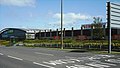
 Tesco Distribution Centre, Livingston, West Lothian.JPG 3,958 × 2,897; 3.29 MB
-
 The end of West Lothian House 16- 80-2010 - panoramio.jpg 3,888 × 2,592; 3.54 MB
-
 Training pitches. - geograph.org.uk - 80040.jpg 640 × 458; 80 KB
-

-
 West Knightsridge. - geograph.org.uk - 80128.jpg 639 × 404; 88 KB
-
 West Lothian House being demolished - panoramio.jpg 3,888 × 2,592; 3.06 MB
-
 West Lothian house nearing it'send. - panoramio.jpg 3,888 × 2,592; 3.43 MB
-
 What to do on a Sunday in Livingston - geograph.org.uk - 3221842.jpg 640 × 438; 309 KB
-
 Winter in Chestnut Grove - panoramio.jpg 3,888 × 2,592; 3.65 MB


.jpg)


.jpg)


.jpg)
.jpg)
.jpg)
.jpg)
.jpg)
.jpg)
.jpg)


.jpg)

.jpg)

.jpg)


.jpg)
.jpg)


