Category:Lake Huron
one of the Great Lakes of North America    | |||||
| Upload media | |||||
| Instance of | |||||
|---|---|---|---|---|---|
| Part of | |||||
| Location | |||||
| Has part(s) |
| ||||
| Width |
| ||||
| Length |
| ||||
| Area |
| ||||
| Elevation above sea level |
| ||||
| Inflows |
| ||||
| Outflows | |||||
| Drainage basin | |||||
| Different from | |||||
 | |||||
Subcategories
This category has the following 42 subcategories, out of 42 total.
+
A
- Lake Algonquin (6 F)
B
C
- Cheboygan State Park (3 F)
- Choctaw (ship, 1892) (34 F)
D
- Defiance (ship, 1848) (4 F)
E
- Echo Bay (Ontario) (6 F)
F
G
- Gawas Bay (4 F)
H
- Harrisville State Park (25 F)
- Hay Bay (2 F)
- History of Lake Huron (2 F)
- Hoeft State Park (2 F)
I
- Ice rescue on Lake Huron (17 F)
K
- Kettle Point (14 F)
L
M
N
- Negwegon State Park (9 F)
S
- Lake Saginaw (4 F)
- Salvage of Arthur J (8 F)
- Shelf Ice (Lake Huron) (4 F)
T
W
Media in category "Lake Huron"
The following 140 files are in this category, out of 140 total.
-

-
-
 20150704 - 095 - Pike Bay, Ont. - Through Trees.jpg 2,048 × 1,229; 565 KB
-
 20150704 - 096 - Pike Bay, Ont. - Huron Cont'd.jpg 2,046 × 1,228; 572 KB
-
 20150705 - 05 - Meaford, Ont. - Sunrise over Lake Huron - "Sparkle and Shine".jpg 2,048 × 1,229; 261 KB
-

-

-
 A sunrise over Lake Huron.jpg 4,032 × 3,024; 2.46 MB
-
 Aquamarine Water.jpg 3,264 × 2,448; 2.26 MB
-
 Beach in Grand Bend (I0015994).jpg 2,485 × 1,974; 3.38 MB
-
 Beach in Grand Bend (I0015995).jpg 2,483 × 1,975; 2.96 MB
-
 Bruce Beach Sunset.jpg 3,036 × 4,048; 3.49 MB
-
 Canadian Flag on Ferry in Tobermory Harbor.jpg 1,456 × 927; 467 KB
-
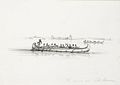 Canoe on Lake Huron (1837).jpg 700 × 494; 28 KB
-
 Chantry Island Lighthouse.jpg 2,048 × 1,536; 3.11 MB
-
 Cliff and Water.jpg 2,448 × 3,264; 2 MB
-
 Colpoys Bay, Lake Huron, Spirit Rock Lookout 5020 (6023517214).jpg 3,456 × 2,304; 2.8 MB
-
 Diffuse (124962415).jpeg 2,048 × 929; 665 KB
-
 DSC 0441 39 40 - Flickr - Jim Sorbie.jpg 3,840 × 2,577; 2.11 MB
-
 Enbridge Line 5 Oil Pipeline at the Straits of Mackinac - Michigan.jpg 7,761 × 5,038; 22.51 MB
-
 Enbridge Line 5 Oil Pipeline at the Straits of Mackinac and Mackinac Bridge - Michigan.jpg 9,397 × 6,265; 52.89 MB
-
 Family of American Mink on a rocky shoreline.jpg 3,000 × 4,000; 4.14 MB
-
 Fifties By The Lake (40064151791).jpg 4,608 × 3,456; 5.56 MB
-
 Flickr - paul bica - blue dream.jpg 2,048 × 1,536; 1,003 KB
-
 FMIB 36056 Huro Nigricans (The Black Bass of the Huron).jpeg 848 × 462; 95 KB
-
 Fort Mackinac (2).jpg 496 × 279; 184 KB
-
 Fort Mackinac.JPG 4,000 × 3,000; 5.76 MB
-
 Fractured Sunset - panoramio.jpg 3,072 × 2,304; 2.33 MB
-
 Great Lakes and St Lawrence River.jpg 2,990 × 1,263; 2.49 MB
-
 Greetings from Lake Huron, Michigan - Large Letter Postcard (5906286384).jpg 1,000 × 639; 838 KB
-
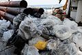 Hazardous material removed from Lake Huron 120722-G-AW789-013.jpg 2,784 × 1,848; 2.24 MB
-
 Hessel-marina-shore.jpg 4,030 × 2,509; 4.06 MB
-
 Ice cover on Tawas Bay.jpg 2,048 × 1,536; 734 KB
-
 Ice dune on Lake Huron.jpg 2,288 × 1,492; 645 KB
-
 Inverhuron Park.jpg 4,320 × 3,240; 10.34 MB
-
 ISS-36 Lake Michigan and Lake Huron.jpg 4,256 × 2,832; 1.56 MB
-
 Lake Huron (28174986085).jpg 4,928 × 3,264; 3.27 MB
-
 Lake Huron (6103911724).jpg 2,896 × 1,944; 1.22 MB
-
 Lake Huron (7906241218).jpg 2,560 × 1,920; 1.21 MB
-
 Lake Huron (7906241750).jpg 2,560 × 1,920; 1.1 MB
-
 Lake Huron (7906242146).jpg 2,560 × 1,920; 1.11 MB
-
 Lake Huron (7906242692).jpg 2,560 × 1,920; 1.05 MB
-
 Lake Huron (7906243066).jpg 2,560 × 1,920; 1.22 MB
-
 Lake Huron (7906243410).jpg 2,560 × 1,920; 1.17 MB
-
 Lake Huron (7906245972).jpg 2,560 × 1,920; 1.05 MB
-
 Lake Huron (7906246452).jpg 2,560 × 1,920; 1.1 MB
-
 Lake Huron (7906246962).jpg 2,560 × 1,920; 1.03 MB
-
 Lake Huron (9775526752).jpg 3,838 × 2,559; 4.88 MB
-
 Lake Huron (9775554702).jpg 3,761 × 2,508; 3.83 MB
-
 Lake Huron (9775707995).jpg 3,715 × 2,476; 4.3 MB
-
 Lake Huron (9775813043).jpg 3,780 × 2,519; 4.02 MB
-
 Lake Huron - Sarnia, Ontario.jpg 4,000 × 6,016; 9.54 MB
-
 Lake Huron Bubbles on Driftwood.jpg 1,920 × 843; 428 KB
-
 Lake Huron Evening (50028340501).jpg 4,000 × 3,000; 4.51 MB
-
 Lake Huron Food Web.pdf 1,650 × 1,275, 2 pages; 684 KB
-
 Lake Huron frm Presque Isle Light (Presque Isle Mich).jpg 800 × 600; 52 KB
-
 Lake Huron from Bayfield, Ontario.jpg 2,398 × 3,189; 7.01 MB
-
 Lake Huron from Upper Peninsula.JPG 1,920 × 1,080; 842 KB
-
 Lake Huron manitoulin.jpg 1,504 × 1,000; 815 KB
-
 Lake Huron met ijs en donkere wolken (2427254424).jpg 5,173 × 3,449; 2.8 MB
-
 Lake Huron Pastel Sunset WTR-SS-9.jpg 1,250 × 938; 616 KB
-
 Lake Huron rocks 01.jpg 2,362 × 2,362; 157 KB
-
 Lake Huron rocks 02.jpg 2,362 × 2,362; 831 KB
-
 Lake Huron rocks 03.jpg 2,155 × 2,058; 1.57 MB
-
 Lake Huron sunset.jpg 2,966 × 1,899; 3.72 MB
-
 Lake Huron viewed from MacGregor Point Provincial Park 01.jpg 4,484 × 2,522; 9.87 MB
-
 Lake Huron viewed from MacGregor Point Provincial Park 02.jpg 5,847 × 3,289; 11.36 MB
-
 Lake Huron viewed from MacGregor Point Provincial Park 03.jpg 5,875 × 3,304; 12.64 MB
-
 Lake Huron viewed from MacGregor Point Provincial Park 04.jpg 5,907 × 3,322; 11.55 MB
-
 Lake Huron viewed from MacGregor Point Provincial Park 05.jpg 5,103 × 2,870; 9.86 MB
-
 Lake Huron, Goderich, 1910 - 16637027595.jpg 1,024 × 762; 330 KB
-
 Lake Huron, Grand Bend, Ontario.jpg 1,152 × 767; 302 KB
-
 Lake Huron.jpg 1,600 × 1,200; 156 KB
-
 Lakeport State Park (June 2025).jpg 4,000 × 2,250; 2.74 MB
-
 Lexington Michigan aerial view.jpg 1,500 × 1,047; 983 KB
-
 LHuron.JPG 4,320 × 2,432; 4.44 MB
-
 Little Current Swing Bridge construction crew.jpg 576 × 885; 161 KB
-
 Little Current Swing Bridge foundations.jpg 800 × 358; 140 KB
-
 Little Current Swing Bridge nearing completion.jpg 800 × 478; 112 KB
-
 Lophodytes cucullatus running.jpg 4,061 × 1,373; 3.9 MB
-
 Manitoulin Island.jpg 1,280 × 986; 369 KB
-
 Mesabi Miner Port Huron.jpg 1,440 × 810; 55 KB
-
 Mississagi Strait.jpg 2,048 × 1,536; 2.71 MB
-
 Nitellopsis obtusa 11399233.jpg 2,048 × 1,536; 947 KB
-
 Nitellopsis obtusa 11399235.jpg 2,048 × 1,536; 868 KB
-
 Nitellopsis obtusa 11399239.jpg 2,048 × 1,536; 1.02 MB
-
 Nitellopsis obtusa 11399270.jpg 2,048 × 1,536; 931 KB
-
 Nitellopsis obtusa 11399271.jpg 2,048 × 1,536; 1.12 MB
-
 Nitellopsis obtusa 11399272.jpg 2,048 × 1,536; 1.06 MB
-

-
-

-
 Oliphant Beach, Lake Huron, Ontario 9522.jpg 3,456 × 2,304; 2.55 MB
-
 Pair of American Mink on a rocky shoreline.jpg 3,000 × 4,000; 4.3 MB
-
 Partial autocorrelation function.png 480 × 480; 4 KB
-
 Pinery Provincial Park, on the shore of Lake Huron.jpg 3,192 × 976; 4.78 MB
-
 Playfair Baie Fine.jpg 4,608 × 3,456; 6.01 MB
-
 Point Clark (42659533900).jpg 4,272 × 2,848; 3.75 MB
-
 Point Edward (3918349154).jpg 2,012 × 1,006; 240 KB
-
 Polk's Indianapolis (Marion County, Ind.) city directory, 1887 (1887) (14595609367).jpg 3,616 × 2,372; 2.44 MB
-
 Port Dolomite.jpg 1,441 × 804; 261 KB
-
 Port Huron and Sarnia from United 643 (6304785099).jpg 1,600 × 1,200; 221 KB
-
 Port Sanilac Michigan aerial view.jpg 1,500 × 1,052; 718 KB
-
 Project Blue Book report - 1967-08-7423185-Lake Huron-Michigan.pdf 3,875 × 4,893, 69 pages; 16.78 MB
-
 Rock Sculptures - panoramio.jpg 1,024 × 686; 401 KB
-
 Rogers city lakeside.jpg 1,200 × 800; 271 KB
-
 Rogers city marina.jpg 1,200 × 800; 255 KB
-
 Sailing, sailing (3908830712).jpg 1,900 × 1,425; 728 KB
-
 Saugeen River Range Front Lighthouse - Ontario.jpg 3,072 × 2,304; 618 KB
-

-
 St. Clair River 2025a.jpg 6,240 × 4,160; 9.68 MB
-
 Station Harbor Beach Practices Ice Rescue 131126-G-ZZ999-001.jpg 1,988 × 1,311; 1.52 MB
-
 Station Harbor Beach practices ice rescue 131126-G-ZZ999-002.jpg 2,494 × 1,401; 1.23 MB
-
 Stevenson Bay Lake Huron (28096443241).jpg 4,517 × 2,992; 2.03 MB
-
 Storm on Lake Huron - Flickr - Ken S Three.jpg 4,000 × 2,252; 2.5 MB
-
 Sunset at Lake Huron in Tobermory, Ontario - panoramio.jpg 3,504 × 2,336; 4.18 MB
-
 Sunset Lake Huron, date unknown - 16449628820.jpg 1,024 × 765; 193 KB
-
 Sunset on a Cloudy Day - panoramio.jpg 3,072 × 2,304; 2.18 MB
-
 Sunset on Lake Huron - panoramio (1).jpg 3,072 × 2,304; 2.55 MB
-
 Sunset on Lake Huron - panoramio (2).jpg 3,072 × 2,304; 2.44 MB
-
 Sunset on Lake Huron - panoramio (3).jpg 3,072 × 2,304; 2.35 MB
-
 Sunset on Lake Huron - panoramio (4).jpg 3,072 × 2,304; 2.54 MB
-
 Sunset on Lake Huron - panoramio.jpg 3,072 × 2,304; 2.61 MB
-
 Sunset over Ice (32862465122).jpg 5,472 × 3,648; 2.44 MB
-
Sunset timelapse Lake Huron looking west from Port Albert.webm 28 s, 1,280 × 720; 6.55 MB
-
 Sunset, Point Clark (21041866186).jpg 5,184 × 3,456; 5.46 MB
-
 The Eye of the Storm - Flickr - jumpinjimmyjava.jpg 5,400 × 3,600; 4.39 MB
-
 The Sorlandet (9369635109).jpg 4,288 × 2,848; 4.35 MB
-
 The USCG freed the bulk carrier Manistee from ice near Mackinac Island.jpg 3,108 × 1,716; 1.23 MB
-
 Thompson's Harbor State Park 11.jpg 4,032 × 3,024; 5.59 MB
-
 Thompson's Harbor State Park 5.jpg 4,032 × 3,024; 3.93 MB
-
 Tobermory shores - panoramio.jpg 3,648 × 2,736; 3.43 MB
-
 Tobermory, Ontario - Laslovarga (8).jpg 5,184 × 3,456; 6.99 MB
-
 Tobermory, Ontario vista al lago.jpg 4,160 × 3,120; 1.71 MB
-
 Turnip Rock - Pointe Aux Barques, Michigan (29111454132).jpg 3,264 × 2,448; 1.69 MB
-
 USCGC Bristol Bay breaking ice on Lake Huron 150210-G-ZZ999-001.jpg 5,184 × 3,456; 7.83 MB
-
 Water Walker (14085067101).jpg 4,288 × 2,848; 6.89 MB
-
 WaterMark 2017-11-11-18-11-05.png 1,421 × 1,388; 3.39 MB
-
 Where lake and river meet, Goderich, 1902 - 16636017112.jpg 1,024 × 755; 196 KB
-
 Winter's last Fling.jpg 3,264 × 3,264; 6.01 MB


.jpg)
.jpg)


.jpg)


.jpg)
.jpeg)


.jpg)

.jpeg)
.jpg)


.jpg)


.jpg)
.jpg)
.jpg)
.jpg)
.jpg)
.jpg)
.jpg)
.jpg)
.jpg)
.jpg)
.jpg)
.jpg)
.jpg)
.jpg)
.jpg)


.jpg)
.jpg)


.jpg)


.jpg)


.jpg)
.jpg)
_city_directory,_1887_(1887)_(14595609367).jpg)

.jpg)


.jpg)


.jpg)


.jpg)
.jpg)
.jpg)
.jpg)

.jpg)
.jpg)

.jpg)


.jpg)

.jpg)

.jpg)


