Butun axtardiqlarinizi tapmaq ucun buraya: DAXIL OLUN
  Mp4 Mp3 Axtar Yukle
  Video Axtar Yukle
  Shekil Axtar Yukle
  Informasiya Melumat Axtar
  Hazir Inshalar Toplusu
  AZERI CHAT + Tanishliq
  Saglamliq Tibbi Melumat
  Whatsapp Plus Yukle(Yeni)

  • Home
  • Random
  • Nearby
  • Log in
  • Settings
Donate Now If this site has been useful to you, please give today.
  • About Wikimedia Commons
  • Disclaimers

Category:Lacalm

<nowiki>Lacalm; Lacalm; Lacalm; Lacalm; Lacalm; Лакальм; Lacalm; Լակալմ; 拉卡尔姆; Lacalm; 拉卡爾姆; Lacalm; Lacalm; Лакальм; Lacalm; 拉卡爾姆; 拉卡尔姆; Lacalm; Lacalm; Lacalm; La Calm; 拉卡尔姆; Lacalm; Lacalm; Lacalm; Lacalm; Lacalm; Лакальм; La Calm; Lacalm; Lacalm; Lacalm; Lacalm; Lacalm; Lakalm; Lacalm; Lacalm; Λακάλμ; لاکالم; Lacalm; Lacalm; Lacalm; Lacalm; comune francese soppresso; település Franciaországban; sveitarfélag í Frakklandi; antic municipi francès; 法国旧市镇; коммуна в департаменте Аверон, регион Юг — Пиренеи, Франция; колишній муніципалітет у департаменті Аверон, Франція; französische Gemeinde im Département Aveyron; comuna francesa; komunë në Francë; ancienne commune française du département de l'Aveyron; 法国阿韦龙省旧市镇; kumun Bro-C'hall; Fransa'da eski commune; comun fransexo; obec v departemente Aveyron vo Francúzsku; una comuna francesa; kommun i Frankrike; voormalige gemeente in het Franse departement Aveyron; tidligere kommune i Frankrike; komune di Peurancih; 法國舊市鎮; 法国阿韦龙省旧市镇; französeschi Gmaind im Département Aveyron; chemun de la Franzia; former commune in Aveyron, France; بلدية في فرنسا; bývalá obec v departementu Aveyron ve Francii; comuna francesa; Lacalm; Cayrac; Michel Rouquette</nowiki>
Lacalm 
former commune in Aveyron, France
 image 
 locator map image 
Upload media
 Wikipedia
Instance of
  • commune of France (–2015)
  • delegated commune (2016–)
Location
  • canton of Sainte-Geneviève-sur-Argence
  • Aveyron
  • arrondissement of Rodez
  • France
Dissolved, abolished or demolished date
  • 31 December 2015
Population
  • 166 (2018)
Area
  • 26.49 km²
Elevation above sea level
  • 981 m (lowest point)
  • 1,284 m (highest point)
Replaced by
  • Argences en Aubrac
Map44° 46′ 19″ N, 2° 52′ 57″ E
Authority file
Wikidata Q1443828
Bibliothèque nationale de France ID:
OpenStreetMap relation ID:
  • Reasonator
  • Scholia
  • Wikidocumentaries
  • PetScan
  • statistics
  • WikiMap
  • Locator tool
  • KML file
  • WikiShootMe
  • OpenStreetMap
  • Search depicted
Edit infobox data on Wikidata

Subcategories

This category has only the following subcategory.

E

  • Église Sainte-Foy de Lacalm (10 F)

Media in category "Lacalm"

The following 6 files are in this category, out of 6 total.

  • Aveyron Pittoresque 110 - Le clairon Rolland.jpg 684 × 1,061; 241 KB
  • Fontaine à Lacalm.jpg 4,000 × 3,000; 4.81 MB
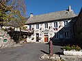
  • La mairie de Lacalm.jpg 4,000 × 3,000; 5.05 MB
  • Mairie de Lacalm.jpg 4,000 × 3,000; 4.89 MB
  • Map commune FR insee code 12117.png 756 × 605; 54 KB
  • Population - Municipality code 12117.svg 475 × 355; 13 KB
Retrieved from "/w/index.php?title=Category:Lacalm&oldid=679363742"
Informasiya Melumat Axtar