Butun axtardiqlarinizi tapmaq ucun buraya: DAXIL OLUN
  Mp4 Mp3 Axtar Yukle
  Video Axtar Yukle
  Shekil Axtar Yukle
  Informasiya Melumat Axtar
  Hazir Inshalar Toplusu
  AZERI CHAT + Tanishliq
  Saglamliq Tibbi Melumat
  Whatsapp Plus Yukle(Yeni)

  • Home
  • Random
  • Nearby
  • Log in
  • Settings
Donate Now If this site has been useful to you, please give today.
  • About Wikimedia Commons
  • Disclaimers

Category:Kursky District, Stavropol Krai

<nowiki>Kurskij rajon; Kurszkajai járás; Курский район; Kurski rajon; Курскан кӀошт; شهرستان کورسکی (سرزمین استاوروپول); 庫爾斯基區; Kursky Koān (Stavropol Pian-kiong-khu); Курський район; District Koerski; Курскаяйы район; Kurski; raïon de Kurskaïa; Kursky District; Kursk rayonu (Stavropol diyarı); districte de Kurskaia; Կուրսկայայի շրջան; rajon russo; raïon municipal russe de Kurskaïa; Rajon in der Region Stawropol, Russland; Oroszország járása a Sztavropoli határterületen; qark komunal në Rusi; муниципальный район в Ставропольском крае России; municipal district in Stavropol Krai, Russia; raion municipal del territori de Stàvropol; Курский район Ставропольского края; Курский район (Ставропольский край)</nowiki>
Kursky District 
municipal district in Stavropol Krai, Russia
 image 
 flag image 
 coat of arms image 
 locator map image 
Upload media
 Wikipedia
Instance of
  • municipal district
LocationStavropol Krai, Russia
Capital
  • Kurskaya
Inception
  • 1935
Population
  • 19,244 (1939)
  • 28,579 (1959)
  • 49,401 (1970)
  • 42,552 (1979)
  • 43,153 (1989)
  • 43,406 (1990)
  • 44,122 (1991)
  • 45,237 (1992)
  • 47,453 (1993)
  • 48,669 (1994)
  • 49,584 (1995)
  • 49,485 (1996)
  • 49,601 (1997)
  • 50,658 (1998)
  • 51,454 (1999)
  • 51,894 (2000)
  • 51,931 (2001)
  • 52,100 (2002)
  • 52,093 (2003)
  • 52,278 (2004)
  • 52,097 (2005)
  • 51,769 (2006)
  • 51,500 (2007)
  • 51,555 (2008)
  • 51,828 (2009)
  • 54,054 (2010)
  • 54,075 (2011)
  • 53,729 (2012)
  • 53,333 (2013)
  • 53,203 (2014)
  • …
Area
  • 3,694 km²
official website
Map44° 02′ 15″ N, 44° 27′ 44″ E
Authority file
Wikidata Q1253843
  • Reasonator
  • Scholia
  • Wikidocumentaries
  • PetScan
  • statistics
  • WikiMap
  • Locator tool
  • KML file
  • WikiShootMe
  • OpenStreetMap
  • Search depicted
Edit infobox data on Wikidata

Subcategories

This category has the following 2 subcategories, out of 2 total.


  • Protected areas of Kursky District, Stavropol Krai (empty)

S

  • Sernovodskoe (4 F)

Media in category "Kursky District, Stavropol Krai"

The following 7 files are in this category, out of 7 total.

  • Flag of Kursky rayon (Stavropol krai).png 1,128 × 752; 132 KB
  • Flag of Kursky rayon (Stavropol kray).svg 1,066 × 711; 448 KB
  • Holy Mother of God church, Edissiya.png 826 × 828; 1.58 MB
  • Coat of Arms of Kurskiy rayon.png 1,558 × 1,893; 218 KB
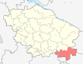
  • Location of Kursky District (Stavropol Krai).svg 512 × 397; 190 KB
  • Location of Kursky District (Stavropol).svg 609 × 466; 23 KB
  • Map of Terek Oblast,1898 (fragment 1).jpg 630 × 344; 308 KB
Retrieved from "/w/index.php?title=Category:Kursky_District,_Stavropol_Krai&oldid=332612794"
Informasiya Melumat Axtar