Category:Krasnoturyinsk
town in Russia  Здание администрации города Краснотурьинска   | |||||
| Upload media | |||||
| Instance of | |||||
|---|---|---|---|---|---|
| Location |
| ||||
| Inception |
| ||||
| Population |
| ||||
| Area |
| ||||
| Elevation above sea level |
| ||||
| official website | |||||
 | |||||
Subcategories
This category has the following 11 subcategories, out of 11 total.
B
C
H
M
- Mednaja Shahta pond (13 F)
- Mednaja Shahta quarry (17 F)
P
T
- Tourjinsk Mine (3 F)
- Trinity Quarry (17 F)
Media in category "Krasnoturyinsk"
The following 23 files are in this category, out of 23 total.
-
 Banner Krasnoturyinsk 006 4128 01.jpg 15,750 × 2,250; 34.42 MB
-
 Banner Krasnoturyinsk 006 4128 02.jpg 11,900 × 1,700; 18.61 MB
-
 Bogoslovsky aluminum plant (cropped).jpg 2,171 × 770; 356 KB
-
 Bogoslovsky aluminum plant.jpg 2,171 × 1,102; 589 KB
-
 Coat of Arms of Krasnoturinsk (Sverdlovsk oblast).png 489 × 800; 295 KB
-
 Entrance into Krasnoturinsk.jpg 2,272 × 1,704; 783 KB
-
 Flag of Krasnoturinsk (Sverdlovsk oblast).png 399 × 266; 14 KB
-
 Kik logo.png 71 × 122; 14 KB
-
 Krasnoturiinsk city coa.gif 200 × 318; 38 KB
-
 Krasnoturinsk gerb 1967.png 200 × 288; 17 KB
-
 Krasnoturinsk, Sverdlovsk Oblast, Russia - panoramio (10).jpg 4,320 × 3,240; 5.74 MB
-
 Krasnoturyinsk 006 4150c.jpg 6,260 × 3,522; 21.49 MB
-
 Krasnoturyinsk city flag.png 396 × 265; 12 KB
-
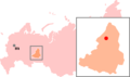 Location Krasnoturinsk.png 325 × 192; 10 KB
-
 Magnetic Field (Gold area) - panoramio - mmpos1.jpg 3,294 × 5,133; 3.81 MB
-
 Magnetic field (Gold area) - panoramio.jpg 1,278 × 673; 68 KB
-
 Panorama view of Krasnoturinsk (2).jpg 6,009 × 1,449; 2.86 MB
-
 Panorama view of Krasnoturinsk.jpg 18,448 × 1,148; 7.16 MB
-
 River Turya (inflow of the Sosva) 2.jpg 2,272 × 1,704; 966 KB
-
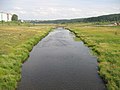 River Turya (inflow of the Sosva).jpg 2,272 × 1,704; 1.04 MB
-
 Закат на озере, Краснотуринск - panoramio.jpg 3,648 × 2,736; 3.96 MB
-
 Старая дорога на гору - panoramio.jpg 3,648 × 2,736; 4.05 MB
-
 Шестой разрез.(Окресности Краснотурьинска) - panoramio.jpg 4,320 × 3,240; 5.76 MB

.png)

.png)

.jpg)


_-_panoramio_-_mmpos1.jpg)
_-_panoramio.jpg)
_2.jpg)
.jpg)


_-_panoramio.jpg)
.jpg)
.jpg)