Category:Kensington
district within the Royal Borough of Kensington and Chelsea in central London  | |||||
| Upload media | |||||
| Instance of | |||||
|---|---|---|---|---|---|
| Location |
| ||||
| Population |
| ||||
 | |||||
Subcategories
This category has the following 87 subcategories, out of 87 total.
A
- Abingdon Villas, London (6 F)
- Adam and Eve Mews (15 F)
- Allen Street, London (3 F)
B
- Bolton Gardens Mews (1 F)
C
- Callcott Street (4 F)
- Campden Street (4 F)
- Canning Place, London (2 F)
- Carmelite Priory, London (14 F)
- Cresswell Place (4 F)
D
- De Vere Mews (7 F)
- Dove Mews (1 F)
- Drayson Mews (3 F)
E
F
- Farm Place (8 F)
G
- Gaspar Close (1 F)
H
- Hillgate Place (13 F)
- Hillgate Street (3 F)
K
- Kensington Barracks (1 F)
- Kensington Central Library (1 P, 34 F)
- Kensington Fire Station (3 F)
- Kensington Green, London (5 F)
- Kensington Place, Kensington (17 F)
- Kensington Vestry Hall (7 F)
L
M
N
O
P
R
- Radnor Terrace (5 F)
S
- South End Row (1 F)
- South End, Kensington (3 F)
- St. Mary Abbots Place (3 F)
- Street signs of London W8 (23 F)
T
- Tor Gardens (3 F)
V
W
- Walpole Street (1 F)
Y
- York House Place (1 F)
Media in category "Kensington"
The following 116 files are in this category, out of 116 total.
-
De-Kensington.ogg 2.1 s; 20 KB
-
 "Christmas is Coming" - geograph.org.uk - 287434.jpg 480 × 640; 139 KB
-
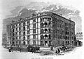
 Image taken from page 138 of 'Old and New London, etc' (11189067536).jpg 1,711 × 1,330; 910 KB
-
 Image taken from page 145 of 'Old and New London, etc' (11192212155).jpg 1,892 × 2,817; 2.05 MB
-
 Image taken from page 181 of 'Old and New London, etc' (11189491034).jpg 1,892 × 2,817; 2.03 MB
-
 500px photo (31130077).jpeg 1,530 × 2,048; 1,000 KB
-
 A ST Grodynski Marriage II.jpg 2,481 × 1,924; 301 KB
-
 Abbotsbury Rd - geograph.org.uk - 4152663.jpg 640 × 430; 89 KB
-
 Abbotsbury Rd - geograph.org.uk - 4152666.jpg 640 × 430; 92 KB
-
 Arbportobellmrkt.jpg 2,560 × 1,920; 932 KB
-
 Arundel Ladbroke gardens - geograph.org.uk - 837152.jpg 480 × 640; 169 KB
-
 Ashburnham Road, Chelsea - geograph.org.uk - 263326.jpg 640 × 480; 88 KB
-
 B317, Kensington - geograph.org.uk - 3522678.jpg 640 × 430; 106 KB
-
 Backside of a London house.JPG 2,448 × 3,264; 4.09 MB
-
 Batty's balloon ascent.jpg 819 × 1,024; 197 KB
-
 Batty's hippo 10-May-1851.jpg 512 × 394; 66 KB
-

-
 BMW Z8 (5).jpg 768 × 504; 116 KB
-
 BMW Z8 (6).jpg 758 × 324; 119 KB
-
 BMW Z8 (7).jpg 768 × 403; 124 KB
-
 BMW Z8 (8).jpg 539 × 284; 72 KB
-
 Boris' Bike Company, W8 - geograph.org.uk - 2156588.jpg 2,336 × 3,504; 1.94 MB
-
 Bristol 411 (2).jpg 640 × 385; 132 KB
-
 Bristol 411 (3).jpg 640 × 480; 155 KB
-
 Bristol 411 (4).jpg 640 × 312; 122 KB
-
 Butterfly (67132281).jpeg 700 × 795; 157 KB
-
 Calyptorhynchus latirostris (26948195156).jpg 5,472 × 3,648; 6.15 MB
-
 Campden St - geograph.org.uk - 4008884.jpg 640 × 464; 77 KB
-
 Campden St - geograph.org.uk - 4008885.jpg 640 × 430; 73 KB
-
 Central Kensington.png 787 × 512; 335 KB
-
 Citroen C6 (2).jpg 768 × 431; 134 KB
-
 Citroen C6 (3).jpg 768 × 397; 134 KB
-
 Clear Channel, Cluny Mews, London SW5 - geograph.org.uk - 647184.jpg 479 × 640; 80 KB
-
 COMO House - panoramio.jpg 3,072 × 2,304; 1.3 MB
-
 Considering Flight (177158921).jpeg 2,048 × 1,365; 445 KB
-

-
 Daihatsu Mira Avanzato TR-XX (2).jpg 799 × 556; 164 KB
-
 Daihatsu Mira Avanzato TR-XX.jpg 768 × 438; 159 KB
-
 Earl's Court from the air - geograph.org.uk - 5074123.jpg 640 × 480; 220 KB
-
 Earl's Court from the air - geograph.org.uk - 5074139.jpg 640 × 504; 229 KB
-
 Edge St - geograph.org.uk - 4008860.jpg 640 × 430; 65 KB
-
-
 Farmer Street - geograph.org.uk - 2799254.jpg 675 × 1,024; 217 KB
-
 Farmer Street - geograph.org.uk - 4123262.jpg 1,024 × 683; 195 KB
-

-
 Freedom for Palestine, Socialist Worker, London, UK.jpg 2,658 × 2,700; 4.02 MB
-
 Garden from Scarsdale House, Kensington, 1892 by Philip Norman.jpg 1,024 × 742; 130 KB
-
 H20130418-7945—Smith River Series Iris—RPBG-1 (8674486970).jpg 1,024 × 768; 962 KB
-
 Hoedenindustrie, damesmode, SFA022808694.jpg 2,671 × 3,304; 1.08 MB
-
 Hogarth Place, Kensington, old kiosk.jpg 3,648 × 2,736; 2.39 MB
-
 Kensington (15137122584).jpg 640 × 640; 136 KB
-
 Kensington - Bart Heemskerk - Heineken Music Hall.jpg 2,048 × 1,365; 444 KB
-
 Kensington - Richmond line 1869.gif 1,509 × 707; 76 KB
-
 Kensington - Richmond line 1911.gif 1,509 × 707; 92 KB
-
 Kensington and Chelsea London UK labelled ward map 2002-2014.svg 1,082 × 1,266; 52 KB
-
 Kensington Buildings.JPG 1,656 × 1,242; 686 KB
-
 Kensington fire - geograph.org.uk - 244376.jpg 640 × 480; 93 KB
-
 Kensington from the air in 1909.jpg 970 × 650; 308 KB
-
 Kensington market london.JPG 1,544 × 1,040; 392 KB
-
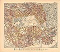
 Kensington Met. B Ward Map 1916.svg 868 × 1,120; 44 KB
-
 Kensington Place - geograph.org.uk - 2799331.jpg 1,024 × 683; 143 KB
-
 Kensington Place - geograph.org.uk - 4008859.jpg 640 × 430; 47 KB
-
 Kensington Women's Social and Political Union shop.jpg 3,249 × 2,016; 1.12 MB
-
 Kensington, Addison Grove - geograph.org.uk - 3161501.jpg 3,456 × 2,304; 4.49 MB
-
 Kensington, Allen Street - geograph.org.uk - 3164576.jpg 3,558 × 2,670; 4.72 MB
-
 Kensington, London, England, UK - panoramio.jpg 4,525 × 2,756; 6.64 MB
-
 Kensington, London, UK - panoramio (1).jpg 2,048 × 1,536; 583 KB
-
 Kensington, London, UK - panoramio (20).jpg 4,132 × 2,756; 7.45 MB
-
 Kensington, London, UK - panoramio (21).jpg 4,893 × 2,756; 6.17 MB
-
 Kensington, London, UK - panoramio (25).jpg 2,448 × 3,264; 3.1 MB
-
 Kensington, London, UK - panoramio (26).jpg 3,264 × 2,448; 3.18 MB
-
 Kensington, London, UK - panoramio (27).jpg 3,264 × 2,448; 3.68 MB
-
 Kensington, London, UK - panoramio (28).jpg 3,264 × 2,448; 3.56 MB
-
 Kensington, London, UK - panoramio (30).jpg 3,264 × 2,448; 4.19 MB
-
 Kensington, London, UK - panoramio (31).jpg 2,448 × 3,264; 2.15 MB
-
 Kensington, London, UK - panoramio (33).jpg 3,264 × 2,448; 2.54 MB
-
 Kensington, London, UK - panoramio (9).jpg 2,048 × 1,536; 627 KB
-
 Kensington-london.jpg 1,024 × 697; 128 KB
-
 Kensington. (15732673686).jpg 640 × 640; 154 KB
-
 Lillie Bridge Depot and Earl's Court 1928-EPW024262.jpg 580 × 492; 61 KB
-
 London, UK (August 2014) - 039.JPG 4,000 × 3,000; 3.13 MB
-
 Mall Chambers Kensington Mall 2005-06-05.jpg 450 × 600; 307 KB
-
 Mary Lowndes Album 0255 (39963670011).jpg 3,479 × 4,036; 1.23 MB
-
 Mary Sinclair entering Kensington Women's Social & Political Union shop.jpg 3,210 × 2,052; 1.27 MB
-
 Matthew Close, Notting Barn Estate - geograph.org.uk - 981028.jpg 640 × 480; 103 KB
-
 Mitsubishi Minica Toppo BJ (2).jpg 737 × 477; 157 KB
-
 Mitsubishi Minica Toppo BJ.jpg 737 × 433; 160 KB
-
 Model Dwelling in the Mall, Kensington. Wellcome L0004836.jpg 1,734 × 1,222; 1.05 MB
-
 Muskelaufbau (31488247344).jpg 3,603 × 5,404; 8.78 MB
-

-

-
 Pembroke Place - geograph.org.uk - 4152939.jpg 640 × 430; 62 KB
-
 Pembroke Road, W8 - geograph.org.uk - 278938.jpg 640 × 480; 112 KB
-
 Porsche 911 Targa (2).jpg 640 × 310; 111 KB
-
 Porsche 911 Targa (3).jpg 640 × 354; 112 KB
-
-

-
 Queen's Gate Gardens, Kensington, United Kingdom - panoramio.jpg 2,557 × 1,898; 1.16 MB
-
 Redfield Lane, Kensington.jpg 2,896 × 1,944; 1,000 KB
-
 Royal Garden Hotel.jpg 640 × 480; 88 KB
-
 Royal Geographical Society - geograph.org.uk - 35092.jpg 640 × 480; 128 KB
-
 Scarsdale House, Wrights Lane, Kensington, 1892 by Philip Norman.jpg 1,024 × 636; 145 KB
-

-
 South End, Kensington - geograph.org.uk - 4338377.jpg 2,272 × 1,704; 880 KB
-
 South Kensington from the air - geograph.org.uk - 6365561.jpg 847 × 1,024; 435 KB
-
 Sportec Audi S6 or RS6 (2).jpg 575 × 260; 97 KB
-
 Sportec Audi S6 or RS6 (3).jpg 737 × 381; 128 KB
-
 Sportec Audi S6 or RS6.jpg 614 × 355; 124 KB
-
 St Mary Abbots old.jpg 450 × 332; 20 KB
-
 Stadium Street and Whistler Tower - geograph.org.uk - 263335.jpg 480 × 640; 80 KB
-
 Stratford Rd - geograph.org.uk - 4160150.jpg 640 × 430; 74 KB
-
 Subaru Legacy B4 (2).jpg 640 × 376; 120 KB
-
 The Sir Oswald Stoll Foundation - geograph.org.uk - 313367.jpg 640 × 480; 111 KB
-
 Trellick Tower & North Kensington from 20th flr of Hall Tower.jpg 2,592 × 1,944; 2.62 MB
-
 View from Westminster Cathedral 2011 Kensington.jpg 3,054 × 1,222; 2 MB
-
 William Nicholson, Hawker.jpg 600 × 675; 630 KB

.jpg)
.jpg)
.jpg)
.jpeg)


_and_Anne_Eliza_Wiggins_(1828-1914)_golden_wedding_anniversary_at_4_Inverness_Gardens,_Kensington.jpg)
.jpg)
.jpg)
.jpg)
.jpg)

.jpg)
.jpg)
.jpg)
.jpeg)
.jpg)


.jpg)
.jpg)

.jpeg)

.jpg)


.jpg)


.jpg)


.jpg)
.jpg)
.jpg)
.jpg)
.jpg)
.jpg)
.jpg)
.jpg)
.jpg)
.jpg)
.jpg)

.jpg)

_-_039.JPG)

.jpg)


.jpg)


.jpg)
_(14591765879).jpg)
_(14591802479).jpg)


.jpg)
.jpg)
.jpg)
.jpg)


.JPG)


.jpg)
.jpg)


.jpg)


