Category:Inishowen
Deutsch: Inishowen (Irisch: Inis Eoghain) ist die größte Halbinsel Irlands und liegt in der Grafschaft Donegal.
English: Inishowen (Irish: Inis Eoghain) is a historical peninsular region in County Donegal, and also the largest peninsula in Ireland. It pre-dates the formation of the county in which it is located by centuries.
Français : Inishowen (Gaélique: Inis Eoghain), Comté de Donegal, la plus grande péninsule d'Irlande.
Italiano: Inishowen (in gaelico irlandese Inis Eoghain) è la penisola più vasta d'Irlanda.
peninsula in Ireland  | |||||
| Upload media | |||||
| Instance of | |||||
|---|---|---|---|---|---|
| Location | County Donegal, Ulster, Ireland | ||||
| Located in or next to body of water | |||||
 | |||||
Subcategories
This category has the following 36 subcategories, out of 36 total.
B
- Ballymacarthur (4 F)
C
- Creeve (1 F)
D
- Drean, County Donegal (2 F)
- Drumlougher (1 F)
F
- Five Finger Strand (8 F)
- Fort Dunree (43 F)
G
H
- Highbank, County Donegal (1 F)
K
- Kinnoge Bay (3 F)
L
- Leenan Pier (1 F)
- Listicall Lower (1 F)
M
- Moneyhaughly (2 F)
Q
- Quigley's Point (53 F)
S
T
U
Media in category "Inishowen"
The following 200 files are in this category, out of 215 total.
(previous page) (next page)-
 Derry from the International Space Station 2013-03-17.jpg 1,024 × 679; 147 KB
-
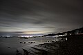
 Ballybrack beach at night.jpg 3,000 × 2,000; 1.67 MB
-
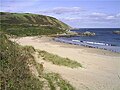
 BeachOnInishowen.jpg 3,957 × 1,585; 1.25 MB
-
 Binion Hill and Dunaff Head from Crockaughrim.jpg 3,000 × 2,000; 1.74 MB
-
 Buncrana from Ned's Point by night.jpg 3,000 × 2,000; 2.13 MB
-
 Calm before the Storms (22967476925).png 3,963 × 2,972; 4.2 MB
-
 Car light trail in Trawbreaga Bay.jpg 2,999 × 1,999; 1.27 MB
-
 Carndonagh Shopping Centre - geograph.org.uk - 3614583.jpg 640 × 480; 65 KB
-
 Cliff guarding Dunree - panoramio.jpg 1,536 × 2,048; 1.33 MB
-

-
 Cliffs at Dunree - panoramio.jpg 2,048 × 1,536; 1.42 MB
-
 Condrum Hill - geograph.org.uk - 1341210.jpg 640 × 479; 55 KB
-
 Condrum Hill - geograph.org.uk - 1341214.jpg 640 × 479; 65 KB
-
 Coolcross Hill from Carrowreagh at night.jpg 3,000 × 1,999; 1.71 MB
-
 Cottage Near Culdaff - panoramio.jpg 3,072 × 2,304; 1.3 MB
-
 Cottages by the sea at Shroove - geograph.org.uk - 910136.jpg 640 × 480; 70 KB
-
 Cove at Portnocker - geograph.org.uk - 910144.jpg 640 × 480; 124 KB
-
 Cross at Quigley's Point.jpg 3,000 × 2,005; 2.7 MB
-
 Culdaff - panoramio.jpg 2,592 × 1,944; 751 KB
-
 Deserted look-out at Inishowen Head - geograph.org.uk - 909063.jpg 640 × 480; 61 KB
-
 Display, Brachan House - geograph.org.uk - 1359753.jpg 640 × 479; 64 KB
-
 Dunaff Head views and sheep.jpg 3,000 × 2,000; 2.08 MB
-
 Dunree Head, Irland, Bild 1.jpg 2,736 × 1,824; 3.02 MB
-
 Dunree Head, Irland, Bild 2.jpg 1,892 × 1,823; 1.25 MB
-
 Dunree Head, Irland, Bild 3.jpg 1,732 × 1,824; 1.41 MB
-
 Dunree Head, Irland, Bild 4.jpg 2,735 × 1,823; 2.22 MB
-
 Fahan hill from Inch Island and reflected sky.jpg 3,000 × 1,999; 2.47 MB
-
 Five Finger Strand from Knockamanny Bens viewpoint at night.jpg 3,000 × 2,005; 1.94 MB
-
 Five Finger Strand from Knockamanny Bens viewpoint.jpg 3,000 × 2,005; 1.87 MB
-
 Foggy morning over Inishowen - Donegal, Ireland.jpg 3,888 × 2,592; 1.14 MB
-
 Foggy morning over Inishowen - Donegal, Ireland.png 3,888 × 2,592; 8.97 MB
-
 Forest track, Crockaveeny, Inishowen - geograph.org.uk - 1052999.jpg 640 × 480; 97 KB
-
 Forestry, Drumdoo - geograph.org.uk - 1359719.jpg 640 × 479; 89 KB
-
 Fuchsia and meadowsweet near the sea - geograph.org.uk - 910140.jpg 640 × 480; 140 KB
-

-
 Gate on cliff path - geograph.org.uk - 909026.jpg 640 × 480; 107 KB
-
 Glengad Townland - geograph.org.uk - 1329224.jpg 640 × 479; 62 KB
-
 Gortin Road - geograph.org.uk - 953656.jpg 640 × 479; 53 KB
-
 Gortin Townland - geograph.org.uk - 953660.jpg 640 × 479; 65 KB
-
 Greenhill Chapel Ruins, Desertegney, Co Donegal.jpg 3,696 × 2,448; 2.92 MB
-
 Grianán of Aileach at night.jpg 3,000 × 2,005; 2.59 MB
-
 Harebells among the rocks - geograph.org.uk - 910182.jpg 480 × 640; 131 KB
-
 Inishowen blank map.svg 784 × 745; 255 KB
-
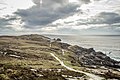
 Inishowen Head - geograph.org.uk - 172897.jpg 640 × 480; 95 KB
-
 Inishowen peninsula.PNG 1,435 × 1,430; 252 KB
-
 Inishowen sunset.jpg 3,008 × 2,000; 1.63 MB
-
 Inishowen-06-Malin Head-Flechten-1989-gje.jpg 2,606 × 1,615; 2.76 MB
-
 Inishowen-08-Graeser und Heide-1989-gje.jpg 2,659 × 1,668; 2.07 MB
-
 Inishowen-10-Hof vor Gebirgspanorama-1989-gje.jpg 2,692 × 1,674; 1.56 MB
-
 Inishowen-12-Wolke-1989-gje.jpg 2,717 × 1,803; 2.68 MB
-
 Inishowen-head-donegal.jpg 1,258 × 530; 110 KB
-
 Inishowen.png 908 × 1,159; 118 KB
-
 Inishowensatmap.jpg 945 × 1,044; 642 KB
-
 Knockengrana Townland - geograph.org.uk - 1338799.jpg 640 × 479; 57 KB
-
 Lane, New Town - geograph.org.uk - 1359761.jpg 640 × 479; 94 KB
-
 Lenan Beach, Inishowen, Co Donegal - geograph.org.uk - 100929.jpg 640 × 427; 40 KB
-
 Lettore Townland - geograph.org.uk - 1329368.jpg 640 × 479; 64 KB
-
 Lichen and heather on near Shroove - geograph.org.uk - 910174.jpg 640 × 480; 135 KB
-
 Lily, Lackboy - geograph.org.uk - 1359772.jpg 479 × 640; 168 KB
-
 Looking down on Pigeon Cove - geograph.org.uk - 909075.jpg 640 × 480; 81 KB
-
-
 Lough Foyle from Inishowen Head at night.jpg 3,000 × 2,000; 1.7 MB
-
 Lough Inn - geograph.org.uk - 1341470.jpg 640 × 479; 74 KB
-
 Magilligan Point from Crockaulin.jpg 3,000 × 2,005; 2.56 MB
-
 Magilligan Point View on a full moon night.jpg 3,000 × 2,000; 1.54 MB
-
 Main St Culdaff. - panoramio.jpg 2,592 × 1,944; 764 KB
-
 Malin Head set(26804900302).png 3,888 × 2,592; 13.5 MB
-
 Malin Head walk.jpg 3,000 × 2,000; 2.93 MB
-
 Malin Head, aerial photograph.jpg 3,000 × 2,425; 5 MB
-

-
 Malin Village Green and Malin Hotel - panoramio.jpg 2,048 × 1,536; 600 KB
-
 Minehill Bridge - geograph.org.uk - 1342319.jpg 640 × 479; 74 KB
-
 Monreagh Townland - geograph.org.uk - 968896.jpg 640 × 479; 75 KB
-
 Moon over Crockalough lake.jpg 3,000 × 2,000; 2.04 MB
-
 Moon rising over Lough Foyle.jpg 3,000 × 1,999; 1.94 MB
-
 Moonlit stream at Buncrana beach.jpg 3,000 × 2,005; 2.5 MB
-
 Moonrise from Shroove Beach.jpg 3,000 × 2,000; 1.92 MB
-
 Mossy Glen - geograph.org.uk - 1338957.jpg 640 × 479; 70 KB
-
 Moville green and waterpark.jpg 3,000 × 2,000; 2.68 MB
-
 Near Malin - geograph.org.uk - 1359740.jpg 640 × 479; 59 KB
-
 Near Muff - geograph.org.uk - 953756.jpg 640 × 479; 41 KB
-
 Near Muff - geograph.org.uk - 953759.jpg 640 × 479; 54 KB
-
 New house at Sleadrin - geograph.org.uk - 1380131.jpg 640 × 479; 68 KB
-
 New Town - geograph.org.uk - 1359759.jpg 640 × 479; 79 KB
-
 Night photo from Ineuran Bay viewpoint.jpg 3,000 × 2,006; 2.04 MB
-
 Night photo of the Isle of Doagh from Knockamany.jpg 3,000 × 1,999; 2.2 MB
-
 Night views from Inishowen Head bunker.jpg 3,000 × 2,000; 2.66 MB
-
 Night views of Buncrana beach.jpg 3,000 × 1,999; 2.21 MB
-
 Night views of Lough Foyle shore at Quigley's Point.jpg 3,000 × 2,000; 1.57 MB
-
 Night views of Lough Swilly from Buncrana beach.jpg 3,000 × 2,000; 1.96 MB
-
 Night views of Moville from Carrickarory pier.jpg 2,999 × 1,999; 1.82 MB
-
 Night views of Moville from the shore path.jpg 3,000 × 1,929; 1.86 MB
-
 Night views of Trawbreaga Bay from the Isle of Doagh.jpg 3,000 × 2,007; 2.3 MB
-
 North Inishowen Coast 002.jpg 4,927 × 3,285; 11.52 MB
-
 North Inishowen Coast.jpg 4,932 × 3,288; 10.17 MB
-
 Path at Buncrana beach by night.jpg 3,000 × 2,000; 2.63 MB
-
 Pollan Bay from Binion Hill.jpg 3,000 × 2,000; 2.09 MB
-
 Port a Dorais - geograph.org.uk - 909042.jpg 640 × 480; 112 KB
-
 Port a Dorais looking east - geograph.org.uk - 909046.jpg 640 × 480; 107 KB
-
 Port a Doras - geograph.org.uk - 884933.jpg 640 × 448; 93 KB
-
 Portaleen, Co Donegal - geograph.org.uk - 1329144.jpg 640 × 479; 71 KB
-
 Portaleen, Co Donegal - geograph.org.uk - 1329147.jpg 640 × 479; 60 KB
-
 Rainy.R238.2007.JPG 2,272 × 1,704; 948 KB
-
 RC Church at Moyglass - geograph.org.uk - 1338967.jpg 640 × 479; 41 KB
-
 Rinenore Point - geograph.org.uk - 953480.jpg 640 × 479; 64 KB
-
 Road at Annagh Upper - geograph.org.uk - 1405904.jpg 640 × 479; 59 KB
-
 Road at Ardmore - geograph.org.uk - 953384.jpg 640 × 479; 62 KB
-
 Road at Aught - geograph.org.uk - 953497.jpg 640 × 479; 48 KB
-
 Road at Ballintruhan - geograph.org.uk - 1331088.jpg 640 × 479; 50 KB
-
 Road at Ballykenny - geograph.org.uk - 1336980.jpg 640 × 479; 51 KB
-
 Road at Ballyloskey - geograph.org.uk - 1358876.jpg 640 × 479; 59 KB
-
 Road at Ballyloskey - geograph.org.uk - 1358889.jpg 640 × 479; 63 KB
-
 Road at Ballyloskey - geograph.org.uk - 1358893.jpg 640 × 479; 58 KB
-
 Road at Ballynacarta - geograph.org.uk - 1390798.jpg 640 × 479; 58 KB
-
 Road at Ballynagard - geograph.org.uk - 953337.jpg 640 × 479; 60 KB
-
 Road at Carrownamaddy - geograph.org.uk - 1037612.jpg 640 × 479; 60 KB
-
 Road at Churchtown - geograph.org.uk - 953708.jpg 640 × 479; 51 KB
-
 Road at Claggan - geograph.org.uk - 1349174.jpg 640 × 479; 66 KB
-
 Road at Cloghglass - geograph.org.uk - 1391631.jpg 640 × 479; 66 KB
-
 Road at Cloghglass - geograph.org.uk - 1391633.jpg 640 × 479; 58 KB
-
 Road at Craigtown - geograph.org.uk - 1359699.jpg 640 × 479; 52 KB
-
 Road at Croagh - geograph.org.uk - 1341427.jpg 640 × 479; 58 KB
-
 Road at Croagh - geograph.org.uk - 1341437.jpg 640 × 479; 42 KB
-
 Road at Crockbrack - geograph.org.uk - 1338962.jpg 640 × 479; 60 KB
-
 Road at Crockglass - geograph.org.uk - 1342356.jpg 640 × 479; 42 KB
-
 Road at Crockglass - geograph.org.uk - 1342358.jpg 640 × 479; 56 KB
-
 Road at Doonmore Hill - geograph.org.uk - 1335994.jpg 640 × 479; 57 KB
-
 Road at Dreenagh - geograph.org.uk - 1329269.jpg 640 × 479; 74 KB
-
 Road at Dreenagh - geograph.org.uk - 1329289.jpg 640 × 479; 73 KB
-
 Road at Drumdoo - geograph.org.uk - 1349242.jpg 640 × 479; 67 KB
-
 Road at Drumdoo - geograph.org.uk - 1359717.jpg 640 × 479; 82 KB
-
 Road at Drumskellen - geograph.org.uk - 953421.jpg 640 × 479; 57 KB
-
 Road at Drung - geograph.org.uk - 1341406.jpg 640 × 479; 76 KB
-
 Road at Fahan - geograph.org.uk - 1332864.jpg 640 × 479; 54 KB
-
 Road at Fallask - geograph.org.uk - 1380281.jpg 640 × 479; 63 KB
-
 Road at Glasmullan - geograph.org.uk - 1391635.jpg 640 × 479; 51 KB
-
 Road at Glasmullan - geograph.org.uk - 1391636.jpg 640 × 479; 45 KB
-
 Road at Glasmullan - geograph.org.uk - 1391638.jpg 640 × 479; 63 KB
-
 Road at Glengad - geograph.org.uk - 1329218.jpg 640 × 479; 71 KB
-
 Road at Gortnamona - geograph.org.uk - 953500.jpg 640 × 479; 49 KB
-
 Road at Hillhead - geograph.org.uk - 1349151.jpg 640 × 479; 59 KB
-
 Road at Knockengrana - geograph.org.uk - 1338797.jpg 640 × 479; 52 KB
-
 Road at Laganaber - geograph.org.uk - 1380106.jpg 640 × 479; 56 KB
-
 Road at Letterore - geograph.org.uk - 1329367.jpg 640 × 479; 42 KB
-
 Road at Magerard - geograph.org.uk - 1349247.jpg 640 × 479; 61 KB
-
 Road at Magherard - geograph.org.uk - 1331051.jpg 640 × 479; 65 KB
-
 Road at Manner's Town - geograph.org.uk - 1030706.jpg 640 × 479; 65 KB
-
 Road at Meenabaltin - geograph.org.uk - 1342296.jpg 640 × 479; 55 KB
-
 Road at Meenalevin - geograph.org.uk - 1341468.jpg 640 × 479; 46 KB
-
 Road at Meenavanaghan - geograph.org.uk - 1342344.jpg 640 × 479; 80 KB
-
 Road at Mitchells Town - geograph.org.uk - 953396.jpg 640 × 479; 45 KB
-
 Road at Moyglass - geograph.org.uk - 1338970.jpg 640 × 479; 40 KB
-
 Road at Muff - geograph.org.uk - 1331064.jpg 640 × 479; 61 KB
-
 Road at Shandrim - geograph.org.uk - 1380300.jpg 640 × 479; 76 KB
-
 Road at Sleadrin - geograph.org.uk - 1380129.jpg 640 × 479; 73 KB
-
 Road at Smith's Town - geograph.org.uk - 953672.jpg 640 × 479; 70 KB
-
 Road at Smith's Town - geograph.org.uk - 953703.jpg 640 × 479; 54 KB
-
 Road at Stoolary - geograph.org.uk - 1358791.jpg 640 × 479; 71 KB
-
 Road at Stranagappoge - geograph.org.uk - 1342311.jpg 640 × 479; 63 KB
-
 Road at Tawnawaddy - geograph.org.uk - 1347980.jpg 640 × 479; 56 KB
-
 Road at Tullydush Upper - geograph.org.uk - 968910.jpg 640 × 479; 53 KB
-
 Road at Tullynavinn - geograph.org.uk - 1341219.jpg 640 × 479; 53 KB
-
 Road at Ture - geograph.org.uk - 953515.jpg 640 × 479; 47 KB
-
 Road at Ture - geograph.org.uk - 953528.jpg 640 × 479; 39 KB
-
 Road at Ture - geograph.org.uk - 953644.jpg 640 × 479; 57 KB
-
 Road at Umley - geograph.org.uk - 953521.jpg 640 × 479; 53 KB
-
 Road near Farragan Hill - geograph.org.uk - 1330775.jpg 640 × 479; 114 KB
-
 Road near Johnston's Bridge - geograph.org.uk - 1342324.jpg 640 × 479; 61 KB
-
 Road near Monreagh Hill - geograph.org.uk - 968898.jpg 640 × 479; 75 KB
-
 Road near Rinenore Point - geograph.org.uk - 953490.jpg 640 × 479; 66 KB
-
 Rocks beneath Inishowen Head - geograph.org.uk - 910165.jpg 640 × 480; 97 KB
-
 Rocks like tree trunks - geograph.org.uk - 909014.jpg 640 × 480; 114 KB
-
 Rocky path to Port a Dorais - geograph.org.uk - 909035.jpg 640 × 480; 107 KB
-
 Sandy cove near Gallanboy - geograph.org.uk - 910191.jpg 640 × 480; 74 KB
-

-
 Secluded beach near Port a Dorais - geograph.org.uk - 910161.jpg 640 × 480; 82 KB
-
 Sheep at Inishowen Head Walk.jpg 3,000 × 2,000; 3.28 MB
-
 Shore below Inishowen Head - geograph.org.uk - 909007.jpg 640 × 480; 86 KB
-
 Shroove lighthouse from the road at night.jpg 3,000 × 1,948; 2.81 MB
-
 Shroove lighthouse.jpg 2,999 × 1,999; 2.31 MB
-
 Shrove Beach Oct 07.jpg 640 × 480; 61 KB
-
 Skull house at Cooly - geograph.org.uk - 3552363.jpg 640 × 480; 113 KB
-
 Smith's Town - geograph.org.uk - 953676.jpg 640 × 479; 60 KB
-
 Smith's Town - geograph.org.uk - 953696.jpg 640 × 479; 53 KB
-
 Stookaruddan, Inishowen, Co. Donegal - geograph.org.uk - 7933551.jpg 800 × 600; 78 KB
-
 Stranagappoge Townland - geograph.org.uk - 1342309.jpg 640 × 479; 64 KB
-
 Strand bei Fahan, Irland, Bild 1.jpg 1,794 × 1,571; 1.65 MB
-
 Strand bei Fahan, Irland, Bild 2.jpg 2,696 × 1,525; 1.41 MB
-
 Strand bei Fahan, Irland, Bild 3.jpg 2,735 × 1,823; 1.3 MB
-
 Strand bei Fahan, Irland, Bild 4.jpg 2,264 × 1,578; 1.05 MB
-
 Sunset from Gap of Mamore viewpoint.jpg 3,000 × 2,000; 1.95 MB
-
 Sunset from Malin Head cliffs.jpg 3,000 × 1,999; 2.33 MB
-
 Sunsetting at Leenkeel Beach.jpg 3,000 × 2,000; 2.34 MB
-
 Tawnawaddy Townland - geograph.org.uk - 1347981.jpg 640 × 479; 70 KB
-
 The coastline at Shroove - geograph.org.uk - 910156.jpg 640 × 480; 66 KB
-
 The Ivre Inn - geograph.org.uk - 953391.jpg 640 × 479; 69 KB
-
 Track at Gibb - geograph.org.uk - 1359694.jpg 640 × 479; 60 KB
-
 Tractor and moon.jpg 3,000 × 2,000; 2.6 MB
-
 Trawbreaga stitch 01 (3778110048).jpg 6,720 × 2,276; 2.71 MB
-
 Trebracken Townland - geograph.org.uk - 1342362.jpg 640 × 479; 57 KB


.png)


.png)


.jpg)