Category:Hinlopenstretet
Strait in Svalbard  | |||||
| Upload media | |||||
| Instance of | |||||
|---|---|---|---|---|---|
| Location | Svalbard, Norway | ||||
| Connects with |
| ||||
| Has part(s) |
| ||||
| Length |
| ||||
 | |||||
Subcategories
This category has the following 3 subcategories, out of 3 total.
Media in category "Hinlopenstretet"
The following 23 files are in this category, out of 23 total.
-
 2020-06-04-00 00 2020-06-04-23 59 Sentinel-1 CDAS-IW-VVVH RGB ratio (53218135325).jpg 1,240 × 1,250; 542 KB
-
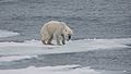
 Arctic ocean drift ice, the realm of the polar bear.jpg 3,628 × 2,041; 3.87 MB
-
 Bearded Seal 20130804 230751.jpg 3,638 × 2,046; 996 KB
-
 Black sea, black fog, sun&ice, polar sea.jpg 3,525 × 5,384; 1.85 MB
-
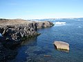 Coast - panoramio (20).jpg 3,264 × 2,448; 1.82 MB
-
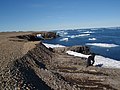 Coast1 - panoramio.jpg 3,264 × 2,448; 1.76 MB
-
 Endangered arctic - starving polar bear (cropped).jpg 2,434 × 1,532; 2.3 MB
-
 Endangered arctic - starving polar bear edit.jpg 2,135 × 1,417; 2.63 MB
-
 Endangered arctic - starving polar bear.jpg 3,009 × 1,693; 2.72 MB
-

-

-

-

-

-

-
 For A Swim (202189163).jpeg 2,048 × 1,366; 696 KB
-
 Hinlopenstretet1 (js).jpg 5,376 × 3,528; 14.2 MB
-
 Hinlopenstretet2 (js).jpg 5,371 × 3,537; 17.31 MB
-
 Nordauslandet.Hinlopenstretet.jpg 3,648 × 2,279; 5.59 MB
-
 Nordaustlandet (js) 2.jpg 5,379 × 3,537; 13.17 MB
-
 Observed (203561623).jpeg 2,048 × 1,153; 455 KB
-
 Spitsbergen partial map by August Petermann 1871.jpg 2,116 × 2,548; 1.12 MB
-
 Visitors (202838597).jpeg 2,048 × 1,152; 491 KB
.jpg)


.jpg)

.jpg)


.jpeg)
.jpg)
.jpg)

_2.jpg)
.jpeg)

.jpeg)