Category:Hamilton, South Lanarkshire
English: Hamilton is a town in South Lanarkshire, Scotland, south-east of Glasgow.
town in South Lanarkshire, Scotland, UK  | |||||
| Upload media | |||||
| Instance of |
| ||||
|---|---|---|---|---|---|
| Location |
| ||||
| Population |
| ||||
| Different from | |||||
 | |||||
Subcategories
This category has the following 37 subcategories, out of 37 total.
9
- 92–94 Cadzow Street (2 F)
B
- Bothwell Road Park (4 F)
C
- Cadzow Bridge (12 F)
- Clyde Bridge, Motherwell (4 F)
F
H
- Hamilton bus station (5 F)
- Hamilton Central Co-Op (2 F)
- Hamilton Grammar School (2 F)
- Hamilton Low Parks Museum (37 F)
- Hamilton Mausoleum (33 F)
- Hamilton Old Parish Church (10 F)
- Hamilton Park Racecourse (12 F)
- Hamilton Services (15 F)
- Hamilton Sheriff Court (1 F)
- Hamilton Town House (6 F)
J
L
- Lanark County Buildings (7 F)
M
- M74 Avon Bridge (7 F)
- M74 Raith Bridge (3 F)
N
P
R
S
Media in category "Hamilton, South Lanarkshire"
The following 194 files are in this category, out of 194 total.
-
 'H' is for...^ - geograph.org.uk - 699758.jpg 640 × 480; 61 KB
-
 'Horn of Hamilton' - geograph.org.uk - 4613260.jpg 1,024 × 576; 151 KB
-

-

-
 A 723 - geograph.org.uk - 900917.jpg 640 × 480; 69 KB
-

-
 A tribute to David Cooper, 1956 - 1995 - geograph.org.uk - 462953.jpg 427 × 640; 101 KB
-
 A view across Brandon Street - geograph.org.uk - 1660405.jpg 640 × 480; 66 KB
-
 A723 at Junction 6, M74 - geograph.org.uk - 2777368.jpg 640 × 430; 56 KB
-
 A723 Hamilton 2023 (blonde).jpg 3,051 × 2,288; 2.46 MB
-
 A723 Hamilton 2023.jpg 4,000 × 3,000; 3.59 MB
-

-

-
 A723 to Hamilton - geograph.org.uk - 1815869.jpg 1,514 × 1,136; 565 KB
-
 A725 - geograph.org.uk - 2669617.jpg 640 × 480; 257 KB
-
 Aldi's Superstore, Hamilton - geograph.org.uk - 1155476.jpg 640 × 481; 51 KB
-

-
 Alness Road, Hamilton - geograph.org.uk - 4212793.jpg 640 × 480; 48 KB
-
 Argyle Drive - geograph.org.uk - 2470671.jpg 640 × 480; 265 KB
-
 ASDA At Hamilton - geograph.org.uk - 4302779.jpg 640 × 386; 62 KB
-
 Auchingramont Church, Hamilton.jpg 2,976 × 3,968; 4.89 MB
-
 Auchingramont Road - geograph.org.uk - 2832291.jpg 640 × 360; 231 KB
-
 Auchingramont Road - geograph.org.uk - 2837491.jpg 640 × 360; 246 KB
-
 Bar in Hamilton - geograph.org.uk - 3080453.jpg 2,304 × 1,728; 1 MB
-
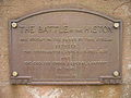 Battle of Hieton plaque.JPG 1,600 × 1,200; 700 KB
-
 Beckford Primary School - geograph.org.uk - 3019422.jpg 640 × 480; 87 KB
-
 BellCollegeHamilton.JPG 1,200 × 1,600; 621 KB
-
 Bent Cemetery - geograph.org.uk - 3080534.jpg 2,304 × 1,728; 1,022 KB
-
 Bent Road - geograph.org.uk - 3080537.jpg 2,304 × 1,728; 1.01 MB
-
 Blantyre Technology Park from the air (geograph 2988862).jpg 640 × 480; 173 KB
-
 Bothwell Road - geograph.org.uk - 2669608.jpg 640 × 480; 269 KB
-
 Bothwell Road roundabout - geograph.org.uk - 3080484.jpg 2,304 × 1,728; 1,019 KB
-
 Brandongate, Hamilton - geograph.org.uk - 2904262.jpg 3,264 × 2,448; 4.39 MB
-
 Brick piers for a conveyor belt - geograph.org.uk - 1750693.jpg 640 × 481; 117 KB
-
 Burnbank and Strathclyde Loch from the air (geograph 5716687).jpg 640 × 480; 244 KB
-
 Burnbank Road, Hamilton - geograph.org.uk - 2903527.jpg 640 × 480; 107 KB
-
 Bus stop and shelter on Burnbank Road (A724) (geograph 6967352).jpg 1,024 × 662; 114 KB
-
 Cadzow bing from the air (geograph 7939857).jpg 1,600 × 900; 701 KB
-
 Cadzow Castle.jpg 1,500 × 1,173; 475 KB
-
 Caird Building - geograph.org.uk - 3080507.jpg 2,304 × 1,728; 999 KB
-
 Caledonian railways building - geograph.org.uk - 1654395.jpg 640 × 480; 74 KB
-
 Car Showrooms Adjacent to A725 - geograph.org.uk - 107086.jpg 640 × 480; 89 KB
-
 Car showrooms, Bothwell Road - geograph.org.uk - 2669602.jpg 640 × 525; 282 KB
-
 Centre of Hamilton - geograph.org.uk - 2668640.jpg 640 × 480; 261 KB
-
 Chriss Avenue - geograph.org.uk - 2469529.jpg 640 × 480; 242 KB
-
 Chriss Avenue - geograph.org.uk - 2469546.jpg 640 × 480; 240 KB
-
 ClimaHamilton.png 773 × 158; 16 KB
-
 Clydesdale Avenue, Eddlewood, Hamilton (geograph 6762898).jpg 1,024 × 768; 192 KB
-
 Co-Operative Store, Hamilton - geograph.org.uk - 3083332.jpg 768 × 576; 102 KB
-
 Come Racing..... - geograph.org.uk - 121368.jpg 640 × 480; 78 KB
-
 David Livingstone's house at Hamilton, Scotland. Lithograph. Wellcome V0018820.jpg 2,200 × 3,327; 3.06 MB
-
 Davie Cooper statue (geograph 6992362).jpg 2,268 × 2,268; 1.56 MB
-
 DavieCooperStatue.jpg 957 × 1,280; 577 KB
-
 Disused Superstore, Hamilton - geograph.org.uk - 105394.jpg 640 × 480; 114 KB
-
 Douglas Chambers - geograph.org.uk - 1470986.jpg 480 × 640; 68 KB
-
 EarnockBurnt.jpg 2,272 × 1,704; 1.54 MB
-
 Eddlewood Public Hall, Hamilton - geograph.org.uk - 98852.jpg 640 × 480; 120 KB
-
 Eddlewood, Hamilton Place - geograph.org.uk - 4705408.jpg 1,024 × 683; 120 KB
-
 Eleganza, Quarry Street - geograph.org.uk - 2668643.jpg 640 × 461; 241 KB
-
 Employment Exchange - geograph.org.uk - 83630.jpg 640 × 480; 147 KB
-
 Flats in Hamilton - geograph.org.uk - 3080447.jpg 2,304 × 1,728; 1.01 MB
-
 Fleming Way - geograph.org.uk - 2470650.jpg 640 × 480; 315 KB
-
 Flooded Underpass at Strathclyde Country Park (geograph 6588465).jpg 1,024 × 768; 420 KB
-
 Frankie & Benny's Hamilton - geograph.org.uk - 3080444.jpg 2,304 × 1,728; 1,016 KB
-
 Hamilton - View SE along Cadzow St - geograph.org.uk - 3743069.jpg 1,024 × 768; 193 KB
-
 Hamilton and Strathclyde Park from the air (geograph 5995114).jpg 1,024 × 768; 460 KB
-
 Hamilton Baptist Church - geograph.org.uk - 365419.jpg 640 × 427; 80 KB
-
 Hamilton Cross - geograph.org.uk - 1470993.jpg 480 × 640; 70 KB
-
 Hamilton from the air (geograph 4601078).jpg 640 × 480; 201 KB
-
 Hamilton from the air (geograph 4601082).jpg 640 × 480; 187 KB
-
 Hamilton from the air (geograph 5379561).jpg 640 × 480; 142 KB
-
 Hamilton from the air (geograph 5716697).jpg 640 × 480; 280 KB
-
 Hamilton from the air (geograph 7939859).jpg 1,600 × 900; 694 KB
-
 Hamilton Golf Course - geograph.org.uk - 410149.jpg 640 × 427; 110 KB
-
 Hamilton High Street.jpg 4,000 × 3,000; 4.41 MB
-
 Hamilton International Technology Park - geograph.org.uk - 96270.jpg 640 × 480; 91 KB
-
 Hamilton Lawn Tennis Club - geograph.org.uk - 3080424.jpg 2,304 × 1,728; 1.02 MB
-
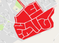
 Hamilton North and East.svg 1,319 × 1,345; 2.63 MB
-
 Hamilton Old Parish Church.jpg 1,816 × 2,157; 1.22 MB
-
 Hamilton Palace nightclub - geograph.org.uk - 3080433.jpg 2,304 × 1,728; 1.01 MB
-

-

-
 Hamilton Parking Lot - geograph.org.uk - 3080418.jpg 2,304 × 1,728; 1 MB
-
 Hamilton Race and Golf Course. - geograph.org.uk - 410143.jpg 640 × 427; 67 KB
-
 Hamilton Retail Park - geograph.org.uk - 1617999.jpg 640 × 480; 61 KB
-
 Hamilton Rugby Football Club Grounds - geograph.org.uk - 107078.jpg 640 × 480; 86 KB
-
 Hamilton South.svg 1,319 × 1,345; 2.63 MB
-
 Hamilton The Top Cross.jpg 640 × 427; 105 KB
-
 Hamilton Water Palace - geograph.org.uk - 3080497.jpg 2,304 × 1,728; 1.02 MB
-
 Hamilton West and Earnock.svg 1,319 × 1,345; 2.63 MB
-
 Hamilton, Beckford Street - geograph.org.uk - 4700229.jpg 1,024 × 683; 158 KB
-
 Hamilton, Low Parks - geograph.org.uk - 4700004.jpg 1,024 × 683; 172 KB
-
 Hamilton; Leisure (geograph 4699995).jpg 1,024 × 683; 125 KB
-
 Hillhouse Road, Hamilton (geograph 6803185).jpg 1,024 × 768; 225 KB
-

-
 House on Union Street, Hamilton - geograph.org.uk - 2905678.jpg 3,264 × 2,448; 3.1 MB
-
 Iceland Hamilton Car-Park - geograph.org.uk - 3080527.jpg 2,304 × 1,728; 1.01 MB
-
 John Carrigans Eating House, Hamilton - geograph.org.uk - 3083327.jpg 2,304 × 1,728; 1.01 MB
-
 Junction of Portland Place and Johnstone Road, Hamilton - geograph.org.uk - 6135216.jpg 1,600 × 1,200; 344 KB
-
 Keepers cottage graffiti.jpg 5,934 × 3,882; 45.75 MB
-
 Keepers cottage south side.jpg 2,855 × 2,855; 10.95 MB
-
 Keepers cottage through the trees.jpg 3,884 × 3,884; 30.27 MB
-
 Keepers cottage up close rear view.jpg 3,807 × 5,848; 31.22 MB
-
 Kinnell House - geograph.org.uk - 3080480.jpg 2,304 × 1,728; 1.01 MB
-

-

-
 Loch Adjacent to Service Station - geograph.org.uk - 15861.jpg 640 × 480; 94 KB
-

-
 Low Waters Road - geograph.org.uk - 2469512.jpg 640 × 480; 268 KB
-
 Low Waters Road, Hamilton (A723) - geograph.org.uk - 1744888.jpg 4,000 × 3,000; 3.56 MB
-
 Low Waters Road, Hamilton - geograph.org.uk - 812886.jpg 640 × 481; 75 KB
-
 M74 flyovers (geograph 7120772).jpg 2,947 × 2,146; 1.16 MB
-
 MapofEarnock.png 1,255 × 922; 207 KB
-
 Masonic Lodge, Hamilton, Lanarkshire. - geograph.org.uk - 3004456.jpg 1,600 × 1,063; 401 KB
-
 May Gardens - geograph.org.uk - 3080510.jpg 2,304 × 1,728; 1.01 MB
-
 McDonald's Clydesdale Street - geograph.org.uk - 3080525.jpg 2,304 × 1,728; 1.01 MB
-
 Meikle Earnock from the air (geograph 2988865).jpg 640 × 480; 167 KB
-
 Mini-Roundabout in Meikle Earnock - geograph.org.uk - 1720069.jpg 640 × 480; 65 KB
-

-
 Morrisons Hamilton - geograph.org.uk - 3080512.jpg 2,304 × 1,728; 1.02 MB
-
 New bridge over an old railway track (geograph 6803163).jpg 1,024 × 768; 362 KB
-
 New Cross Shopping Centre - geograph.org.uk - 3080411.jpg 2,304 × 1,728; 1.02 MB
-
 New Douglas Park from the air - geograph.org.uk - 5717888.jpg 640 × 480; 200 KB
-
 New flats in Hamilton - geograph.org.uk - 3080429.jpg 2,304 × 1,728; 1 MB
-

-
 New houses at Brackenhill above Hamilton (geograph 6762894).jpg 1,024 × 768; 197 KB
-
 OldGrammarSchoolofHamiltonBuilding1800's.jpg 432 × 283; 32 KB
-
 Pedestrianised area of Hamilton - geograph.org.uk - 3080407.jpg 2,304 × 1,728; 1,024 KB
-
 Primark Hamilton - geograph.org.uk - 3080403.jpg 2,304 × 1,728; 1.01 MB
-
 Quarry Place Entrance - geograph.org.uk - 3080410.jpg 2,304 × 1,728; 1.02 MB
-
 Quarry Street - geograph.org.uk - 3427129.jpg 640 × 480; 115 KB
-
 Quarry Street - geograph.org.uk - 3427131.jpg 640 × 420; 106 KB
-
 Quarry Street - geograph.org.uk - 3427135.jpg 640 × 480; 117 KB
-
 Quarry Street - geograph.org.uk - 3427150.jpg 640 × 480; 107 KB
-
 Quarry Street - geograph.org.uk - 3427154.jpg 640 × 343; 99 KB
-
 Quarry Street - geograph.org.uk - 3427179.jpg 640 × 386; 86 KB
-
 Quarry Street and Baird's Store - geograph.org.uk - 3080412.jpg 2,304 × 1,728; 1,018 KB
-
 Quarry Street at Kemp Street - geograph.org.uk - 3427142.jpg 480 × 640; 106 KB
-
 Quarry Street Hamilton (geograph 6992350).jpg 3,120 × 2,650; 1.18 MB
-
 Quarry Street railway bridge - geograph.org.uk - 3427133.jpg 640 × 480; 136 KB
-
 Quarry Street, Hamilton - geograph.org.uk - 2282072.jpg 768 × 576; 205 KB
-
 Red sandstone building on Quarry Street - geograph.org.uk - 3427146.jpg 480 × 640; 126 KB
-
 Restaurant on Burnbank Road (A724) (geograph 6967356).jpg 1,024 × 681; 148 KB
-
 Ross House from the Clyde Walkway - geograph.org.uk - 103898.jpg 520 × 640; 138 KB
-
 Roundabout at Torheads Farm Estate - geograph.org.uk - 2166688.jpg 640 × 481; 70 KB
-

-
 Roundabout on the B755 in Hamilton - geograph.org.uk - 1752390.jpg 4,000 × 3,000; 4.42 MB
-
 Santa Lucia - geograph.org.uk - 2668636.jpg 640 × 373; 208 KB
-
 Scot1975Hamilton.png 200 × 229; 30 KB
-
 Sheiling Hill - geograph.org.uk - 2217815.jpg 3,264 × 1,800; 1.18 MB
-
 Shopping precinct, Hamilton - geograph.org.uk - 1660375.jpg 640 × 480; 80 KB
-
 Shops in Neilsland Road, Hamilton (geograph 6739772).jpg 1,024 × 768; 273 KB
-
 Shops, Fleming Way - geograph.org.uk - 2470647.jpg 640 × 480; 265 KB
-
 Silvertonhill Avenue, Hamilton - geograph.org.uk - 2247486.jpg 640 × 469; 57 KB
-
 Slip road from M74 at junction 6 joining the A723 (geograph 6611917).jpg 1,024 × 768; 265 KB
-
 South Lanarkshire - 2-6 Cadzow Street, Hamilton - 20150714162738.jpg 1,958 × 2,611; 1.1 MB
-
 South Lanarkshire - Cadzow Parish Church, Woodside Walk, Hamilton - 20230519134427.jpg 4,000 × 3,000; 3.79 MB
-
 South Lanarkshire - Douglas Chambers, 1-3 Keith Street, Hamilton - 20150714162423.jpg 1,958 × 2,611; 1.12 MB
-
 South Lanarkshire - St Andrews Parish Church, Avon Street, Hamilton - 20230519134613.jpg 4,000 × 3,000; 3.66 MB
-
 South Lanarkshire - Vogue Social Club, Keith Street, Hamilton - 20150714163119.jpg 1,814 × 1,360; 608 KB
-

-
 Southbound M74, Hamilton (geograph 4032509).jpg 640 × 480; 254 KB
-
 St. Johns Primary School - geograph.org.uk - 3080531.jpg 2,304 × 1,728; 1.01 MB
-
 Strathclyde Fire Brigade - geograph.org.uk - 108249.jpg 640 × 480; 79 KB
-
 Swing Park and Grassed Area - geograph.org.uk - 3083335.jpg 2,304 × 1,728; 1.01 MB
-
 The Jock Stein Centre from the air - geograph.org.uk - 5716713.jpg 640 × 480; 273 KB
-
 The M74 Junction 6 (Hamilton) from the air (geograph 5719064).jpg 640 × 480; 205 KB
-
 The Peacock and Ivy, Hamilton (geograph 6967365).jpg 800 × 551; 79 KB
-
 The Post-Office annual Glasgow directory (1880) (14742876166).jpg 1,856 × 2,988; 1.41 MB
-
 The Watson Fountain, Hamilton - geograph.org.uk - 2345606.jpg 512 × 640; 69 KB
-
 Tower Block UK photo cl2-32 (Hamilton Wyler 1982).jpg 2,602 × 1,737; 837 KB
-
 Tower Block UK photo cl2-33 (Hamilton Almada 1983).jpg 2,602 × 1,731; 806 KB
-
 Town Hall, New Cross, Hamilton.jpg 450 × 705; 163 KB
-
 Townhill Road - geograph.org.uk - 2470641.jpg 640 × 480; 284 KB
-
 Townhill Terrace, Hamilton - geograph.org.uk - 4212777.jpg 640 × 480; 54 KB
-

-

-
 Trinity2007-2009.jpg 320 × 240; 13 KB
-
 University of the West of Scotland (geograph 5878432).jpg 1,024 × 768; 132 KB
-
 University of the West of Scotland - geograph.org.uk - 3080493.jpg 2,304 × 1,728; 1,009 KB
-

-
 Victoria Cross Memorial (geograph 4302788).jpg 499 × 640; 80 KB
-
 Vogue Building - geograph.org.uk - 3080423.jpg 2,304 × 1,728; 1.02 MB
-
 Vue Hamilton - geograph.org.uk - 3080437.jpg 2,304 × 1,728; 1,012 KB
-
 Watson Fountain, Hamilton.jpg 2,614 × 3,486; 1.78 MB
-
 Wellhall Road, Hamilton - geograph.org.uk - 1723232.jpg 640 × 480; 77 KB
-
 Westerpark Avenue, Hamilton (geograph 6803171).jpg 1,024 × 683; 208 KB
-
 William Drive, Eddlewood, Hamilton (geograph 6762899).jpg 1,024 × 768; 209 KB
-
 Wyler Tower (geograph 3427139).jpg 640 × 463; 124 KB
-
 Cadzow Oaks - geograph.org.uk - 261624.jpg 640 × 480; 158 KB
-

-
 Hamilton - geograph.org.uk - 441024.jpg 640 × 427; 88 KB
-
 Hamilton Low Parks - geograph.org.uk - 710097.jpg 640 × 567; 74 KB
-


.jpg)


.jpg)


.jpg)


.jpg)

_(geograph_6967352).jpg)
.jpg)


.jpg)


.jpg)


.jpg)


.jpg)


.jpg)
.jpg)
.jpg)
.jpg)
.jpg)


.jpg)
.jpg)


.jpg)


_-_geograph.org.uk_-_1744888.jpg)

.jpg)


.jpg)


.jpg)


.jpg)


.jpg)


_(geograph_6967356).jpg)


.jpg)


.jpg)


.jpg)


_from_the_air_(geograph_5719064).jpg)
.jpg)
_(14742876166).jpg)

.jpg)
.jpg)


.jpg)


.jpg)


.jpg)


.jpg)
.jpg)
.jpg)


