Category:Gotō Islands
|
日本語: 五島列島(ごとうれっとう)
Asturianu: Isles Gotō · Azərbaycanca: Qoto adaları · Deutsch: Gotō-Inseln · English: Gotō Islands · Español: Islas Gotō · Français : Îles Gotō · 한국어: 고토 열도 · Italiano: Isole Gotō · Polski: Gotō · Русский: Острова Гото · Svenska: Gotōöarna · Tiếng Việt: Quần đảo Gotō · Українська: Острови Ґото · 中文:五島列島 · |
 |
Japanese islands    | |||||
| Upload media | |||||
| Instance of | |||||
|---|---|---|---|---|---|
| Located in protected area | |||||
| Location | Nagasaki Prefecture, Japan | ||||
| Located in or next to body of water | |||||
| Has part(s) | |||||
| Highest point |
| ||||
| Population |
| ||||
| Area |
| ||||
 | |||||
Subcategories
This category has the following 20 subcategories, out of 20 total.
*
F
H
K
- Kabashima (Goto) (7 F)
M
- Maps of the Gotō Islands (12 F)
N
R
- Route 384 (Japan) (2 F)
S
- Saganoshima (22 F)
- Shimayamajima (Gotō) (2 F)
U
W
Ō
- Ōshima (Ojika, Nagasaki) (3 F)
Media in category "Gotō Islands"
The following 31 files are in this category, out of 31 total.
-
 Baramon - Nagasaki kite 2023 Jan 26 11-44AM.jpeg 4,032 × 3,024; 3.24 MB
-
 Baramondako Kite.jpg 3,240 × 4,320; 5.89 MB
-
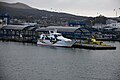
 Ferryhisaka Kiguchikisen.jpg 4,928 × 3,264; 5.27 MB
-
 Ferryocean Gotoryokakusen.jpg 8,256 × 5,504; 24.58 MB
-
 Goto island - panoramio.jpg 4,896 × 3,672; 3.91 MB
-
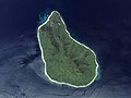
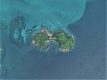
 Goto Islands ISS065.jpg 1,500 × 2,000; 197 KB
-
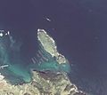
 Hime-shima Island Nagasaki prefecture Aerial photograph.jpg 1,426 × 1,224; 1.39 MB
-
 HISAKASIMA ORIGAMI IMG 8052.JPG 5,472 × 3,648; 7.52 MB
-

-
 Kazurashima Island Goto, Nagasaki Aerial photograph.2014.jpg 2,385 × 1,788; 2.23 MB
-
 Kirinokojima aerial photograph.2014.jpg 836 × 627; 551 KB
-
 Koguro-jima Island Ojika, Nagasaki Aerial photograph.2014.jpg 822 × 537; 153 KB
-
 Kuroshima Island Ojika, Nagasaki Aerial photograph.2014.jpg 1,911 × 1,248; 550 KB
-
 Kushijima Island, Nagasaki Aerial photograph.2014.jpg 2,883 × 2,162; 2.03 MB
-
 Maeshima Island Goto, Nagasaki Aerial photograph.2010.jpg 2,330 × 1,748; 1.21 MB
-
 Mushima Island Ojika, Nagasaki Aerial photograph.2014.jpg 1,647 × 1,075; 623 KB
-
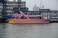
 Newtaiyou Gotoryokakusen.jpg 2,400 × 1,603; 460 KB
-
 Noshima Island Ojika, Nagasaki Aerial photograph.2014.jpg 1,870 × 1,222; 649 KB
-
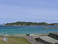
 OjikaIslands.jpg 2,048 × 1,536; 1.37 MB
-
 Oushima Oushimakaiun.jpg 8,256 × 5,504; 22.29 MB
-
 Rokuro-shima Island.jpg 3,648 × 2,736; 3.81 MB
-
 Sazaejima Island, Nagasaki, Goto Aerial photograph.2014.jpg 2,458 × 1,844; 695 KB
-
 Seagull Newtaiyo.jpg 4,928 × 3,264; 4.99 MB
-
 Shugenjima Island, Nagasaki Aerial photograph.2014.jpg 2,996 × 2,246; 2.13 MB
-
 Soleil Kiguchikisen.jpg 8,256 × 5,504; 22.37 MB
-
 Soleil1 Kiguchikisen.jpg 4,928 × 3,264; 5.68 MB
-
 Terashima Island Uku Sasebo, Nagasaki Aerial photograph.2016.jpg 5,165 × 3,719; 4.65 MB
-
 Tsuburajima Island, Nagasaki, Goto Aerial photograph.2014.jpg 2,495 × 1,871; 1.49 MB
-
 Uujima Island Ojika, Nagasaki Aerial photograph.2014.jpg 1,450 × 1,088; 456 KB
-
 Warabikojima.jpg 1,752 × 1,569; 318 KB
-
 Yaburogi Island Aerial photograph.2014.jpg 1,420 × 1,065; 423 KB


