Category:Fugloy
island   | |||||
| Upload media | |||||
| Instance of | |||||
|---|---|---|---|---|---|
| Part of | |||||
| Location | Fugloy Municipality, Norðoyar | ||||
| Located in or next to body of water | |||||
| Capital | |||||
| Highest point |
| ||||
| Population |
| ||||
| Area |
| ||||
| Elevation above sea level |
| ||||
| Different from | |||||
| official website | |||||
 | |||||
Subcategories
This category has the following 3 subcategories, out of 3 total.
Media in category "Fugloy"
The following 22 files are in this category, out of 22 total.
-
 Detailed map fugloy 2006.jpg 690 × 646; 160 KB
-
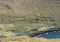
 Faroe Islands, Fugloy, Hattarvik (01a), Uppi í Húsi.jpg 4,032 × 1,830; 2.01 MB
-
 Faroe Islands, Fugloy, Hattarvik (01b), Uppi í Húsi.jpg 1,578 × 1,112; 890 KB
-
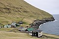 Faroe Islands, Fugloy, Hattarvik (03), Uppi í Húsi.jpg 4,288 × 2,848; 2.65 MB
-
 Faroe Islands, Fugloy, Hattarvík (02), Uppi í Húsi.jpg 4,288 × 2,848; 2.94 MB
-
 Faroe stamp 351 fugloy.jpg 447 × 309; 38 KB
-
 Fuglejagt ved Fuglø i Færøerne (DNT-118379).jpg 2,619 × 1,785; 2.95 MB
-
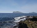
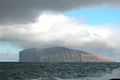 Fugloy, Faroe Islands.JPG 2,560 × 1,704; 892 KB
-
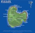 Fugloy-map.jpg 571 × 529; 77 KB
-
 Fugloy-stamp.jpg 448 × 304; 54 KB
-
 FugloyarKommunaKort.png 688 × 1,035; 18 KB
-
 FugloyMap.jpg 567 × 526; 64 KB
-
 Färöer Fugloy 1.JPG 3,444 × 2,586; 5.85 MB
-
 Färöer Fugloy 2.JPG 3,444 × 2,586; 5.3 MB
-
 Färöer Fugloy 3.JPG 3,444 × 2,586; 5.17 MB
-
 Färöer Svinoy & Fugloy.JPG 3,444 × 2,586; 5.91 MB
-
 Kirkja, Faroe Islands (4).JPG 2,560 × 1,704; 2.39 MB
-
 Kirkja, Fugloy, Faroe Islands, 1988.jpg 1,799 × 1,219; 327 KB
-
 Loading a boat at Hattarvík.png 1,244 × 1,800; 2.65 MB
-
 Map-position-fugloyar-kommuna-2005.png 600 × 800; 24 KB
-
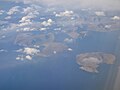 Northeast Faroe Islands 2011.jpg 3,648 × 2,736; 1.81 MB
-
 Position of Fugloy on Faroe map.png 688 × 1,035; 19 KB

,_Uppi_í_Húsi.jpg)
,_Uppi_í_Húsi.jpg)
,_Uppi_í_Húsi.jpg)
,_Uppi_í_Húsi.jpg)

.jpg)


.JPG)


