Category:Free State
Provinces of South Africa: Eastern Cape · Free State · Gauteng · KwaZulu-Natal · Limpopo · Mpumalanga · Northern Cape · North West · Western Cape
province of South Africa    | |||||
| Upload media | |||||
| Instance of | |||||
|---|---|---|---|---|---|
| Location | RSA | ||||
| Capital | |||||
| Legislative body |
| ||||
| Executive body |
| ||||
| Head of government |
| ||||
| Inception |
| ||||
| Highest point |
| ||||
| Population |
| ||||
| Area |
| ||||
| Elevation above sea level |
| ||||
| Replaces |
| ||||
| official website | |||||
 | |||||
Subcategories
This category has the following 17 subcategories, out of 17 total.
Media in category "Free State"
The following 90 files are in this category, out of 90 total.
-
 FS prov coa.jpg 480 × 380; 65 KB
-
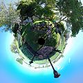
 4FKtZan.jpg 2,764 × 2,073; 419 KB
-
 AA signs with distances between Free State towns shown in miles.jpg 1,600 × 1,200; 348 KB
-
 Aerial view of river in Koffiefontein, South Africa (from north) - panoramio.jpg 3,072 × 2,304; 2.36 MB
-
 Aerial view of River in Koffiefontein, South Africa - panoramio.jpg 3,072 × 2,304; 1.94 MB
-
 Boulders on the foot of Rensburgkop, Appin farm - panoramio.jpg 1,600 × 1,071; 555 KB
-
 Campus of the Central University of Technology.jpg 1,742 × 974; 327 KB
-
 Cattle herder in the Free State, South Africa.jpg 2,048 × 803; 1 MB
-
 Dam View - panoramio.jpg 3,312 × 1,924; 1.53 MB
-
 Daspoort - panoramio (1).jpg 2,592 × 1,936; 1.99 MB
-
 Daspoort - panoramio.jpg 2,592 × 1,936; 2.03 MB
-
 Filiose.jpg 3,000 × 4,000; 4.39 MB
-
 Flamingo Pan - panoramio.jpg 1,600 × 1,068; 539 KB
-
 Flamingo Pan yacht club - panoramio (1).jpg 1,600 × 1,066; 583 KB
-
 Flamingo Pan yacht club - panoramio.jpg 1,600 × 1,071; 527 KB
-
 FM Tower, Bloemfontein - panoramio.jpg 1,463 × 2,048; 295 KB
-
 Free State National Botanical Garden - Bloemfontein.jpg 4,608 × 3,456; 5.63 MB
-
 Free State National Botanical Garden.jpg 3,456 × 4,608; 5.59 MB
-
 Grey college.png 152 × 190; 40 KB
-
 Groenhoek Guest Farm - panoramio.jpg 1,600 × 1,200; 876 KB
-
 Heilbron.jpg 3,000 × 4,000; 3.7 MB
-
 Hells Hoogte - panoramio.jpg 1,600 × 1,200; 496 KB
-
 Home - panoramio (7).jpg 2,048 × 2,048; 643 KB
-
 JAGUARS ROCK OR ALSO KNOWN AS E-TYPES ROCK.jpg 2,592 × 3,888; 1.39 MB
-
 JFKHöhne photo web.jpg 1,194 × 1,589; 182 KB
-
 Kakebeenwa.jpg 2,988 × 5,312; 2.67 MB
-
 Kimberley. Christian Brother's College (NBY 441084).jpg 3,600 × 2,319; 2.21 MB
-
 Koppie Alleen.jpg 593 × 440; 48 KB
-
 Lea Manor Dam - panoramio.jpg 1,600 × 1,200; 714 KB
-
 Lea Manor House - panoramio.jpg 1,600 × 1,200; 737 KB
-
 Lea Manor Water Tank - panoramio.jpg 1,600 × 1,200; 803 KB
-
 Lea Nanor Flat - panoramio.jpg 1,600 × 1,200; 798 KB
-
 Naledi, South Africa - panoramio (2).jpg 2,592 × 1,936; 1.67 MB
-
 Naledi, South Africa - panoramio (4).jpg 3,264 × 2,448; 3.06 MB
-
 Naledi, South Africa - panoramio (5).jpg 3,264 × 2,448; 2.94 MB
-
 Naledi, South Africa - panoramio (6).jpg 9,154 × 2,944; 6.19 MB
-
 Naledi, South Africa - panoramio (7).jpg 3,264 × 2,448; 2.67 MB
-
 National Anthem of the OFS.jpg 2,532 × 3,326; 2.05 MB
-
 Near the eye of Rhinosterrivier at Rhino Heritage Park , Petrus Steyn.jpg 4,000 × 3,000; 6.49 MB
-
 Oaklands Country Manor - panoramio.jpg 1,600 × 1,071; 581 KB
-
 On the road in South Africa 25.jpg 3,498 × 2,332; 11.33 MB
-
 On the road in South Africa 29.jpg 3,888 × 2,592; 12.72 MB
-
 On the road in South Africa 30.jpg 3,888 × 2,592; 14.38 MB
-
 On the road in South Africa 31.jpg 3,580 × 2,387; 9.94 MB
-
 On the road in South Africa 34.jpg 3,877 × 2,585; 9.84 MB
-
 On the road in South Africa 35.jpg 3,888 × 2,592; 9.32 MB
-
 On the road in South Africa 37.jpg 3,880 × 1,551; 4.93 MB
-
 On the road in South Africa 38.jpg 3,884 × 1,887; 5.17 MB
-
 On the road in South Africa 40.jpg 2,766 × 1,844; 8.75 MB
-
 Pastor of the church in an informal settlement near Parys, Free State.jpg 1,365 × 2,048; 3.76 MB
-
 PZSL1889Plate54.png 1,809 × 2,968; 5.07 MB
-
 PZSL1889Plate55.png 2,958 × 1,913; 4.01 MB
-
 Qwaqwa-Mountain Range.jpg 4,080 × 3,060; 8.69 MB
-
 R711 tussen Clarens en Fouriesburg, oos-Vrystaat.jpg 4,000 × 2,382; 6.05 MB
-
 Rensburgkop - panoramio.jpg 1,071 × 1,600; 575 KB
-
 Rensburgkop boulders, Appin farm - panoramio.jpg 1,065 × 1,600; 590 KB
-
 Rensburgkop covered in smoke - panoramio.jpg 1,066 × 1,600; 577 KB
-
 Rensburgkop, Appin farm - panoramio.jpg 1,600 × 1,067; 574 KB
-
 Rustfontein Dam - panoramio.jpg 1,600 × 1,200; 533 KB
-
 Scenery in the Free State.jpg 2,048 × 1,365; 1.75 MB
-
 SepapusHueh Border Post - panoramio.jpg 3,072 × 2,304; 1.37 MB
-
 Shell Garage near Bloemfontein - panoramio.jpg 1,944 × 2,592; 690 KB
-
 South Africa-Free State-Cattle01.jpg 800 × 600; 70 KB
-
 Speech by Bobby.jpg 4,000 × 3,000; 4.89 MB
-
 Stateway leading into the CBD.jpg 1,792 × 1,344; 598 KB
-
 Stereopgraphic Panorama - panoramio.jpg 1,775 × 1,775; 1.66 MB
-
 SterkfonteinDam-2006.jpg 788 × 582; 57 KB
-
 Sunset in the Free State.jpg 1,280 × 960; 165 KB
-
 Take the road, leave the rail - panoramio.jpg 1,200 × 1,600; 861 KB
-
 The wall- Holhoek - panoramio.jpg 1,944 × 2,592; 1.81 MB
-
 Venue Sight.jpg 960 × 1,280; 218 KB
-
 View after a veld fire - panoramio.jpg 1,600 × 1,071; 542 KB
-
 View east with approaching veld fire from KZN - panoramio.jpg 1,600 × 901; 521 KB
-
 View north from Oaklands Country Manor - panoramio.jpg 1,600 × 902; 565 KB
-
 View over Flamingo Pan with airport in background - panoramio.jpg 1,600 × 1,067; 596 KB
-
 Visuals at the venue.jpg 1,280 × 960; 171 KB
-
 Voorspoed industrial area.jpg 2,560 × 1,841; 1,002 KB
-
 Vrede Church - panoramio.jpg 768 × 1,024; 383 KB
-
 Vredefort dome - Vaal River - panoramio.jpg 2,048 × 1,536; 1.26 MB
-
 Vredefort dome - world heritage site - panoramio.jpg 2,048 × 1,536; 1.47 MB
-
 Vrystaat N1.JPG 4,608 × 3,456; 2.87 MB
-
 Vrystaat Rest.JPG 4,608 × 3,456; 3.06 MB
-
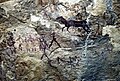
 Witkoppen Lodge Bushmen paintings.jpg 3,564 × 2,395; 11.5 MB
-
 Witkoppen Lodge Guided horseback rides.jpg 3,425 × 2,569; 4.32 MB
-
 Witkoppen Lodge Interior.jpg 3,425 × 2,569; 6.5 MB
-
 Witkoppen Lodge Sandstone mountain.jpg 3,566 × 2,397; 4.89 MB
-
 Witkoppen Lodge Spacious Room.jpg 3,425 × 2,283; 6.5 MB
-
 Witkoppen Reserve rock art.jpg 3,564 × 2,395; 11.5 MB
-
 Witpan camping - panoramio.jpg 1,600 × 900; 596 KB
-
 Zastron, South Africa - panoramio.jpg 3,264 × 2,448; 1.66 MB


_-_panoramio.jpg)


.jpg)


.jpg)


.jpg)


.jpg)


.jpg)
.jpg)
.jpg)
.jpg)


.jpg)