Category:Foxe Basin
large bay north of Hudson Bay in Nunavut, Canada  | |||||
| Upload media | |||||
| Instance of | |||||
|---|---|---|---|---|---|
| Named after | |||||
| Location | Nunavut, Canada | ||||
| Located in or next to body of water |
| ||||
| Has part(s) | |||||
| Significant event |
| ||||
| Width |
| ||||
| Length |
| ||||
| Area |
| ||||
| Inflows |
| ||||
 | |||||
Media in category "Foxe Basin"
The following 54 files are in this category, out of 54 total.
-
 1 Walross 2002.jpg 918 × 611; 59 KB
-
 10 Walross 2001.jpg 880 × 597; 65 KB
-
 11 Walross 2001.jpg 861 × 546; 56 KB
-
 12 Walross 2001.jpg 882 × 622; 87 KB
-
 13 Walross 1999.jpg 922 × 594; 46 KB
-
 14 Walross 2001.jpg 920 × 601; 46 KB
-
 15 Walross 2001.jpg 907 × 576; 78 KB
-
 16 Walross 2001.jpg 888 × 541; 64 KB
-
 17 Walross 1999.jpg 874 × 1,309; 89 KB
-
 18 Walross 1999 cropped.jpg 861 × 984; 255 KB
-
 18 Walross 1999.jpg 865 × 1,291; 102 KB
-
 19 Walross 2002.jpg 1,055 × 707; 135 KB
-
 2 Walross 1999.jpg 890 × 622; 52 KB
-
 24 Walross 2001.jpg 866 × 952; 118 KB
-
 3 Walross 2001.jpg 920 × 602; 97 KB
-
 4 Walross 2001.jpg 921 × 601; 86 KB
-
 5 Walross 1999.jpg 909 × 579; 55 KB
-
 6 Walross 1999.jpg 891 × 613; 59 KB
-
 7 Walross 1999.jpg 918 × 611; 64 KB
-
 9 Walross 2001.jpg 920 × 601; 50 KB
-
 Bird Sanctuaries of Nunavut.jpg 732 × 646; 226 KB
-
 Canadian Arctic - Envisat.jpg 926 × 893; 232 KB
-
 Canadian Arctic ESA204883.tiff 926 × 893; 4.48 MB
-
 Canadian Arctic ESA232484.tiff 1,512 × 2,428; 4.64 MB
-
 Canadian Arctic.jpg 1,512 × 2,428; 1.63 MB
-
 Cloud Streets over Foxe Basin (MODIS 2021-11-04).jpg 4,865 × 3,888; 13.46 MB
-
 Foleyisland.png 320 × 329; 12 KB
-
 Foxe Basin (MODIS 2019-08-16).jpg 5,630 × 4,772; 12.77 MB
-
 Foxe Basin and Baffin Island (MODIS 2024-09-01).jpg 3,217 × 2,665; 1.51 MB
-
 Foxe Basin to Cumberland Sound, Canada (MODIS 2018-09-06).jpg 3,051 × 2,800; 1.31 MB
-
 Foxe Basin, Canada.jpg 1,024 × 864; 996 KB
-
 Foxe Basin’s Scenic Sea Ice (153149 - oli2 20240715 lrg).jpg 5,777 × 3,851; 7.59 MB
-
 Foxe Basin’s Scenic Sea Ice (153149 - zm1 oli2 20240715 lrg).jpg 1,189 × 793; 451 KB
-
 Foxe Basin’s Scenic Sea Ice (153149 - zm2 oli2 20240715 lrg).jpg 1,614 × 1,076; 620 KB
-
 Foxe.jpg 1,400 × 1,800; 655 KB
-
 FoxeBasinCloseup.png 497 × 543; 19 KB
-
 Grant-Suttie Bay satellite.jpg 853 × 538; 94 KB
-
 Grönlandwal 1-1999.jpg 923 × 603; 58 KB
-
 Grönlandwal 2-1999.jpg 922 × 580; 47 KB
-
 Grönlandwal 3-1999.jpg 921 × 583; 49 KB
-
 Grönlandwal 4-1999.jpg 921 × 589; 37 KB
-
 Grönlandwal 5-1999.jpg 922 × 592; 44 KB
-
 Grönlandwal 6-1999.jpg 874 × 1,360; 44 KB
-
 Ice-free Foxe Basin ESA201308.jpg 1,757 × 1,552; 1.13 MB
-
 Ice-free Foxe Basin ESA201308.tiff 1,757 × 1,552; 6.06 MB
-
 Jensmunkisland.png 320 × 329; 13 KB
-
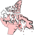
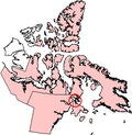
 Map indicating Foxe Basin, Nunavut, Canada.png 360 × 330; 47 KB
-
 Operational Navigation Chart C-11, 2nd edition.jpg 9,254 × 6,640; 19.27 MB
-
 Operational Navigation Chart C-12, 4th edition.jpg 9,254 × 6,705; 17.03 MB
-
 Rowleyisland.png 320 × 329; 13 KB
-
 Sea ice in the Foxe Basin, Nunavut - Canada.jpg 3,508 × 2,540; 3.49 MB
-
 Thawing Ice in Foxe Basin (MODIS 2018-07-20).jpg 2,423 × 2,026; 716 KB
-
 Vansittartisland.png 320 × 329; 12 KB
-
 Whiteisland.png 320 × 329; 12 KB


.jpg)

.jpg)
.jpg)
.jpg)

.jpg)
.jpg)
.jpg)


.jpg)

