Category:Eifel
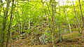
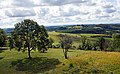
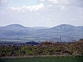
English: The Eifel is a low mountain range in western Germany (North Rhine-Westphalia and Rhineland-Palatinate), East-Belgium and Luxembourg.
Deutsch: Die Eifel ist ein Mittelgebirge in Westdeutschland, Ostbelgien und Luxemburg.
Français : L'Eifel est une région de collines en Allemagne occidentale, dans les cantons de l'Est de Belgique et au Luxembourg.
Nederlands: De Eifel is het oostelijke deel van het middelhoog plateau Eifel-Ardennen in het westen van Duitsland in de deelstaten Noordrijn-Westfalen en Rijnland-Palts. De Eifel ligt ten oosten van België en Luxemburg.
low mountain range in Germany    | |||||
| Upload media | |||||
| Instance of |
| ||||
|---|---|---|---|---|---|
| Made from material | |||||
| Location | |||||
| Length |
| ||||
| Mountain range | |||||
| Highest point | |||||
| Area |
| ||||
| Elevation above sea level |
| ||||
| Different from | |||||
 | |||||
Nederlands: Afbeeldingen van de Eifel is het oostelijke deel van het middelhoog plateau Eifel-Ardennen in het westen van Duitsland in de deelstaten Noordrijn-Westfalen en Rijnland-Palts. De Eifel ligt ten oosten van België en Luxemburg.
Subcategories
This category has the following 46 subcategories, out of 46 total.
- Panoramics in Eifel (48 F)
- Quarries in Eifel (5 F)
A
- Ahrsteig (6 F)
B
C
D
E
H
- Hochwildpark Rheinland (6 F)
- Hüttenbrennen (32 F)
M
N
R
S
- Südeifel (2 F)
T
V
W
Media in category "Eifel"
The following 61 files are in this category, out of 61 total.
-
 (Eifel, 2015) - Flickr - pluggedmind.jpg 3,072 × 2,050; 1.78 MB
-
 086 Bergweiler, WIL - Römerstr 080685.jpg 4,514 × 2,907; 1.24 MB
-
 2014-03-30 10-43-34 RX100 3287 Zerkall A1x2.jpg 3,599 × 1,800; 2.55 MB
-
 2019 Nationalpark Eifel.jpg 1,960 × 2,450; 766 KB
-
 20190608 Naturpark.jpg 4,032 × 1,960; 1.15 MB
-
 20220428131826 522A8183 (1).jpg 4,176 × 2,784; 5.89 MB
-
 20290519 Naturpark Eifel.jpg 1,903 × 996; 771 KB
-
 Burg Pyrmont bei Sonnenaufgang.jpg 5,184 × 3,456; 4.82 MB
-
 Diptere.080421.jpg 850 × 1,068; 96 KB
-
 Eifel (艾费尔山); Attractions, 景點.jpg 2,388 × 3,282; 687 KB
-
 Eifel C S Langbein HStaS J 317 Nr 6 Bild 2.jpg 1,539 × 1,008; 452 KB
-
 Eifel C S Langbein HStaS J 317 Nr 6 Bild 3.jpg 1,541 × 1,102; 534 KB
-
 Eifel snow.JPG 1,184 × 1,792; 501 KB
-
 Eifel south of Mayen.jpg 4,000 × 3,000; 3.77 MB
-
 Eifelkühe - panoramio.jpg 4,032 × 3,024; 11.55 MB
-
 Ein Eifeldorf. Helmuth Linder Russlandalbum. helmuth0021-1.png 2,123 × 1,463; 3.56 MB
-
 ETH-BIB-Friedlaender-Bipolare Bombe, Flugfront, ebendaher (?)-Hs 0625a-0002-062.tif 2,629 × 1,766; 13.34 MB
-
-
 ETH-BIB-Friedlaender-Bipolare Schweissnahtbombe, Kunksköpfe, Eifel-Hs 0625a-0002-072.tif 3,472 × 2,065; 20.58 MB
-
 ETH-BIB-Friedlaender-Bombe mit Kalksteineinschluss als Kern, Eifel-Hs 0625a-0002-071.tif 1,920 × 2,220; 12.26 MB
-
 ETH-BIB-Friedlaender-Kugelige, massive Lavabombe, Eifel-Hs 0625a-0002-070.tif 1,783 × 1,998; 10.25 MB
-

-
 European Networks in der Eifel.JPG 2,448 × 3,264; 4.18 MB
-
 Feld in der Eifel, 2022.jpg 4,592 × 3,448; 7.76 MB
-
 Feld in der Eifel.jpg 4,592 × 3,448; 7.71 MB
-
 Feld in der Vulkanregion Eifel.jpg 4,592 × 3,448; 6.35 MB
-
 FelsAmRundweg.JPG 756 × 425; 388 KB
-
 Geognostische beschreibung der Eifel (IA geognostischebes00stei).pdf 1,177 × 1,643, 176 pages; 12.13 MB
-
 Geopark Vulkaneifel 03.jpg 5,496 × 3,376; 12.07 MB
-
 Geopark Vulkaneifel 04.jpg 6,000 × 3,376; 13.37 MB
-
 Geopark Vulkaneifel Kaltwasser- Geysir in Wallenborn 01.jpg 4,896 × 2,976; 6.67 MB
-
 Geopark Vulkaneifel Kaltwasser- Geysir in Wallenborn 03.jpg 6,000 × 3,376; 8.64 MB
-
 Heimatphotographie 61-1.jpg 1,208 × 800; 439 KB
-
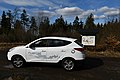 Hyundai ix35 Fuel Cell Vehicle at Hohe Acht mountain range.jpg 5,568 × 3,712; 10.99 MB
-
 Landschaftsschutzgebiet Schild Eifel.jpg 2,496 × 1,664; 3.8 MB
-
 LASB K Hellwig 0144.jpg 7,308 × 5,778; 8.38 MB
-
 LASB K Hellwig 0693.jpg 4,872 × 3,726; 2.64 MB
-
 Magischer Wald.JPG 6,016 × 4,000; 13.09 MB
-
 Mauereidechse am Rursee.JPG 2,762 × 1,368; 901 KB
-
 Meerfelder Maar-Juli 2014.jpg 3,264 × 1,836; 2.6 MB
-
 Michael Emil Sachs - Eifellandschaft mit Kirchdorf 1859.jpg 750 × 533; 104 KB
-
 Michelsberg, Wallfahrtskapelle St. Michael mit Blick auf Mahlberg bei Sonnenuntergang.jpg 4,383 × 2,723; 1.09 MB
-
 Mohnwiese in der Eifel.jpg 4,032 × 2,268; 3.46 MB
-
 Monschau, Mützenich, Eifel-Blick Steling -- 2021 -- 6561.jpg 6,720 × 4,480; 14.32 MB
-
 Moonblumen Eifel, 2022.jpg 4,592 × 3,448; 7.31 MB
-
 Moonblumen Eifel.jpg 4,592 × 3,448; 7.78 MB
-
 NSG Kartsteinhoehle 1.jpg 4,288 × 2,848; 6.18 MB
-
 NSG Kartsteinhoehle 2.jpg 2,848 × 4,288; 6.21 MB
-
 NSG Kartsteinhoehle 3.jpg 2,848 × 4,288; 6.21 MB
-
 Oberdürenbach Burg Olbrück.jpg 5,472 × 3,648; 7.38 MB
-
 Obermaubach 01.jpg 4,032 × 3,024; 3.23 MB
-
 Obermaubach 02.jpg 4,032 × 3,024; 3.56 MB
-
 Papaver rhoeas im Weizenfeld, Eifel (3771089891).jpg 2,560 × 1,920; 2.18 MB
-
 RSG-NASA-250 Ausschnitt mit Umriss.jpg 1,628 × 1,360; 585 KB
-
 Schiefer anstehend.jpg 1,000 × 750; 411 KB
-
 Schlange in der Wacholderheide Lampertstal.jpg 3,008 × 2,000; 809 KB
-
 Sonderzug Diesellok 215 034-0.jpg 3,143 × 1,666; 964 KB
-
 Spaziergängerin mit Hund neben Hochsitz Deutschland 09.png 4,752 × 3,168; 17.51 MB
-
 Uedersdorf Panorama.jpg 4,400 × 1,140; 4.3 MB
-
 Vom Schnee gezeichnete Tannen im Wald bei Bad Münstereifel.jpg 900 × 1,600; 419 KB
-
 Вулканические купола Эйфеля.jpg 2,048 × 1,536; 2.91 MB
_-_Flickr_-_pluggedmind.jpg)


.jpg)


;_Attractions,_景點.jpg)


.jpg)


