Category:Coventry
English: Coventry is a city in the West Midlands of England.
city in the West Midlands in England, UK    | |||||
| Upload media | |||||
| Pronunciation audio | ⓘ | ||||
|---|---|---|---|---|---|
| Instance of |
| ||||
| Location | Coventry, West Midlands, England | ||||
| Official language | |||||
| Head of government |
| ||||
| Founded by | |||||
| Inception |
| ||||
| Population |
| ||||
| Area |
| ||||
| Different from | |||||
| Said to be the same as | Coventry | ||||
| official website | |||||
 | |||||
Subcategories
This category has the following 35 subcategories, out of 35 total.
*
B
- Benchmarks in Coventry (99 F)
C
- Cityscapes of Coventry (52 F)
- Coventry City Farm (7 F)
E
H
K
- Kings Hill Nurseries (11 F)
N
- Night in Coventry (14 F)
P
Q
- Quality images of Coventry (16 F)
R
- River Sowe, Coventry (488 F)
S
- Snow in Coventry (5 F)
T
- Three Spires (23 F)
Media in category "Coventry"
The following 200 files are in this category, out of 290 total.
(previous page) (next page)-
 114-115 Gosford Street Coventry, Medieval house, Grade II listed.jpg 3,220 × 2,724; 1.74 MB
-
 121 - 123 Hermes Crescent, Manor Farm, Coventry.jpg 3,056 × 2,292; 1.08 MB
-
 1940 Jaquard loom by T Wilkinson Ltd Coventry.jpg 5,040 × 5,265; 3.77 MB
-
 25813 three spires 19-02-86 (23770292110).jpg 3,620 × 2,181; 1.67 MB
-
 31-45 Corinthian Place, Manor Farm.jpg 2,292 × 3,056; 937 KB
-
 500px photo (27813313).jpeg 2,048 × 2,048; 601 KB
-
 500px photo (27813319).jpeg 2,044 × 2,048; 828 KB
-
 A429 approaching Coventry (geograph 4937219).jpg 1,024 × 683; 353 KB
-
 Abbey Road, Whitley - geograph.org.uk - 1266156.jpg 640 × 429; 77 KB
-
 Abbey Road, Whitley - geograph.org.uk - 1266160.jpg 640 × 429; 79 KB
-
 Arena Retail Park.jpg 5,152 × 3,864; 7.77 MB
-
 Armstrong Siddeley memento, Parkside - geograph.org.uk - 896383.jpg 640 × 456; 96 KB
-
 Arundel House Coventry (vertical).jpg 3,024 × 4,032; 8.59 MB
-
 Arundel House Coventry.jpg 3,022 × 2,271; 4.01 MB
-
 Ashington Grove, Whitley - geograph.org.uk - 1266154.jpg 640 × 429; 62 KB
-
 Belgrade Plaza hoarding - geograph.org.uk - 1082755.jpg 640 × 480; 99 KB
-
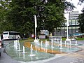
 Belgrade Theatre Coventry fountain Mar 2021.jpg 4,032 × 3,024; 3.71 MB
-
 Benchmark on milestone (geograph 4412914).jpg 2,560 × 1,920; 1.05 MB
-
 Berries (27777762569).jpg 3,648 × 2,736; 5.86 MB
-
 Bluebells Coventry.jpg 6,130 × 4,087; 31.93 MB
-
 Brownshill Green - geograph.org.uk - 1706242.jpg 2,560 × 1,920; 1.03 MB
-
 Buildings near Allesley Hall - geograph.org.uk - 1655916.jpg 640 × 480; 99 KB
-
 Bupa Health Care grafitti.JPG 2,848 × 4,272; 10.66 MB
-
 Bus Gate.jpg 4,032 × 3,024; 2.99 MB
-
 Butchers Row in Coventry, 1890-1920.jpg 1,070 × 1,600; 1.38 MB
-
 Canley Way Coventry Nov 2011.jpg 960 × 637; 192 KB
-
 Carved medieval bosses on St Marys Guildhall Gatehouse.jpg 2,920 × 2,725; 1.89 MB
-
 Cattle grazing at Canley Ford - geograph.org.uk - 1525836.jpg 640 × 480; 99 KB
-
 City Village, Bond Street, Coventry (geograph 5568444) (Cropped).jpg 293 × 220; 96 KB
-
 CLANNAD band - Magic scenery - panoramio.jpg 3,264 × 2,448; 1.66 MB
-
 Corinthian Place, Coventry.jpg 3,056 × 2,292; 1.08 MB
-
 Courtyard of St Marys Guildhall Coventry.jpg 2,430 × 2,479; 866 KB
-
 Coventry (14440403090).jpg 2,632 × 1,294; 869 KB
-
 Coventry - 50 And 52, Birmingham Road - 20201017120735.jpg 4,032 × 3,024; 3.71 MB
-
 Coventry - 54 And 56, Birmingham Road - 20201017120809.jpg 4,032 × 3,024; 3.88 MB
-
 Coventry - 58 And 60, Birmingham Road - 20201017120801.jpg 4,032 × 3,024; 3.74 MB
-
 Coventry - 58 And 60, Birmingham Road - 20201017120810.jpg 4,032 × 3,024; 3.45 MB
-
 Coventry - 59, Birmingham Road - 20201017120209.jpg 4,032 × 3,024; 4.21 MB
-
 Coventry - 62 And 64, Birmingham Road - 20201017120816.jpg 4,032 × 3,024; 3.95 MB
-
 Coventry - 79, Birmingham Road - 20201017121015.jpg 4,032 × 3,024; 3.21 MB
-
 Coventry 2 (49679326892).jpg 5,710 × 3,905; 11 MB
-
 Coventry being redeveloped in 1936.jpg 1,956 × 1,056; 253 KB
-
 Coventry Cathedral Through the archered window.jpg 2,310 × 3,052; 994 KB
-
 Coventry Citry Council Chambers.jpg 2,922 × 3,762; 1.6 MB
-
 Coventry City Centre (2020) cropped a bit.jpg 4,892 × 2,259; 2.17 MB
-
 Coventry City Centre Bombing 25 August 1939.jpg 578 × 348; 79 KB
-
 Coventry City Centre UK Christmas Market 2025.jpg 799 × 1,134; 167 KB
-
 Coventry City Centre UK Christmas Market 2025☃️🙂.jpg 3,072 × 4,096; 960 KB
-
 Coventry City Centre UK Christmas Market 2025🎀.jpg 3,072 × 3,854; 1.77 MB
-
 Coventry City Centre UK Christmas Market 2025🎄.jpg 4,096 × 3,072; 1.16 MB
-
 Coventry Corporation Waterworks (22889890773).jpg 2,120 × 2,120; 2.07 MB
-
 Coventry Corpration Waterworks (23257921203).jpg 2,619 × 2,200; 2.12 MB
-
 Coventry Facade (49678506928).jpg 5,219 × 3,462; 4.52 MB
-
 Coventry Godcakes.jpg 2,848 × 2,136; 1.4 MB
-
 Coventry H Waterworks (23676191275).jpg 2,208 × 1,939; 1.35 MB
-
 Coventry Jordan Well (7275429284).jpg 2,880 × 1,623; 1.87 MB
-
Coventry lady Godiva clock.webm 1 min 7 s, 720 × 1,280; 54.65 MB
-
 Coventry Press Line for HFQ.jpg 1,600 × 1,067; 530 KB
-
 Coventry Priory st opposit the Cathedral - panoramio.jpg 2,816 × 2,112; 2.78 MB
-
 Coventry Priory street - panoramio.jpg 2,816 × 2,112; 2.58 MB
-
 Coventry Reflections (9137205002).jpg 3,648 × 2,011; 743 KB
-
 Coventry ring road and station area including Greyfriars Green.jpg 4,160 × 3,120; 2.07 MB
-
 Coventry ring road Hillcross flyover.jpg 5,751 × 3,705; 15.88 MB
-
 Coventry Ringway St Nicholas.jpg 2,000 × 1,500; 223 KB
-
 Coventry store (8318335456).jpg 1,024 × 768; 74 KB
-
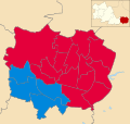
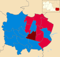 Coventry UK local election 2006 map.svg 1,340 × 1,266; 260 KB
-
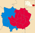
 Coventry UK local election 2012 map.svg 1,340 × 1,266; 260 KB
-
 Coventry UK local election 2014 map.svg 1,340 × 1,266; 260 KB
-
 Coventry UK local election 2015 map.svg 1,340 × 1,266; 260 KB
-
 Coventry UK local election 2016 map.svg 1,340 × 1,266; 260 KB
-
 Coventry UK local election 2019 map.svg 1,340 × 1,266; 260 KB
-
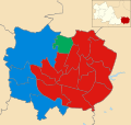
 Coventry UK ward map 2022.svg 1,340 × 1,266; 260 KB
-
 Coventry UK ward map 2023.svg 1,340 × 1,266; 260 KB
-
 Coventry UK ward map 2024.svg 1,340 × 1,266; 260 KB
-
 Coventry University Lanchester Library 2001 Prof Alan Short.jpg 4,938 × 2,502; 3.41 MB
-
 Coventry View, corner from Coundon St., Coundon R. - panoramio.jpg 3,072 × 2,304; 1.09 MB
-
 Coventry Ware, c. 1940.jpg 5,152 × 3,864; 2.84 MB
-
 Coventry, Top Green - geograph.org.uk - 1739798.jpg 480 × 640; 93 KB
-
 Coventry, UK - panoramio (2).jpg 5,472 × 3,648; 5.48 MB
-
 Coventry, UK - panoramio (3).jpg 5,472 × 3,648; 5.68 MB
-
 Coventry, UK - panoramio (4).jpg 5,472 × 3,648; 4.96 MB
-
 Coventry, United Kingdom (Unsplash).jpg 7,360 × 4,912; 37.49 MB
-
Coventry-en GB.ogg 1.5 s; 41 KB
-
 Coventry-London Road - geograph.org.uk - 1225018.jpg 640 × 480; 66 KB
-
 Coventry-London Road - geograph.org.uk - 1225026.jpg 640 × 480; 62 KB
-
 Coventry-Toll Bar End - geograph.org.uk - 1204879.jpg 640 × 480; 73 KB
-
 Coventrys industries public art Coventry.jpg 4,032 × 3,024; 1.65 MB
-
 CreamsCoventry Underwater 1.jpg 2,560 × 1,440; 439 KB
-
 CreamsCoventry Underwater 2.jpg 2,560 × 1,440; 437 KB
-
 CreamsCoventry Underwater 3.jpg 2,560 × 1,440; 455 KB
-
 CreamsCoventry Underwater 4.jpg 2,560 × 1,440; 356 KB
-
 CreamsCoventry Underwater 5.jpg 2,560 × 1,440; 360 KB
-
 CreamsCoventry Underwater 6.jpg 2,560 × 1,440; 416 KB
-
 Daimler Halt BR (M) totem.jpg 2,664 × 747; 274 KB
-
 Daimler heritage marker Coventry Canal plaque.jpg 4,032 × 3,024; 4.14 MB
-
 Daimler heritage marker Coventry Canal.jpg 4,032 × 3,024; 3.07 MB
-
 Day 171 - West Midlands Police - Kickz Project (9091747029).jpg 800 × 581; 158 KB
-

-
 Day 342 - West Midlands Police - Student Laptop safety (8251738935).jpg 3,000 × 2,250; 2.03 MB
-

-
 Day 48 - Coventry Police c.1964 (8476615048).jpg 332 × 500; 76 KB
-
 Details Coventry arch.jpg 4,288 × 2,848; 2.88 MB
-
 Earlsdon Open Gardens (26749850986).jpg 3,648 × 2,736; 3.76 MB
-
 Electric meter -Broomfield Road, Coventry, England-16Jan2014.jpg 3,616 × 2,712; 4.35 MB
-
 Electronic barrier.JPG 2,772 × 4,222; 3.14 MB
-
En-uk-Coventry.ogg 1.1 s; 8 KB
-
 Ethnic demography of Coventry over time.gif 1,200 × 1,134; 407 KB
-
 Ethnic makeup of Coventry by single year ages in 2021.svg 3,467 × 2,309; 45 KB
-
 Factory gateway with no factory - geograph.org.uk - 1555105.jpg 640 × 468; 100 KB
-
 Family festival in the park with inflatables.jpg 4,160 × 3,120; 2.01 MB
-
 Family festival in the park.jpg 4,160 × 3,120; 2.23 MB
-
 Coventry city flag.svg 886 × 531; 33 KB
-
 Flood-meadow north of the Sowe - geograph.org.uk - 1701008.jpg 640 × 427; 403 KB
-
 Flywheel sculpture Coventry reverse.jpg 4,032 × 3,024; 4.7 MB
-
 Flywheel sculpture Coventry.jpg 4,032 × 3,024; 4.79 MB
-
 Four watercolours of Coventry by Sydney John Bunney.jpg 1,232 × 1,829; 665 KB
-
 Frederick George Smyth.jpg 960 × 1,187; 111 KB
-
 Frosty Morning (8199368969).jpg 3,648 × 2,736; 1.36 MB
-
 GadgetShowLive 2.jpg 2,541 × 1,142; 497 KB
-
 Garden building at Park Gardens, Stoney Road, Coventry.jpg 4,896 × 3,672; 6.76 MB
-

-

-
 Gosford Green 1969 + (39974941232).jpg 2,513 × 1,675; 2.59 MB
-
 Gosford Green goods yard (28227562629).jpg 2,592 × 1,728; 3.82 MB
-
 GreenRoof CoventryCentralCoventry.jpg 1,536 × 1,152; 244 KB
-
 GreenRoof InfinityStudentAccommodationCoventry.jpg 2,048 × 1,491; 477 KB
-
 GreenRoof StudentLivingCoventry.jpg 2,048 × 1,536; 413 KB
-
 GreenWall CoventryCentralCoventry.jpg 2,048 × 1,536; 876 KB
-
 GreenWall UniversityofWarwickCoventry.jpg 2,048 × 1,536; 624 KB
-
 Grove Court, Davenport Road - geograph.org.uk - 1800304.jpg 640 × 480; 184 KB
-
 Hearsall Common 10.jpg 3,024 × 4,032; 4.45 MB
-
 Hearsall Common 2.jpg 3,024 × 4,032; 4.07 MB
-
 Hearsall Common 7.jpg 3,024 × 4,032; 4.6 MB
-
 Hearsall Common 8.jpg 3,024 × 4,032; 3.92 MB
-
 Hearsall Common Edges 9.jpg 3,024 × 4,032; 4.4 MB
-
 Hill Top - geograph.org.uk - 1606356.jpg 640 × 428; 80 KB
-
 Hill Top and St Michael's spire - geograph.org.uk - 950916.jpg 499 × 640; 99 KB
-
 Hutchison (H3G) only 3G site on the outskirts of Coventry, off Fletchamsted Highway.jpg 3,072 × 4,080; 1.39 MB
-
 Jugendstil shops.jpg 2,640 × 2,488; 1.12 MB
-

-
 Kenilworth - Clement House - panoramio.jpg 3,456 × 2,304; 3.07 MB
-
 Lady Godiva nameplate from LMS Patriot 4-6-0 No.5519.jpg 3,545 × 1,050; 556 KB
-
 Lane to Canley Ford - geograph.org.uk - 1742747.jpg 480 × 640; 99 KB
-
 Lewes Ladies 1 Coventry City 1 27 Apr 2014. 439 (13890474378).jpg 1,809 × 1,425; 380 KB
-
 Lock Gates sculpture Coventry.jpg 4,032 × 3,024; 6.32 MB
-
 London Road Cemetery, Coventry.jpg 3,648 × 2,736; 4.31 MB
-
 Mary and Jesus statue Coventry detail.jpg 4,032 × 3,024; 2.69 MB
-
 Mary and Jesus statue Coventry.jpg 4,032 × 3,024; 5.17 MB
-

-
 Mattress in Coventry July 29 2021.jpg 4,624 × 3,472; 6.6 MB
-
 MI130 Coventry Crest.svg 512 × 560; 1.4 MB
-
 Middleborough Terrace doorway detail - geograph.org.uk - 1570176.jpg 800 × 600; 102 KB
-
 Middleborough Terrace doorways - geograph.org.uk - 1570168.jpg 489 × 640; 99 KB
-
 Milestone beside Kenilworth Road (geograph 4937113).jpg 683 × 1,024; 262 KB
-
 Milestone, Kenilworth Road (geograph 5209270).jpg 640 × 480; 165 KB
-
 Milestone, Kenilworth Road (geograph 6343918).jpg 800 × 600; 135 KB
-
 Millennium Commission Lottery Project sign.JPG 3,674 × 2,713; 4.54 MB
-
 Mini Daleks, Redemption 13.jpg 3,264 × 2,448; 3.56 MB
-
 Mobile Phone Mast, Coventry. - panoramio.jpg 1,536 × 2,048; 430 KB
-
 Mod Pizza, Cathedral Lanes, Coventry (50378191206).jpg 4,032 × 3,024; 4.65 MB
-
 Nando's barrier.JPG 4,245 × 1,901; 3.26 MB
-
 Nando's sign (bw).JPG 2,738 × 4,202; 4.12 MB
-
 Nando's sign.JPG 2,718 × 4,190; 6.63 MB
-
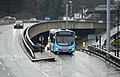
 National Express Coventry - Bendy-bus - 6018 (16758510737).jpg 4,288 × 3,216; 3.27 MB
-
 National Express Coventry - bus (16778177378).jpg 4,288 × 3,216; 3.49 MB
-
 Nuneaton and Bedworth District, UK - panoramio (2).jpg 3,648 × 5,472; 5.47 MB
-
 Nuneaton and Bedworth District, UK - panoramio (3).jpg 5,472 × 3,648; 5.27 MB
-
 Nuneaton and Bedworth District, UK - panoramio (7).jpg 5,472 × 3,648; 5.06 MB
-
 Nuneaton and Bedworth District, UK - panoramio (8).jpg 5,472 × 3,648; 4.57 MB
-
 October 1st. This Road will be CLOSED (8043981991).jpg 3,648 × 2,736; 1.18 MB
-
 October 8th. Remnants (8068136620).jpg 3,648 × 2,736; 1.39 MB
-
 Old Hall Performance Ltd HQ.jpg 4,032 × 3,024; 3.4 MB
-
 Old milemarker (geograph 6098432).jpg 600 × 800; 214 KB
-
 Old milemarker by Foleshill, Coventry (geograph 6076424).jpg 600 × 800; 235 KB
-
 Old milemarker by the Coventry Canal, Stoke Heath (geograph 6095583).jpg 480 × 640; 387 KB
-

-
 Old Milestone by the A429, Kenilworth Road, Coventry Parish (geograph 6045249).jpg 1,164 × 1,704; 410 KB
-

-
 Ordnance Survey One-Inch Sheet 72 Birmingham, Published 1921.jpg 11,951 × 8,944; 11.67 MB
-
 Oriel dormitory window at Whitefriars monastery Coventry.jpg 3,740 × 2,490; 2.28 MB
-
 Oxford Canal Fischer.jpg 1,500 × 1,000; 125 KB
-
 Oxfordcanal.jpg 1,360 × 1,020; 759 KB
-
 Pages from Charles Knight's 'Old England- A Pictorial Museum' RMG PY6172-007.tiff 4,008 × 4,744; 54.4 MB
-
 PanoramicGolfcourses Coventry 01.jpg 16,350 × 3,796; 30.3 MB
-
 PanoramicGolfcourses Coventry 02.jpg 10,209 × 3,501; 11.05 MB
-
 PanoramicGolfcourses Coventry 03.jpg 16,350 × 3,786; 22.2 MB
-
 PanoramicGolfcourses Coventry 04.jpg 16,350 × 3,628; 18.9 MB
-
 PanoramicGolfcourses Coventry 05.jpg 13,066 × 3,870; 20.35 MB
-
 Path leading to Priory Row - panoramio.jpg 2,000 × 3,008; 2.38 MB
-
 Pergola UniversityofWarwickCoventry.jpg 1,702 × 1,276; 567 KB
-
 Pickford Grange Farm - geograph.org.uk - 96829.jpg 640 × 480; 92 KB
-
 Pinley-Seven Stars Industrial Estate - geograph.org.uk - 1528628.jpg 640 × 480; 75 KB
-
 Post War Planning and Reconstruction in Britain- Coventry D15515.jpg 690 × 800; 77 KB
-
 Post War Planning and Reconstruction in Britain- Coventry D15516.jpg 786 × 800; 71 KB
-
 Post War Planning and Reconstruction in Britain- Coventry D15521.jpg 786 × 800; 75 KB
-
 Religious make up of Coventry by single year age groups in 2021.svg 3,195 × 2,206; 41 KB
-
 RoofGarden CoventryUniversity.jpg 2,048 × 1,536; 447 KB
-
 RoofGarden GlamorousCoventry.jpg 2,048 × 1,536; 608 KB
-
 RoofGarden InfinityCoventry.jpg 2,048 × 1,536; 532 KB
-
 Scrubland at edge of Cross Point Business Park, Coventry - geograph.org.uk - 1748208.jpg 2,000 × 1,494; 217 KB


.jpg)

.jpeg)
.jpeg)
.jpg)


.jpg)


.jpg)
.jpg)


_(Cropped).jpg)


.jpg)


.jpg)


_cropped_a_bit.jpg)


.jpg)
.jpg)
.jpg)

.jpg)
.jpg)


.jpg)


.jpg)


.jpg)
.jpg)
.jpg)
.jpg)


.jpg)
.jpg)
.jpg)
.jpg)
.jpg)

.jpg)


.jpg)


.jpg)
.jpg)
.jpg)
.jpg)


_only_3G_site_on_the_outskirts_of_Coventry,_off_Fletchamsted_Highway.jpg)


.jpg)


.jpg)
.jpg)
.jpg)


.jpg)

.JPG)

.jpg)
.jpg)
.jpg)
.jpg)
.jpg)
.jpg)
.jpg)
.jpg)

.jpg)
.jpg)
.jpg)
.jpg)
.jpg)
.jpg)


_totem.jpg)