Category:Cotentin
peninsula    | |||||
| Upload media | |||||
| Instance of | |||||
|---|---|---|---|---|---|
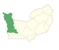
| Location | Manche, Normandy, metropolitan France, France | ||||
| Located in or next to body of water | |||||
 | |||||
Subcategories
This category has the following 2 subcategories, out of 2 total.
N
- Nez de Jobourg (18 F)
T
Media in category "Cotentin"
The following 34 files are in this category, out of 34 total.
-
 06 LeoniTheMare UnellerCoin 810.jpg 810 × 751; 289 KB
-
 2010 Nez de Jobourg, France.jpg 400 × 300; 43 KB
-
 Admiralty Chart No 1106 C. de Flamanville to Is. St. Marcouf, Published 1888.jpg 16,351 × 11,334; 50.14 MB
-
 Arrivée au Fort Vauban de La Hougue depuis Saint Vaast - panoramio.jpg 1,984 × 1,305; 495 KB
-
 Barfleur sca1.jpg 7,712 × 2,516; 7.8 MB
-
 Barfleur, Manche.jpg 2,816 × 2,112; 512 KB
-
 Channel Islands viewed from ISS in 2012, cropped.JPG 1,864 × 1,864; 1.04 MB
-
 Channel Islands viewed from ISS in 2012.JPG 2,832 × 4,256; 3.78 MB
-
 Contentin.png 5,455 × 4,582; 447 KB
-
 Cotentin Peninsula.jpg 1,336 × 1,181; 725 KB
-
 Cotentin.jpg 328 × 515; 88 KB
-
 Embouchure de La Saire près de Jonville - panoramio.jpg 2,417 × 1,731; 1.07 MB
-
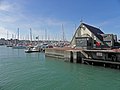 Entrée du port de plaisance de Saint-Vaast-La-Hougue - panoramio.jpg 2,381 × 1,786; 530 KB
-
 Escargot des dunes.JPG 1,728 × 2,304; 1.38 MB
-
 Ile de Tatihou depuis le port de Saint-Vaast-La-Hougue - panoramio.jpg 1,802 × 1,488; 407 KB
-
Jer-Cotentin.ogg 1.1 s; 13 KB
-
 Jobourg - Biville - btv1b53015075c.jpg 8,801 × 12,248; 8.98 MB
-

-
 Le long des fortifications de La Hougue à Saint-Vaast - panoramio (1).jpg 1,984 × 1,488; 964 KB
-
 Le long des fortifications de La Hougue à Saint-Vaast - panoramio (2).jpg 2,381 × 1,647; 1 MB
-
 Le long des fortifications de La Hougue à Saint-Vaast - panoramio.jpg 1,690 × 1,268; 530 KB
-
 Location map of Cotentin.svg 1,487 × 2,356; 156 KB
-
 Lé Cotentîn veu d'Saint Jean Jèrri 2006.jpg 1,566 × 544; 620 KB
-
 Manche department relief location map (cropped).jpg 658 × 846; 153 KB
-
 Maupertus Anse du Brick sca1.jpg 4,272 × 1,437; 3.05 MB
-
 NezduJobourgSentierLittoral.JPG 3,240 × 4,320; 4.71 MB
-
 Nteglisecarteret.JPG 2,560 × 1,714; 1.22 MB
-
 Parc naturel régional des Marais du Cotentin et du Bessin.svg 170 × 279; 7 KB
-
 PaysCotentin.svg 892 × 818; 173 KB
-
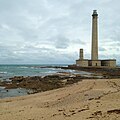 Phare gatteville sca2.jpg 2,448 × 2,448; 2.9 MB
-
 Pièce des Unneli Unelles ERNOUF GUILLAUME.jpg 621 × 651; 139 KB
-
 Périmètre PNR des Marais du Cotentin et du Bessin.png 997 × 818; 681 KB
-
 Ruines de la Ferme de la Cotentine 01.jpg 3,264 × 2,448; 4 MB
-
 Ruines de la Ferme de la Cotentine.jpg 3,264 × 1,952; 4 MB


.jpg)
.jpg)

.jpg)


