Category:Congo Basin
- Congo Basin — the drainage basin/watershed of the Congo River in western West-Central Tropical Africa.
- Location of the Congo Rainforest ecoregion.
basin of the Congo River in West Equatorial Africa  Бассейн реки Конго, центральную часть которого составляет впадина Конго | |||||
| Upload media | |||||
| Instance of | |||||
|---|---|---|---|---|---|
| Location |
| ||||
| Located in or next to body of water | |||||
| Highest point | |||||
| Area |
| ||||
| Drainage basin | |||||
| Different from | |||||
 | |||||
Subcategories
This category has the following 21 subcategories, out of 21 total.
+
G
- Gamagama (2 F)
I
K
- Chutes de Kalambo (3 F)
L
- Lake Mai-Ndombe (12 F)
- Lake Tumba (8 F)
- Lukulu River (24 F)
S
U
Media in category "Congo Basin"
The following 25 files are in this category, out of 25 total.
-
 KONGO1877.JPG 6,137 × 5,393; 5.58 MB
-
 1911French Congo.png 1,348 × 1,360; 1.98 MB
-
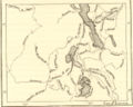
 CartoRef- Bassin du congo.jpg 363 × 300; 130 KB
-
 Congo explorations.jpg 652 × 523; 343 KB
-
 Congo Pedicle map showing neighbouring Zambia.png 412 × 436; 59 KB
-
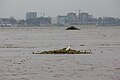
 Fishermen of the Congo Basin 1.jpg 5,184 × 3,456; 6.47 MB
-
 Fishermen of the Congo Basin 3.jpg 5,184 × 3,456; 4.51 MB
-
 Fishermen of the Congo Basin 4.jpg 5,184 × 3,456; 7.93 MB
-
 Fishermen of the Congo Basin 5.jpg 4,000 × 3,000; 2.53 MB
-
 Garcin 2022 Cuvette Centrale.jpg 699 × 692; 209 KB
-
 Gorges de Diosso image.jpg 1,920 × 1,920; 738 KB
-
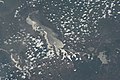 ISS034-E-33973 - View of Tanzania.jpg 4,256 × 2,832; 1.04 MB
-
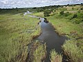
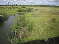 Kanchibya River.jpg 4,000 × 3,000; 3.53 MB
-
 La rivière Lulilaka, parc national de Salonga, 2005.jpg 500 × 344; 39 KB
-
 Lake Kisale NASA.jpg 886 × 600; 181 KB
-
 Les Gorges de Diosso.jpg 1,920 × 1,920; 1.52 MB
-
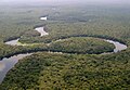
 Lwitikila River 1.jpg 4,000 × 3,000; 4.28 MB
-
 Lwitikila River 2.jpg 4,000 × 3,000; 3.88 MB
-
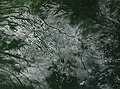 Popcorn Clouds in the Congo Basin (MODIS).jpg 2,967 × 2,205; 1.85 MB
-
 Rafting on the Congo River.jpg 5,184 × 3,456; 4.79 MB
-

-
 Savane et coucher du soleil 2022.jpg 2,448 × 3,264; 1,023 KB
-
 The hills of Kilungutwe village.jpg 1,284 × 1,279; 499 KB
-
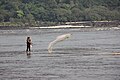 Throwing a cast net.jpg 5,184 × 3,456; 6.11 MB
-
 Zaire AnnaSergejevna hudrograaf.jpg 510 × 370; 49 KB


.jpg)

.jpg)


