Category:Christmas Island
Selected maps are included in the Wikimedia Atlas of Christmas Island.
island and external territory of Australia, located in the Indian Ocean    .jpg)  .svg)   | |||||
| Upload media | |||||
| Audio | ⓘ | ||||
|---|---|---|---|---|---|
| Instance of | |||||
| Part of | |||||
| Named after | |||||
| Location | AUS | ||||
| Located in or next to body of water | |||||
| Capital | |||||
| Highest judicial authority |
| ||||
| Official language | |||||
| Anthem | |||||
| Currency | |||||
| Inception |
| ||||
| Highest point |
| ||||
| Population |
| ||||
| Area |
| ||||
| Elevation above sea level |
| ||||
| Top-level Internet domain | |||||
| Different from | |||||
| official website | |||||
 | |||||
Subcategories
This category has the following 12 subcategories, out of 12 total.
C
G
H
O
P
S
T
Pages in category "Christmas Island"
The following 2 pages are in this category, out of 2 total.
Media in category "Christmas Island"
The following 40 files are in this category, out of 40 total.
-
 'End of the rainbow' Hidden Garden farm at Christmas Island.jpg 1,280 × 720; 325 KB
-
 All eyes on me.jpg 3,894 × 4,868; 6.39 MB
-
 BoNM - Christmas Island (cropped).png 416 × 671; 278 KB
-
 BoNM - Christmas Island.png 1,473 × 959; 1.44 MB
-
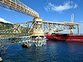 Cantilever Arms (25212638932).jpg 1,024 × 768; 147 KB
-
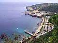
 Christmas Island (5774536659).jpg 4,409 × 2,940; 2.12 MB
-
 Christmas Island (5775114458).jpg 5,616 × 3,744; 7.23 MB
-
 Christmas Island and its capital.svg 150 × 137; 5 KB
-
 Christmas Island banner.jpg 2,100 × 300; 259 KB
-
 Christmas Island Export Treemap (2012).svg 1,240 × 831; 77 KB
-
 Christmas Island Exports Treemap 2017.svg 900 × 900; 107 KB
-
 Christmas Island Golf Course (25192494380).jpg 1,024 × 768; 148 KB
-
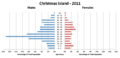 Christmas Island Population Pyramid-2011.png 1,347 × 651; 44 KB
-
 Christmas Island STS007-5-299.JPG 992 × 992; 137 KB
-
 Christmas Island, Naturally.jpg 2,085 × 1,390; 2.09 MB
-
 ChristmasIsland(Australia) FlyingFishCove01.jpg 480 × 360; 49 KB
-
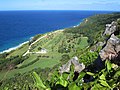
 East Coast of Christmas Island (24935368013).jpg 1,024 × 768; 146 KB
-
 Flag-map of Christmas Island (1952-1958).png 941 × 850; 74 KB
-
 Fleeting fame.jpg 6,000 × 4,000; 7.06 MB
-
 Hastings TG 582 on the coral Chistmas Island Jul 1956.jpg 1,740 × 1,146; 257 KB
-
 Hold of a Ship (25323456636).jpg 1,024 × 768; 149 KB
-
 Japanese Marines in Christmas Island 1942.jpg 800 × 586; 222 KB
-
 Lily-Beach-Christmas-Island-881x588.jpg 881 × 588; 258 KB
-
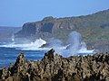
 Limestone Cliffs (25372180932).jpg 1,024 × 768; 146 KB
-
 North East Point (25366256611).jpg 1,024 × 768; 150 KB
-
 Phosphate Conveyor Belt (25064149669).jpg 1,024 × 768; 146 KB
-
 Phosphate Hill Cemetery.jpg 2,048 × 1,536; 2.04 MB
-
 Phosphate Rock (25509053072).jpg 1,024 × 768; 159 KB
-
 Poonsaan1.jpg 1,600 × 1,200; 642 KB
-
 Poonsaan1v2.jpg 1,600 × 1,200; 1.4 MB
-
 Red Crab Migration (25172962299).jpg 1,024 × 768; 149 KB
-
 Road Train (25543202171).jpg 1,024 × 768; 145 KB
-
 Ruins at Old Railway Station.jpg 2,048 × 1,536; 1.76 MB
-
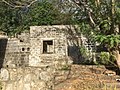 Ruins at The Settlement.jpg 2,048 × 1,536; 1.72 MB
-
 Sky sea.jpg 2,448 × 3,264; 1.01 MB
-
 South Coast of Christmas Island (25376180530).jpg 1,024 × 768; 148 KB
-
 Spar to the beat.jpg 6,000 × 4,000; 11.22 MB
-
 Stage fright.jpg 6,000 × 4,000; 7.21 MB
-
 The first dam ever built on Christmas Island.jpg 1,087 × 960; 346 KB
-
 Watching The Stars.jpg 4,225 × 2,817; 1.59 MB


.png)

.jpg)
.jpg)

.svg)

.jpg)


_FlyingFishCove01.jpg)
.jpg)
.png)


.jpg)


.jpg)
.jpg)
.jpg)

.jpg)


.jpg)
.jpg)


.jpg)


