Category:Chesapeake Bay
- English: The Chesapeake Bay, surrounded by Maryland, and Virginia, in the Middle Atlantic region of the eastern United States.
estuary in the U.S. states of Maryland, Delaware, District of Columbia, and Virginia   | |||||
| Upload media | |||||
| Instance of | |||||
|---|---|---|---|---|---|
| Location | |||||
| Heritage designation |
| ||||
| Length |
| ||||
| Area |
| ||||
| Origin of the watercourse | |||||
| Mouth of the watercourse | |||||
| Basin country | |||||
| Tributary |
| ||||
 | |||||
Subcategories
This category has the following 19 subcategories, out of 19 total.
Media in category "Chesapeake Bay"
The following 200 files are in this category, out of 355 total.
(previous page) (next page)-
De-Chesapeake Bay.ogg 2.1 s; 20 KB
-

-
 141103-A-OI229-005 (15538183399).jpg 5,184 × 3,456; 4.59 MB
-
 15, MD, USA - panoramio.jpg 2,048 × 1,536; 1.23 MB
-
 151204-A-OI229-036 (23494887840).jpg 5,184 × 3,456; 3.72 MB
-
 161006-N-NX690-166 (30127303861).jpg 2,000 × 1,331; 1.03 MB
-

-

-
-

-

-

-

-

-
-

-
-

-
 20171027-AMS-LSC-1109 (37358455464).jpg 7,118 × 4,507; 19.03 MB
-

-

-
-

-

-

-

-

-

-

-

-

-

-

-

-
 330-PS-81-2 (20082528464).jpg 2,691 × 2,200; 1.34 MB
-
 330-PS-84 (USN 707570) (20695833212).jpg 2,364 × 3,036; 1.9 MB
-
 330-PS-84 (USN 707571) (20695827802).jpg 2,144 × 2,712; 1.35 MB
-
 330-PS-84 (USN 707581) (20517088700).jpg 3,016 × 2,416; 2.11 MB
-
 330-PS-84 (USN 707582) (20517083170).jpg 2,972 × 2,432; 2.49 MB
-
 428-GX-K-54430 (26907874986).jpg 1,632 × 1,050; 637 KB
-

-
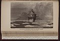
 A - M (Page 81) BHL47093304.jpg 3,100 × 6,115; 5.49 MB
-

-

-

-

-

-

-

-
 American Black Duck (8574371991).jpg 1,200 × 798; 540 KB
-
 An F-35 Lightning II completes a flyover of USS Zumwalt (DDG 1000). (29774535153).jpg 3,000 × 2,357; 2.85 MB
-
 Anchor of Hope Cemetery, landscape (21416361538).jpg 2,592 × 1,944; 1,020 KB
-
 Annapolis, Chesapeake Bay, Lighthouses - DPLA - dd331996c250e9a05e1abf851243eb55.JPG 2,048 × 1,360; 1.23 MB
-
 Annapolis, Chesapeake Bay, Lighthouses - DPLA - f82843c2b377ceb15821b23ee5169960.JPG 2,048 × 1,360; 1.01 MB
-
 ARC-3 Aeolus - DPLA - 79d96d585018e6db4790f63c26949485.jpg 3,150 × 2,527; 3.27 MB
-
 AT HOME ON A CHANNEL MARKER IN CHESAPEAKE BAY - NARA - 548490.jpg 3,000 × 2,007; 621 KB
-
 AT HOME ON A CHANNEL MARKER IN CHESAPEAKE BAY - NARA - 548497.jpg 3,000 × 2,015; 625 KB
-
 ATOP A CHANNEL MARKER IN CHESAPEAKE BAY - NARA - 548493.jpg 3,000 × 2,026; 709 KB
-
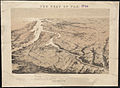 Birds eye view of part of Maryland, Distr of Columbia and part of Virginia (2675386400).jpg 2,000 × 1,467; 2.71 MB
-
 Birds Mill Swamp 1.jpg 640 × 480; 132 KB
-
 Breakwater construction close to completion (21427391111).jpg 3,456 × 2,304; 3.73 MB
-
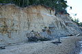 Calvert Cliffs state park, md.jpg 3,872 × 2,592; 4.14 MB
-
 Calvert Cliffs State Park.jpg 1,024 × 680; 499 KB
-
 Calvert Cliffs, Calvert Cliffs State Park.jpg 2,272 × 1,704; 874 KB
-
 Cape Charles harbor - east side of harbor - panoramio.jpg 2,408 × 3,234; 1.74 MB
-
 Cape Charles harbor - north side breakwater - panoramio (1).jpg 3,251 × 2,432; 1.41 MB
-
 Cape Charles harbor - north side breakwater - panoramio.jpg 3,242 × 2,435; 1.88 MB
-
 Cape Charles harbor - south side of harbor - panoramio.jpg 3,246 × 2,425; 1.92 MB
-
 Cape Charles harbor - yacht harbor - panoramio.jpg 3,235 × 2,413; 1.86 MB
-

-

-
 Cape Charles, Virginia - leaving harbor looking north to marker ^1 - panoramio.jpg 3,264 × 2,448; 2.8 MB
-
 Cape Charles, Virginia - leaving harbor looking north to port marker ^3 - panoramio.jpg 3,264 × 2,448; 2.87 MB
-
 Cape Charles, Virginia - leaving harbor looking south to port marker ^3 - panoramio.jpg 3,264 × 2,448; 2.63 MB
-
 Cape Charles, Virginia - leaving harbor looking south-east to gravel plant - panoramio.jpg 3,264 × 2,448; 2.72 MB
-

-
 Car Carrier 001.jpg 4,000 × 3,000; 2.37 MB
-
 Car Carrier 004.jpg 4,000 × 3,000; 1.79 MB
-
 Technical documentation of the regional manure management model for the Chesapeake Bay watershed (IA CAT30935396).pdf 1,135 × 1,587, 60 pages; 5.29 MB
-

-
 Chesapeake Bay (26668862520).jpg 4,271 × 2,837; 4.5 MB
-
 Chesapeake Bay (5816908776) (2).jpg 2,576 × 1,932; 572 KB
-
 Chesapeake Bay - Deck in Downs Park in Pasadena, MD.jpg 6,000 × 4,000; 6.07 MB
-
 Chesapeake Bay - Dissolved oxygen requirements.jpg 1,313 × 985; 166 KB
-
 Chesapeake Bay - Downs Park in Pasadena, MD.jpg 6,000 × 2,731; 1.88 MB
-
 CHESAPEAKE BAY - NARA - 548506.jpg 3,000 × 1,983; 547 KB
-
 CHESAPEAKE BAY - NARA - 548507.jpg 3,000 × 2,038; 659 KB
-
 CHESAPEAKE BAY - NARA - 548508.jpg 2,025 × 3,000; 803 KB
-
 CHESAPEAKE BAY - NARA - 548509.jpg 3,000 × 2,019; 636 KB
-
 CHESAPEAKE BAY - NARA - 548511.jpg 3,000 × 2,036; 620 KB
-
 CHESAPEAKE BAY - NARA - 548512.jpg 3,000 × 2,012; 618 KB
-
 CHESAPEAKE BAY - NARA - 548513.jpg 3,000 × 2,025; 704 KB
-
 CHESAPEAKE BAY - NARA - 548514.jpg 3,000 × 2,028; 716 KB
-
 CHESAPEAKE BAY - NARA - 548516.jpg 2,025 × 3,000; 425 KB
-
 CHESAPEAKE BAY - NARA - 548517.jpg 3,000 × 2,021; 695 KB
-
 CHESAPEAKE BAY - NARA - 548520.jpg 3,000 × 2,020; 563 KB
-
 CHESAPEAKE BAY - NARA - 548521.jpg 2,030 × 3,000; 742 KB
-
 CHESAPEAKE BAY - NARA - 548524.jpg 2,016 × 3,000; 659 KB
-
 CHESAPEAKE BAY - NARA - 548527.jpg 3,000 × 2,048; 663 KB
-
 CHESAPEAKE BAY - NARA - 549409.jpg 3,000 × 2,018; 647 KB
-
 Chesapeake Bay - panoramio (1).jpg 4,369 × 2,455; 4.21 MB
-
 Chesapeake Bay - panoramio.jpg 4,089 × 2,351; 1.97 MB
-
 Chesapeake Bay - Sandy Point Sunshine.jpg 4,032 × 3,024; 2.91 MB
-
 Chesapeake Bay - Sandy Point.jpg 4,608 × 3,456; 3.66 MB
-
 Chesapeake Bay at North Point State Park MD1.jpg 8,648 × 4,816; 38.05 MB
-

-
 CHESAPEAKE BAY AT TWILIGHT - NARA - 549417.jpg 3,000 × 2,027; 500 KB
-
 Chesapeake Bay Belted Kingfisher (26889583806).jpg 4,255 × 2,630; 7.14 MB
-
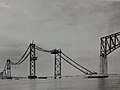 Chesapeake Bay Bridge - DPLA - 94d93fa96912e4f7ebf8660107cf814e.jpg 3,264 × 2,448; 1.8 MB
-
 Chesapeake Bay Bridge from Sandy Point State Park (50982776857).png 3,648 × 2,052; 5.66 MB
-
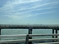
 Chesapeake Bay Bridge Tunnel Trip 01.jpg 3,024 × 4,032; 2.61 MB
-
 Chesapeake Bay Bridge Tunnel Trip 02.jpg 3,024 × 4,032; 1.94 MB
-
 Chesapeake Bay Bridge Tunnel Trip 03.jpg 4,032 × 3,024; 1.8 MB
-
 Chesapeake Bay Bridge Tunnel Trip 04.jpg 3,024 × 4,032; 2.1 MB
-
 Chesapeake Bay Bridge Tunnel Trip 05.jpg 3,024 × 4,032; 2.02 MB
-
 Chesapeake Bay Bridge Tunnel Trip 06.jpg 4,032 × 3,024; 1.99 MB
-
 Chesapeake Bay Bridge Tunnel Trip 07.jpg 4,032 × 3,024; 1.97 MB
-
 Chesapeake Bay Bridge Tunnel Trip 08.jpg 4,032 × 3,024; 2.34 MB
-
 Chesapeake Bay Bridge Tunnel Trip 09.jpg 3,024 × 4,032; 2 MB
-
 Chesapeake Bay Bridge Tunnel Trip 10.jpg 3,024 × 4,032; 2.03 MB
-
 Chesapeake Bay Bridge Tunnel Trip 11.jpg 3,024 × 4,032; 1.94 MB
-
 Chesapeake Bay Bridge Tunnel Trip 12.jpg 4,032 × 3,024; 1.65 MB
-
 Chesapeake Bay Bridge Tunnel Trip 13.jpg 3,024 × 4,032; 1.85 MB
-
 Chesapeake Bay Bridge Tunnel Trip 14.jpg 3,024 × 4,032; 1.52 MB
-
 Chesapeake Bay Bridge Tunnel Trip 15.jpg 3,024 × 4,032; 1.84 MB
-
 Chesapeake Bay Bridge Tunnel Trip 16.jpg 3,024 × 4,032; 1.96 MB
-
 Chesapeake Bay Bridge Tunnel Trip 17.jpg 3,024 × 4,032; 2.13 MB
-
 Chesapeake Bay Bridge Tunnel Trip 18.jpg 4,032 × 3,024; 1.78 MB
-
 Chesapeake Bay Bridge Tunnel Trip 19.jpg 3,024 × 4,032; 2.67 MB
-
 Chesapeake Bay Bridge Tunnel Trip 20.jpg 4,032 × 3,024; 2.01 MB
-
 Chesapeake Bay Bridge Tunnel Trip 22.jpg 4,032 × 3,024; 2.11 MB
-
 Chesapeake Bay Bridge Tunnel Trip 23.jpg 4,032 × 3,024; 2.32 MB
-
 Chesapeake Bay Bridge Tunnel Trip 24.jpg 3,000 × 4,000; 2.22 MB
-
 Chesapeake Bay Bridge Tunnel Trip 25.jpg 4,000 × 3,000; 2.17 MB
-
 Chesapeake Bay Bridge Tunnel Trip 26.jpg 4,000 × 3,000; 2.34 MB
-
 Chesapeake Bay Bridge Tunnel Trip 27.jpg 4,000 × 3,000; 2.63 MB
-
 Chesapeake Bay Bridge Tunnel Trip 28.jpg 4,000 × 3,000; 2.17 MB
-
 Chesapeake Bay Bridge Tunnel Trip 29.jpg 4,000 × 3,000; 2.26 MB
-
 Chesapeake Bay Bridge Tunnel Trip 30.jpg 3,000 × 4,000; 2.39 MB
-
 Chesapeake Bay Bridge Tunnel Trip 31.jpg 2,160 × 3,840; 1.55 MB
-
 Chesapeake Bay Bridge Tunnel Trip 32.jpg 3,840 × 2,160; 1.36 MB
-
 Chesapeake Bay Bridge Tunnel Trip 33.jpg 3,840 × 2,160; 1.55 MB
-
 Chesapeake Bay Bridge Tunnel Trip 34.jpg 3,840 × 2,160; 1.31 MB
-
 Chesapeake Bay Bridge Tunnel Trip 35.jpg 3,840 × 2,160; 1.47 MB
-
 Chesapeake Bay from airplane.jpg 4,032 × 3,024; 1.47 MB
-
 Chesapeake Bay from Fort Monroe seawall.jpg 3,024 × 4,032; 3.99 MB
-
 Chesapeake Bay from Havre de Grace Walking Pier.jpeg 4,032 × 3,024; 2.49 MB
-
 Chesapeake Bay from Perryville Community Park.jpeg 4,032 × 3,024; 3.22 MB
-
 Chesapeake Bay from the Air 2.jpg 3,264 × 2,448; 1.21 MB
-
 Chesapeake Bay from the Air.jpg 3,264 × 2,448; 1.19 MB
-
 CHESAPEAKE BAY MARINA - NARA - 548515.jpg 3,000 × 2,028; 854 KB
-
 CHESAPEAKE BAY MARINA - NARA - 548518.jpg 3,000 × 2,031; 889 KB
-
 CHESAPEAKE BAY MARINA - NARA - 548528.jpg 3,000 × 2,029; 888 KB
-
 CHESAPEAKE BAY MARINA - NARA - 549407.jpg 3,000 × 2,023; 757 KB
-
 CHESAPEAKE BAY SAILING RACE - NARA - 549408.jpg 2,045 × 3,000; 731 KB
-
 Chesapeake Bay sunset, Maryland LCCN2011630543.tif 6,081 × 4,716; 164.12 MB
-
 Chesapeake Bay Sunset.jpg 3,071 × 1,916; 332 KB
-
 Chesapeake Bay, Potomac River (sl2-05-393).jpg 4,240 × 4,242; 4.43 MB
-
 Chesapeake fg03.jpg 800 × 576; 199 KB
-
 Chesapeake fg04.jpg 800 × 626; 252 KB
-
 Chesapeake fg05.jpg 800 × 568; 177 KB
-
 Chesapeake Waterbird Food Web.jpg 565 × 440; 48 KB
-
 Chesapeakeduckblind.jpg 2,877 × 1,406; 1.08 MB
-
 ChesapeakeTidalWetlands.jpg 2,272 × 1,704; 1.1 MB
-
 Chessie, A Chesapeake Bay Story Cover Art.png 638 × 825; 156 KB
-
 Climate March 1298 (34327143146).jpg 1,399 × 2,034; 396 KB
-

-

-
 COAST GUARD RECOVERS A SWAMPED BOAT IN CHESAPEAKE BAY - NARA - 546786.jpg 3,000 × 2,023; 839 KB
-
 COAST GUARD VESSEL MAKING SHARP PORT TURN ON CHESAPEAKE BAY - NARA - 546798.jpg 3,000 × 2,030; 737 KB
-
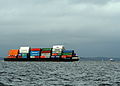 Containers on a barge in the Chesapeake Bay.jpg 2,794 × 1,994; 3.41 MB
-
 Contributed by Linda Cole (8668693941).jpg 4,608 × 3,440; 4.15 MB
-
 Controlled burn at Eastern Neck National Wildlife Refuge (6022724166).jpg 4,000 × 3,000; 1.86 MB
-
 County Dock, Tangier, Virginia.jpg 4,032 × 3,024; 2.72 MB
-
 CRABBING FROM A MARINA DOCK ON CHESAPEAKE BAY - NARA - 548523.jpg 3,000 × 2,024; 675 KB
-

-
 Craighill's channel range or leading lights, Chesapeake Bay-The high light LCCN2005691948.tif 2,785 × 1,937; 15.44 MB
-
-
 Craighill's channel range or leading lights, Chesapeake Bay-The low light LCCN2006678400.tif 2,784 × 1,920; 15.32 MB
-
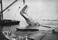 Crashed Martin JRM-1 Hawaii Mars in Chesapeake Bay 1945.jpg 988 × 684; 452 KB
-
 De Grasse (D612) underway in Chesapeake Bay 1981.JPEG 2,727 × 1,975; 2.41 MB
-

-

-

-

-

-

-

-

-
 Defense.gov News Photo 040730-N-6616W-009.jpg 2,000 × 2,800; 977 KB
-
-
 Dobbins island.jpg 3,967 × 1,488; 2.95 MB
-
 Dutchman Point.jpg 4,032 × 3,024; 1.06 MB
-
 Dymer Creek, Chesapeake Bay - panoramio.jpg 4,088 × 2,725; 2.47 MB
-
 Edge Creek Maryland.png 1,910 × 1,000; 2.07 MB
-
 Elk and Bohemia Rivers Plate XLVII WBClark 1898.jpg 2,082 × 1,364; 214 KB
-
 Elk Neck Peninsula 2020.jpg 2,144 × 1,424; 707 KB
-
 Entering the Virginia Eastern Shore - panoramio.jpg 3,264 × 2,448; 922 KB
-
 Entrance to Somers Cove, Crisfield, Maryland - panoramio.jpg 1,710 × 809; 387 KB
-
 Estuary of Chesapeake Bay Plate VII WBClark 1897.jpg 2,253 × 953; 236 KB
_412-DSP-2-StreamsLakes_000142.jpg_-_DPLA_-_fcd0bf016b677e4a982dac356c4bbb73.jpg)
.jpg)

.jpg)
.jpg)


.jpg)


.jpg)
,_seen_from_an_aircraft.jpg)

.jpg)
_(20695833212).jpg)
_(20695827802).jpg)
_(20517088700).jpg)
_(20517083170).jpg)
.jpg)
_FINISHED_8TH_IN_THE..._-_NARA_-_547449.jpg)
_BHL47093304.jpg)
_passing_under_the_Bay_Bridge_during_Cobra_Judy,_an_exercise_to_test_the_seaworthiness_of_the_-_DPLA_-_bb12248c37d758f979fe4f89876dac3d.jpeg)
_and_the_French_destroyer_De_GRASSE_(D-612)_underway_near_Cape_Henry_on_their_way_to_Norfolk._The_ships_participat_-_DPLA_-_b254c9ed37aed0d12474de05b4748b41.jpeg)
_underway_-_DPLA_-_032b38b589dce3cac3c0564d6331664b.jpeg)
_underway_-_DPLA_-_9cf7a91fed5d19223d7f4c7e4d763490.jpeg)
_underway_shortly_after_departing_Baltimore_harbor_-_DPLA_-_c27539d9fef4bcbcc83d089850c971c6.jpeg)
.jpg)
._(29774535153).jpg)
.jpg)


.jpg)

.jpg)


.jpg)


_(The_Journal_of_Geology_V2N6P576).png)
.jpg)
_(2).jpg)


.jpg)


.jpg)

.jpg)

.png)


.jpg)


.jpg)


.jpg)
.jpg)


_underway_in_Chesapeake_Bay_1981.JPEG)


_underway_for_sea_trials_prior_to_its_commissioning_-_DPLA_-_720a3cac5db98320fa1c566e86d1d334.jpeg)
_underway_prior_to_its_commissioning_-_DPLA_-_b54ba500903cfaf36fad966bfe752439.jpeg)