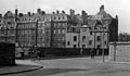
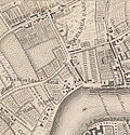
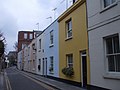
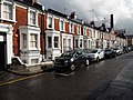
Category:Chelsea, London
area of London and former civil parish  | |||||
| Upload media | |||||
| Pronunciation audio | ⓘ | ||||
|---|---|---|---|---|---|
| Instance of |
| ||||
| Location | Royal Borough of Kensington and Chelsea, Greater London, London, England | ||||
| Located in or next to body of water | |||||
| Population |
| ||||
| Different from | |||||
 | |||||
English: Chelsea is an area of West London, England and part of the Royal Borough of Kensington and Chelsea.
Subcategories
This category has the following 138 subcategories, out of 138 total.
A
- Anderson Street, London (1 F)
- Ashburnham Road, Chelsea (5 F)
B
- Bellville Sassoon (4 F)
- Billing Place (2 F)
- Billing Road (2 F)
- Billing Street (1 F)
- Britten Street (7 F)
- Burnaby Street (9 F)
- Burnsall Street, Chelsea (10 F)
- Bury Walk (6 F)
C
- Cadogan Pier (41 F)
- Cale Street (11 F)
- Caversham Street (1 F)
- Chelsea Bun House (6 F)
- Chelsea Manor Street (21 F)
- Cheltenham Terrace (3 F)
- Cheyne Gardens (7 F)
- Christchurch Street (14 F)
- Christchurch Terrace (4 F)
- Clover Mews (3 F)
- Coulson Street (3 F)
- Crescent Place, London (2 F)
D
- D'Oyley Street (7 F)
- Danube Street, London (2 F)
- Dilke Street (12 F)
- Draycott Place (7 F)
- Durham Place, Chelsea (1 F)
E
- Elm Park Gardens (13 F)
- Elm Park Lane (5 F)
- Elm Park Road (2 F)
- Elm Place (5 F)
- Elystan Street, London (5 F)
- Embankment Gardens (20 F)
- Evelyn Gardens (7 F)
F
- Fountains in Chelsea (7 F)
G
- Godfrey Street, Chelsea (19 F)
- Gunter Grove (11 F)
H
- Halsey Street, London (6 F)
- Hasker Street (3 F)
- Holbein Mews (3 F)
- Hortensia Road (6 F)
I
- Ifield Road (19 F)
- Ixworth Place (19 F)
J
- Justice Walk, London (2 F)
K
L
- The Little Boltons (2 F)
- Lower Sloane Street (28 F)
M
- Milman's Street (2 F)
- Mulberry Walk (3 F)
N
O
- Ormonde Gate (3 F)
P
- Paulton Street (1 F)
- Pavilion Road, London SW1 (23 F)
- Pond Place (4 F)
R
- Radnor Walk (5 F)
S
- St. Loo Avenue (7 F)
- Scotch Corner, London (2 F)
- Selwood Place (3 F)
- Sloane Court East (1 F)
- Sloane Gardens, Chelsea (11 F)
- Swan Walk (22 F)
- Symons Street, London (10 F)
T
- Tregunter Road (6 F)
- Tryon Street (2 F)
U
W
- Walton Street, London (38 F)
- Whiteheads Grove (10 F)
Media in category "Chelsea, London"
The following 102 files are in this category, out of 102 total.
-
De-Chelsea.ogg 1.8 s; 18 KB
-
 Rocque Battersea.png 1,443 × 1,642; 4.52 MB
-
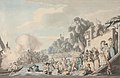
 Contemporary engraving of Blanchard's Balloon Ascent 1784. Wellcome M0010326.jpg 2,792 × 3,942; 2.9 MB
-
 Signed ticket for Blanchard Balloon Ascent 1784. Wellcome M0010325.jpg 3,766 × 2,904; 5.88 MB
-
 Image taken from page 72 of 'Old and New London, etc' (11186990763).jpg 1,892 × 2,213; 1.64 MB
-
 Image taken from page 73 of 'Old and New London, etc' (11186852003).jpg 1,892 × 2,817; 1.92 MB
-
 Image taken from page 102 of 'Old and New London, etc' (11189032025).jpg 1,725 × 1,295; 998 KB
-
 1911 Britannica-Architecture-Chelsea Town Hall.png 497 × 293; 160 KB
-
 383 Kings Road Osteria dell'Arancio, Chelsea, SW10.jpg 3,647 × 2,432; 3.92 MB
-
 477 of 'London, edited by C. K' (11225111493).jpg 1,600 × 1,223; 683 KB
-
 A new and accurate history and survey of London Fleuron T138208-10.png 1,453 × 941; 92 KB
-
 Augustus Edwin Mulready After rain - Chelsea.jpg 2,097 × 2,860; 1.02 MB
-
 Barnklubb Children's Activities, Chelsea copy 2.jpg 3,264 × 2,448; 8.97 MB
-
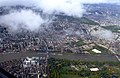 Battersea Park and Chelsea from the air - geograph.org.uk - 2646390.jpg 640 × 415; 132 KB
-
 Cale Street on Sheet 053, Ordnance Survey, 1869-1880.png 3,642 × 1,941; 6.68 MB
-
 Car-thumbnail.JPG 393 × 157; 17 KB
-

-
 Charles James Watson - The Thames at Chelsea - 9193.jpg 2,048 × 1,339; 609 KB
-
 Chelsea - panoramio (1).jpg 3,648 × 2,048; 2.5 MB
-
 Chelsea - panoramio.jpg 3,648 × 2,048; 1.71 MB
-
 Chelsea and Hyde Park from the air - geograph.org.uk - 5074075.jpg 640 × 480; 209 KB
-
 Chelsea Common.jpg 4,032 × 3,024; 9.36 MB
-
 Chelsea from the air - geograph.org.uk - 6080119.jpg 1,024 × 768; 777 KB
-
 Chelsea Old Church and bridge; viewed from Battersea on the Wellcome V0012956.jpg 2,987 × 2,349; 2.72 MB
-
 Chelsea water works.jpg 712 × 502; 119 KB
-
 Chelsea Waterfront 3.jpg 2,592 × 3,456; 1.87 MB
-
 Chelsea Waterworks 1752.jpg 1,551 × 900; 226 KB
-
 Chelsea, England, Spelling Lesson, 1912.JPG 751 × 556; 113 KB
-

-
 Chelsea; viewed from the Surrey bank with boats on the river Wellcome V0012959.jpg 3,350 × 2,136; 3.22 MB
-
 Christmas Tree in Chelsea Farmers Market Sydney Street - geograph.org.uk - 1596807.jpg 3,000 × 4,000; 3.05 MB
-
 Coulson St - geograph.org.uk - 4181487.jpg 640 × 430; 85 KB
-

-
-
 Elm Parks Gardens Chelsea - geograph.org.uk - 2871655.jpg 4,000 × 3,000; 4.17 MB
-
 Elystan Street, SW3, Chelsea (Formerly College St) about 1906.jpg 1,641 × 1,032; 574 KB
-
 Forlorn-hope-p21.png 1,180 × 632; 414 KB
-
 Frontage Chelsea.jpg 4,000 × 2,248; 5.55 MB
-
 G-Wiz -2 28 07 2007 (932064472).jpg 752 × 500; 144 KB
-
 Guatemalan Embassy, London.jpg 2,112 × 2,816; 1.47 MB
-
 Hemus Place, Chelsea - geograph.org.uk - 2956907.jpg 4,000 × 3,000; 1.94 MB
-
 Holy Trinity Sloane Street 552.jpg 640 × 480; 87 KB
-
 Houses in Hans Road, Chelsea.jpg 824 × 1,370; 376 KB
-
 Hugh zoom.jpg 1,522 × 1,161; 944 KB
-

-
 Joking Apart - Marks flat.jpg 2,136 × 2,848; 705 KB
-
 Leto Caffe, London, United Kingdom (Unsplash jjZsHhEtees).jpg 3,252 × 4,691; 5.6 MB
-
 Leto Caffe, London, United Kingdom (Unsplash).jpg 4,694 × 3,456; 6.82 MB
-

-
 London - Chelsea (6254606675).jpg 3,168 × 4,752; 5.15 MB
-
 London - Chelsea (6254652491).jpg 4,752 × 3,168; 4.44 MB
-
 London - Chelsea (6254683169).jpg 4,752 × 3,168; 4.75 MB
-
 London - Chelsea (6254704187).jpg 4,752 × 3,168; 4.08 MB
-
 London - Chelsea (6254833995).jpg 4,752 × 3,168; 6.16 MB
-
 London - Chelsea (6254838317).jpg 4,752 × 3,168; 6.51 MB
-
 London - Chelsea (6254846345).jpg 4,752 × 3,168; 5.75 MB
-
 London - Chelsea (6255185982).jpg 3,168 × 4,752; 4.63 MB
-
 London - Chelsea (6255194720).jpg 4,752 × 3,168; 10.12 MB
-
 London - Chelsea (6255237104).jpg 4,752 × 3,168; 5.3 MB
-
 London - Chelsea (6255366810).jpg 4,752 × 3,168; 6.09 MB
-
 London Chelsea Cale Street geograph-3064292-by-Ben-Brooksbank.jpg 2,394 × 1,416; 1.16 MB
-
 London Chelsea Dovehouse Street geograph-3064248-by-Ben-Brooksbank.jpg 2,394 × 1,399; 1.04 MB
-
 London view SE from Chelsea Hospital for Women geograph-3064390-by-Ben-Brooksbank.jpg 2,179 × 1,447; 1.17 MB
-
 London, UK - panoramio (282).jpg 1,720 × 2,408; 895 KB
-
 Makins St - geograph.org.uk - 4181196.jpg 640 × 430; 82 KB
-

-
 Margaret Chilton Chelsea 2.jpg 768 × 1,024; 289 KB
-
 Memorial to London blitz in Dovecote Green, Chelsea - geograph.org.uk - 4279126.jpg 3,264 × 1,836; 1.43 MB
-

-
 POSTCARD - London, St Mark's College Chelsea, the Smoking Room (50272729226).jpg 1,468 × 926; 733 KB
-
 Recorregut línia 11 bus Londres - 11.jpeg 3,264 × 2,448; 2.64 MB
-
 Redburn Street SW3 - geograph.org.uk - 2752563.jpg 640 × 480; 68 KB
-
 A road-book to old Chelsea (IA roadbooktooldche00stua).pdf 712 × 1,079, 92 pages; 2.84 MB
-

-
 Rocquelittlechelsea.jpg 822 × 855; 361 KB
-
 Shalcomb Street Chelsea - geograph.org.uk - 2984302.jpg 3,264 × 2,448; 1.96 MB
-
 Shawfield Street, eastern side - geograph.org.uk - 3390846.jpg 1,600 × 1,200; 346 KB
-
 Slaidburn Street, Chelsea - geograph.org.uk - 3383272.jpg 4,320 × 3,240; 4.61 MB
-
 Stadium Street - geograph.org.uk - 4598746.jpg 420 × 640; 114 KB
-
 Stadium Street, Chelsea - geograph.org.uk - 4585241.jpg 2,272 × 1,704; 1.01 MB
-
 Stanford 1891 Chelsea bridges.jpg 700 × 474; 145 KB
-
 Stanford 1891 Chelsea bridges.png 700 × 474; 698 KB
-
 Stewarts Grove, Chelsea, London - geograph.org.uk - 3385918.jpg 3,140 × 2,350; 1.5 MB
-
 Stewarts Grove, London - geograph.org.uk - 3556845.jpg 3,264 × 2,448; 3.25 MB
-
 Sunset over Chelsea - geograph.org.uk - 2940069.jpg 640 × 401; 94 KB
-
 Tadema Road, Chelsea - geograph.org.uk - 4585250.jpg 2,272 × 1,704; 924 KB
-
 Tetcott Road - geograph.org.uk - 4220610.jpg 640 × 480; 135 KB
-
 Tetcott Road - geograph.org.uk - 4546515.jpg 1,024 × 768; 216 KB
-
 Tetcott Road, Chelsea - geograph.org.uk - 4585257.jpg 2,272 × 1,704; 932 KB
-
 The life of William Cobbett - written by himself. No 6 by James Gillray.jpg 2,400 × 3,730; 3.1 MB
-
 The Old Dairy, Chelsea - geograph.org.uk - 493823.jpg 640 × 480; 93 KB
-
 The Thames and Chelsea from the air - geograph.org.uk - 3893228.jpg 640 × 480; 168 KB
-
 Theodore Roussel - Roussel-B98197 - Chelsea street.jpg 2,250 × 1,640; 668 KB
-
 Thomas Girtin 'The White House at Chelsea'.jpg 2,048 × 1,183; 144 KB
-
 Upcerne Road - geograph.org.uk - 4546517.jpg 768 × 1,024; 231 KB
-
 Upcerne Road, Chelsea - geograph.org.uk - 4585253.jpg 2,272 × 1,704; 926 KB
-
 Uverdale Road - geograph.org.uk - 4546520.jpg 768 × 1,024; 310 KB
-
 Uverdale Road, Chelsea - geograph.org.uk - 4585252.jpg 2,272 × 1,704; 1.03 MB
-
 King James's College, Chelsea; bird's eye view looking south Wellcome V0012922.jpg 3,728 × 2,478; 4.62 MB
-
 Chelsea viewed from the Surrey bank with boats on the river. Wellcome V0012958.jpg 3,036 × 2,275; 3.08 MB
-
 Chelsea water-works in 1750. Wood engraving by W.P.? Wellcome V0020215.jpg 3,000 × 2,300; 3.2 MB
-
 World's End, 1795.jpg 427 × 534; 453 KB


.jpg)
.jpg)
.jpg)


.jpg)


_-_NARA_-_20809568.jpg)

.jpg)


.jpg)


_about_1906.jpg)


.jpg)


_-_Maunder%27s_Fish_Shop,_Chelsea_-_1951.457_-_Cleveland_Museum_of_Art.jpg)

.jpg)
.jpg)

.jpg)
.jpg)
.jpg)
.jpg)
.jpg)
.jpg)
.jpg)
.jpg)
.jpg)
.jpg)
.jpg)


.jpg)

.jpg)


_(14591707858).jpg)
.jpg)


