<nowiki>Baia del Čaun; baie de Tchaoun; Čaunski zaljev; Badia de Txaun; Tschaunbucht; Tsjaunskajabukta; Čaunas līcis; 恰翁灣; Čaunský záliv; Çaun Körfezi; チャウンスカヤ湾; Bahía Chaunskaya; Chaunskaya Guba; Čaunský záliv; Zatoka Czauńska; Чаунська губа; Tsjaoenbaai; อ่าวชวานสกายา; Çaun körfəzi; Чаунска губа; Tšauninlahti; Chaunskaya Bay; Чаунская губа; Κόλπος Τσαούνσκαγια; خلیج چائون; bahía rusa; Koy; baie russe; baia della Russia; bay of the East Siberian Sea, Russia; خليج في روسيا; záliv Východosibiřského moře v Rusku; Bucht im Kreis in Nordosten Sibiriens; Bahia Chaunskaya; チャウン湾; baie Tchaounskaïa; B. Tchaoun; B. de Tchaoun; Chaunskaya; Chaunskaya B.; Bay of Chaunskaya; B. of Chaun.; B. of Tchaun; Bay of Tchaun; Tchaunskaya Bay; Chaun Bay; Tchaun Bay</nowiki>
Parent categories were assigned using the {{Category Russia}} template. In general, new categories should not be added by hand. The tree of categories is maintained automatically, any human edits may be overridden by bot.
This is the category of the protected area of Russia number 8710040
This template and pages using it are maintained by the Russian WLE team. Please read the guidelines before making any changes that can affect the database!
Subcategories
This category has the following 2 subcategories, out of 2 total.


 TE&II Vol 06 Fig 203.jpg 1,475 × 1,468; 178 KB
 TE&II Vol 06 Fig 203b.jpg 1,440 × 1,230; 155 KB
 Chaunskaya Bay (MODIS on June 5 2001).jpg 900 × 900; 123 KB
 Pevek.jpg 1,600 × 1,200; 1.05 MB
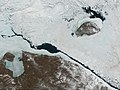 Wrangelisland (cropped).jpg 2,710 × 2,035; 820 KB
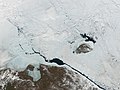 Wrangelisland.jpg 4,000 × 3,000; 1.55 MB
 Чаунская губа.jpg 640 × 428; 172 KB
.jpg)


.jpg)

.jpg)
