Category:Caribbean Sea
Marginal tropical sea of the Atlantic Ocean, located east of Central America, south of the Greater Antilles and north of South America .jpeg)    | |||||
| Upload media | |||||
| Spoken text audio | ⓘ | ||||
|---|---|---|---|---|---|
| Instance of | |||||
| Part of |
| ||||
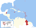
| Location | Caribbean | ||||
| Area |
| ||||
| Elevation above sea level |
| ||||
| Inflows |
| ||||
| Drainage basin |
| ||||
| Basin country |
| ||||
| Different from | |||||
 | |||||
Subcategories
This category has the following 28 subcategories, out of 28 total.
A
- Caribbean Sea in art (13 F)
B
C
- Cabo Catoche (8 F)
- Caribbean Current (4 F)
G
I
N
P
R
S
T
Y
- Yucatan Channel (8 F)
Media in category "Caribbean Sea"
The following 200 files are in this category, out of 296 total.
(previous page) (next page)-
 2 islands on the horizon line - Flickr - aagay.jpg 6,880 × 2,259; 15.61 MB
-
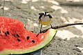
 2011 03 Half Moon Cay Bananaquit Coereba flaveola 7056.jpg 5,880 × 4,060; 10.54 MB
-
 2011 03 Half Moon Cay Bananaquit Coereba flaveola 7062.jpg 3,888 × 2,592; 4.6 MB
-
 2011 03 Half Moon Cay Coereba flaveola Bananaquit 7057.jpg 5,880 × 4,060; 10.46 MB
-
 2011 03 Sunset at Sea 6524.jpg 3,888 × 1,935; 3.17 MB
-
 50 Shades Of Blue (187611681).jpeg 2,048 × 1,834; 912 KB
-

-

-

-
 After Golden SunSet - panoramio.jpg 4,320 × 3,240; 2.4 MB
-
 Amerikanisches Mittelmeer NASA World Wind Globe.jpg 1,600 × 1,050; 753 KB
-
 AS09-21-3314 (21729210589).jpg 4,400 × 4,600; 1.51 MB
-
 AS09-21-3321 (21925793861).jpg 4,400 × 4,600; 865 KB
-
 AS09-21-3322 (21916068405).jpg 4,400 × 4,600; 885 KB
-
 AS09-22-3343 (21412049884).jpg 4,400 × 4,600; 1.17 MB
-
 AS09-22-3344 (21846997518).jpg 4,400 × 4,600; 1.16 MB
-
 AS09-22-3347 (21413699733).jpg 4,600 × 4,400; 1.57 MB
-
 AS09-22-3348 (21413699503).jpg 4,600 × 4,400; 1.62 MB
-
 AS09-22-3349 (22008658436).jpg 4,400 × 4,600; 1.11 MB
-
 AS09-22-3350 (22034857275).jpg 4,400 × 4,600; 1.52 MB
-
 AS09-22-3351 (21846995978).jpg 4,400 × 4,600; 1.52 MB
-
 AS09-22-3352 (22008657666).jpg 4,400 × 4,600; 1.52 MB
-
 AS09-22-3468 (21847876329).jpg 4,400 × 4,600; 1.38 MB
-
 AS09-22-3469 (21846617980).jpg 4,400 × 4,600; 1.35 MB
-
 AS09-22-3470 (22044697171).jpg 4,400 × 4,600; 1.24 MB
-
 AS09-22-3471 (22044697011).jpg 4,600 × 4,400; 1.54 MB
-
 AS09-22-3472 (22008595396).jpg 4,400 × 4,600; 1.02 MB
-
 AS09-22-3473 (21847875199).jpg 4,400 × 4,600; 1.07 MB
-
 AS09-22-3474 (21846933688).jpg 4,400 × 4,600; 1.12 MB
-
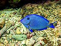 Atlantic Blue Tang (Acanthurus coeruleus).jpg 2,048 × 1,536; 4.61 MB
-
 Atlantik 2022.jpg 5,152 × 3,864; 5.42 MB
-
 Atlantski ocean 2022.jpg 5,152 × 3,864; 5.34 MB
-
 Aves Ridge - panoramio.jpg 4,320 × 3,240; 4.02 MB
-
 Barracks Road, Belize City, 1975 - Our front yard - 01.jpg 5,192 × 4,141; 8.87 MB
-
 Broad Area of Showers in Eastern Caribbean Sea (CIRA 2022-10-28 - labels).gif 1,920 × 1,080; 128.27 MB
-
Broad Area of Showers in Eastern Caribbean Sea (CIRA 2022-10-28 - labels).webm 3.2 s, 1,920 × 1,080; 11.33 MB
-
 Broad Area of Showers in Eastern Caribbean Sea (CIRA 2022-10-28 - nolabels).gif 1,920 × 1,080; 130.97 MB
-
Broad Area of Showers in Eastern Caribbean Sea (CIRA 2022-10-28 - nolabels).webm 3.2 s, 1,920 × 1,080; 11.6 MB
-
 Broad Area of Showers in Eastern Caribbean Sea (CIRA 2022-10-28).png 1,920 × 1,080; 4.03 MB
-
 Brooding Caribbean Sunrise 5707.jpg 5,184 × 3,456; 8.67 MB
-
 Brooding Caribbean Sunrise 6630.jpg 5,184 × 3,456; 8.05 MB
-
 Brooding Caribbean Sunrise 6666.jpg 5,134 × 3,423; 7.24 MB
-
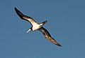
 Brown booby Sula leucogaster in Flight 0609.jpg 3,676 × 2,455; 3.02 MB
-
 Brown Booby Sula leucogaster Off St Maarten 6882.jpg 3,888 × 2,592; 2.99 MB
-
 Brown Booby Sula leucogaster Off St Maarten 6885.jpg 3,888 × 2,592; 3.3 MB
-
 Brown Booby Sula leucogaster Off St Maarten 6886.jpg 3,042 × 2,102; 2.23 MB
-
 Campo de corrientes en el mar Caribe.jpg 711 × 328; 106 KB
-
 Cancún 1986 04.jpg 1,057 × 704; 491 KB
-
 Cancún 1986 05.jpg 953 × 609; 437 KB
-
 Caribbean Dark Sunrise 6619.jpg 3,349 × 4,359; 6.61 MB
-
 Caribbean Island Sunrise 5706.jpg 5,184 × 3,456; 13.49 MB
-
 Caribbean Island Sunrise 5715.jpg 5,184 × 3,456; 8.69 MB
-
 Caribbean Island Sunrise 5750.jpg 5,168 × 2,860; 1.73 MB
-
 Caribbean Sea (Unsplash).jpg 5,616 × 3,744; 14.45 MB
-
 Caribbean Sea - Long Exposure.jpg 4,997 × 2,700; 6.73 MB
-
 Caribbean sea - panoramio (3).jpg 1,600 × 1,200; 539 KB
-
 Caribbean Sea - Venezuelan Basin - panoramio.jpg 4,320 × 3,240; 3.75 MB
-
Caribbean Sea coralbleaching 2023273.webm 9.2 s, 1,920 × 1,080; 3.44 MB
-
 Caribbean Sunrise 5705.jpg 5,184 × 3,456; 7.75 MB
-
 Caribbean Sunrise 5712.jpg 3,222 × 2,879; 4.42 MB
-
 Caribbean Sunrise 5715.jpg 2,943 × 1,943; 2.17 MB
-
 Caribbean Sunrise 6302.jpg 5,116 × 3,410; 8.55 MB
-
 Caribbean sunrise and dramatic cloudscape.jpg 5,176 × 2,504; 1.15 MB
-
 Caribbean Sunset 6665.jpg 5,096 × 2,726; 5.5 MB
-
 CaribbeanCocoaDamselfishJG.jpg 1,500 × 1,500; 887 KB
-
 CaribMask 2023 (53160392139).jpg 6,466 × 4,704; 5.02 MB
-
 CARIFTA and the rest of the Commonwealth Caribbean 1971-1972.png 2,000 × 1,600; 219 KB
-
 Cayo Blanco (1983) 01.jpg 1,062 × 709; 405 KB
-
 Cerros1.jpg 3,036 × 1,989; 1.85 MB
-
 Chatham Beach, South Coast, Trinidad and Tobago 2.JPG 4,320 × 3,240; 5.55 MB
-
 Chatham Beach, South Coast, Trinidad and Tobago 3.JPG 4,320 × 3,240; 5.63 MB
-
 Chatham Beach, South Coast, Trinidad and Tobago.JPG 4,320 × 3,240; 5.56 MB
-
 Chinese Fan Palm Livistona chinensis Berries, St. Kitts 5237.jpg 3,168 × 2,588; 6.82 MB
-
 Clouds Flow Over the Cayman Islands and Caribbean Sea (CIRA 2024-02-21 - labels).gif 1,920 × 1,080; 231.2 MB
-
Clouds Flow Over the Cayman Islands and Caribbean Sea (CIRA 2024-02-21 - labels).webm 6.0 s, 1,920 × 1,080; 15.07 MB
-
 Clouds Flow Over the Cayman Islands and Caribbean Sea (CIRA 2024-02-21 - nolabels).gif 1,920 × 1,080; 236.45 MB
-
Clouds Flow Over the Cayman Islands and Caribbean Sea (CIRA 2024-02-21 - nolabels).webm 6.0 s, 1,920 × 1,080; 15.49 MB
-
 Clouds Flow Over the Cayman Islands and Caribbean Sea (CIRA 2024-02-21).png 1,920 × 1,080; 3.49 MB
-
 Coast Guard Cutter Dauntless with Stars.jpg 4,151 × 2,762; 2.65 MB
-

-

-

-

-
 Coconut Palms St lucia 0105.jpg 3,456 × 4,893; 14.99 MB
-
 Colombia Desembocadura del rio Sinu en el mar Caribe.jpeg 2,448 × 3,264; 1.03 MB
-
 Colombia Desembocadura del río Sinú en el mar Caribe.jpeg 3,264 × 2,448; 807 KB
-
 Colombia's La Guajira Peninsula on the Caribbean Sea (iss073e0379768).jpg 8,256 × 5,504; 8.21 MB
-
 Conchfritter.jpg 1,080 × 1,080; 272 KB
-
 Coral cluster near Roatán Honduras.jpeg 3,840 × 2,160; 1.51 MB
-
 CROEM Caribbean vista 2007.jpg 600 × 450; 36 KB
-
 Croquis de la Bahía de Ponce, PR (6A-JPG).jpg 1,022 × 752; 135 KB
-
 Croquis de la Bahía de Ponce, Puerto Rico (6B-PNG).png 1,022 × 752; 40 KB
-
 Croquis de la Bahía de Ponce, Puerto Rico (6C-SVG).svg 990 × 765; 16 KB
-
 Cruise Ship Azura 6679.jpg 3,888 × 2,592; 5 MB
-
 Cruise Ship Azura approaching St Maarten.jpg 3,888 × 2,592; 5.76 MB
-
 Cruise Ship Caribbean Sunrise 2014.jpg 5,088 × 3,044; 7.64 MB
-
 Cruise Ship Celebrity Solstice.jpg 3,555 × 1,494; 3.5 MB
-
 Cruise Ship Celebrity Summit against Grenada Sunset.jpg 2,588 × 1,487; 3.03 MB
-
 Cruise Ship Celebrity Summit.jpg 3,888 × 2,592; 5.28 MB
-
 Cruise Ship View of Sunrise 5277.jpg 5,184 × 3,456; 7.11 MB
-
 Cruise Ship Wake 5850.jpg 3,456 × 5,184; 9.6 MB
-
 Cuba 3.jpg 960 × 720; 28 KB
-
 Cubacayorosario01.jpg 884 × 605; 93 KB
-
 Cueva del Indio, sea view on the cave, March 17th 2018.jpg 1,440 × 1,080; 260 KB
-
 Dominican Republic - panoramio (40).jpg 4,913 × 3,456; 2.23 MB
-
 El mar de Tulum.jpg 3,264 × 2,448; 1.79 MB
-
Es-Mar Caribe-article.ogg 13 min 51 s; 9.67 MB
-
 Festival nacional de gaitas Francisco Llirene.png 720 × 452; 472 KB
-
 Fishing at Mayaro 40.JPG 2,272 × 1,704; 1.94 MB
-
 Fishing at Mayaro Bay 20.JPG 2,272 × 1,704; 1.91 MB
-
 Flat Point Tide Pools, Saba, with St. Eustatius in the distance.jpg 1,707 × 2,603; 1.44 MB
-
 Florida Sunrise 33.jpg 1,560 × 1,011; 1.07 MB
-
 HEARING TO CONSIDER 6 TREATIES (IA gov.gpo.fdsys.CHRG-107shrg81051).pdf 1,275 × 1,650, 38 pages; 351 KB
-
 Gymnothorax miliaris.jpg 2,048 × 1,536; 5.52 MB
-
 Gymnothorax miliaris2.jpg 2,048 × 1,536; 6.13 MB
-
 Hawksbill Sea Turtle (Eretmochelys imbricata).jpg 2,048 × 1,536; 5.3 MB
-
 Hermod at Cassia A and Cassia B platforms, offshore Trinidad.jpg 2,272 × 1,704; 1.09 MB
-
 Hernan Vasquez.jpg 2,984 × 1,184; 2.8 MB
-
 HNLMS Groningen interdicts suspected drug runner in Caribbean Sea (6459899).jpg 1,600 × 739; 122 KB
-
 Hurricane Gilbert in the Caribbean Sea (2268-387).jpg 2,000 × 1,455; 496 KB
-
 Hurricane Maria in the Caribbean Sea (CIRA 2017-09-20 - ir5).png 1,729 × 1,096; 2.78 MB
-
 Hurricane Maria in the Caribbean Sea (CIRA 2017-09-20 - labels).gif 1,920 × 1,080; 160.8 MB
-
Hurricane Maria in the Caribbean Sea (CIRA 2017-09-20 - labels).webm 7.0 s, 1,920 × 1,080; 6.26 MB
-
Hurricane Maria in the Caribbean Sea (CIRA 2017-09-20 - nolabels portrait).webm 7.0 s, 1,080 × 1,920; 6.07 MB
-
 Hurricane Maria in the Caribbean Sea (CIRA 2017-09-20 - nolabels).gif 1,920 × 1,080; 161.69 MB
-
Hurricane Maria in the Caribbean Sea (CIRA 2017-09-20 - nolabels).webm 7.0 s, 1,920 × 1,080; 6.44 MB
-
 Hurricane Maria in the Caribbean Sea (CIRA 2017-09-20 - vis1 zoomed).png 1,299 × 910; 296 KB
-
 Hurricane Maria in the Caribbean Sea (CIRA 2017-09-20 - vis1).png 1,729 × 1,096; 1.53 MB
-
 In Flight (17622231646).jpg 4,608 × 3,456; 2.65 MB
-
 Inshore Forage Fish, prob anchovies, Grenada.jpg 3,888 × 2,592; 10.75 MB
-
 Jsc2021e019119 - Cuba, the Bahamas and southern Florida from ISS.jpg 8,217 × 3,134; 3.17 MB
-
 KARIBI.jpg 5,152 × 3,864; 4.99 MB
-
 Karipsko more.jpg 5,152 × 3,864; 4.7 MB
-
 King's Wharf 2, San Fernando, Trinidad and Tobago.JPG 4,320 × 3,240; 5.55 MB
-
-
 Lay Down And Breathe (187298149).jpeg 1,333 × 2,048; 1.01 MB
-
 Lisa Organizes, Pushes West in Caribbean Sea (CIRA 2022-11-01 - labels).gif 1,920 × 1,080; 135.4 MB
-
Lisa Organizes, Pushes West in Caribbean Sea (CIRA 2022-11-01 - labels).webm 7.9 s, 1,920 × 1,080; 5.43 MB
-
 Lisa Organizes, Pushes West in Caribbean Sea (CIRA 2022-11-01 - nolabels).gif 1,920 × 1,080; 125.85 MB
-
Lisa Organizes, Pushes West in Caribbean Sea (CIRA 2022-11-01 - nolabels).webm 7.9 s, 1,920 × 1,080; 5.63 MB
-
 Lisa Organizes, Pushes West in Caribbean Sea (CIRA 2022-11-01).png 1,920 × 1,080; 1.22 MB
-
 Little Tobago.JPG 3,669 × 2,064; 2.97 MB
-
 Mapa de la Bahía de Ponce, Puerto Rico, por Eugene Ellicott en 1898 (DP6).jpg 9,873 × 8,332; 58.5 MB
-
 Mar Caribe - panoramio.jpg 3,264 × 2,448; 4.05 MB
-
 Mar caribe a la orilla de mis ojos.jpg 4,160 × 3,120; 7.51 MB
-
 Mar caribe.jpg 2,048 × 1,536; 774 KB
-
 Marine sediment in Guadeloupe (Atlantic side).jpg 7,430 × 9,111; 20.58 MB
-
 Mariner of the Seas and Green Rocks.jpg 2,982 × 2,419; 1.72 MB
-
 Mer des Caraïbes.jpg 629 × 348; 235 KB
-
 Metate de basalto del Área Intermedia.jpg 2,048 × 1,536; 1.06 MB
-
 MIEMBROS DE CARICOM.jpg 4,096 × 3,038; 765 KB
-
 Montañas y Mar caribe.jpg 1,069 × 802; 212 KB
-
 Mt. Gimie.jpg 2,288 × 1,712; 753 KB
-
 Muelle en Playa el Yaque en Margarita.JPG 2,560 × 1,920; 676 KB
-
 Mysterious Ocean - panoramio.jpg 4,320 × 3,240; 3.76 MB
-
 Nemirno Karipsko more.jpg 5,152 × 3,864; 4.85 MB
-
 Nowegian Dawn sunset 1.jpg 3,264 × 2,448; 3.31 MB
-
 Nowegian Dawn sunset 2.jpg 3,264 × 2,448; 3.29 MB
-
 Nowegian Dawn sunset 3.jpg 3,264 × 2,448; 2.29 MB
-
 Nowegian Dawn sunset 4.jpg 3,264 × 2,448; 3.19 MB
-
 Ocean and Sky.jpg 5,124 × 3,417; 13.49 MB
-
 P1220081-A view of the beach at Sandals, Negril (205033139).jpg 2,048 × 1,536; 448 KB
-
 Playacar en Playa del Carmen.jpg 4,160 × 3,120; 2.12 MB
-
 Posse do Governador Jerônimo (52600309788).jpg 768 × 1,024; 152 KB
-
 Potential Tropical Cyclone Nine Forms in the Caribbean Sea (CIRA 2024-09-23 - labels).gif 1,920 × 1,080; 152.69 MB
-
Potential Tropical Cyclone Nine Forms in the Caribbean Sea (CIRA 2024-09-23 - labels).webm 4.3 s, 1,920 × 1,080; 7.12 MB
-
Potential Tropical Cyclone Nine Forms in the Caribbean Sea (CIRA 2024-09-23 - nolabels portrait).webm 4.3 s, 1,080 × 1,920; 3.99 MB
-
 Potential Tropical Cyclone Nine Forms in the Caribbean Sea (CIRA 2024-09-23 - nolabels).gif 1,920 × 1,080; 156.92 MB
-
Potential Tropical Cyclone Nine Forms in the Caribbean Sea (CIRA 2024-09-23 - nolabels).webm 4.3 s, 1,920 × 1,080; 7.09 MB
-
 Potential Tropical Cyclone Nine Forms in the Caribbean Sea (CIRA 2024-09-23).png 1,920 × 1,080; 2.98 MB
-
 Potential Tropical Cyclone Nine Organizes in Caribbean Sea (CIRA 2024-09-23 - labels).gif 1,920 × 1,080; 127.16 MB
-
Potential Tropical Cyclone Nine Organizes in Caribbean Sea (CIRA 2024-09-23 - labels).webm 3.1 s, 1,920 × 1,080; 10.02 MB
-
 Potential Tropical Cyclone Nine Organizes in Caribbean Sea (CIRA 2024-09-23 - nolabels).gif 1,920 × 1,080; 129.79 MB
-
Potential Tropical Cyclone Nine Organizes in Caribbean Sea (CIRA 2024-09-23 - nolabels).webm 3.1 s, 1,920 × 1,080; 9.15 MB
-
Potential Tropical Cyclone Nine Organizes in Caribbean Sea (CIRA 2024-09-23 - portrait).webm 3.1 s, 1,080 × 1,920; 8.92 MB
-
 Potential Tropical Cyclone Nine Organizes in Caribbean Sea (CIRA 2024-09-23).png 1,920 × 1,080; 4.07 MB
-

-
Potential Tropical Cyclone Twenty-Two Bubbles Over the Western Caribbean Sea (CIRA 2023-11-16 - labels).webm 3.6 s, 1,920 × 1,080; 7.78 MB
-

-
Potential Tropical Cyclone Twenty-Two Bubbles Over the Western Caribbean Sea (CIRA 2023-11-16 - nolabels).webm 3.6 s, 1,920 × 1,080; 8.66 MB
-

-
 Puerto La Cruz desde una azotea.JPG 1,280 × 960; 425 KB
-
-
 Quinam bay, Columbus Channel, South Coast, Trinidad & Tobago.jpg 2,272 × 1,704; 1.9 MB
-
 Reef1538 - Flickr - NOAA Photo Library.jpg 3,395 × 2,302; 2.97 MB
-
 Reef1614 - Flickr - NOAA Photo Library.jpg 3,150 × 2,090; 2.15 MB
-
 Reef1648 - Flickr - NOAA Photo Library.jpg 3,057 × 2,255; 2.32 MB
-
 Relax and chill on the island of Holboy, Mexico (29724988358).jpg 6,240 × 4,160; 11.83 MB
-
 RFA Argus interdicts suspected drug runners in Caribbean Sea (6459895).jpg 3,600 × 2,218; 1.23 MB
-
 RFA Argus interdicts suspected drug runners in Caribbean Sea (6459896).jpg 3,600 × 2,400; 3.7 MB
-
 Rio Quehueche, Livingston, Guatemala - panoramio.jpg 2,816 × 2,112; 2.72 MB
-
 Rodney Bay Anchorage, St. lucia 0205.jpg 5,184 × 3,456; 2.34 MB
-
 Royal Clipper.png 4,608 × 3,456; 24.99 MB
-
 S Shand.jpg 1,476 × 2,048; 316 KB
-
 Sailboats, Silhouetted, Off Grenada, 2011.jpg 3,725 × 2,449; 10.44 MB
-
 Sailing Trimaran.jpg 3,154 × 2,369; 6.79 MB
-
 Sailing Yachts, Marigot Bay, St Lucia.jpg 3,663 × 2,441; 9.57 MB
-
 San Fernando Fish Market, Trinidad and Tobago.JPG 4,320 × 3,240; 5.75 MB
-
 Santamar 222 Aruba 0579.jpg 6,000 × 4,000; 3.47 MB
-
 Sargassum in the Caribbean Sea (Copernicus 2025-04-29).png 4,961 × 3,508; 21.51 MB


,_the_guided_missile_frigate_USS_DOYLE_(FFG-39)_and_anothe_-_DPLA_-_775eaa2e182a84c1d82366218615b843.jpeg)
_Nimitz_Class_Aircraft_Carrier,_USS_GEORGE_WASHINGTON_(CVN_73),_showing_the_USN_Arleigh_Burke_Class_(Flight_I)-_Guided_Missile_Destroyer_(Aegis)_-_DPLA_-_c757b70373ef076e62bc8b03b66c54be.jpeg)

.jpg)
.jpg)
.jpg)
.jpg)
.jpg)
.jpg)
.jpg)
.jpg)
.jpg)
.jpg)
.jpg)
.jpg)
.jpg)
.jpg)
.jpg)
.jpg)
.jpg)
.jpg)
.jpg)


.gif)
.gif)
.png)


.jpg)

.jpg)


.jpg)

_01.jpg)


.gif)
.gif)
.png)

.jpg)
.jpg)
.jpg)
.jpg)


.jpg)


.jpg)
.png)
.svg)


.jpg)


.jpg)

.jpg)
.jpg)
.png)
.gif)
.gif)
.png)
.png)
.jpg)


.jpg)
.jpeg)
.gif)
.gif)
.png)

.jpg)


.jpg)


.jpg)

.jpg)
.gif)
.gif)
.png)
.gif)
.gif)
.png)
.gif)
.gif)
.png)

.jpg)


.jpg)
.jpg)
.jpg)


.png)
_-_DPLA_-_9c7d148287446394ba963f5dfee45bb3.jpeg)